

Collection
USA
By · 138 photos
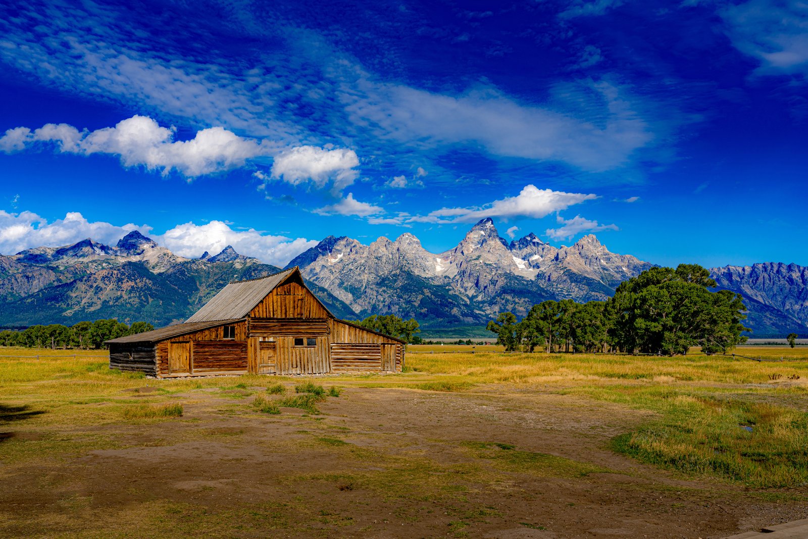
T.A. Moulton Barn, Mormon Row within Grand Teton National Park in Wyoming
It is widely celebrated as one of the most photographed barns in the United States. Key Features of the Location: The Historic Site: The homestead barn was constructed between 1912 and 1945 by Thomas Alma Moulton, one of the Mormon pioneers who originally settled the area. The Backdrop: The structure stands against the jagged peaks of the Teton Range, with the prominent, pointed peak of Grand Teton looming directly behind it. Mormon Row Historic District: This area is a designated historic district on the National Register of Historic Places, featuring a cluster of early 20th-century homesteads that offer a glimpse into the region's agricultural history.
Prints from $14Downloads from $19
US Capital
This photograph captures the United States Capitol Building in Washington, D.C., framed from the west lawn across the Capitol Reflecting Pool at the foot of the National Mall. The equestrian statue in front of the dome is part of the Ulysses S. Grant Memorial, honoring the Civil War general and 18th president of the United States, which sits at the base of Capitol Hill below the west front of the Capitol. The building's white dome and columned facade rise above manicured lawns and mature trees, doubled perfectly in the still water below. Key Features: The Capitol Dome: A cast iron dome topped by the Statue of Freedom, the defining silhouette of the seat of the United States Congress. The Grant Memorial: Its central sculpture of Grant on horseback faces west, overlooking the Capitol Reflecting Pool and facing toward the Lincoln Memorial, which honors Grant's wartime president, Abraham Lincoln. The National Mall: The reflecting pool marks the eastern terminus of this ceremonial park stretching toward the Lincoln Memorial. The Vantage Point: Shot from the pool's edge, using the mirrored water to double the grandeur of the facade and sky.
Prints from $14Downloads from $19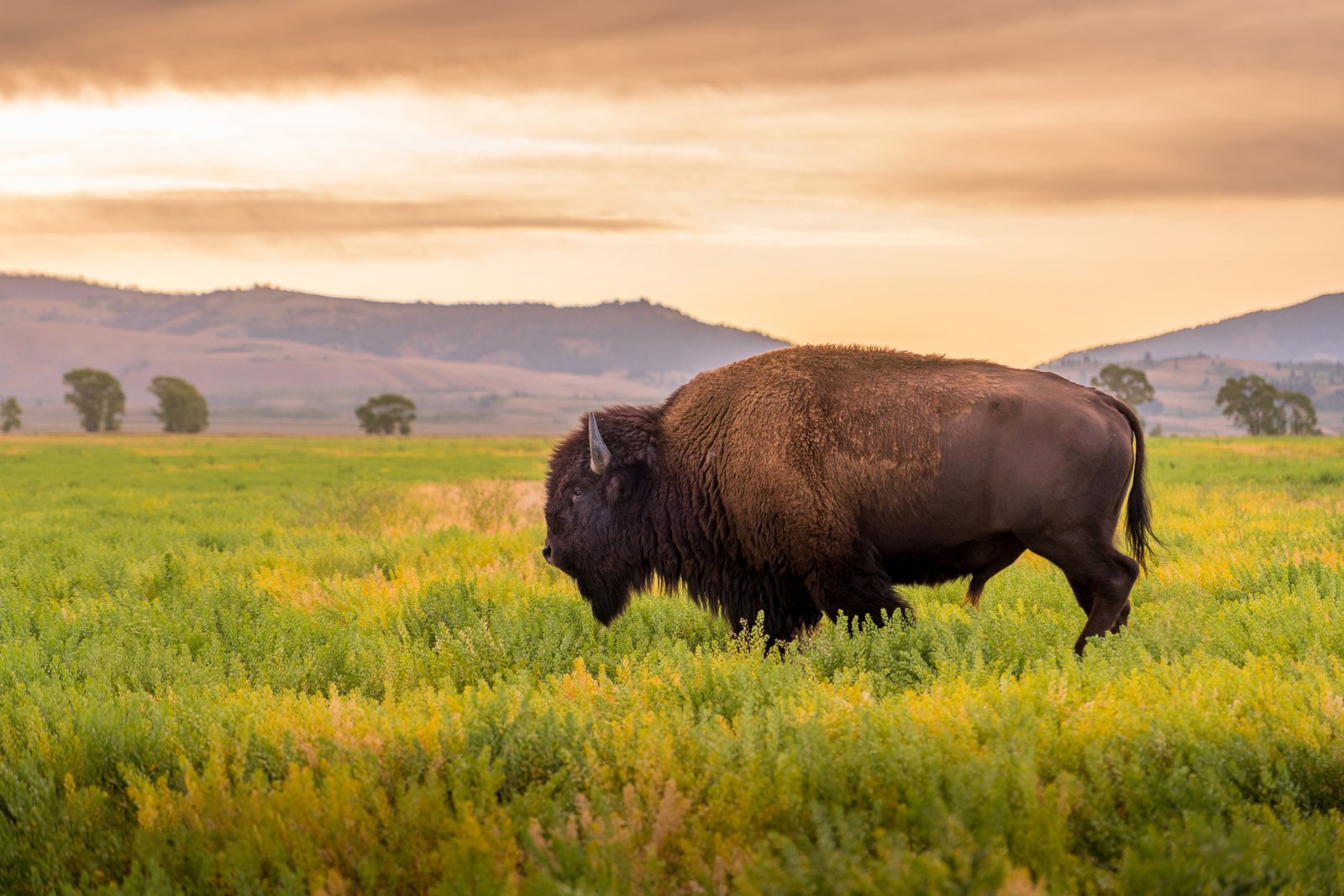
Wild Bison grazing in the Yellowstone National Park in Wyoming
While a specific, exact pinpoint is difficult due to the wide, open landscape, the wide valley floors, surrounding rolling hills, and sagebrush plains are highly characteristic of Yellowstone's northern range. Key Contextual Features: The Subject: This is an American bison (Bison bison). Yellowstone is famous for hosting the oldest and largest public herd of bison in the United States. The Habitat: The open grassland valley ringed by distant, pine-dotted mountains perfectly matches the topography of the park's major valley floors, which serve as prime grazing territories for thousands of bison. The Lighting: The warm, golden hue across the sky and landscape indicates either sunrise or sunset, which are peak activity times for wildlife observation in these valleys.
Prints from $14Downloads from $19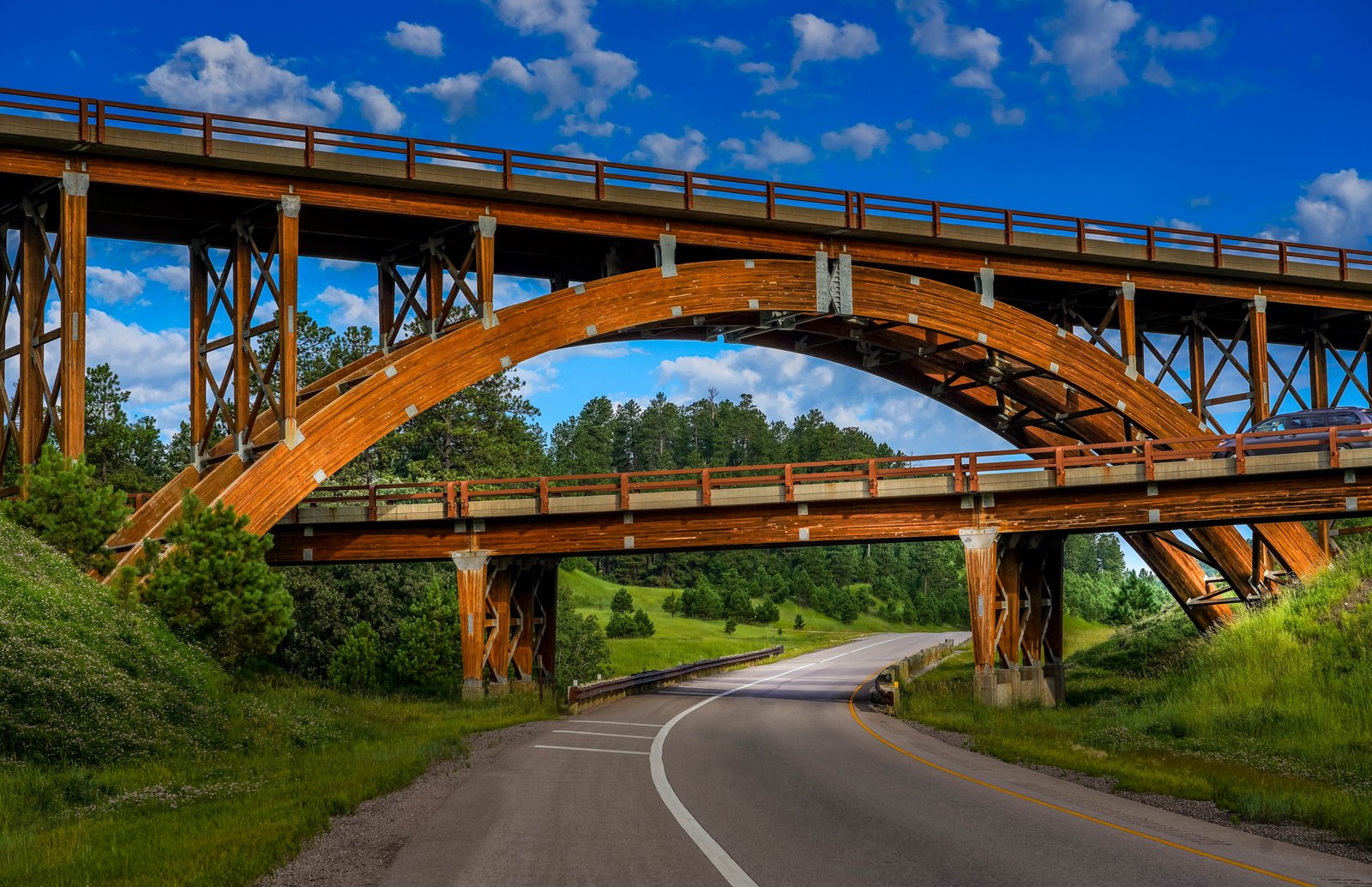
Keystone Wye Interchange, a famous architectural landmark located in the Black Hills of South Dakota
This three-level directional interchange serves as a gateway to major tourist sites, connecting U.S. Route 16 and U.S. Route 16A just north of the town of Keystone. Key Features of the Structure:The Architecture: Built between 1967 and 1968, the interchange is famous for its two interlocking bridges supported by massive glued-laminated timber ("glulam") arches. The Design Philosophy: The engineers chose a timber-framed architectural style specifically to blend seamlessly with the natural evergreen forest environment of the surrounding Black Hills National Forest. Route to Landmarks: If you are driving underneath this high arch along the road pictured, you are traveling southwest directly toward Keystone and Mount Rushmore National Memorial.
Prints from $14Downloads from $19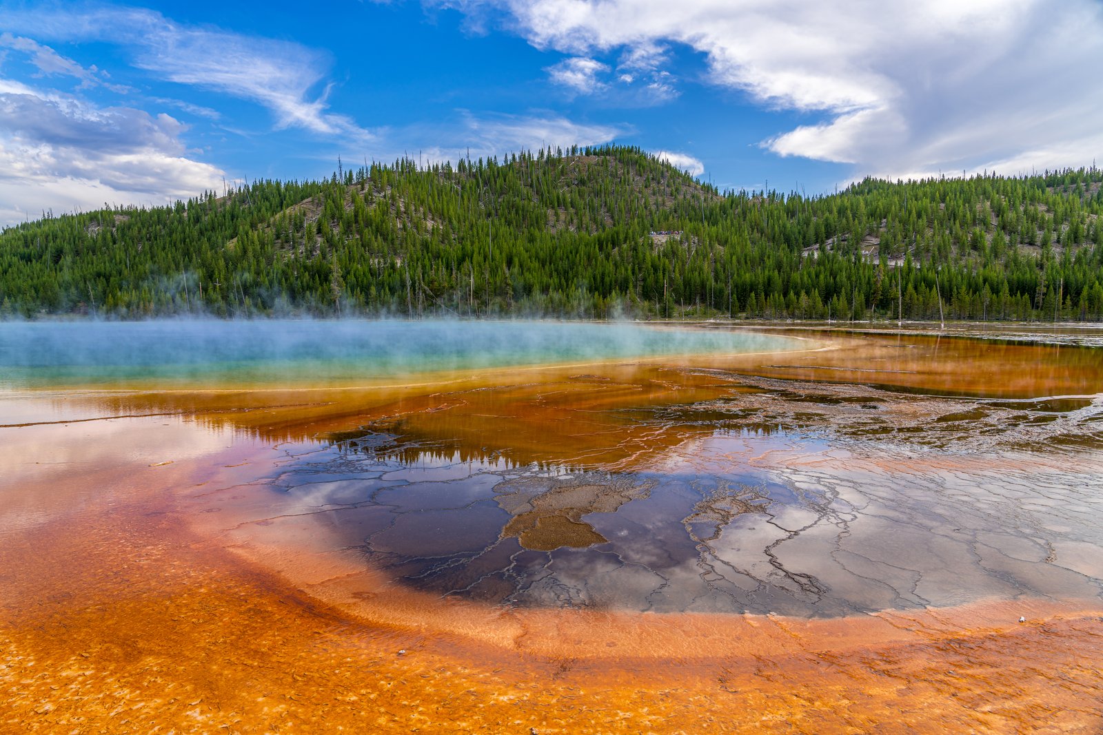
Grand Prismatic Spring, Midway Geyser Basin of Yellowstone National Park in Wyoming
It is the largest hot spring in the United States and the third largest in the world. Key Features of the Spring: The Brilliant Colors: The deep blue center is caused by the depth and absolute purity of the water absorbing red wavelengths of light. The vivid yellow, orange, and red bands radiating outward are formed by vast mats of thermophilic (heat-loving) bacteria growing in the cooler, shallow edges. The Scale: The spring stretches roughly 370 feet (110 meters) across and plunges to a depth of over 120 feet (37 meters), constantly discharging a massive volume of scalding water into the nearby Firehole River. The Viewpoint: This ground-level perspective highlights the delicate, terraced bacterial mats and steam rising off the water, set against the backdrop of the park's characteristic lodgepole pine forests.
Prints from $163Downloads from $19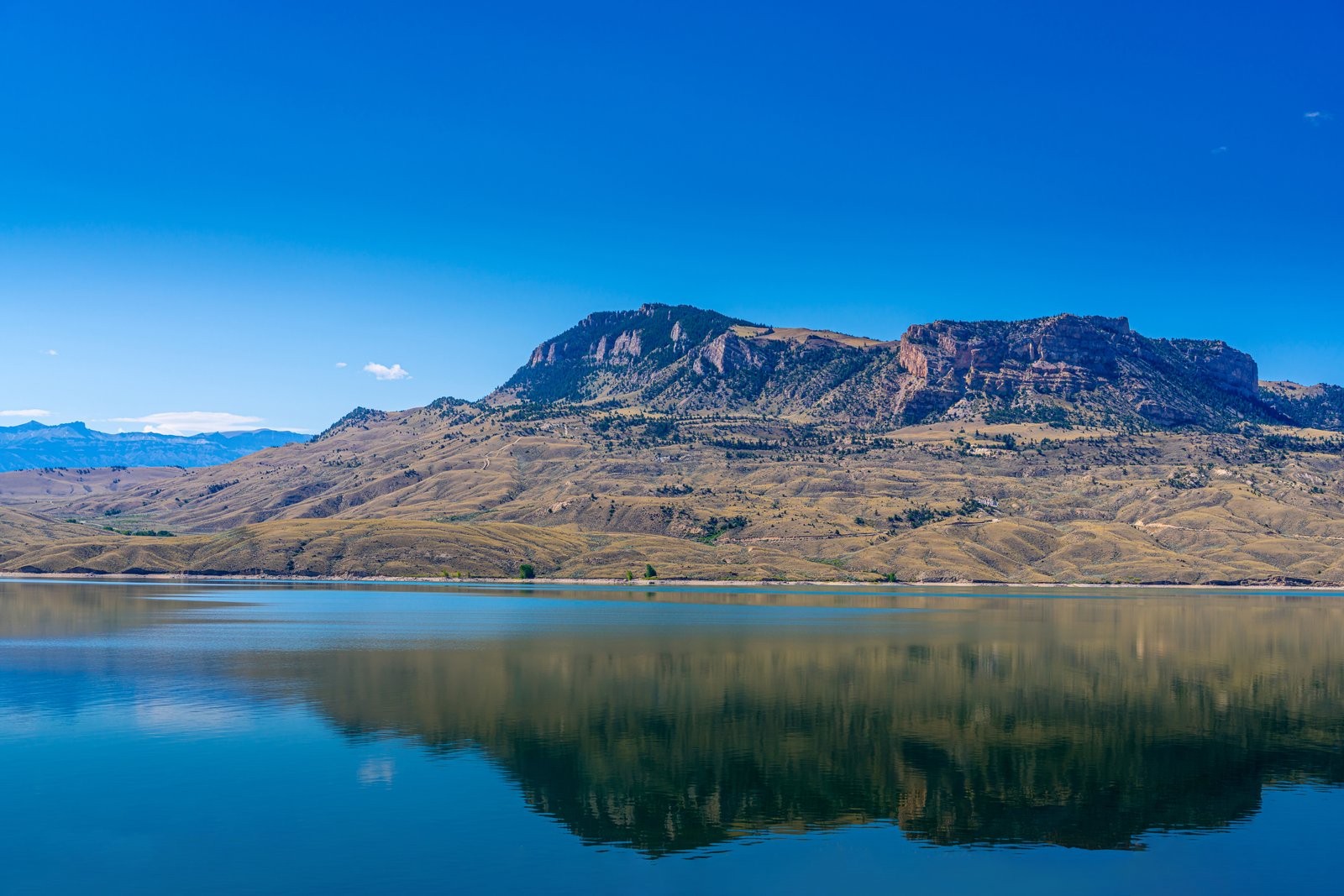
Bighorn Canyon National Recreation Area, border of Wyoming and Montana
he specific view highlights the high canyon walls and distinctive layered sedimentary rock strata of the northern Bighorn Mountains, which reflect clearly across the deep blue water of the reservoir. Key Features of the Area: The Reservoir: Bighorn Lake was created by the construction of the Yellowtail Dam on the Bighorn River in 1965. It stretches for over 71 miles, cutting directly through the dramatic rock formations. The Geology: The massive exposed limestone cliffs visible in the background showcase millions of years of geological history, drawing researchers and outdoor enthusiasts alike to study the stark, arid canyons of the region. Recreation: The water sits within the Bighorn Canyon National Recreation Area, a popular destination for boating, fishing, viewing wild horses, and exploring steep hiking trails along the canyon rims.
Prints from $14Downloads from $19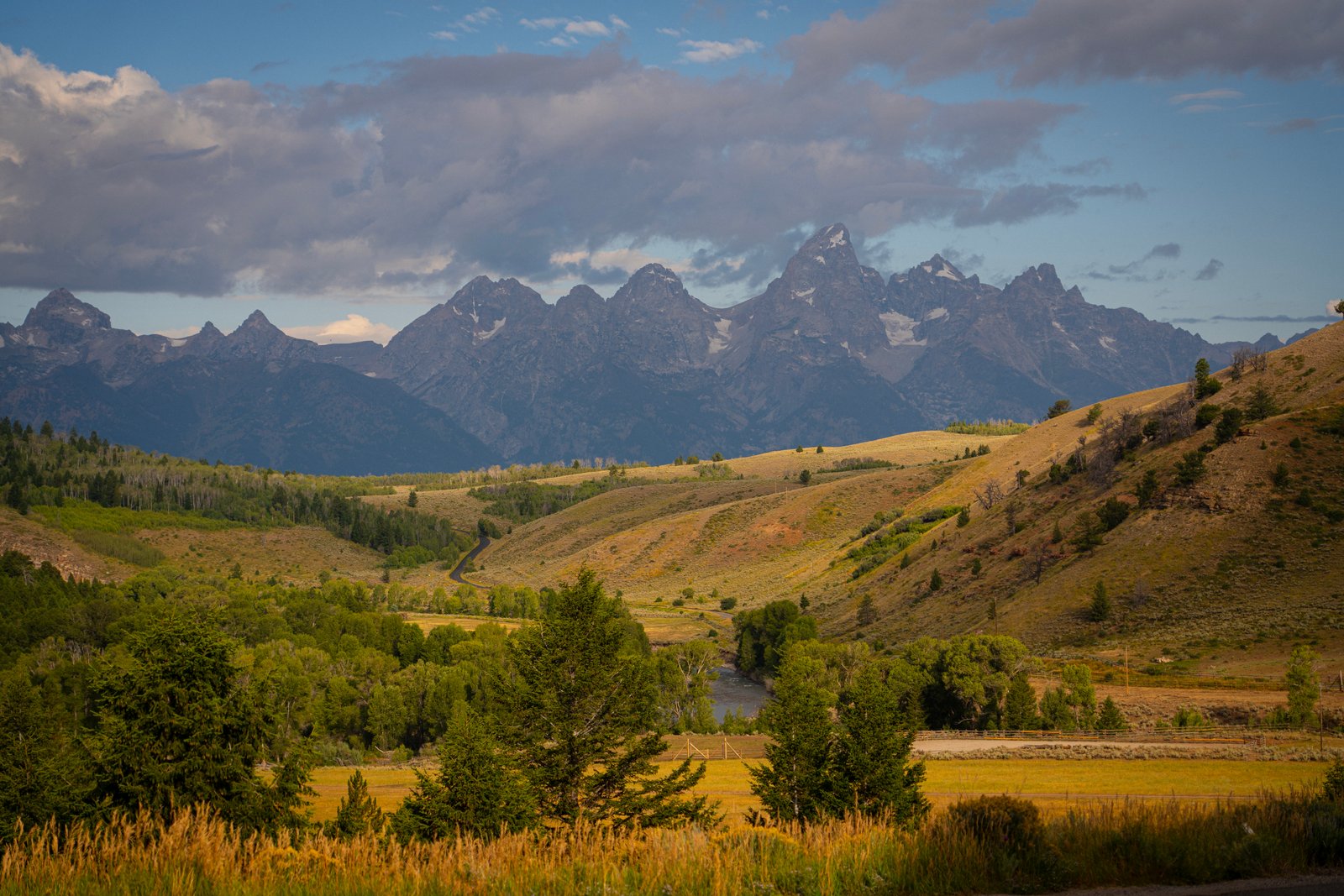
Schwabacher Landing area near the Teton Range in Grand Teton National Park, Wyoming
The view captures the winding Snake River valley in the middle ground, framed by the rolling, sagebrush-covered hills and groves of cottonwood trees characteristic of the park's eastern boundary. In the background, the jagged, prominent peaks of Grand Teton, Mount Owen, and Teewinot Mountain dominate the skyline under a dramatic, cloudy sky.
Prints from $14Downloads from $19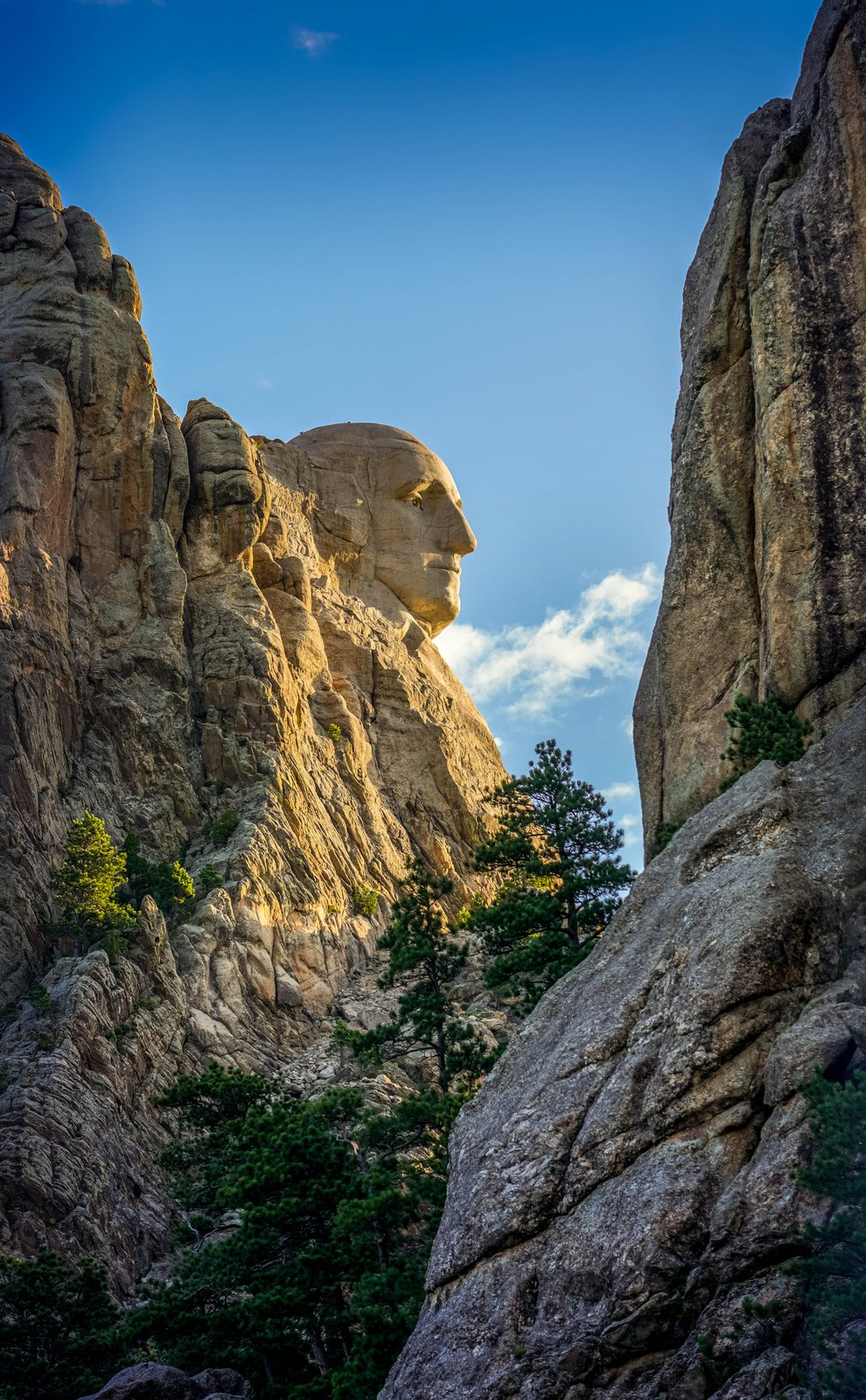
Unique Profile George Washington at Mount Rushmore National Memorial, Black Hills, South Dakota
While most travelers view the monument directly from the Grand View Terrace, this specific shot is taken from a profile perspective—likely along the Presidential Trail or the historic flume trail area—where the surrounding granite canyons frame the sculpture from the side. Key Features of the Memorial: The Profile View: From this angle, only George Washington’s face is visible in crisp detail, highlighting the precision of sculptor Gutzon Borglum's work on the granite cliffside. The Scale: The carved face stands roughly 60 feet (18 meters) high, towering over the surrounding ponderosa pine forests and rugged rock formations of the Black Hills. The Context: Carved between 1927 and 1941, the monument also features Thomas Jefferson, Theodore Roosevelt, and Abraham Lincoln just out of view to the right of this frame.
Prints from $14Downloads from $19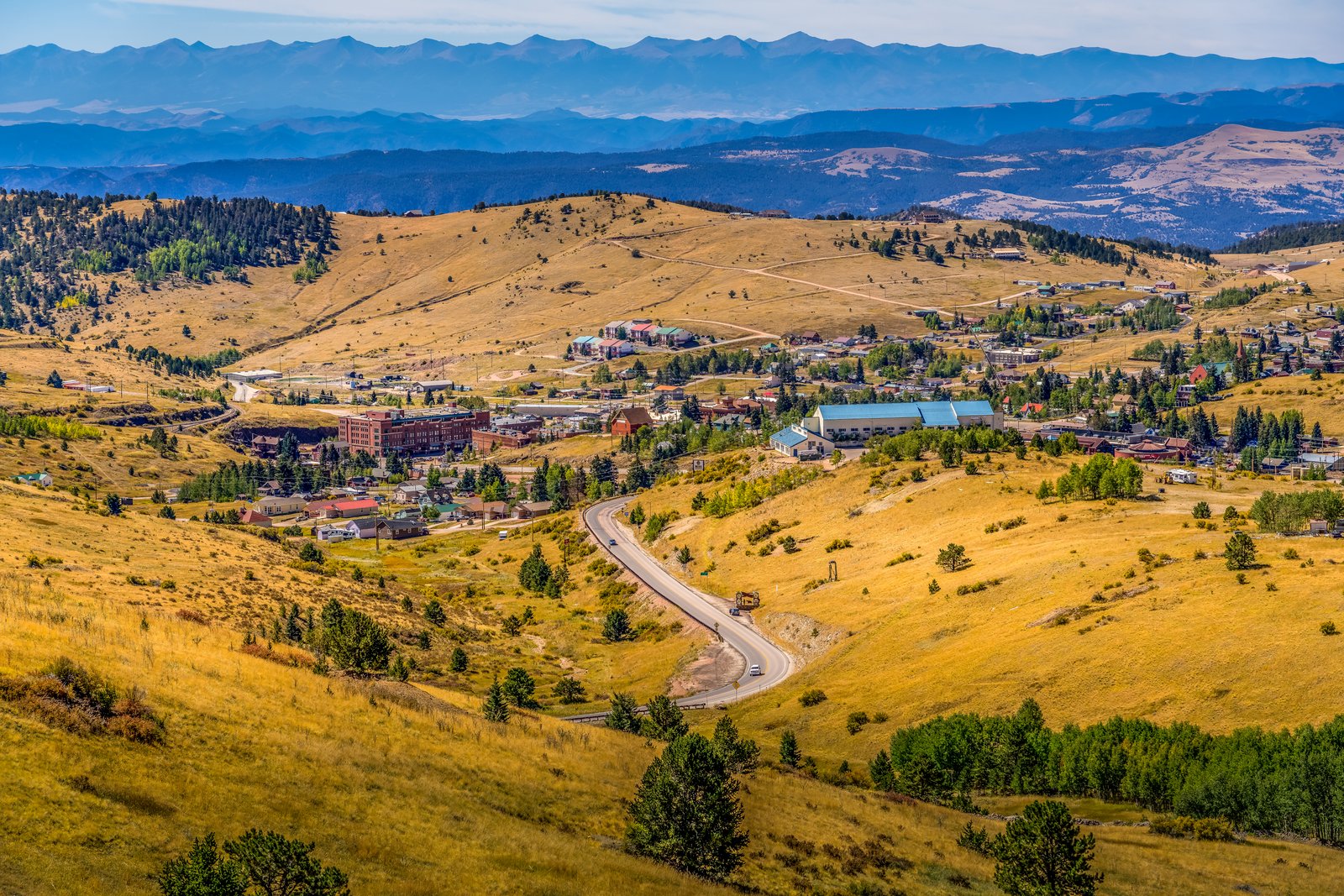
Historic Mountain Town of Cripple Creek, Colorado
The image is captured looking southwest from a popular scenic pull-off along Colorado State Highway 67 (visible winding down the hillside into the town). Key Features of the Location: The Town Layout: Nestled at an elevation of 9,494 feet (2,894 meters), the historic 1890s gold rush mining camp is spread across the high-altitude valley floor. The prominent, large building with the long blue roof on the right side of the valley is the Cripple Creek-Victor High School campus. The Backdrop: Spanning across the far horizon in the background is the dramatic, jagged curtain of the Sangre de Cristo Mountains, a subrange of the Rocky Mountains that remains snow-capped well into the warmer months. Historic Context: The hillsides surrounding the town are part of the famous Cripple Creek Historic District, which was the site of the greatest gold mining boom in Colorado history.
Prints from $14Downloads from $19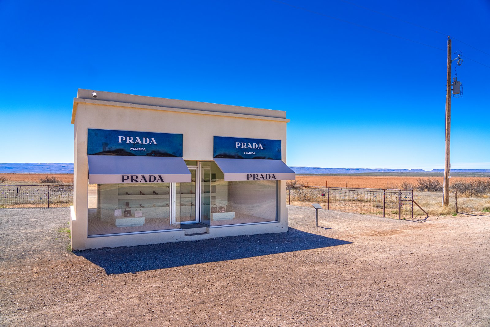
Prada Marfa, Valentine, Texas
Despite its name, the structure is actually situated roughly 26 miles northwest of the city of Marfa, standing entirely isolated alongside a desolate stretch of U.S. Highway 90 in Jeff Davis County. Key Features of the Installation: The Concept: Created in 2005 by Elmgreen and Dragset, this "pop architectural land art" piece is designed to look exactly like a luxury storefront. It is intended to function as a critique of consumerism and gentrification by slowly decaying into the surrounding Chihuahuan Desert landscape. The Inventory: The large glass display windows reveal genuine Prada shoes and handbags from the Fall/Winter 2005 collection, personally selected and provided by Miuccia Prada.T he Surrounding Landscape: The structure contrasts sharply with its environment—surrounded only by gravel pull-offs, a barbed-wire fence, sparse desert scrub, a lone utility pole, and the flat Texas desert horizon.
Prints from $14Downloads from $19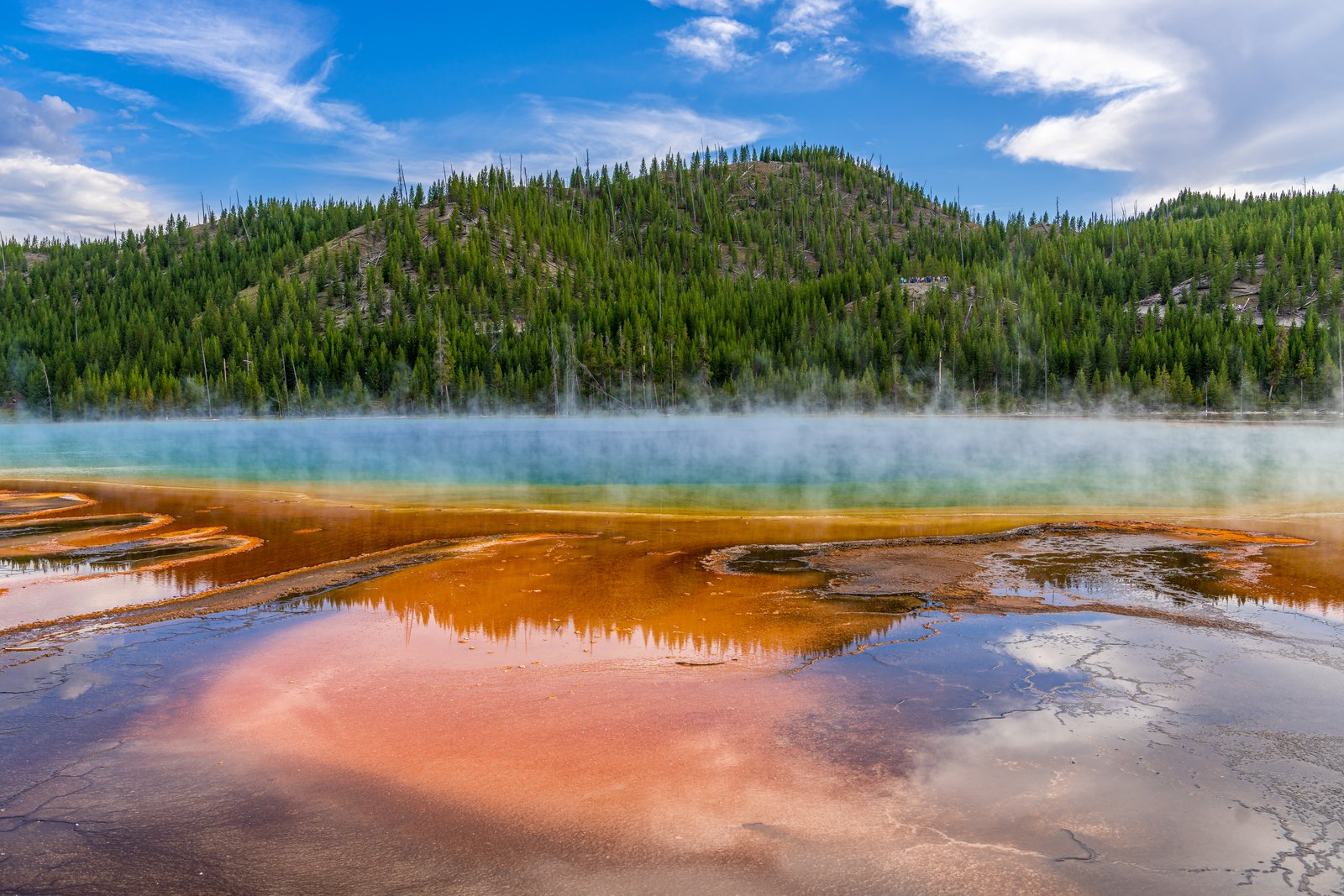
Grand Prismatic Spring
Grand Prismatic Spring lies in the Midway Geyser Basin of Yellowstone National Park, Wyoming, seen here from the boardwalk that skirts its steaming edge. Rising sulfur mist drifts across a forested hillside as the spring's mineral rich runoff channels spread in bands of amber and rust toward the viewer, with the spring's blue heart glowing faintly beyond the steam. Key Features: The Spring: The Grand Prismatic Spring is the largest hot spring in Yellowstone National Park, and the third largest in the world. The Colors: Its size, the world's third largest, and its colors, bands of orange, yellow, and green ring the deep blue waters, make it remarkable. The Cause: The distinct rings of temperature in the water contribute to the coloration, with different species of heat loving thermophile bacteria inhabiting each zone, and the colors change with the seasons. The Setting: Visitors are asked to stay on the boardwalk path, as touching the extremely hot water can be dangerous and is prohibited within the park.
Prints from $14Downloads from $19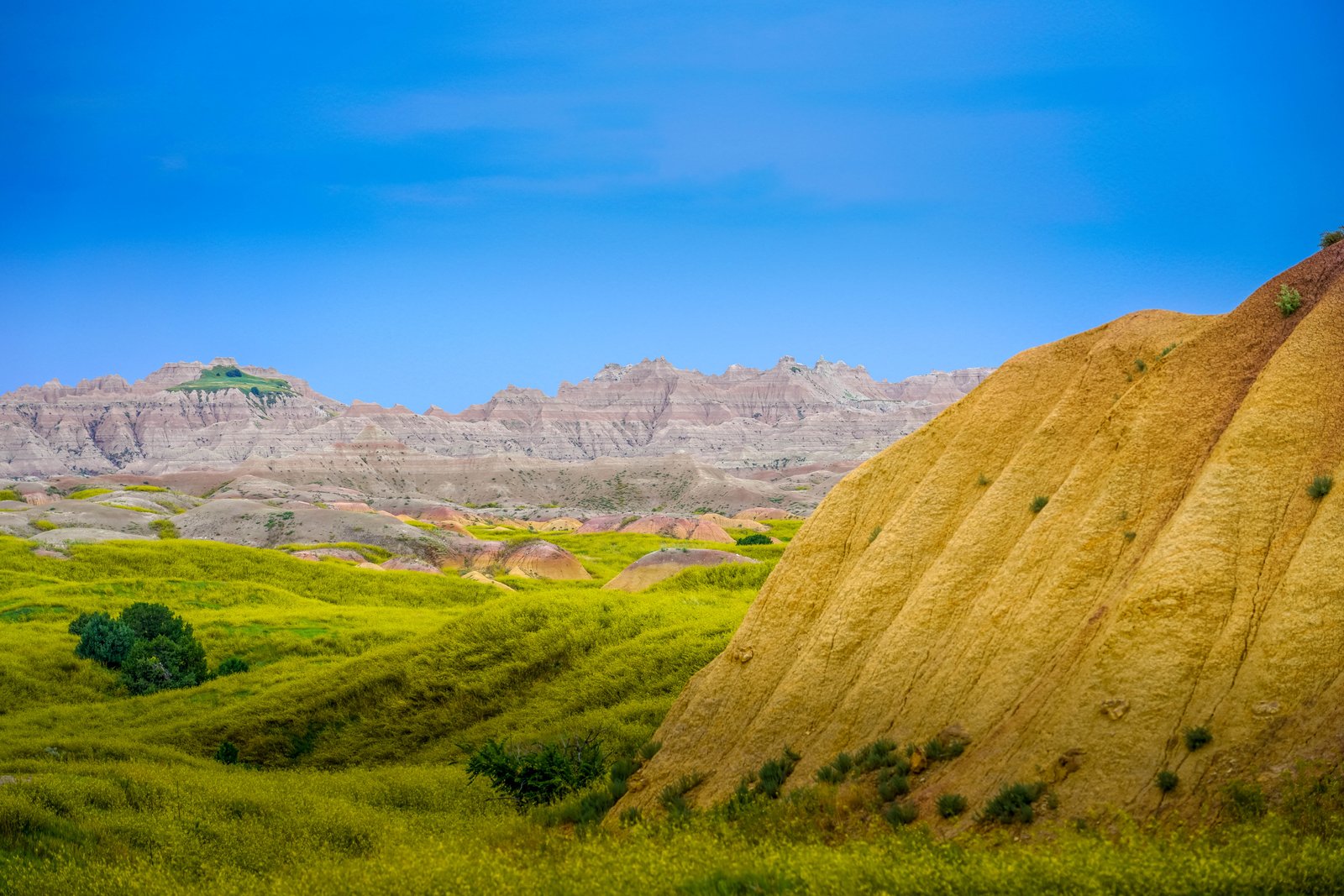
Badlands Yellow Mounds
This photograph captures the Yellow Mounds overlook area in Badlands National Park, South Dakota, where rolling green prairie in the foreground gives way to a striated golden mound and the pale, jagged badlands wall rising in the distance. The vantage point looks out across a mix of grassland and eroded formations toward the layered buttes that define the park's rugged terrain. Key Features: The Yellow Mounds: These brightly colored layers are paleosols, ancient fossilized soils, and the Yellow Mounds get their mustardy color from a mineral called goethite. Ancient Seabed Origins: The golden soil formed as an ancient sea retreated and exposed dark ocean mud, which weathered into the yellow paleosol seen here. Layered Rock Record: The Chadron Formation beneath these mounds, made largely of light gray claystone, was deposited about 37 to 34 million years ago across an ancient floodplain. Mixed Prairie Setting: The surrounding green grassland is part of the mixed-grass prairie that borders the park's dramatic eroded buttes and spires.
Prints from $14Downloads from $19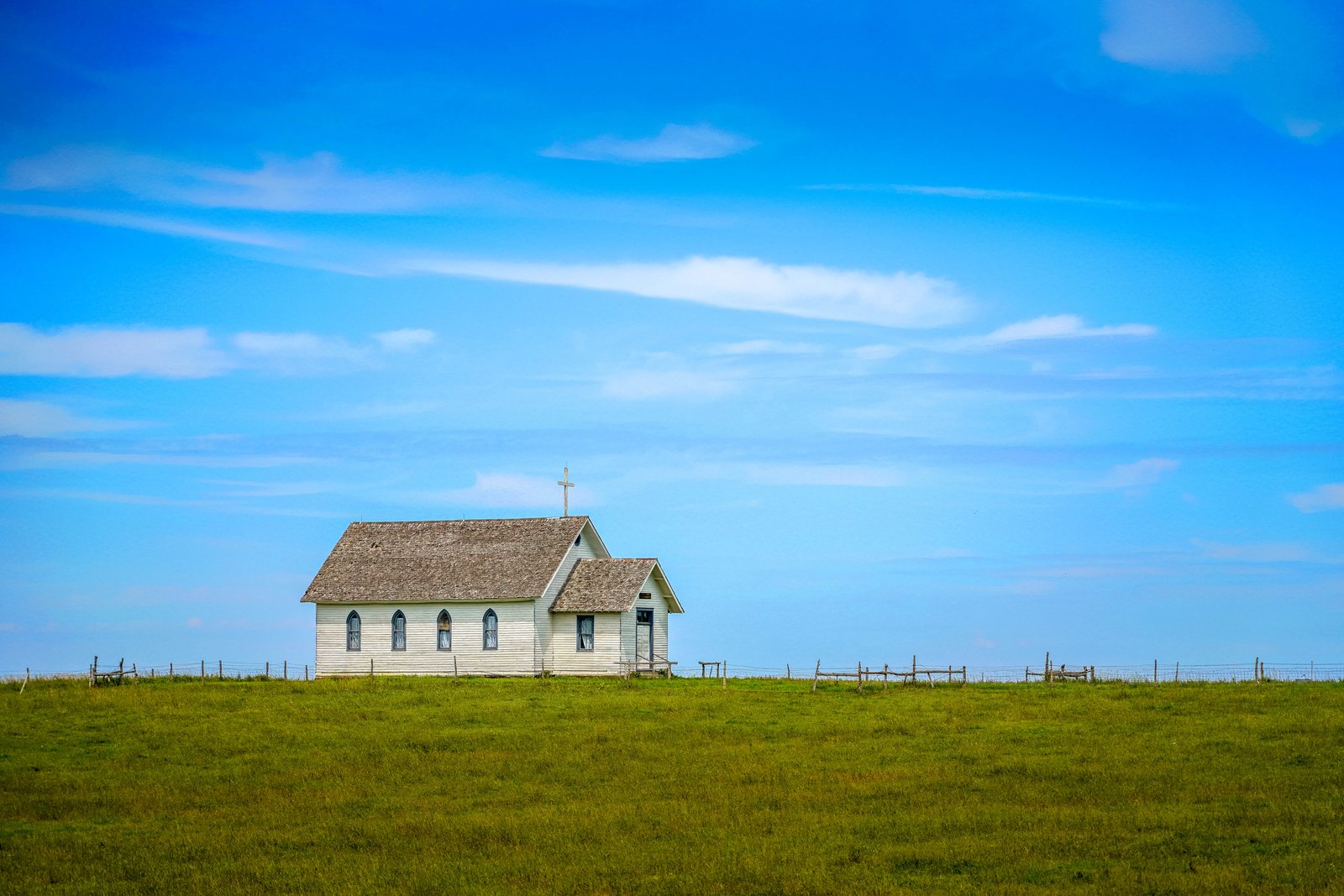
1880 Town Church
Now I have enough to write the story.This photograph was taken at South Dakota's Original 1880 Town, a recreated pioneer village on Interstate 90 near Murdo, South Dakota. The frame shows a small white clapboard church with pointed gothic windows and a wooden cross atop its gabled roof, standing alone against a wide prairie sky behind a split rail fence. The open grassland stretching to the horizon reflects the homestead landscape the village was built to evoke. Key Features: Origin: The complex gathers more than 30 authentic buildings from the 1880 to 1920 era, relocated from towns across the region and refurnished with period relics. The Setting: Located west of Murdo along Interstate 90, the attraction sits on open prairie with Main Street running toward the horizon. Architecture: The steepled, wood frame church with arched windows reflects small congregational chapels built by early homesteaders on the Dakota plains.
Prints from $14Downloads from $19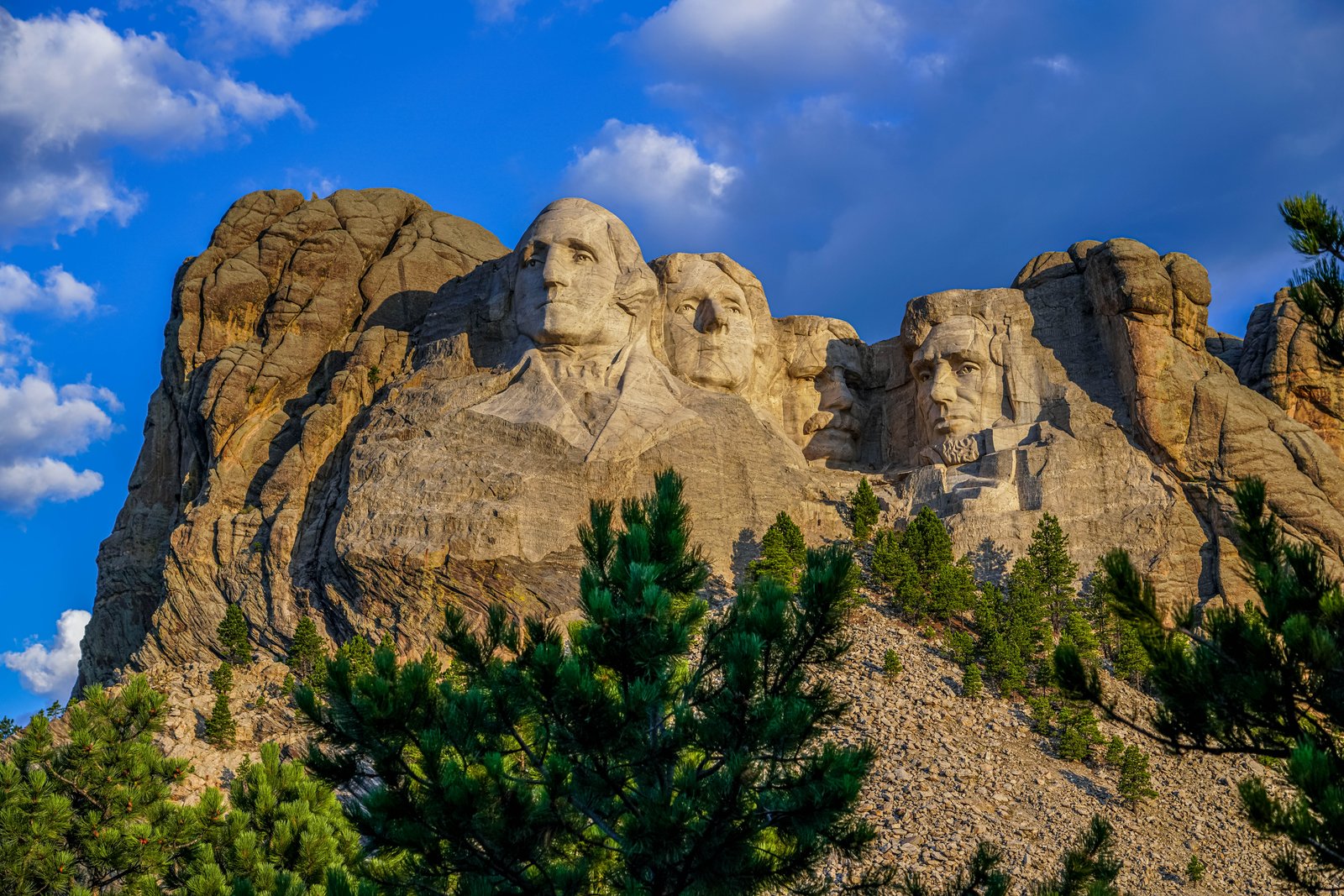
Mount Rushmore National Memorial
Mount Rushmore National Memorial rises above the Black Hills near Keystone, South Dakota, where the photograph looks up from a pine covered slope toward the mountain's granite face. Mount Rushmore National Memorial in Keystone, South Dakota, was carved on the granite face of a mountain in the Black Hills between 1927 and 1941. The image captures the sixty foot likenesses of George Washington, Thomas Jefferson, Theodore Roosevelt, and Abraham Lincoln, with scattered clouds and blue sky behind the peak. Key Features: The Sculpture: The memorial features the 60-foot faces of four U.S. presidents, George Washington, Thomas Jefferson, Theodore Roosevelt, and Abraham Lincoln, carved into granite. The Construction Era: The mountainside carving was completed between 1927 and 1941, though funding problems made the project take longer than originally expected. The Setting: The presidents' faces are carved into a mountain nestled among the Black Hills, twenty miles from the nearest city. Visitor Draw: Despite its remoteness, the site draws two million tourists each year.
Prints from $14Downloads from $19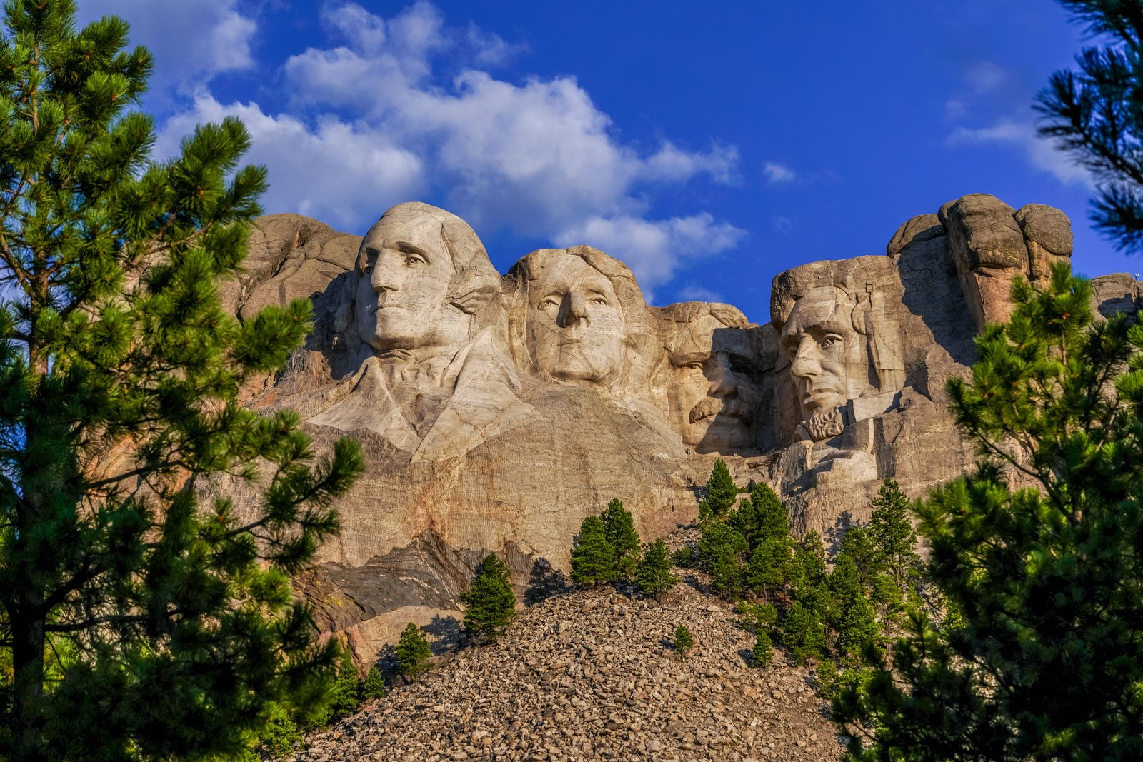
Mount Rushmore National Memorial
This photograph was taken at Mount Rushmore National Memorial in the Black Hills of Keystone, South Dakota, viewed from a lower vantage point through ponderosa pines that frame the granite cliff face. The image captures the sixty foot high carved heads of Presidents George Washington, Thomas Jefferson, Theodore Roosevelt, and Abraham Lincoln set against a bright blue sky, with a rocky talus slope and evergreen trees in the foreground. Key Features: The Sculptor: Mount Rushmore was sculpted by Gutzon Borglum and his son, Lincoln Borglum. The Subjects: The rock carving depicts the faces of four U.S. Presidents, from left to right, George Washington, Thomas Jefferson, Theodore Roosevelt, and Abraham Lincoln. The Timeline: Gutzon Borglum started drilling into the 6,200 foot mountain in 1927. The Setting: The memorial is located in Pennington County, South Dakota, near the town of Keystone.
Prints from $14Downloads from $19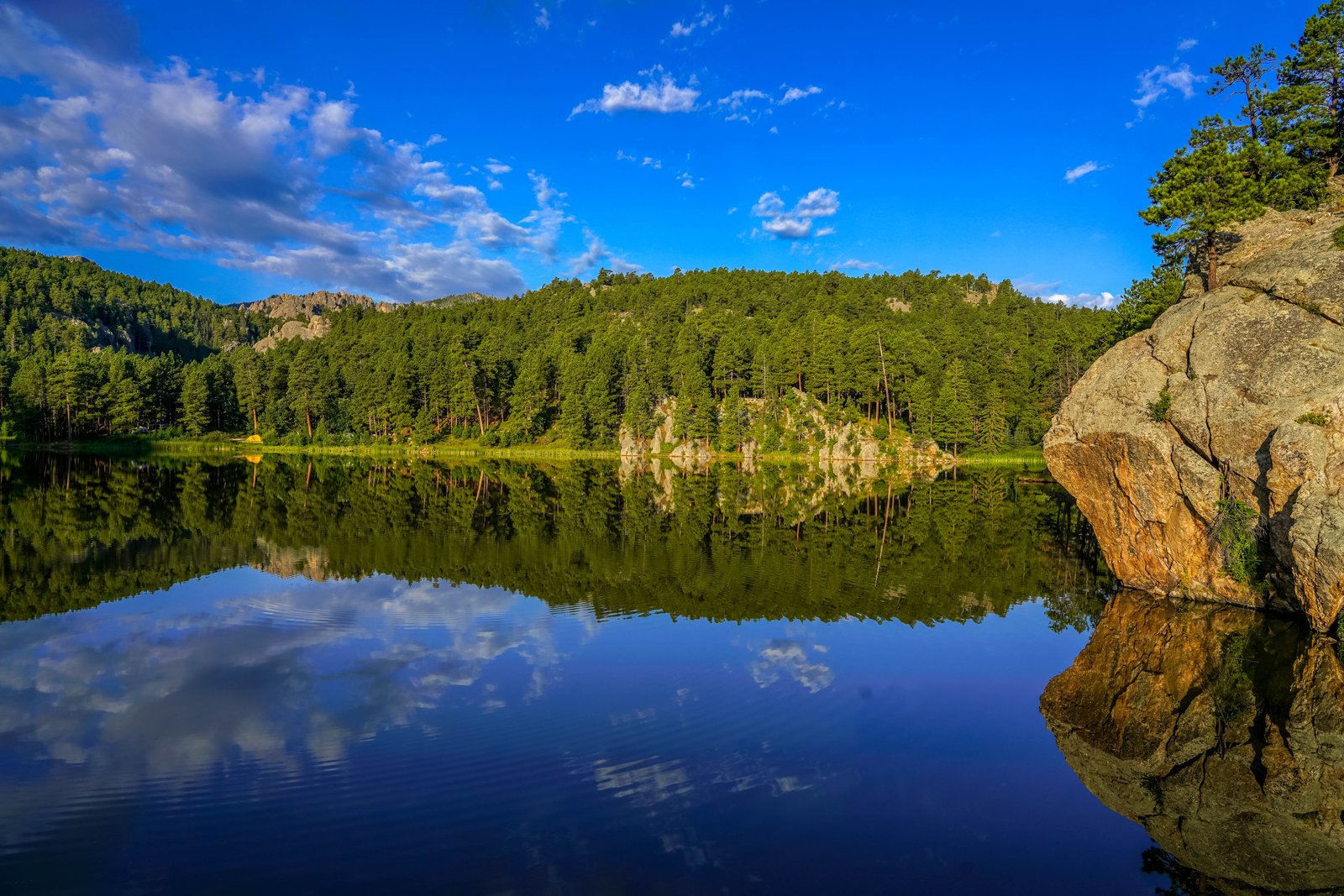
Horsethief Lake in the Black Hills
The photo was taken at Horsethief Lake in the Black Hills National Forest of South Dakota, near Mount Rushmore and Custer State Park. The vantage point looks across the still surface of the small lake toward a wooded shoreline of Ponderosa pine and pale granite outcrops, with the calm water creating a near perfect mirror image of the trees, rock and sky above. A massive granite boulder crowned with a lone pine juts into the frame on the right, anchoring the reflection and giving a sense of scale to the scene. Key Features: The Granite Core: The Black Hills owe their pale, rounded rock formations to ancient granite pushed up through the plains and slowly exposed by erosion, forming the spires and boulders seen along the shoreline. The Forest Setting: Dense stands of Ponderosa pine cover the surrounding hills, a signature of the Black Hills National Forest that gives the range its dark, forested appearance from a distance. The Lake Itself: Horsethief Lake sits within the Black Hills, prized for its calm water, granite backdrop and nearby hiking trail into the Black Elk Wilderness. The Reflection Effect: Windless mornings turn the lake into a mirror, doubling the pines, rock and sky and making the boulder in the foreground the visual anchor of the composition.
Prints from $14Downloads from $19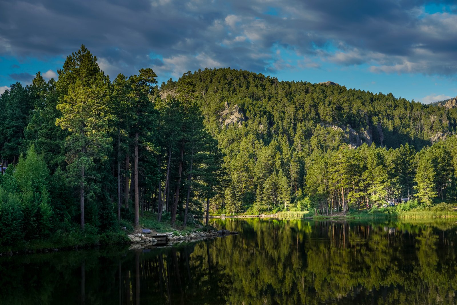
Rocky Water Lake
The photograph shows a still forest lake in the granite highlands of North America's northern Great Plains, most consistent with the Black Hills region of South Dakota. The view looks across calm water toward a tree covered ridge where weathered granite outcrops break through dense Ponderosa pine forest, with a small dock and bench on the near shore and a campground visible along the far bank. Key Features: The Setting: A quiet lake ringed by pine forest, with granite rock formations rising along the ridge line that are typical of the ancient granite core exposed in this mountain region. The Reflection: Calm evening water mirrors the trees and rock face, a common effect on small, sheltered lakes tucked into forested canyons. The Human Presence: A modest dock, bench, and distant campground show the lake is used for recreation and camping rather than being a wholly untouched wilderness site. The Landscape Type: The mix of pine forest, exposed granite spires, and a small impounded lake reflects the geology and land use pattern common to protected forest and park lands in this part of the country.
Prints from $14Downloads from $19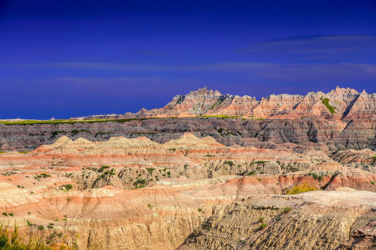
Badlands Chadron
This photograph looks over the eroded buttes and pinnacles of the Badlands, the rugged formation stretching across southwestern South Dakota near the Nebraska border by Chadron. The view shows layered mounds of rose, tan and gray sediment rising toward a jagged ridge of spires, with a thin band of green prairie marking the flatter tableland above the eroded basin. Key Features: The Rock Layers: The geology comprising the Badlands is a colorful layer-cake of various sedimentary rocks deposited between 28 to 75 million years ago by shallow seas, rivers, and wind, giving the buttes their striped color bands. The Volcanic Ash: Some of the layers include volcanic ash that originated from volcanoes located over 500 miles away, blown eastward before settling in the area. Ongoing Erosion: Because the rock layers are relatively soft, erosion occurs at about one inch per year, and at that rate the hills are expected to erode completely within the next half a million years.
Prints from $14Downloads from $19