


Photographer
Rick Billings, Master Photographer
Orlando, Florida
I've been a professional photographer since I graduated high school in 1978. I'm bringing over four decades of professional photography experience and offering images I captures as beautiful display prints in your home or office.
Collections
All photos by Rick Billings, Master Photographer
The Palace Of Fine Arts San Francisco
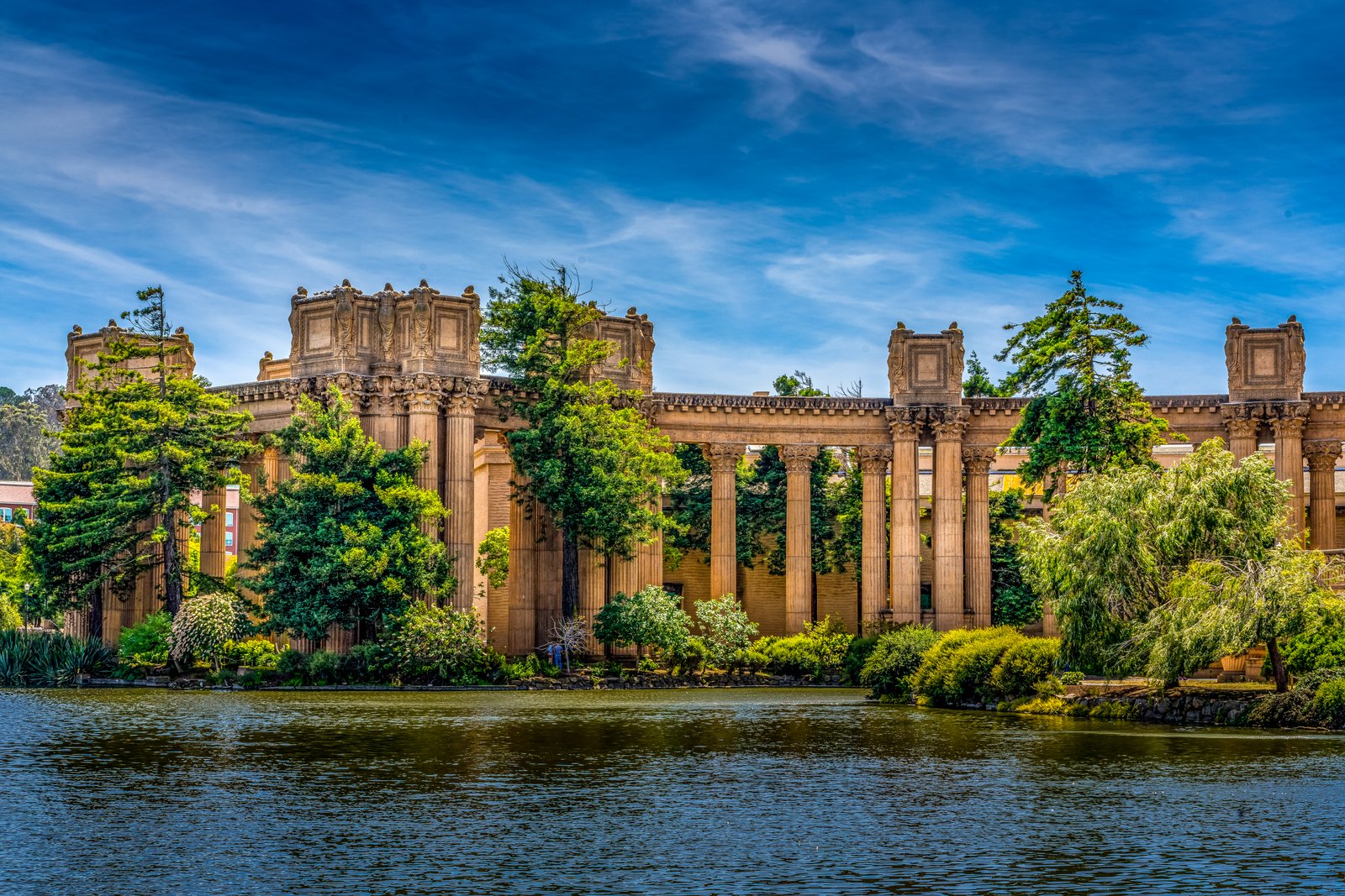
This photograph captures the Palace of Fine Arts in San Francisco's Marina District, seen from across its tranquil lagoon. The view frames the monumental Corinthian colonnade and open rotunda, their classical stonework partially veiled by tall cypress and willow trees along the water's edge. Key Features: The Origin: Bernard R. Maybeck was chosen as architect for the Palace of Fine Arts, designing it as a Beaux Arts structure evoking a Roman ruin for the 1915 Panama Pacific International Exposition. The Lagoon: The surrounding lagoon was original marshland that Maybeck preserved rather than filling in, weaving the water into his design so the colonnade appears mirrored in its surface. The Recognition: The site is a designated San Francisco Landmark and is listed on the National Register of Historic Places, occupying about 17 acres beside the Marina.
Prints from $14Downloads from $19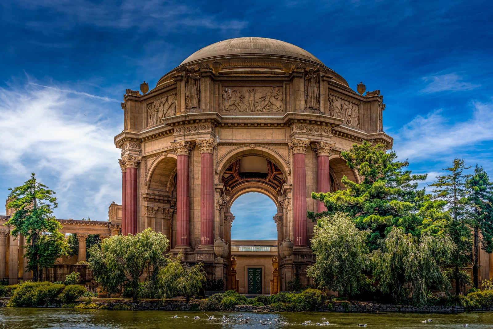
The Palace Of Fine Arts San Francisco
This photograph shows the Palace of Fine Arts in San Francisco's Marina District, viewed from across the lagoon looking directly through the great central arch of the rotunda toward the colonnade beyond. Reflecting pools, willows and pines frame the reddish Corinthian columns and sculpted frieze panels beneath the massive dome, with waterfowl gathered on the water in the foreground. Key Features: The Origin: The Palace of Fine Arts was one of the finest buildings constructed for the 1915 Panama Pacific International Exposition in San Francisco. The Architect: It was designed by Bernard Maybeck, one of America's most important and influential architects. The palace established a new standard for civic monumental architecture in the city. The Rebuild: Originally built of temporary materials for the fair, the decaying structure was reconstructed using permanent materials between 1964 and 1974. The Setting: The open rotunda rises roughly 162 feet and is framed by sweeping colonnades and a lagoon, giving the complex its theatrical presence today.
Prints from $14Downloads from $19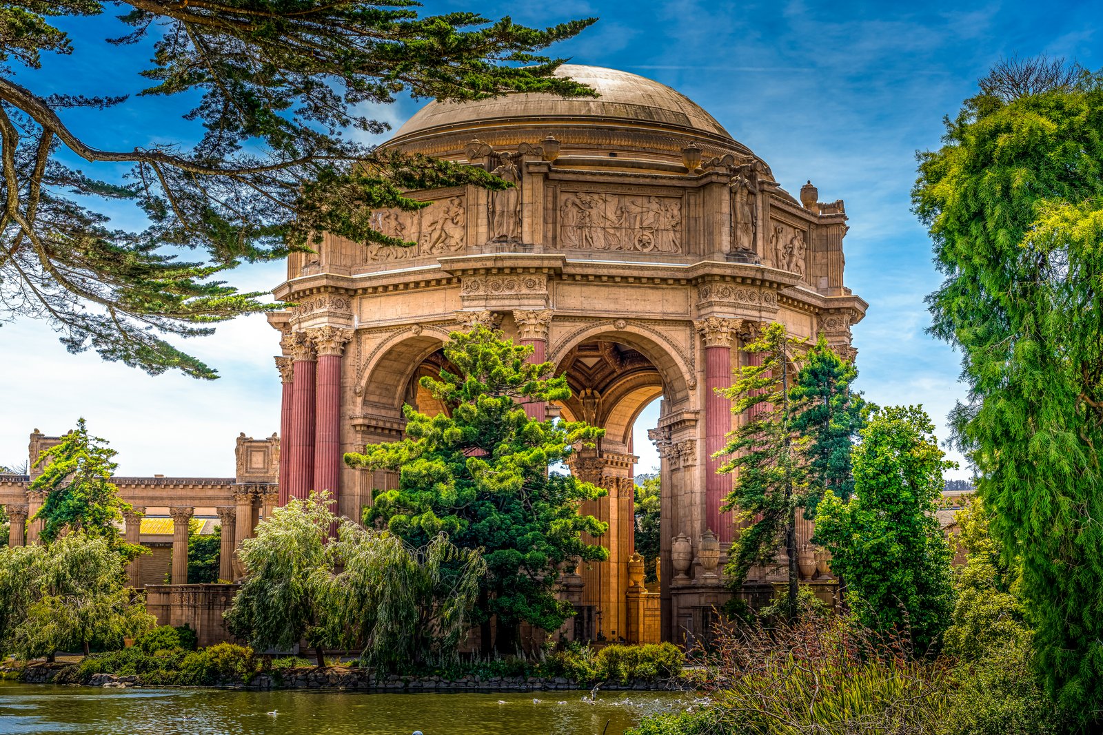
The Palace Of Fine Arts San Francisco
The photograph shows the Palace of Fine Arts in San Francisco's Marina District, viewed from across its lagoon with the great domed rotunda framed by cypress and pine trees. The arched openings, paired Corinthian columns and carved friezes of the open-air rotunda dominate the frame, with the curving colonnade visible beyond. Key Features: The Origin: The Palace is a faithful recreation of an earlier structure designed by Bernard Maybeck for the 1915 Panama-Pacific International Exposition, originally built of temporary materials for the fair before the decaying structure was reconstructed with permanent materials decades later. The Design Concept: Maybeck chose the theme of a Roman ruin for his design, meant to show the mortality of grandeur and the vanity of human wishes, choosing a Marina District site for the Palace. The Structure: The Palace consists of a rotunda and two flanking curvilinear colonnades fronting a lagoon, with its domed rotunda an open-air octagon supported by eight piers framing arched openings. Its Legacy: The Palace and the Marina Green are the only remnants of the 1915 Exposition still on site today.
Prints from $14Downloads from $19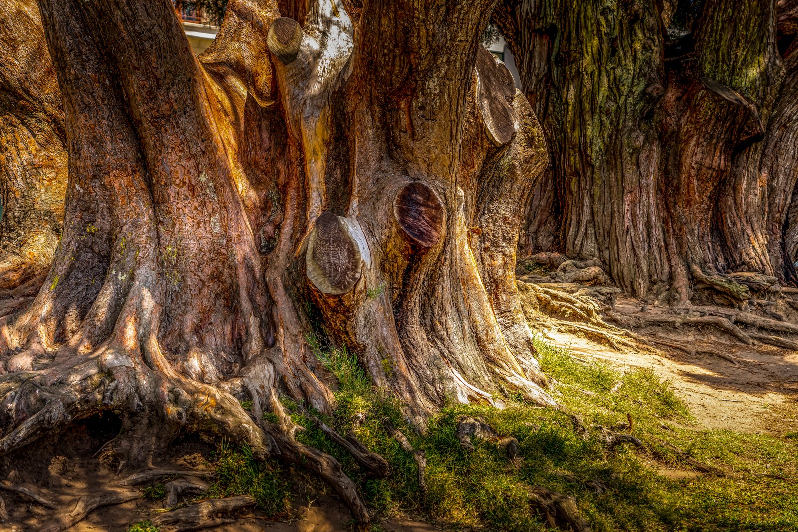
Tree of Life
The photograph shows the immense, gnarled trunk of El Árbol del Tule, a single Montezuma cypress standing on church grounds in the town center of Santa María del Tule, Oaxaca, Mexico. The close vantage point reveals its massive buttressed roots, deeply furrowed bark, and thick lobes of wood that give the impression of several separate trunks fused together, with the shaded churchyard and grass at its base. Key Features: The Ancient Tree: El Árbol del Tule is a mighty Montezuma cypress located in the town center of Santa María del Tule in the Mexican state of Oaxaca, chronicled for more than 2,000 years by both the Aztecs and the Spanish, making it one of the oldest trees in the world. Record Trunk: Its trunk measures 11.62 meters in diameter and reaches a height of 35.4 meters, making it the tree with the largest trunk diameter worldwide. Hidden Shapes: Its knotted trunk and branches have taken different forms and with a little imagination one can see faces of goblins and monsters and animals. Single Organism: DNA analysis has confirmed that this 1,500-year-old cypress is a single living organism, though researchers initially believed it might be several trees merged together.
Prints from $14Downloads from $19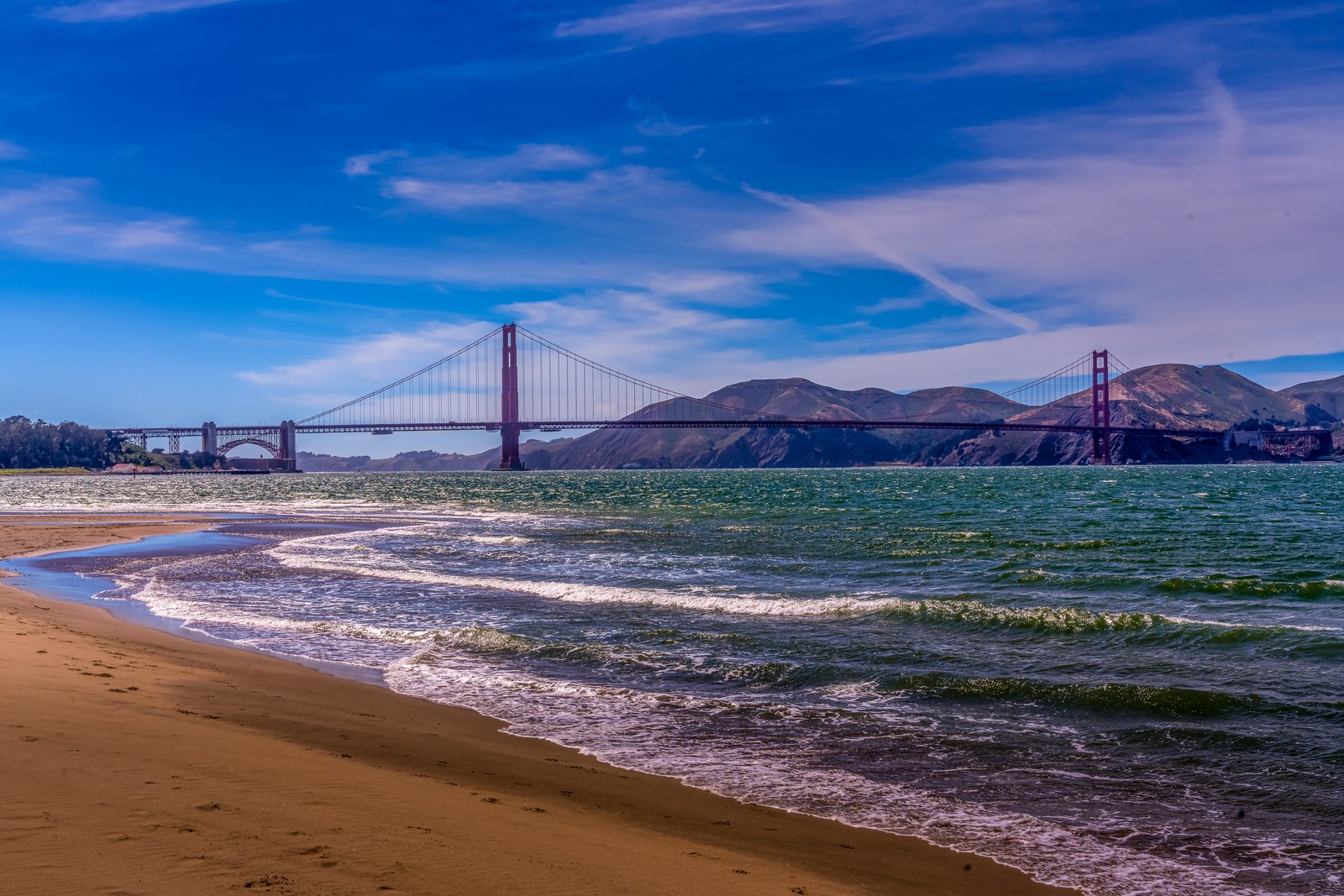
The Golden Gate Bridge San Francisco
The photograph looks north across San Francisco Bay from the sandy shoreline of Baker Beach, in the Presidio, toward the Golden Gate Bridge and the Marin Headlands beyond. From this low vantage point at the water's edge, waves roll in over the beach while the bridge's towers and cables stretch across the strait, with the rugged headlands rising against the sky in the distance. Key Features: The Vantage Point: Baker Beach is one of the closest beaches to the Golden Gate Bridge, offering a view of waves breaking in front of the bridge with the Marin Headlands in the distance, all captured in one frame. The Setting: Baker Beach stretches a mile below rugged cliffs on the Presidio's western shoreline, with spectacular views of the bridge and the Marin Headlands beyond. The Bridge: The Golden Gate Bridge spans the entrance to San Francisco Bay, connecting the city to the Marin Headlands and standing as one of the most photographed landmarks in the United States. Natural Surroundings: The strait's cold currents and steady winds shape the waves seen breaking on the beach, while the headlands' dry, rounded hills form a dramatic backdrop typical of the Northern California coast.
Prints from $14Downloads from $19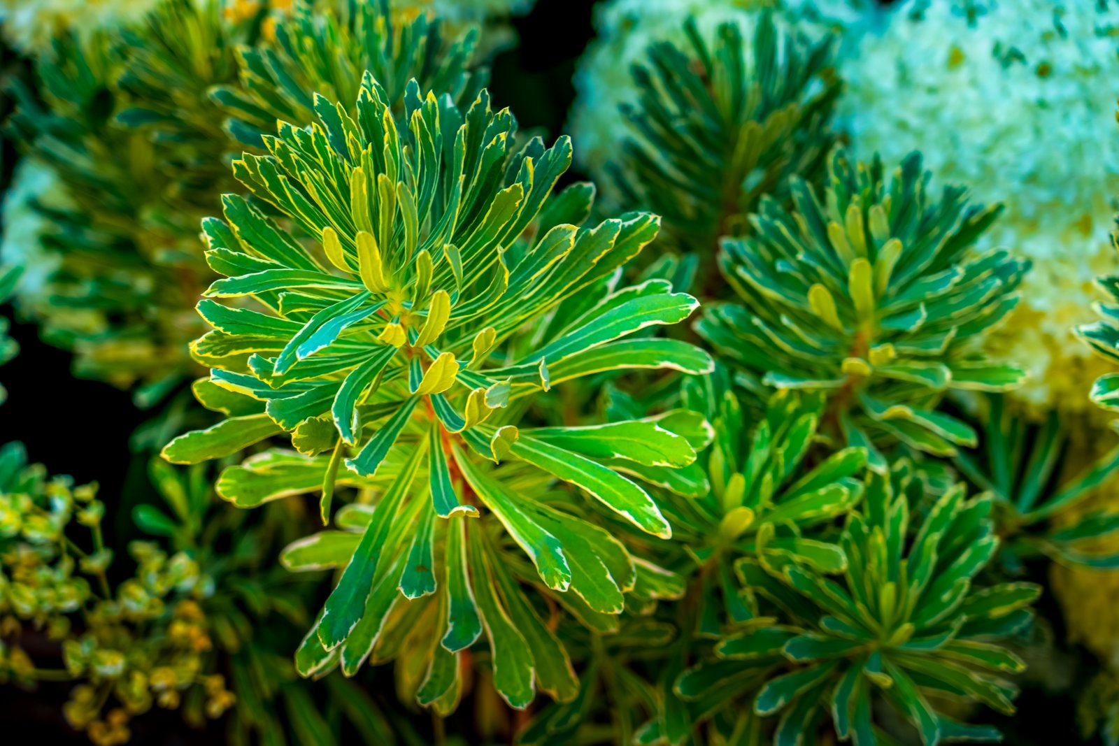
Napa Valley CA
This photograph is a close up detail taken in a garden setting in Napa Valley, California, showing the variegated foliage of an ornamental Euphorbia shrub, likely the cultivar known as Tasmanian Tiger spurge. The tightly whorled, sword shaped leaves with their pale cream margins and yellow green centers radiate outward from a central rosette, while soft blurred foliage and pale blossoms fill the background, suggesting a cultivated landscape bed typical of the valley's wine country estates and gardens. Key Features: The Plant: Euphorbia characias 'Tasmanian Tiger' has variegated foliage. It was reportedly discovered in 1993 as a chance hybrid growing in a garden in Hobart, Tasmania, Australia. Foliage Detail: Its slender, gray-green leaves are variegated with thick white margins. Garden Use: It is a broadleaf evergreen perennial with blue, green, variegated and white foliage, producing chartreuse flowers in spring and summer. Such plants are popular in Napa Valley's drought tolerant landscape gardens. Regional Setting: Napa Valley is renowned for its vineyard estates, whose surrounding gardens often showcase ornamental, low water plantings like this variegated spurge.
Prints from $14Downloads from $19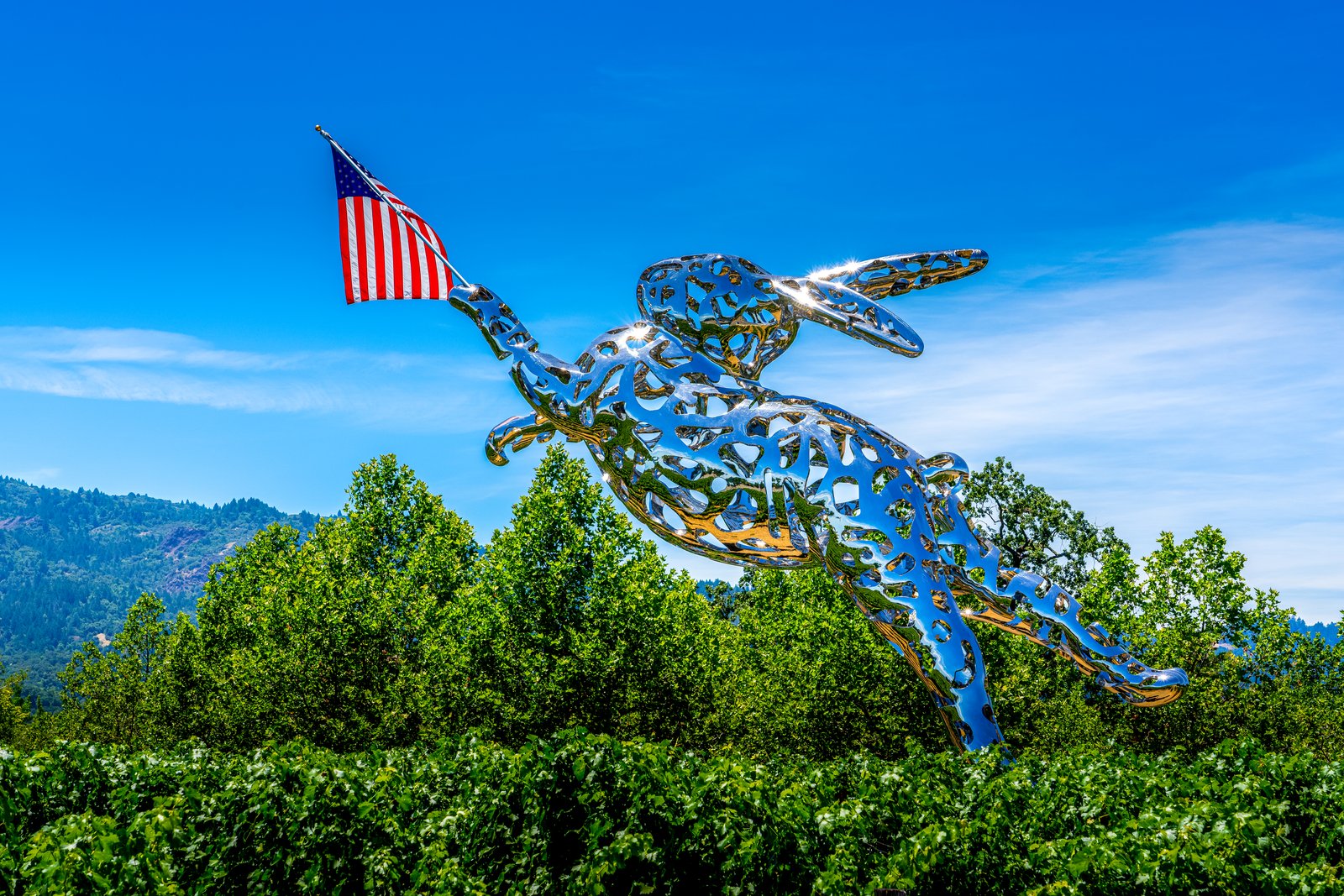
Napa Valley CA
Now I have enough information to write the story.This photograph captures Bunny Foo Foo, a 35 foot tall stainless steel rabbit sculpture leaping above the vineyards of HALL Wines along Highway 29 in St. Helena, in Napa Valley. Shot from among the vines, it frames the rabbit's polished, lattice body against a clear sky, with wooded valley hills behind and a small American flag set into its forepaw. Key Features: The Sculpture: Created by artist Lawrence Argent from over three metric tons of polished stainless steel. The Setting: Stands in the HALL Wines vineyard beside Highway 29, one of Napa Valley's main wine touring routes. The Artist: Argent also created Denver's giant blue bear and Sacramento's giant red rabbit. The Landscape: Grapevines and forested mountains identify the scene as Napa Valley wine country.
Prints from $14Downloads from $19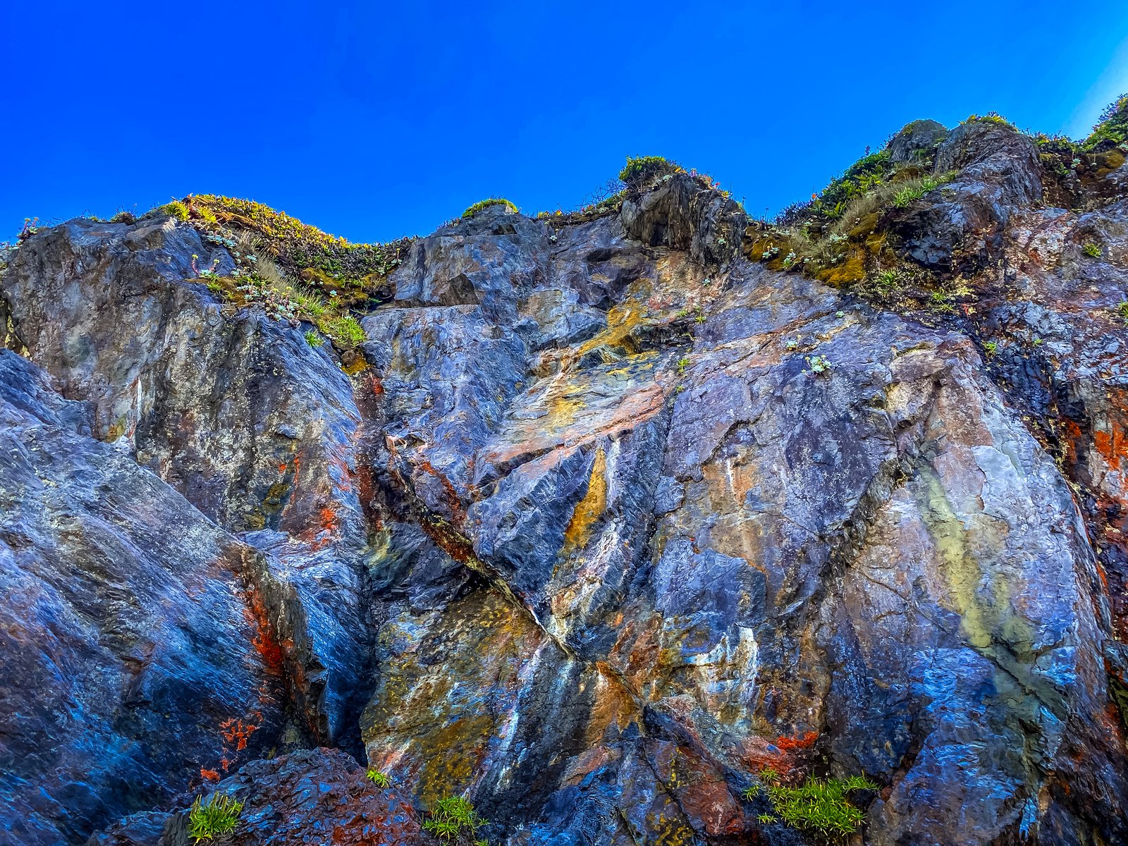
Humboldt Lagoon State Park California
Humboldt County, California
The photograph looks straight up a steep coastal bluff within Humboldt Lagoons State Park along California's north coast, where a thin strip of dune and beach separates a chain of lagoons from the open Pacific. The close vantage from the shoreline captures a jagged rock face streaked with rust, ochre and blue gray tones, its jointed surface crowned by a thin fringe of wind sculpted coastal scrub and grasses against a deep blue sky. Key Features: The Rock: These deposits protect the underlying Franciscan formation from erosion by waves, forming pinnacles and jagged bluffs. The Origin: The park was formed by the clash of two tectonic plates, part of the largest lagoon system in the United States. The Setting: Forty miles north of Eureka, the park features dunes, forests, prairies, coastal scrub and marshland that support a rich variety of plants, birds and other wildlife. The Coastline: Black cliffs mark the edge of the bluffs where the sandy lagoon beaches give way to exposed, mineral streaked rock.
Prints from $14Downloads from $19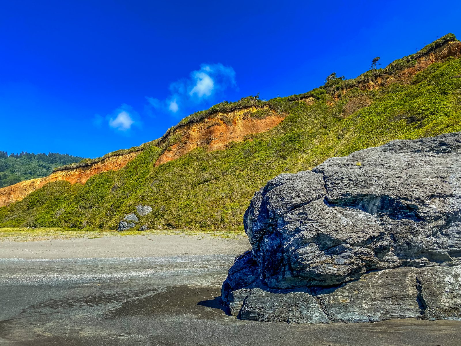
Humbolt Lagoon State Park CA
Humboldt County, California
This matches nicely - Freshwater Rocks at Humboldt Lagoons State Park.The photo was taken along the coast of Humboldt Lagoons State Park in Humboldt County, California, likely near Freshwater Lagoon Beach where dark, weathered sea rocks known locally as the Freshwater Rocks rise from the sand. The vantage point is low on the open beach, looking toward a steep coastal bluff whose face shows a band of rust colored exposed soil beneath a cap of wind sheared coastal scrub and a lone conifer, with a large dark boulder anchoring the foreground. Key Features: The Freshwater Rocks: black cliffs known as the Freshwater Rocks rise up at the edge of a range of coastal bluffs, marking where the open sand ends The Lagoon System: Humboldt Lagoons State Park is part of the largest lagoon system in the United States, formed by the clash of two tectonic plates The Setting: the ocean beach side of Freshwater Lagoon lies within the boundary of Redwood National Park, with dunes behind the long wide beach The Landscape: Layers of orange sediment cut through the green covered bluff, evidence of ongoing coastal erosion along this stretch of the Redwood Coast.
Prints from $14Downloads from $19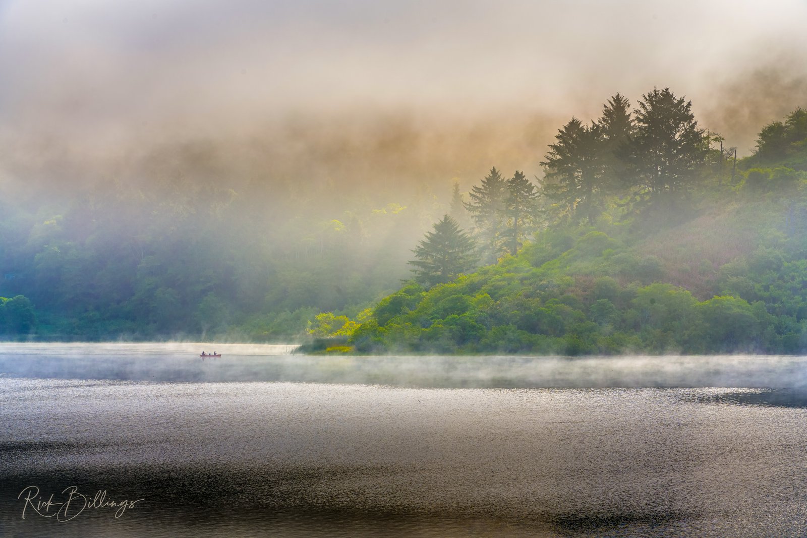
Humboldt Lagoon California
Morning fog rolls off the Pacific and drifts over one of the coastal lagoons within Humboldt Lagoons State Park on California's redwood coast, likely Stone or Big Lagoon. A canoe glides quietly along the misty shoreline while sunlight filters through low clouds, illuminating a hillside of redwood and spruce forest above the water. Wisps of fog cling to the surface, softening the line between water, trees, and sky. Key Features: The Lagoon System: This stretch of shoreline is part of the largest lagoon system in the United States, where shallow coastal waters are separated from the Pacific by narrow strips of sand. The Setting: The park sits along a redwood coast forty miles north of Eureka, where dense stands of coast redwood, spruce, and fir crowd the hills above the water. Native Heritage: The Yurok people have lived along this coastal strip for generations, once using hollowed redwood log canoes to travel between villages. Natural Character: Frequent fog and mist off the Pacific shape the region's cool, moist climate, often burning off by midday to reveal the forested hillsides.
Prints from $14Downloads from $19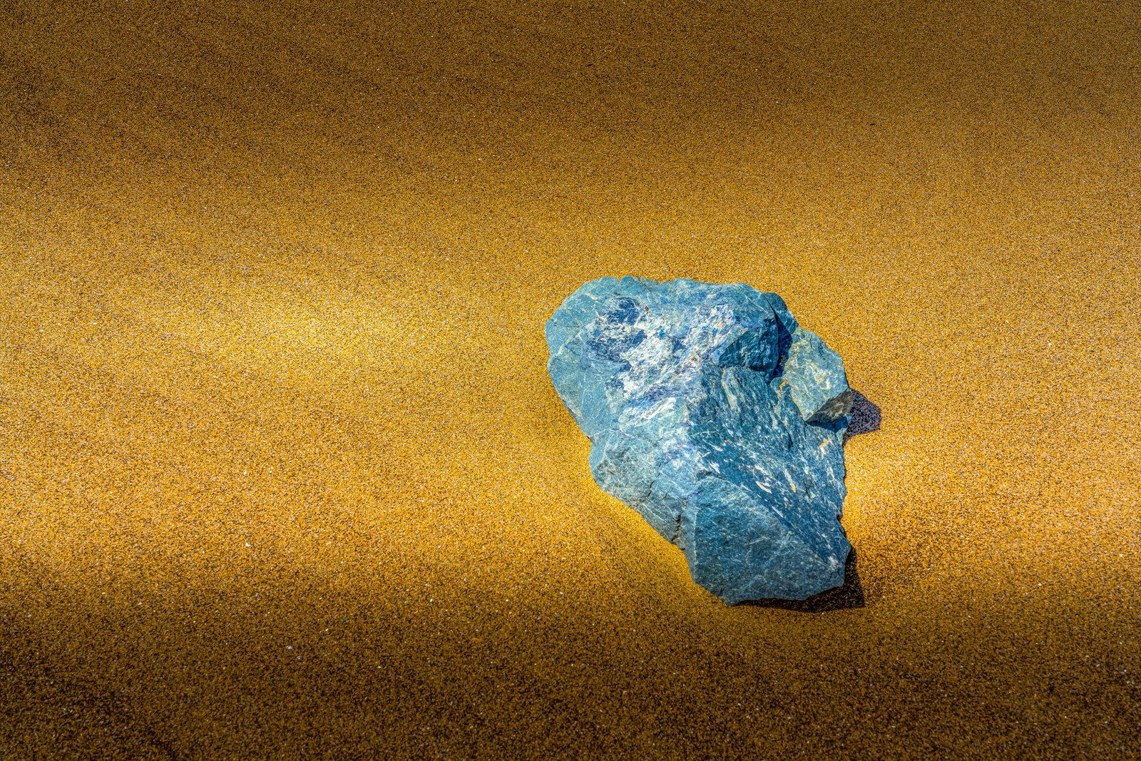
Beach Rock
This close-up study captures a single weathered stone resting on fine, sun warmed sand, its cool blue grey surface striking a sharp contrast against the golden grains surrounding it. The tight framing and raking light emphasize the rock's fractured, crystalline texture, turning an ordinary beach find into an abstract composition of color and form. No wider shoreline or landmark is visible, keeping the focus entirely on the interplay between stone and sand. Key Features: The Color Contrast: The cool blue tones of the rock stand out dramatically against the warm, golden sand. The Texture: Sharp facets and mineral veining in the stone suggest exposure to weathering and erosion over time. The Composition: A tight, minimalist framing turns a simple beach object into a study of natural abstraction. The Setting: The soft, granular sand points to a coastal or shoreline environment, though no specific location is identifiable.
Prints from $14Downloads from $19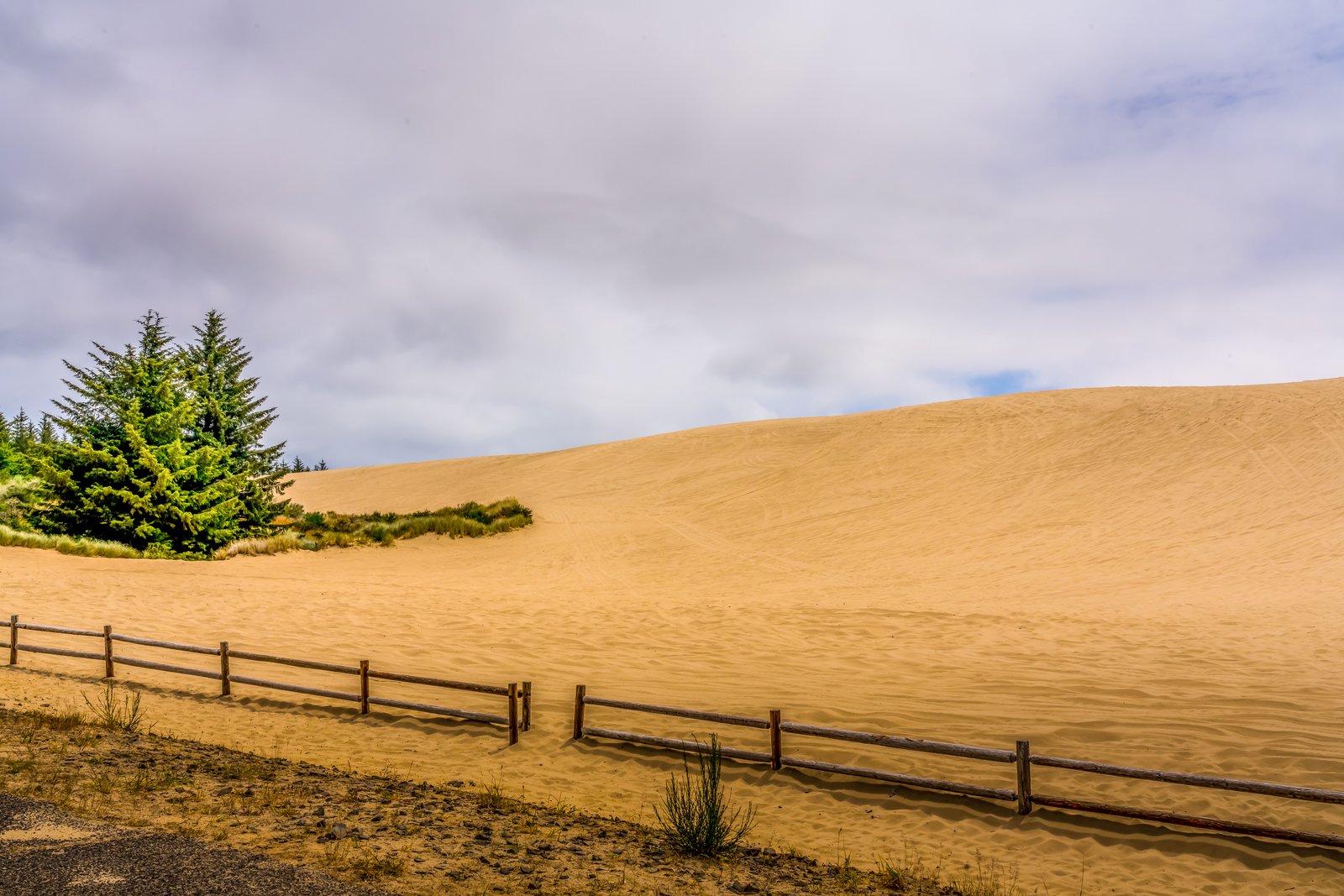
Oregon Dunes
Along the Oregon Coast, a great wave of pale sand rises against a heavy, cloud filled sky, with dark conifers clinging to its edge and a simple log fence marking a trailhead where the forest gives way to open desert. This is the Oregon Dunes National Recreation Area, stretching along the shoreline between Florence and Coos Bay, where wind and time have built some of the largest coastal dune fields in the world. Key Features: The Scale: The Oregon Dunes are one of the world's largest expanses of temperate coastal sand dunes. The Setting: The dunes extend for 40 miles along the Oregon coast between Florence and Coos Bay, with wind sculpted peaks towering almost 500 feet above the shore. The Landscape Mix: Desert, lake, and tree covered regions provide shelter and life to rare and diverse plants and wildlife within the same recreation area. The Ongoing Change: A major challenge the Forest Service faces in managing the area is the loss of open sand to encroaching vegetation.
Prints from $14Downloads from $19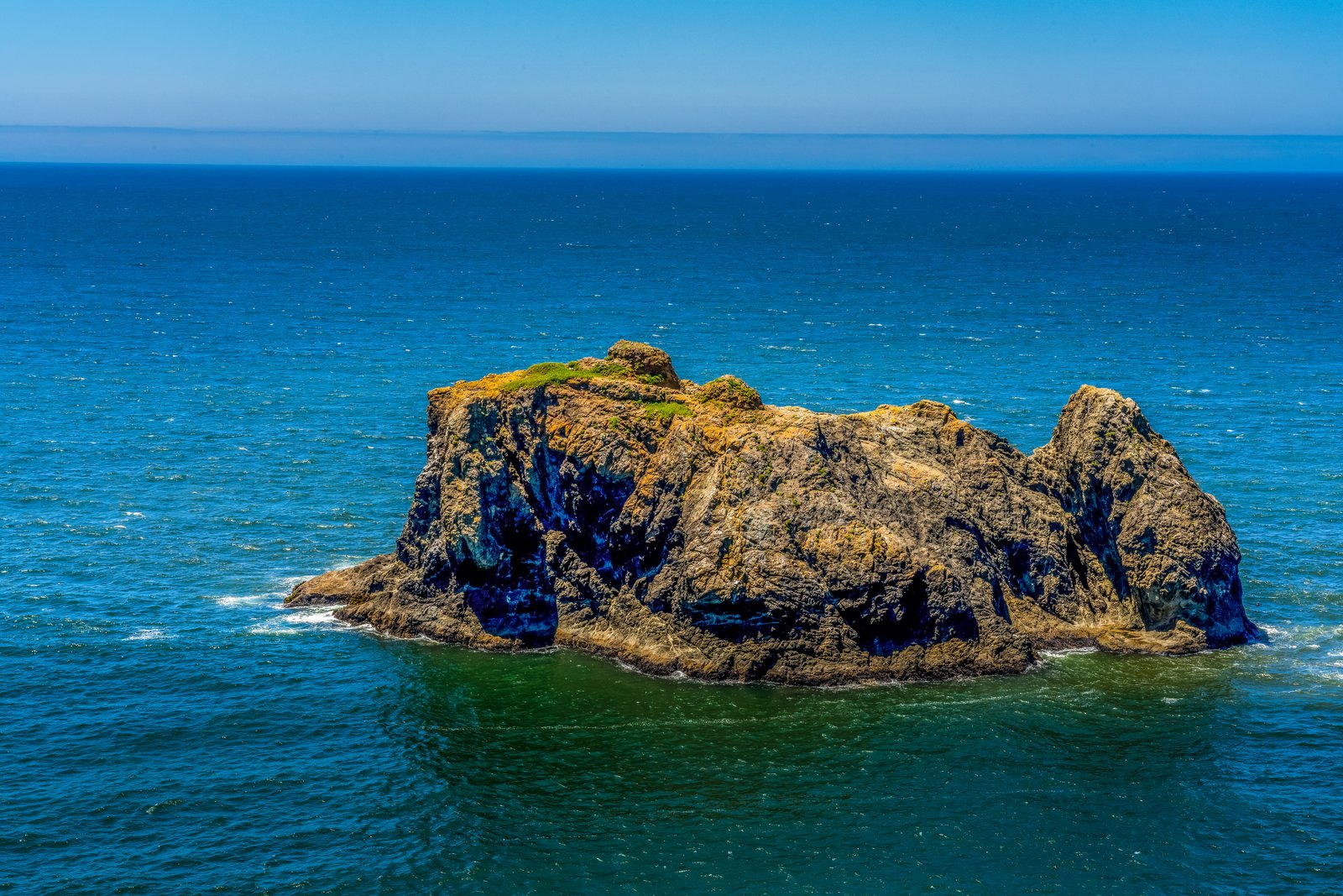
Frog Rock Oregon Coast
Prints from $14Downloads from $19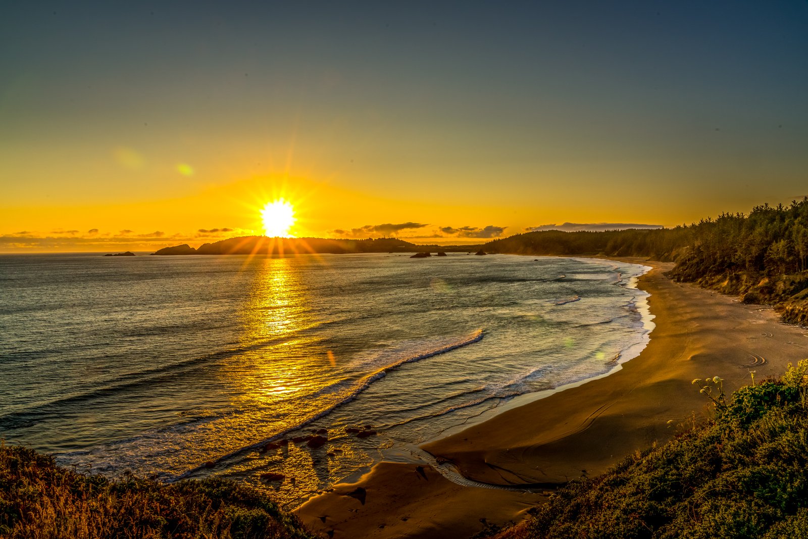
Oregon Coast Sunset
This matches well. The photo shows the classic vantage point from Ecola State Park, looking south over Crescent Beach toward Cannon Beach and its sea stacks, with Tillamook Head's forested slopes framing the shoreline.Good, I have enough to write the piece.This sunset was captured from a cliffside viewpoint in Ecola State Park on Oregon's north coast, looking south over Crescent Beach toward Cannon Beach. The curving shoreline, offshore sea stacks, and forested slopes of Tillamook Head frame the sun as it sinks into the Pacific, its light spreading across wet sand and breaking waves. Key Features: The Vantage Point: The view looks south from cliffs above Crescent Beach, a secluded cove between Tillamook Head and Cannon Beach. Historic Ground: In 1806 Captain William Clark of the Lewis and Clark Expedition surveyed this coastline from Tillamook Head, calling it one of the finest views he had seen. The Sea Stacks: The offshore rocks belong to the same chain as Haystack Rock, a landmark of the Cannon Beach shoreline. The Setting: Ecola State Park preserves rugged, forested headlands and beaches along the northern Oregon coast.
Prints from $14Downloads from $19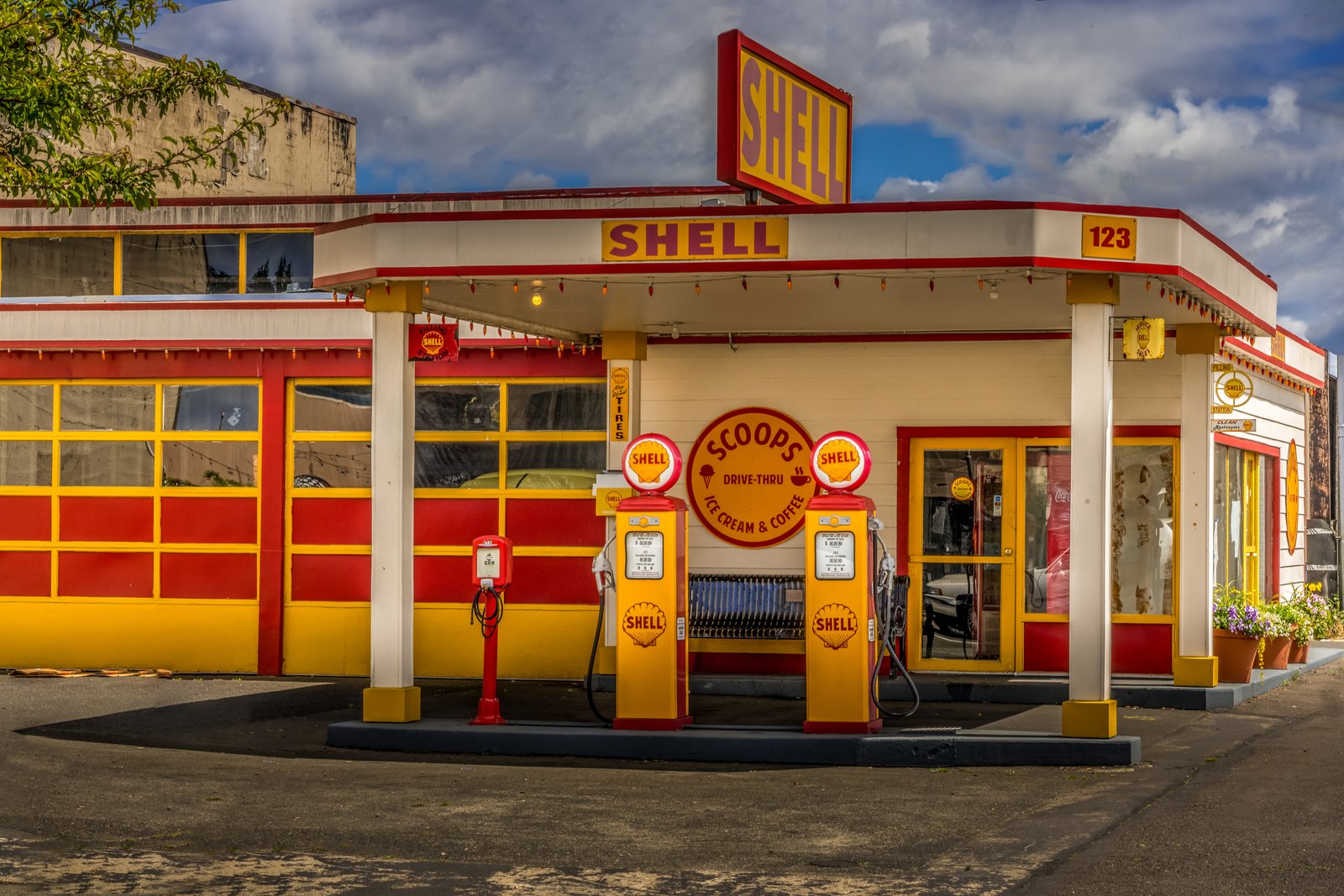
Shell Aberdeen Washington
Now I have enough confirmed detail to write the story.This is Scoops, a beautifully restored vintage Shell filling station at 123 in Aberdeen, Washington, photographed straight on from across the forecourt. The frame captures the classic yellow and red livery, twin globe-topped Shell pumps, and the hand painted Scoops sign advertising ice cream and coffee where fuel was once sold. Key Features: The Building: A former roadside Shell service station preserved in its original 1930s era paint scheme and signage. The Transformation: The garage bays and pump island now serve as a working ice cream and coffee shop rather than an auto repair stop. The Setting: Located in Aberdeen in the Grays Harbor region of coastal Washington, a working timber town along Highway 12. The Appeal: Its period details, from the illuminated Shell sign to the original gas pumps, make it a favorite stop for travelers and photographers.
Prints from $14Downloads from $19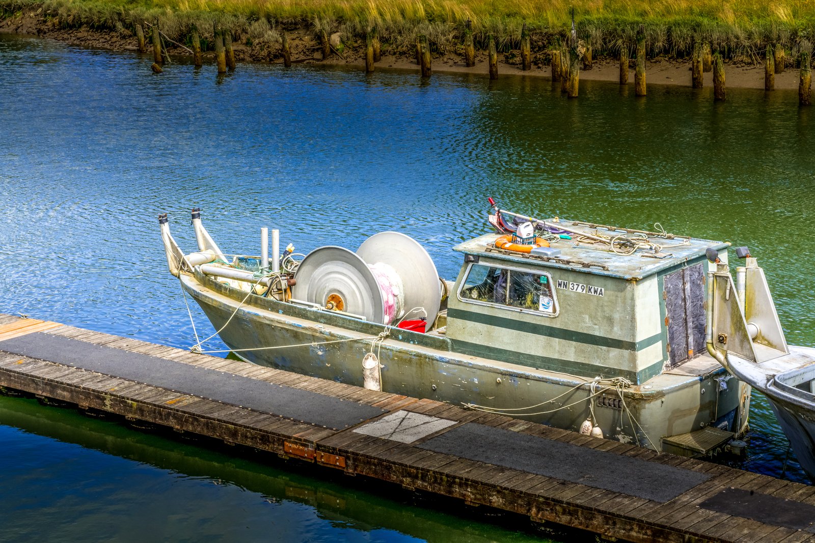
Time to Fish
This confirms WN is Washington State boat registration prefix. The photo shows a small aluminum gillnet fishing boat, likely used for salmon fishing, with its net drum reel mounted at the bow, docked at a wooden floating dock in a tidal slough or estuary along the Washington coast, with wooden pilings and marsh grass along the banks in the background.This confirms the boat type: a bowpicker gillnetter used for salmon fishing in Washington's coastal waters such as the Columbia River, Willapa Bay, or Grays Harbor. I have enough to write a well-supported, general regional description without over-specifying an exact dock. This photograph looks down onto a small aluminum gillnet fishing boat, registered in Washington State as shown by its WN bow numbers, tied to a wooden floating dock in a quiet tidal channel. Coiled net line sits on the bow's large net reel, while weathered pilings and golden marsh grass line the muddy banks beyond, suggesting a working harbor along Washington's southwest coast, likely near Willapa Bay, Grays Harbor, or the Columbia River estuary. Key Features: The Boat Type: This is a bowpicker style gillnetter, a design developed to net salmon by hauling nets over the bow using a mounted drum reel. The Setting: The vessel is moored in a tidal slough with wooden piling remnants and marsh grass, typical of Washington's estuarine fishing communities. The Registration: The WN prefix on the hull identifies it as a vessel registered with the Washington State Department of Licensing. The Fishery: Boats like this one work the region's commercial gillnet salmon fisheries, targeting Chinook, coho, and chum runs each season.
Prints from $14Downloads from $19
Stacks Aberdeen WA
A close-up view of freshly cut timber logs stacked at a mill yard in Aberdeen, Washington, at the mouth of the Chehalis River on Grays Harbor. The image fills the frame with row upon row of raw log ends, their sawn faces glowing amber and gold in low sunlight while bark and moisture streak the surrounding wood. Key Features: The Timber Town: Aberdeen sits in Grays Harbor County, where mills processed enormous logs cut from the region's old growth forests. Industrial Peak: The area's timber operations were once record setters, with the county's mills exporting a billion board feet of lumber by the mid 1920s. Working Waterfront: The growth of the mills brought a large workforce of millworkers and loggers to the town and surrounding forests. The Composition: The tight framing turns the raw stacked timber into an abstract pattern of circles and diagonals, highlighting texture, grain and color over any single log.
Prints from $14Downloads from $19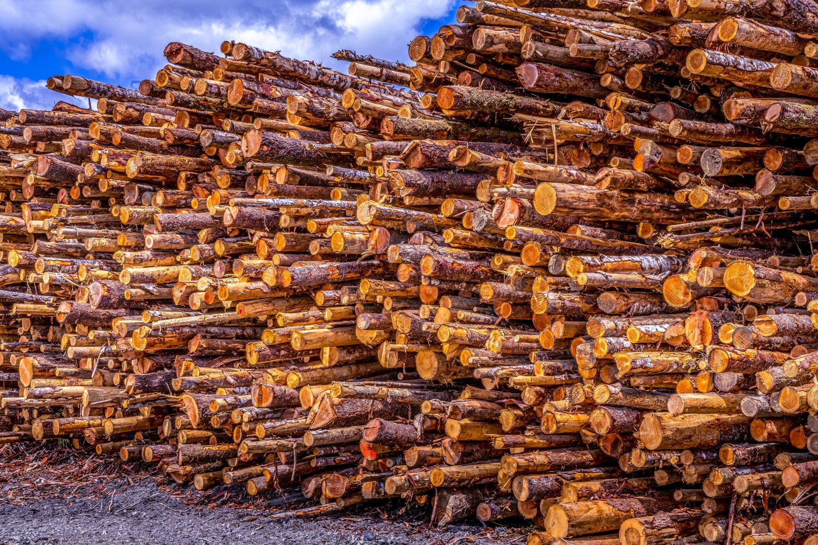
Stacks Aberdeen WA
This photograph was taken at a timber storage yard in Aberdeen, Washington, on Grays Harbor, where towering stacks of freshly cut logs are held before milling. The close, ground level vantage point emphasizes the sheer volume of the pile, with hundreds of cut trunks layered against a bright blue sky, their pale cut ends and bark textures catching the sunlight. Key Features: The Region: Grays Harbor County's forests and port access made Aberdeen a center of the Pacific Northwest timber trade. A Historic Title: In 1924 a new milestone for annual lumber production was reached when the one billionth foot of timber was shipped from Aberdeen, earning the town the title of "Lumber Capital of the World." Industrial Scale: Weyerhaeuser Timber Company opened its first mill in Aberdeen in 1924, part of a long line of operations that shaped the town's economy. Changing Times: The timber industry continued to boom, but by the late 1970s most of the timber had been logged, and most of the mills were closing down by the 1970s and 1980s.
Prints from $14Downloads from $19