

Fine Art Display Pics
America's landscapes, printed big and signed.
Photographs by Rick Billings, printed by a professional photo lab on paper, art board, metal, canvas or acrylic. Every print carries Rick's signature, and every photo is also sold as a full-resolution download.
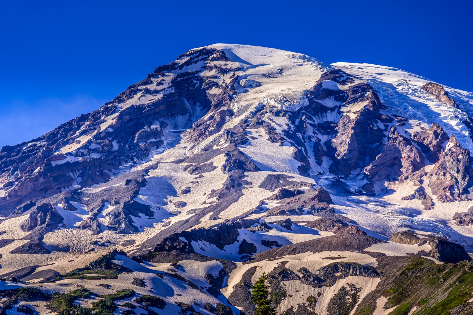
Mt Rainier WA
by Rick Billings, Master Photographer
This photograph looks toward the glaciated upper slopes of Mount Rainier in Washington State, likely captured from a high vantage point in the park such as the Paradise or Sunrise area, with the mountain's rocky flanks and snowfields filling the frame beneath a deep blue sky. Streaks of andesite rock cut through the ice, showing the layered volcanic structure beneath the permanent snowcap. Key Features: The Volcano: Mount Rainier is a stratovolcano rising to 14,410 feet, the highest peak in the Cascade Range. The Ice: It carries more glacial ice than any other Cascade volcano, with twenty six glaciers feeding major rivers into the Puget Sound and Columbia basins. The Setting: The peak sits within Mount Rainier National Park, its dramatic relief of nearly ten thousand feet from valley floor to summit visible in this close view of its upper reaches.
Prints from $14Downloads from $19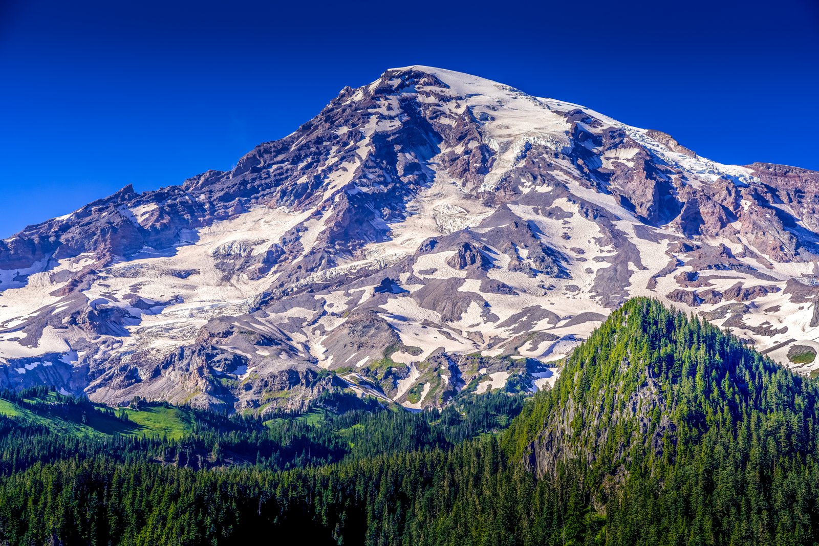
Mt Rainier Washington
by Rick Billings, Master Photographer
This photograph looks south across the subalpine forests and meadows of Mount Rainier National Park in Washington State, likely from the Paradise or Reflection Lakes area, toward the mountain's summit. Sunlit crevassed glaciers and volcanic rock streak the peak, while dense stands of Pacific silver fir and mountain hemlock climb the foreground ridges under a clear alpine sky. Key Features: The Peak: Mount Rainier, an active volcano currently at rest between eruptions, is the highest peak in the Cascade Range, rising to 14,406 feet above sea level. The Ice: Its edifice, capped by snow and 25 glaciers, has been built up by untold eruptions over the past 500,000 years, making it one of the most heavily glaciated peaks in the contiguous United States. The Landscape: Elevations in the park range from approximately 1,600 feet to the summit of Mount Rainier, creating dramatic ecological diversity, from dense evergreen forest to bare rock and ice. The Park: Popular destinations include Paradise, Sunrise, Reflection Lakes, and the Wonderland Trail, which circles the entire mountain, drawing hikers and photographers throughout the summer season.
Prints from $14Downloads from $19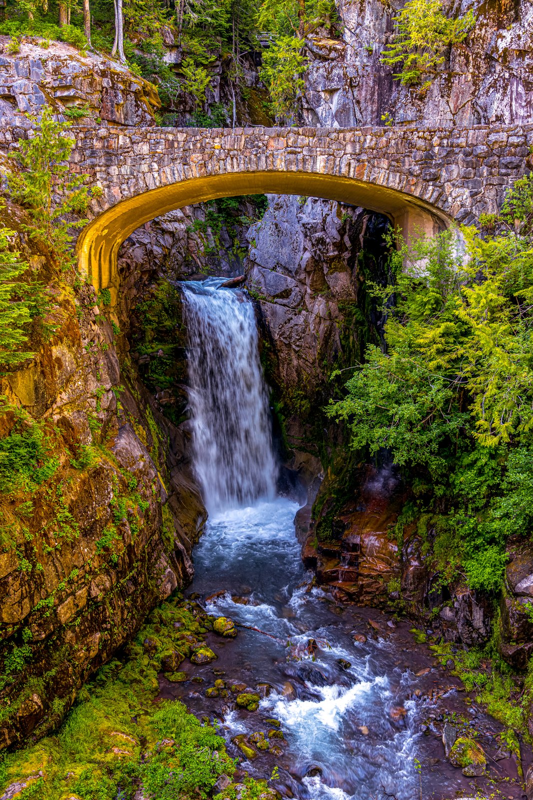
Mt Rainier Washington Falls
by Rick Billings, Master Photographer
This is confirmed as Christine Falls at Mount Rainier National Park in Washington State.This photograph captures Christine Falls in Mount Rainier National Park, Washington, framed beneath the historic stone bridge carrying the Paradise Road across Van Trump Creek. The view looks up into a narrow, moss covered canyon where the creek plunges in a two tiered drop before rushing on toward the Nisqually River. Ferns, conifers, and deep green foliage crowd the surrounding cliffs, framing the arch and falling water below. Key Features: The Bridge: Built of reinforced concrete faced with native stone in a rustic style, it was completed in 1928 and still carries road traffic over the falls. Historic Recognition: The bridge is listed on the National Register of Historic Places as part of the park's rustic architecture collection. The Setting: The falls sit between Rampart Ridge and Cushman Crest, a well known stop on the road between Longmire and Paradise.
Prints from $14Downloads from $19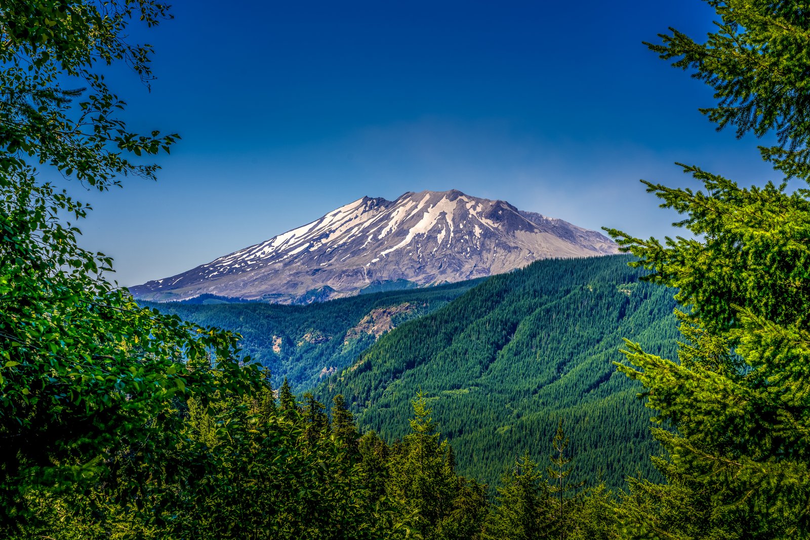
Mt Rainier Washington
by Rick Billings, Master Photographer
This photograph shows Mount St. Helens in southwest Washington's Gifford Pinchot National Forest, framed through evergreen boughs and deciduous foliage at the edge of a forest clearing. The view looks toward the volcano's north face, where the distinctive horseshoe-shaped crater and steep, ash-gray slopes stand in contrast to the deep green, regrown timberland filling the valley below. Key Features: The Crater: The volcano lost an estimated 3.4 billion cubic yards of its cone, about 1,300 feet in height, leaving behind a horseshoe-shaped crater open to the north, visible here as the truncated, snow-streaked summit. The 1980 Eruption: During the 1980 eruption the upper 400 meters of the summit was removed by a huge debris avalanche, radically reshaping the once-symmetrical peak into its present jagged profile. The Setting: The mountain rises within the Gifford Pinchot National Forest, part of the Cascade Range, with surrounding slopes showing decades of forest recovery since the blast. The Elevation Change: The eruption reduced the summit from roughly 9,600 feet to about 8,000 feet, permanently altering its silhouette against the Washington sky.
Prints from $14Downloads from $19
Butterfly
by Rick Billings, Master Photographer
This close-up nature photograph captures a fritillary butterfly perched on a cluster of common ragwort blossoms, its wings folded to reveal the intricate orange and black checkered pattern typical of the species. The image was likely taken in a garden, meadow, or hedgerow setting in a temperate region such as the UK or similar climate, where ragwort grows wild among broad-leaved foliage. Soft, blurred greenery in the background isolates the butterfly and blooms as the clear subject of the frame. Key Features: The Butterfly: Fritillaries are recognized by the checkered orange and black pattern on their wings, a hallmark of this widespread group of species. The Flowers: Common ragwort is a native, biennial plant that can become a problem on land due to its wind-spread seeds, yet it thrives as a wildflower in the countryside. Ecological Value: Ragwort is an important nectar source for hundreds of species of butterflies, bees, moths, flies and other invertebrates, helping to support populations in the countryside. The Setting: The dense, sunlit foliage suggests a natural meadow or garden edge, a common habitat where such pollinator activity is easily observed in summer.
Prints from $14Downloads from $19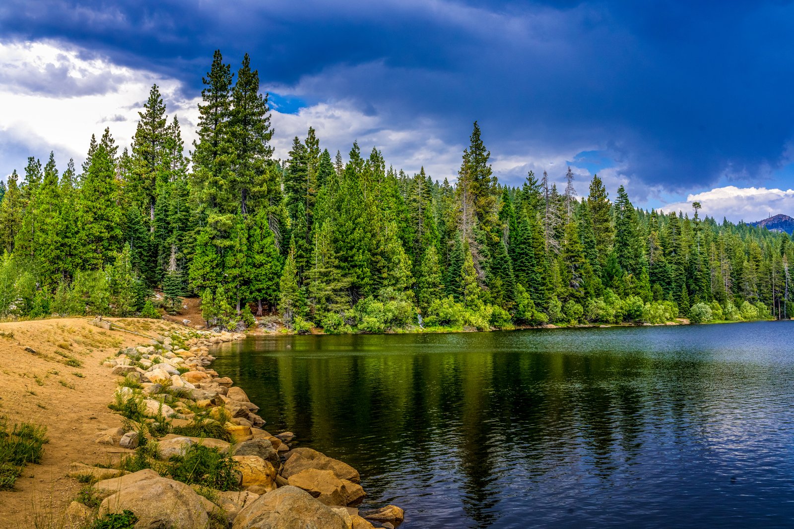
Snowflower RV Reno
by Rick Billings, Master Photographer
The photograph was taken at Snowflower Lake, the private stocked trout lake at Snowflower RV Resort in Emigrant Gap, California, high in the Sierra Nevada along the Interstate 80 corridor between Sacramento and Reno. The view looks across the calm water from the resort's sandy, boulder lined shoreline toward a dense wall of pine and fir forest, with a darkening storm sky gathering overhead. Key Features: The Setting: Snowflower RV Resort is located in the Sierras on I-80 at Exit 160, with elevations ranging from 5,800 to 6,150 feet. The Lake: It features a 23-acre lake with stocked trout, and canoe and paddle boat rentals. The Grounds: Snowflower consists of nearly 700 acres, with elevations ranging from 5,100 to 6,200 feet, centered on the lake. Nearby City: Reno is a short drive away, offering casinos, shopping, and restaurants for visitors staying at the resort.
Prints from $14Downloads from $19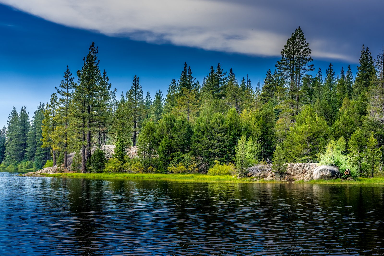
Snowflower Lake
by Rick Billings, Master Photographer
Snowflower Lake lies within the Snowflower RV Resort near Emigrant Gap, California, in the Sierra Nevada foothills along the Interstate 80 corridor. The photograph looks across the still, dark water toward a granite-studded shoreline where dense stands of Jeffrey and lodgepole pine crowd down to the grassy bank, all beneath a heavy bank of clouds sliding over the ridge. Sunlight breaks through just enough to pick out a golden strip of shoreline grass and the pale granite boulders scattered among the trees. Key Features: The Setting: Snowflower RV Resort is located in the Sierras on I-80 at Exit 160, with elevations ranging from 5,800 to 6,150 feet. The Lake: It features a 23-acre lake with stocked trout, and canoe and paddle boat rentals. The Landscape: Granite outcrops and mixed conifer forest are typical of this stretch of the northern Sierra Nevada. The Access: Snowflower RV Resort is located in the Sierras on I-80 at Exit 160.
Prints from $14Downloads from $19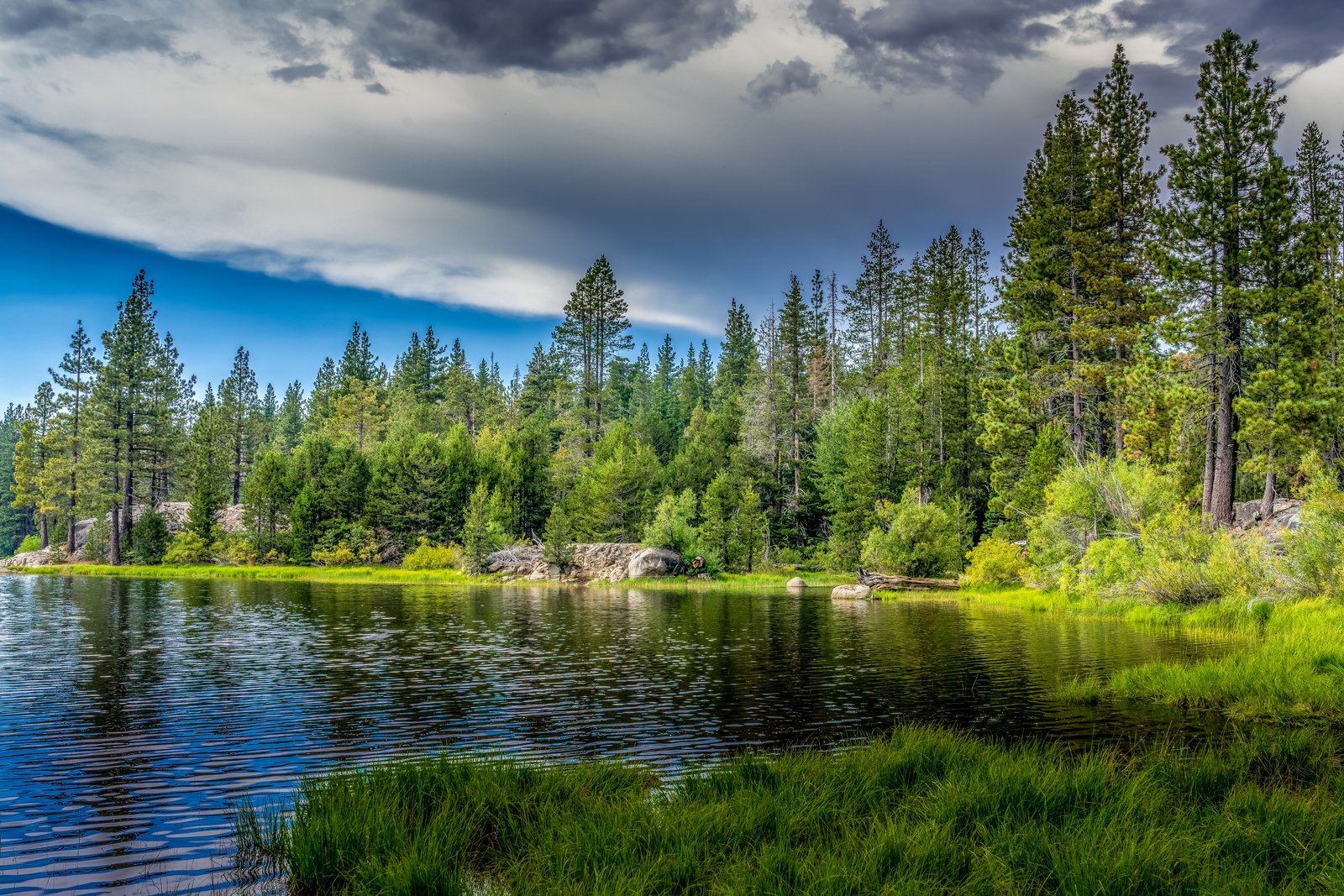
Snowflower Lake
by Rick Billings, Master Photographer
The photo shows Snowflower Lake, a small backcountry lake in the Sierra Nevada near Yuba Gap and Emigrant Gap in Placer County, California. The view looks across the still, dark water from a grassy, granite studded shoreline toward a dense stand of Jeffrey and ponderosa pines, with a dramatic bank of storm clouds breaking to reveal blue sky overhead. Key Features: The Setting: Snowflower Lake sits a short drive off Interstate 80 at Yuba Gap, on the western side of Donner Summit, spread through forest in the Tahoe National Forest area. The Region: Snowflower Lake is located in Placer County, California. Recreation: Popular activities at the lake include fishing, swimming, kayaking, bicycling, and hiking. The Moment: The frame captures a passing summer storm clearing over the Sierra forest, its clouds mirrored in the calm surface of the lake alongside the surrounding pines and granite boulders.
Prints from $14Downloads from $19
Lazy Day at Lake Tahoe
by Rick Billings, Master Photographer
Based on the vantage point, mountain backdrop, and deep blue water, this matches Lake Tahoe on the California-Nevada border in the Sierra Nevada.This photograph looks out across Lake Tahoe, the deep alpine lake straddling the California-Nevada border in the Sierra Nevada. A figure in a sun hat rests on a shoreline bench, taking in the vivid blue water with the mountains of the Carson Range rising along the far shore. Key Features: The Lake's Color: the dominant reason for Lake Tahoe's intense blue hue is the way sunlight interacts with its exceptionally pure water Its Scale: Lake Tahoe is North America's largest alpine lake at 22 miles long and 12 miles wide, as well as its deepest, with an average depth of 1,645 feet Its Origins: faulting along the Carson Range created the basin about two million years ago The Setting: Lake Tahoe sits at an elevation of 6,225 feet (1,897 meters) in the Sierra Nevada mountains.
Prints from $14Downloads from $19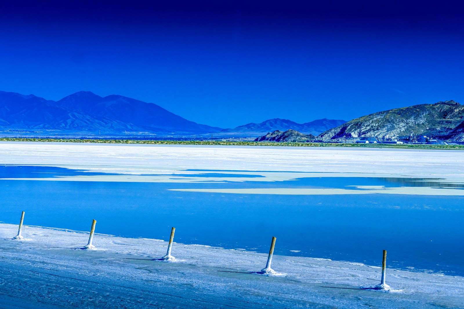
Utah Salt Flats
by Rick Billings, Master Photographer
The photograph looks across a flooded stretch of salt flats on the shore of the Great Salt Lake in northern Utah, likely near the vast solar evaporation ponds operated along the lake's north arm. A line of weathered wooden posts marks the edge of a pond or channel, leading the eye toward distant desert mountains and a cluster of industrial buildings tucked at their base, all beneath a deep saturated sky. Key Features: The Salt Industry: Ogden's solar evaporation pond complex produces salt, sulfate of potash and magnesium chloride from the Great Salt Lake. The Process: Mineral-rich brine from the lake's most remote areas is pumped into a series of shallow ponds where the sun naturally evaporates the water over a three-year span, leaving beds of naturally occurring crystallized minerals. The Scale: The 55,000-acre solar evaporation pond complex in Utah is one of only four in the world that can produce SOP from a naturally occurring brine source using solar evaporation. The Setting: The wooden markers likely delineate pond boundaries against the Great Salt Lake's remote desert mountain backdrop.
Prints from $14Downloads from $19