


Photographer
Rick Billings, Master Photographer
Orlando, Florida
I've been a professional photographer since I graduated high school in 1978. I'm bringing over four decades of professional photography experience and offering images I captures as beautiful display prints in your home or office.
Collections
All photos by Rick Billings, Master Photographer
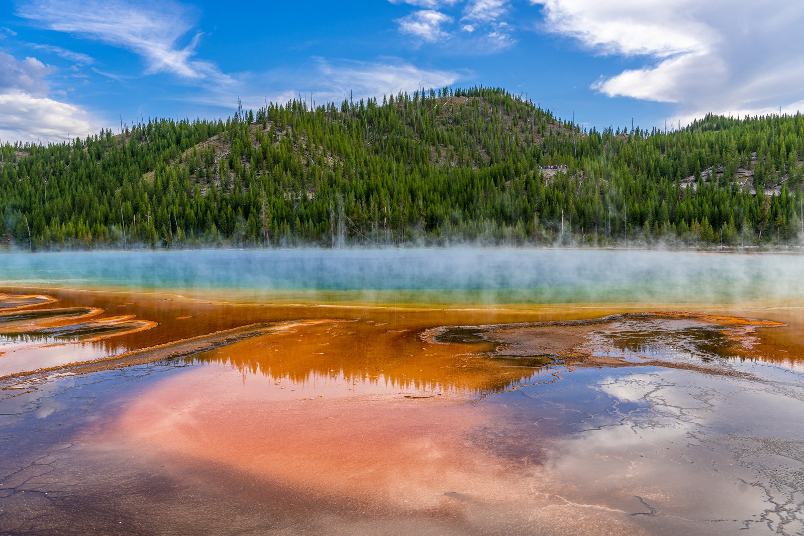
Grand Prismatic Spring
Grand Prismatic Spring lies in the Midway Geyser Basin of Yellowstone National Park, Wyoming, seen here from the boardwalk that skirts its steaming edge. Rising sulfur mist drifts across a forested hillside as the spring's mineral rich runoff channels spread in bands of amber and rust toward the viewer, with the spring's blue heart glowing faintly beyond the steam. Key Features: The Spring: The Grand Prismatic Spring is the largest hot spring in Yellowstone National Park, and the third largest in the world. The Colors: Its size, the world's third largest, and its colors, bands of orange, yellow, and green ring the deep blue waters, make it remarkable. The Cause: The distinct rings of temperature in the water contribute to the coloration, with different species of heat loving thermophile bacteria inhabiting each zone, and the colors change with the seasons. The Setting: Visitors are asked to stay on the boardwalk path, as touching the extremely hot water can be dangerous and is prohibited within the park.
Prints from $14Downloads from $19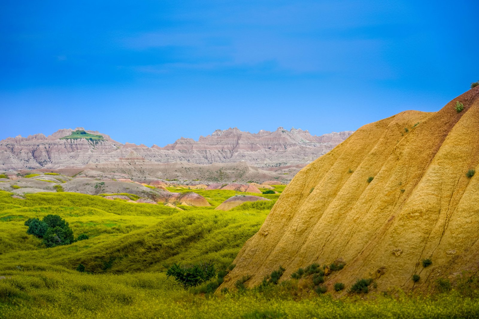
Badlands Yellow Mounds
This photograph captures the Yellow Mounds overlook area in Badlands National Park, South Dakota, where rolling green prairie in the foreground gives way to a striated golden mound and the pale, jagged badlands wall rising in the distance. The vantage point looks out across a mix of grassland and eroded formations toward the layered buttes that define the park's rugged terrain. Key Features: The Yellow Mounds: These brightly colored layers are paleosols, ancient fossilized soils, and the Yellow Mounds get their mustardy color from a mineral called goethite. Ancient Seabed Origins: The golden soil formed as an ancient sea retreated and exposed dark ocean mud, which weathered into the yellow paleosol seen here. Layered Rock Record: The Chadron Formation beneath these mounds, made largely of light gray claystone, was deposited about 37 to 34 million years ago across an ancient floodplain. Mixed Prairie Setting: The surrounding green grassland is part of the mixed-grass prairie that borders the park's dramatic eroded buttes and spires.
Prints from $14Downloads from $19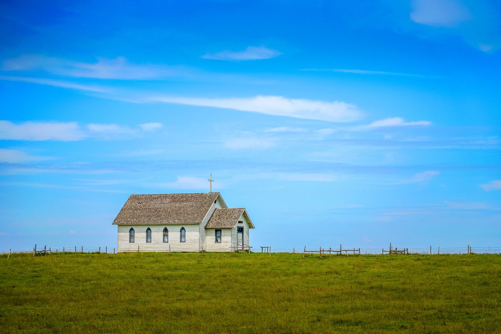
1880 Town Church
Now I have enough to write the story.This photograph was taken at South Dakota's Original 1880 Town, a recreated pioneer village on Interstate 90 near Murdo, South Dakota. The frame shows a small white clapboard church with pointed gothic windows and a wooden cross atop its gabled roof, standing alone against a wide prairie sky behind a split rail fence. The open grassland stretching to the horizon reflects the homestead landscape the village was built to evoke. Key Features: Origin: The complex gathers more than 30 authentic buildings from the 1880 to 1920 era, relocated from towns across the region and refurnished with period relics. The Setting: Located west of Murdo along Interstate 90, the attraction sits on open prairie with Main Street running toward the horizon. Architecture: The steepled, wood frame church with arched windows reflects small congregational chapels built by early homesteaders on the Dakota plains.
Prints from $14Downloads from $19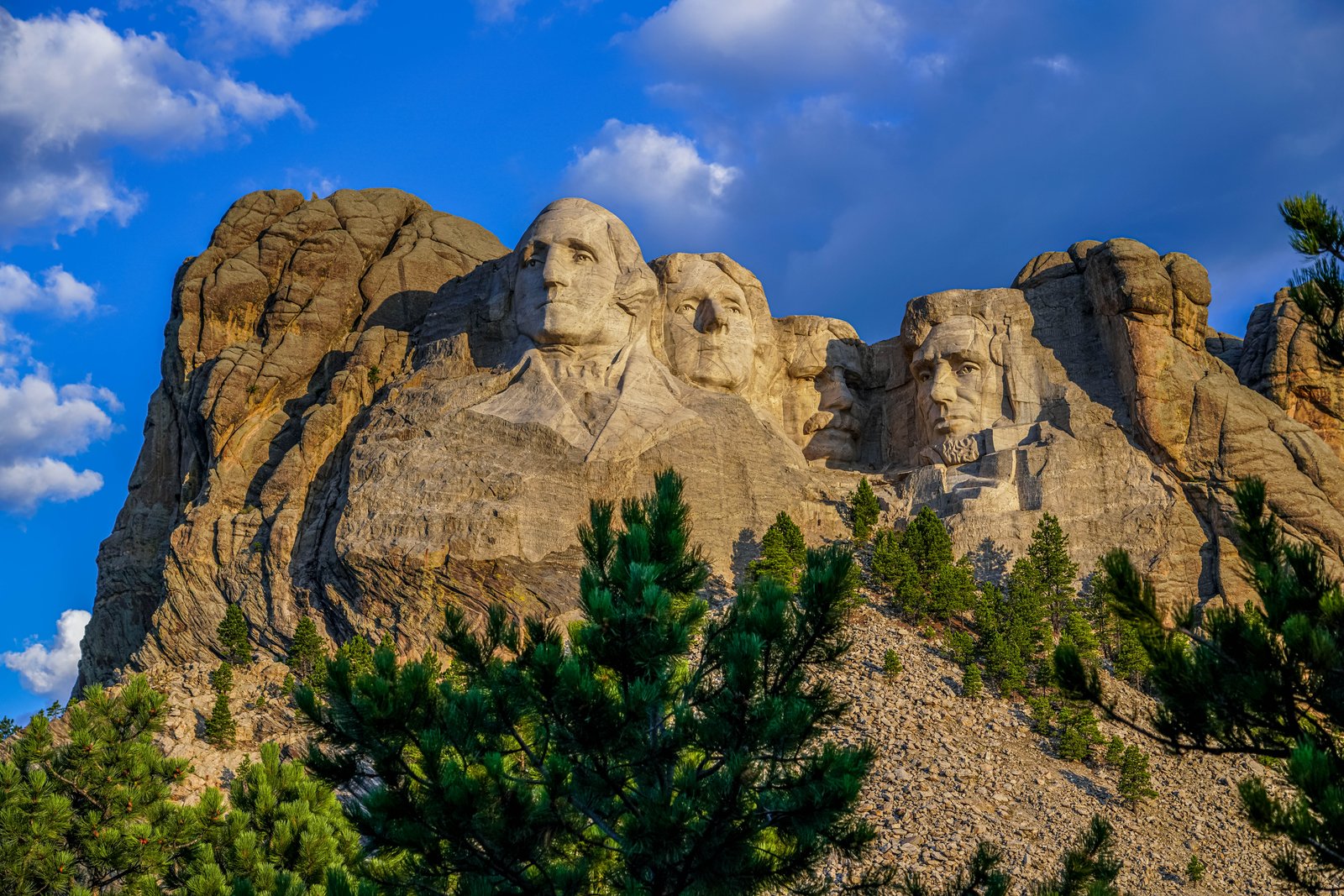
Mount Rushmore National Memorial
Mount Rushmore National Memorial rises above the Black Hills near Keystone, South Dakota, where the photograph looks up from a pine covered slope toward the mountain's granite face. Mount Rushmore National Memorial in Keystone, South Dakota, was carved on the granite face of a mountain in the Black Hills between 1927 and 1941. The image captures the sixty foot likenesses of George Washington, Thomas Jefferson, Theodore Roosevelt, and Abraham Lincoln, with scattered clouds and blue sky behind the peak. Key Features: The Sculpture: The memorial features the 60-foot faces of four U.S. presidents, George Washington, Thomas Jefferson, Theodore Roosevelt, and Abraham Lincoln, carved into granite. The Construction Era: The mountainside carving was completed between 1927 and 1941, though funding problems made the project take longer than originally expected. The Setting: The presidents' faces are carved into a mountain nestled among the Black Hills, twenty miles from the nearest city. Visitor Draw: Despite its remoteness, the site draws two million tourists each year.
Prints from $14Downloads from $19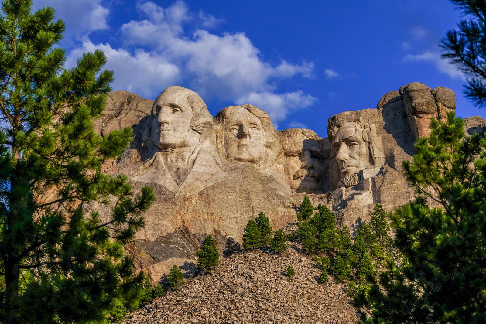
Mount Rushmore National Memorial
This photograph was taken at Mount Rushmore National Memorial in the Black Hills of Keystone, South Dakota, viewed from a lower vantage point through ponderosa pines that frame the granite cliff face. The image captures the sixty foot high carved heads of Presidents George Washington, Thomas Jefferson, Theodore Roosevelt, and Abraham Lincoln set against a bright blue sky, with a rocky talus slope and evergreen trees in the foreground. Key Features: The Sculptor: Mount Rushmore was sculpted by Gutzon Borglum and his son, Lincoln Borglum. The Subjects: The rock carving depicts the faces of four U.S. Presidents, from left to right, George Washington, Thomas Jefferson, Theodore Roosevelt, and Abraham Lincoln. The Timeline: Gutzon Borglum started drilling into the 6,200 foot mountain in 1927. The Setting: The memorial is located in Pennington County, South Dakota, near the town of Keystone.
Prints from $14Downloads from $19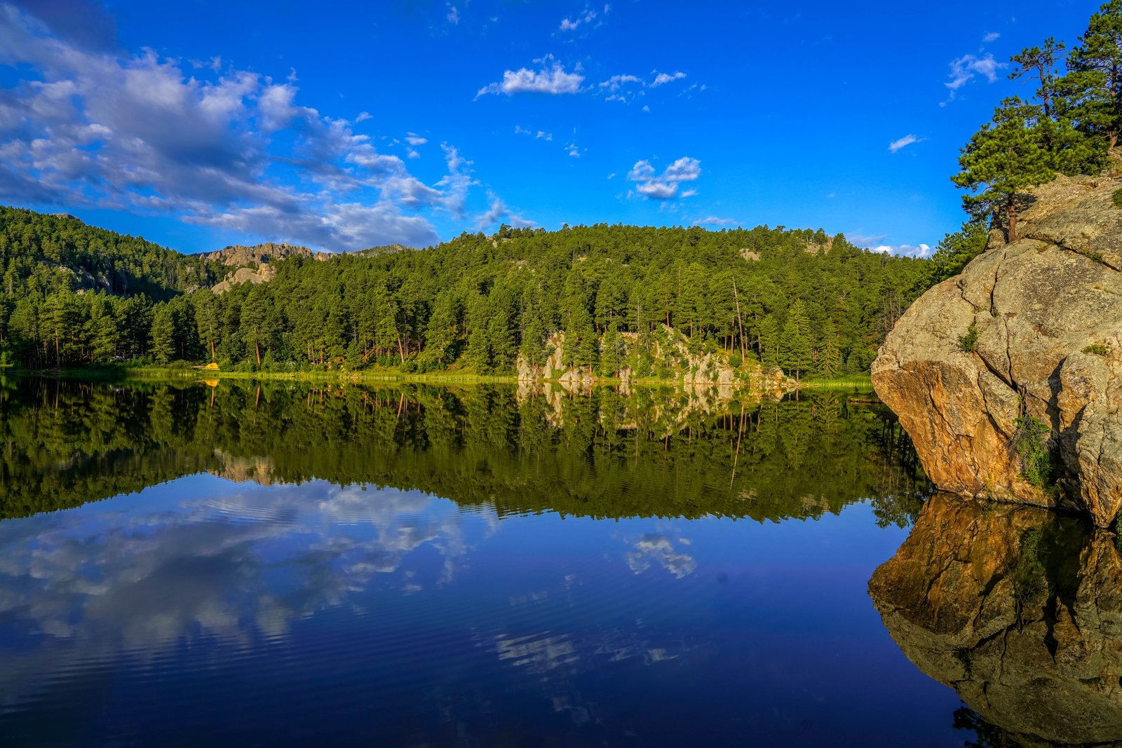
Horsethief Lake in the Black Hills
The photo was taken at Horsethief Lake in the Black Hills National Forest of South Dakota, near Mount Rushmore and Custer State Park. The vantage point looks across the still surface of the small lake toward a wooded shoreline of Ponderosa pine and pale granite outcrops, with the calm water creating a near perfect mirror image of the trees, rock and sky above. A massive granite boulder crowned with a lone pine juts into the frame on the right, anchoring the reflection and giving a sense of scale to the scene. Key Features: The Granite Core: The Black Hills owe their pale, rounded rock formations to ancient granite pushed up through the plains and slowly exposed by erosion, forming the spires and boulders seen along the shoreline. The Forest Setting: Dense stands of Ponderosa pine cover the surrounding hills, a signature of the Black Hills National Forest that gives the range its dark, forested appearance from a distance. The Lake Itself: Horsethief Lake sits within the Black Hills, prized for its calm water, granite backdrop and nearby hiking trail into the Black Elk Wilderness. The Reflection Effect: Windless mornings turn the lake into a mirror, doubling the pines, rock and sky and making the boulder in the foreground the visual anchor of the composition.
Prints from $14Downloads from $19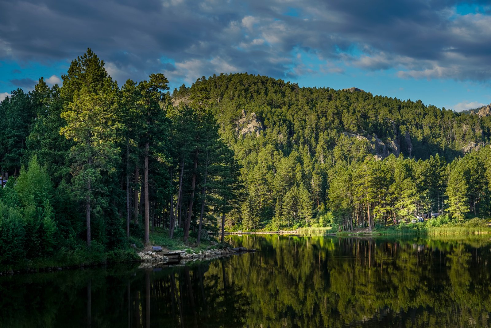
Rocky Water Lake
The photograph shows a still forest lake in the granite highlands of North America's northern Great Plains, most consistent with the Black Hills region of South Dakota. The view looks across calm water toward a tree covered ridge where weathered granite outcrops break through dense Ponderosa pine forest, with a small dock and bench on the near shore and a campground visible along the far bank. Key Features: The Setting: A quiet lake ringed by pine forest, with granite rock formations rising along the ridge line that are typical of the ancient granite core exposed in this mountain region. The Reflection: Calm evening water mirrors the trees and rock face, a common effect on small, sheltered lakes tucked into forested canyons. The Human Presence: A modest dock, bench, and distant campground show the lake is used for recreation and camping rather than being a wholly untouched wilderness site. The Landscape Type: The mix of pine forest, exposed granite spires, and a small impounded lake reflects the geology and land use pattern common to protected forest and park lands in this part of the country.
Prints from $14Downloads from $19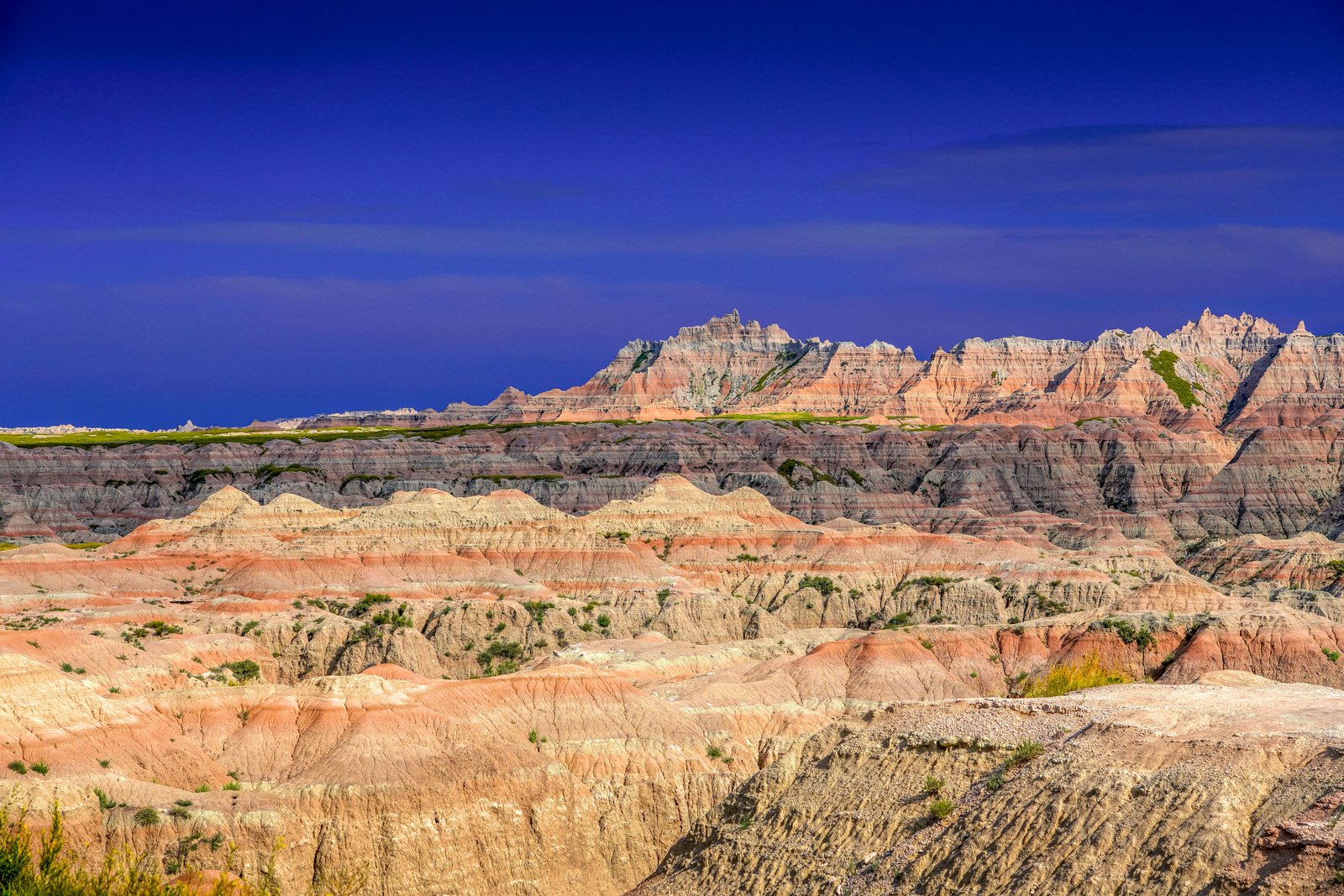
Badlands Chadron
This photograph looks over the eroded buttes and pinnacles of the Badlands, the rugged formation stretching across southwestern South Dakota near the Nebraska border by Chadron. The view shows layered mounds of rose, tan and gray sediment rising toward a jagged ridge of spires, with a thin band of green prairie marking the flatter tableland above the eroded basin. Key Features: The Rock Layers: The geology comprising the Badlands is a colorful layer-cake of various sedimentary rocks deposited between 28 to 75 million years ago by shallow seas, rivers, and wind, giving the buttes their striped color bands. The Volcanic Ash: Some of the layers include volcanic ash that originated from volcanoes located over 500 miles away, blown eastward before settling in the area. Ongoing Erosion: Because the rock layers are relatively soft, erosion occurs at about one inch per year, and at that rate the hills are expected to erode completely within the next half a million years.
Prints from $14Downloads from $19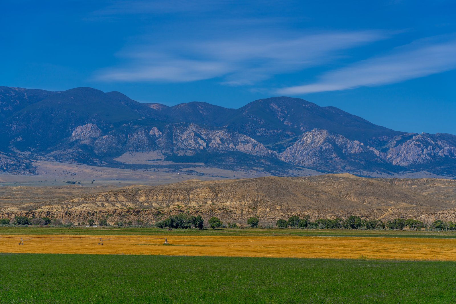
Clark's Fork Range Cody Wyoming
The photograph looks north toward the Absaroka Range along the Clark's Fork of the Yellowstone River, in the ranch country near Cody, Wyoming. From a valley vantage point across irrigated hay meadows, the view stretches over sagebrush foothills and eroded badland slopes to a wall of jagged, layered peaks rising along the edge of the Absaroka-Beartooth country. Key Features: The Mountain Front: This canyon is at the intersection of the Laramide age Cody Arch and Beartooth Uplift, and the Eocene Absaroka Volcanic Province, providing one of the most spectacular views in Wyoming. The Valley Floor: Clark's Fork Ranch sits in a scenic, private mountain valley along the Absaroka-Beartooth Mountains in northwest Wyoming, with dramatic views of the Clarks Fork of the Yellowstone River Canyon. The Climate: Cody experiences a semi-arid climate with highly variable conditions, hot dry summers and minimal snow coverage in winter, with about 300 days of sunshine per year. The Land Use: irrigated fields in the foreground reflect the working ranches that stretch beneath these peaks toward the Shoshone National Forest.
Prints from $14Downloads from $19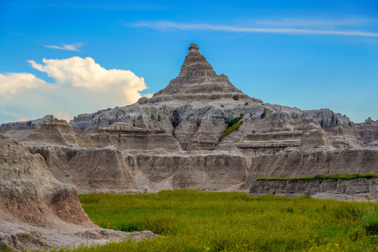
Badlands Peak
Badlands National Park in southwestern South Dakota rises here as a jagged sandstone and claystone pyramid, its layered slopes striped in muted tan and rose. The pointed spire sits above a broad green apron of prairie grasses, with lower buttes and eroded gullies fanning out in the foreground beneath a wide, cloud streaked sky. Key Features: The Landscape: Erosion has carved the region into distinctive spires, pinnacles, hoodoos, monuments, buttes, and mesas that are known collectively as the White River Badlands. The Formation: The Badlands were formed when thick layers of sediment were deposited across western South Dakota and then slowly carved by erosion into ridges, buttes, gullies, and sharp spires. The Timeline: The serrated Badlands terrain did not exist until about 500,000 years ago when water started to cut through the sediments. The Scale: The park is a breathtaking landscape of rugged terrain, towering spires, deep canyons, and unique rock formations, covering over 244,000 acres.
Prints from $14Downloads from $19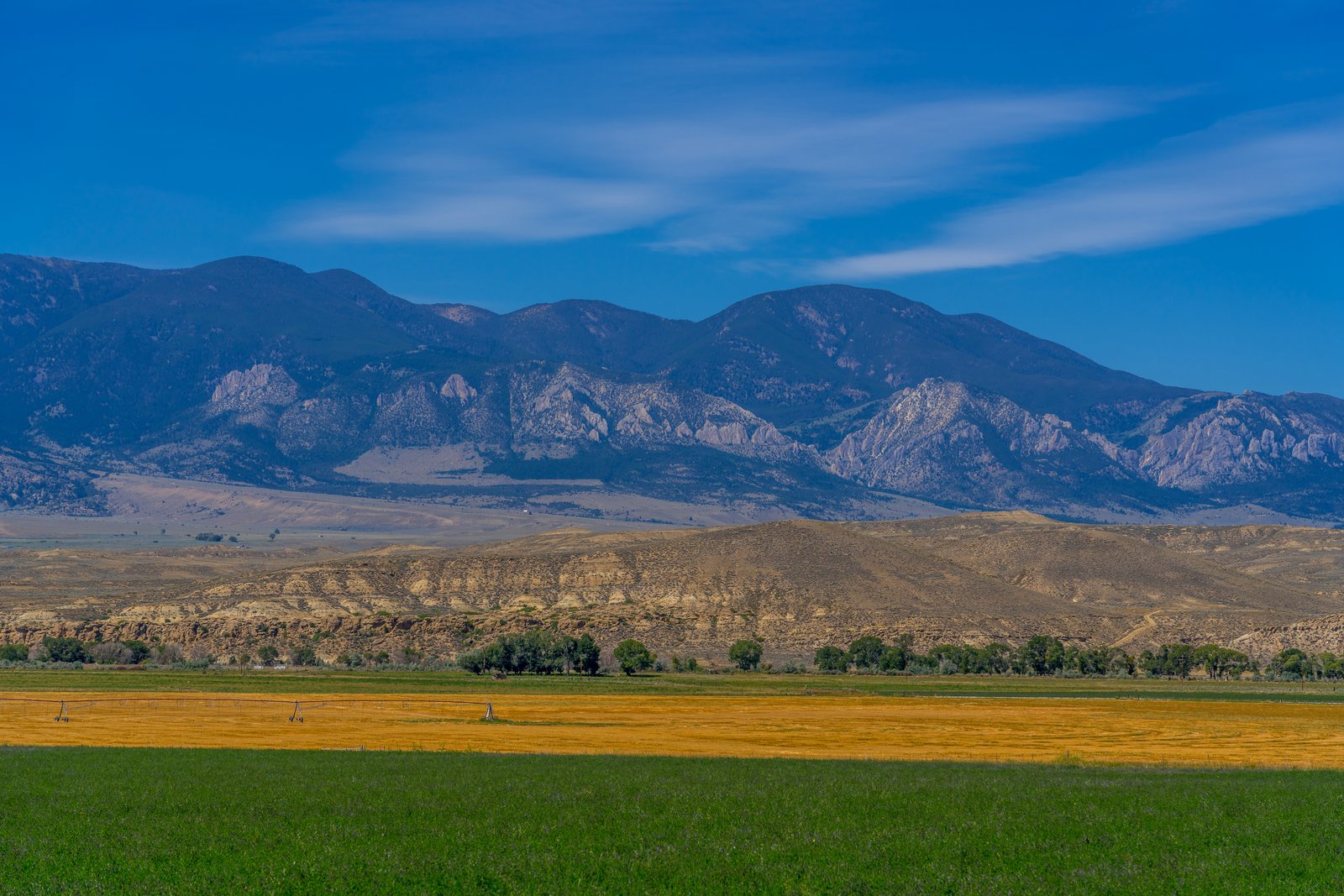
Clark's Fork Range Cody Wyoming
The photograph looks north across an irrigated ranch valley near Clark, Wyoming, toward the Absaroka Range along the Clarks Fork of the Yellowstone River north of Cody. In the foreground, freshly cut hay fields and center pivot irrigation lines stretch beneath dry, eroded foothills, while a jagged band of pale limestone reef rock rises abruptly before the higher, timbered summits of the range fade into blue haze. Key Features: The Setting: Clark's Fork Ranch is a large, scenic, private, live water, mountain ranch situated in its own valley along the Absaroka-Beartooth Mountains in northwest Wyoming, with views of the river canyon nearby. The Community: The property sits near the community of Clark, thirty miles north of Cody, Wyoming, on an easy scenic drive toward Yellowstone National Park and the Beartooth Highway. The Climate: The surrounding area is semi-arid high desert sagebrush plains with little rain or snowfall, averaging less than ten inches a year, as the bordering mountains squeeze much of the moisture from the atmosphere. The Geology: The exposed reef of tilted rock marks the mountain front fold where basin sediments meet the rising Absaroka Range.
Prints from $14Downloads from $19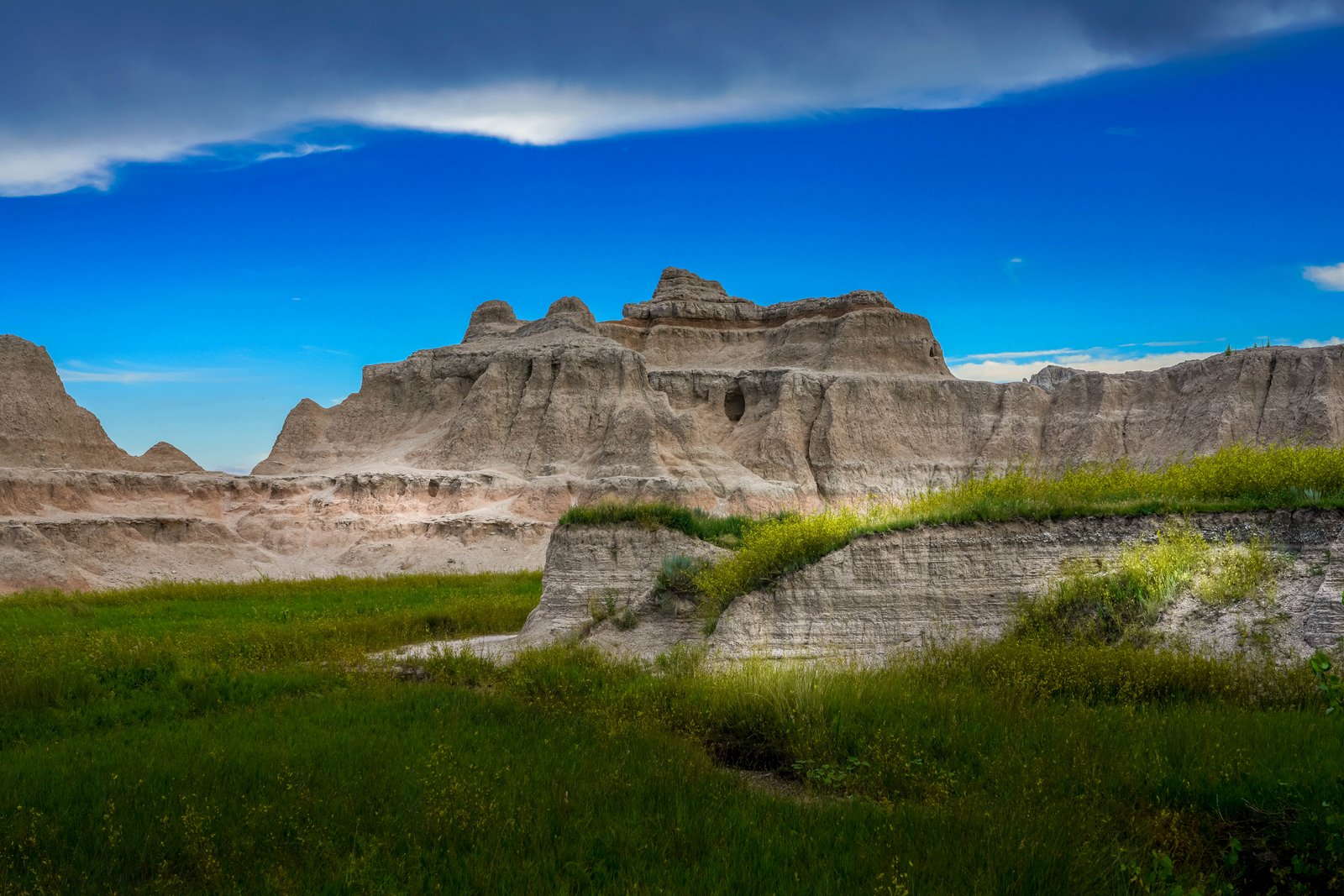
Badlands Rockyford Ash
The Badlands of South Dakota rise abruptly from a green mixed grass prairie, their pale, eroded buttes catching afternoon light beneath a deep blue, storm streaked sky. The vantage point is low, at the edge of the grassland where wind and water have carved the soft sedimentary rock into spires, domes and channels, with wildflowers and prairie grass spilling right up to the base of the formations. Key Features: The Rock Layers: The Rockyford Ash comes from a volcanic tuff that was deposited when the Great Basin erupted, carried all the way from Utah and Nevada to cause this greyish colorization. The Formation: Above the Brule lies the Sharps Formation, the youngest geologic formation of the park at 30-28 million years old, with the Rockyford Ash forming its base. The Landscape: Badlands National Park is known for its bright colors and beautiful layers that span over 381 square miles of South Dakota. The Name: the park got its name from the local Lakota people, who first called it "mako sica," meaning land that is bad.
Prints from $14Downloads from $19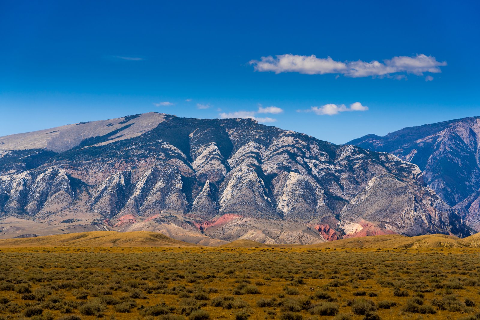
Clark's Fork Cody Wyoming
Along the sagebrush flats north of Cody, Wyoming, this view looks toward the jagged limestone front of the Absaroka Range where it meets the Beartooth Mountains near Clark's Fork Canyon. The photograph captures a broad expanse of golden high desert giving way to steep, tooth like ridgelines streaked with pale rock and dark timber, with bands of reddish stone visible in the foothills below the peaks. Key Features: The Location: This stretch of country lies roughly thirty to forty miles north of Cody near the Clark's Fork of the Yellowstone River, at the intersection of the Laramide age Cody Arch and Beartooth Uplift, and the Eocene Absaroka Volcanic Province. The Rock Layers: The red fins visible in the landscape are Triassic Chugwater Formation, sometimes holding erratic glacial boulders within them, while the pale jagged peaks above are formed from ancient Madison and Bighorn carbonate rock. The Range Divide: The Clarks Fork Canyon marks the division between the Beartooth Mountains to the north and the Absaroka Mountains to the south, two very differently formed ranges meeting at this point. The River: The Clarks Fork of the Yellowstone River, Wyoming's only federally designated wild and scenic river, flows out of the Clarks Fork Canyon through this rugged terrain.
Prints from $14Downloads from $19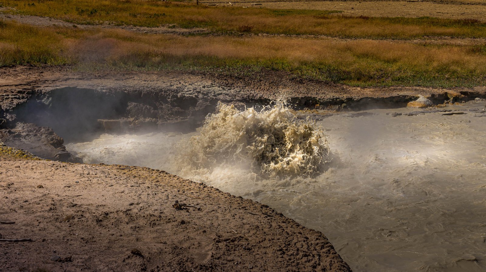
Churning Caldron
The photograph shows Churning Caldron, a boiling, muddy hot spring in the Mud Volcano area along the Grand Loop Road in Yellowstone National Park. Steam and murky, sediment laden water surge violently across the frame, framed by scorched thermal ground and grassy meadow in the background, likely taken from the boardwalk overlook just above the pool's edge. Key Features: The Mud Volcano Area: Part of Yellowstone's thermal zone near Hayden Valley, known for acidic, sulfurous features with names like Sour Lake and Black Dragon's Caldron.Now I'll compose the final story text. This photograph captures Churning Caldron, a violently roiling hot spring in the Mud Volcano area of Yellowstone National Park, seen from the boardwalk overlook just above the pool. Steam rises from the muddy, sulfur laden water as it froths and surges over its scorched banks, with the open sagebrush meadow of the Hayden Valley region stretching out behind. Key Features: The Mud Volcano Area: A cluster of acidic, sulfurous thermal features along Yellowstone's Grand Loop Road, including Sour Lake and Black Dragon's Caldron. Earthquake Driven Activity: Shaken again and again by earthquakes, the temperature beneath it rises and falls, transforming Churning Caldron, with nearly five hundred earthquakes shaking the area between July 1 and July 15 in 1995. Roiling, Not Boiling: Churning Caldron is scalding hot, but not boiling, as gases rise through vents opened by earthquakes, then rumble and bubble to the surface, causing the water to roil. Ongoing Change: Churning Caldron defied its name in 1971 when mats of microorganisms grew on the pool's warm, calm surface, before earthquakes in 1978 and 1979 raised its temperature again.
Prints from $14Downloads from $19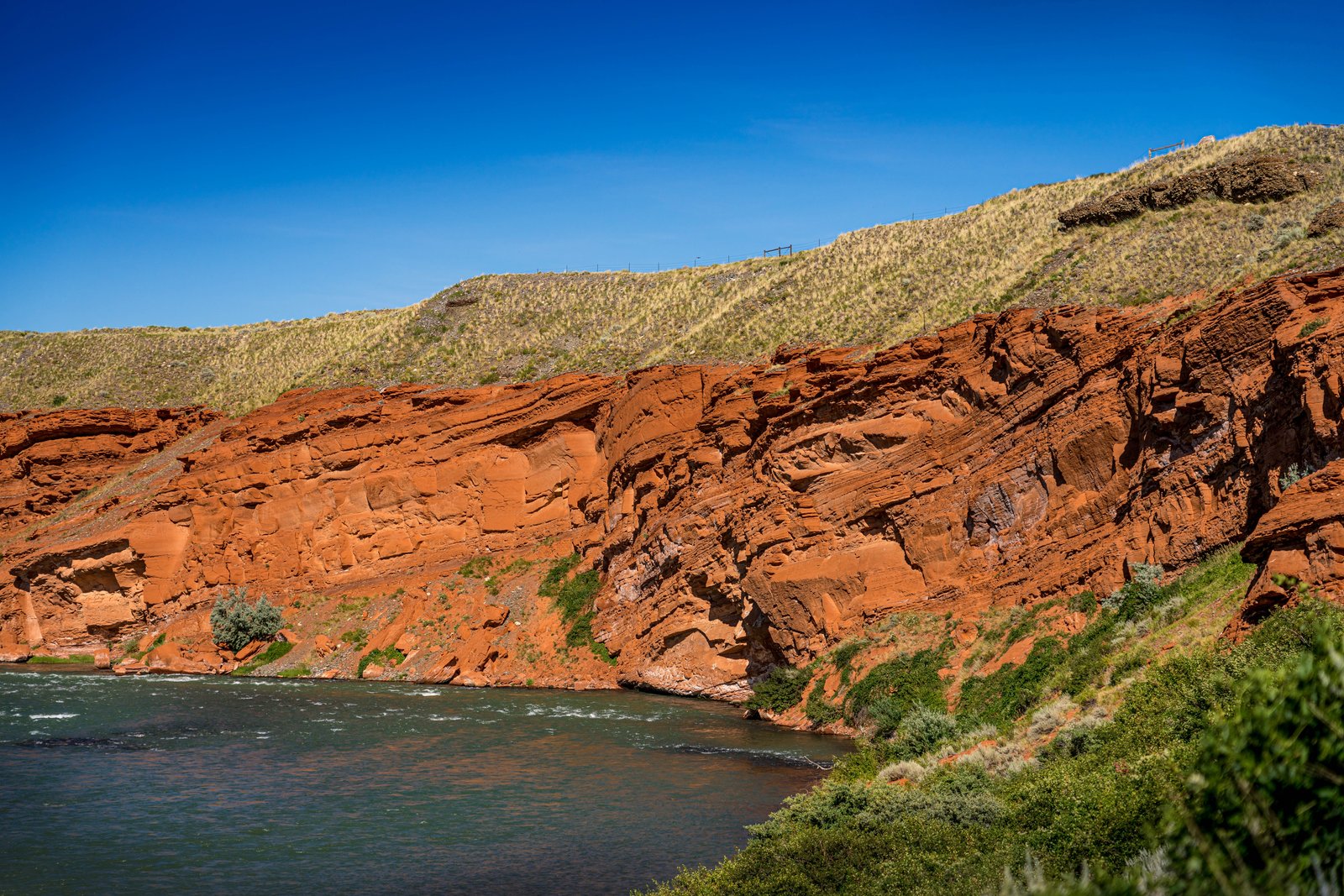
Shoshone Canyon River
The photo looks down onto the Shoshone River as it cuts through the Red Rock Canyon section just west of Cody, Wyoming, where the water bends beneath towering banded sandstone cliffs. Grass covered slopes of Rattlesnake Mountain rise above the rock, with sagebrush and green shrubs lining the riverbank in the foreground. Key Features: The Canyon: Geologic compressive forces which formed the uplift also caused rocks to move vertically along the fault, with Rattlesnake Mountain uplift beginning to form 66 million years ago. The River: The Shoshone River runs from the Buffalo Bill Dam through a canyon bordered by Cedar and Rattlesnake Mountains through Cody, Wyoming. The Setting: Shoshone Canyon is situated near Cody, Wyoming, carved by the Shoshone River, and is walled in by the sheer cliffs of Rattlesnake Mountain and Cedar Mountain. Recreation: It is easily accessible and a popular route to the East Entrance of Yellowstone National Park.
Prints from $14Downloads from $19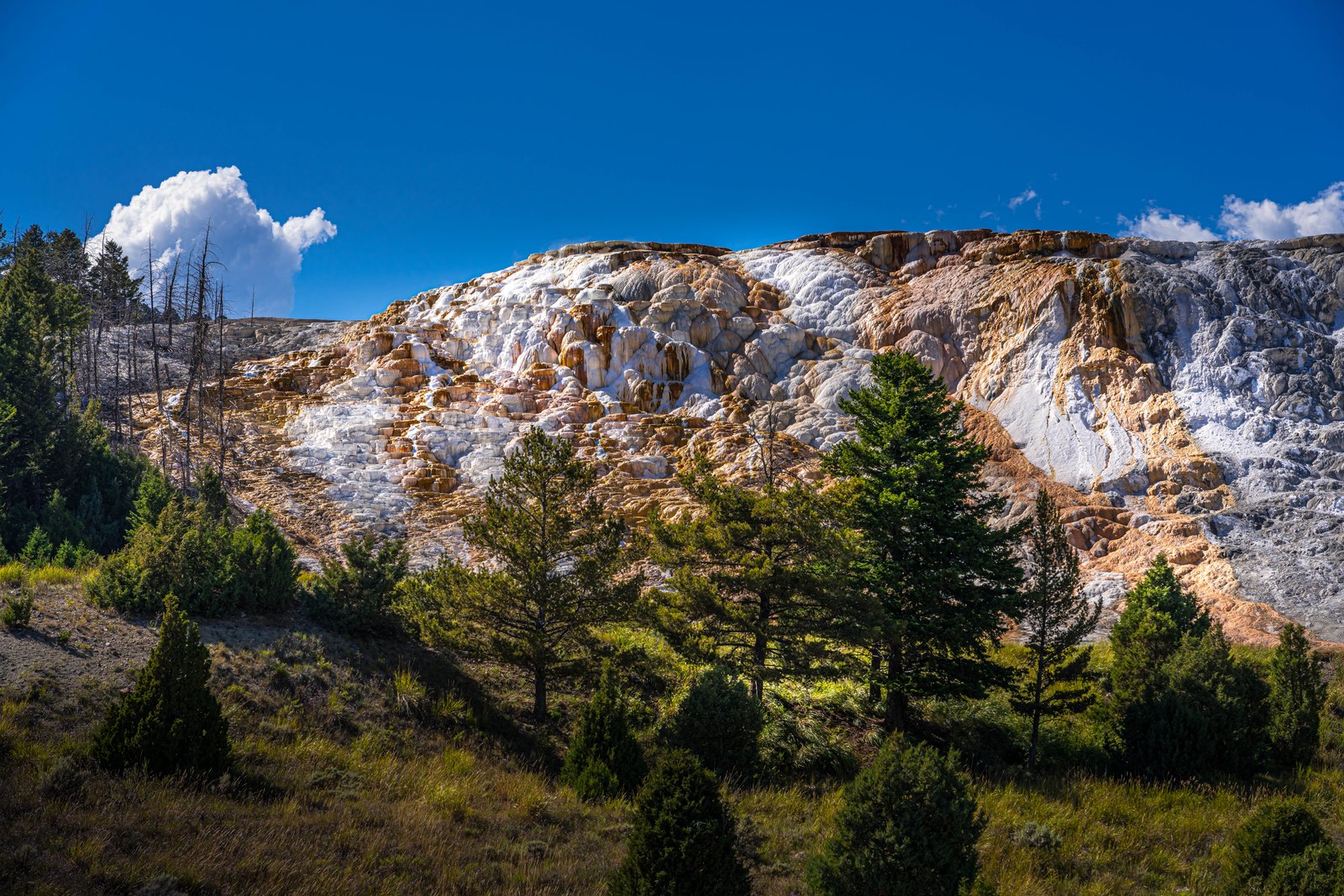
Mammoth Hot Springs
Mammoth Hot Springs, in the northern reaches of Yellowstone National Park, is captured here from a hillside vantage among lodgepole pines and juniper, looking up at a broad terrace of white and orange travertine rising against a deep blue sky. The mineral-streaked slope, sculpted into scalloped ledges and folds, glows in the afternoon light while a lone thunderhead builds over distant ridgelines. Key Features: The Formation: Mammoth Hot Springs is an extensive mass of travertine terraces that have been forming over thousands of years, as travertine crystallizes from mineral springs saturated with dissolved calcium carbonate. The Setting: Located on the slope of Terrace Mountain near the northern boundary of Yellowstone National Park, Mammoth Hot Springs shows unique characteristics compared to the more southern geyser basins. The Scale: The terraces have reached an overall thickness of roughly 75 meters and an expansion of more than 4 square kilometers since the first springs started flowing nearly 8,800 years ago. The Discovery: Early explorers during the Washburn, Hayden, and Hague expeditions of the 1870s were astonished by the massive terraces and pools of hot spring limestone at Mammoth Hot Springs.
Prints from $14Downloads from $19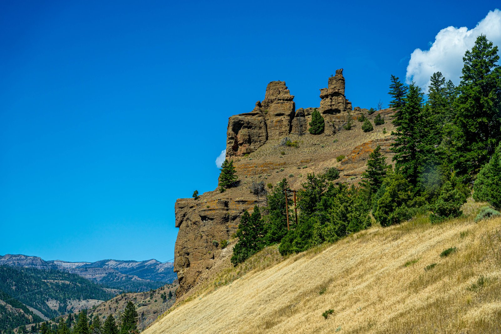
Yellowstone Hillside
Yellowstone National Park's northern range holds this rugged outcrop, its weathered spires rising above a sloping, gold-hued grassland dotted with lodgepole pine. The jagged rock crown, carved from ancient volcanic rock, overlooks a forested draw with the Absaroka Range fading into the distance, capturing the rough, layered terrain typical of the park's Tower and Lamar country. Key Features: The Rock Formation: The pinnacles are remnants of volcanic breccia, a coarse rock formed from ancient lava and debris flows that cooled and fractured into blocky towers, a geology famously documented near Tower Fall since the park's earliest surveys. The Setting: Rolling, sun-dried grass hills meet stands of pine on the slope below the outcrop, typical of Yellowstone's drier northern range in late summer. The Backdrop: Snow-streaked peaks of the Absaroka Range are visible on the horizon, marking the mountainous boundary that frames the park's interior valleys. The Significance: These eroded volcanic towers are a striking, lesser-known counterpart to Yellowstone's famous geothermal features, showing the park's deeper volcanic history carved by wind, water, and time.
Prints from $14Downloads from $19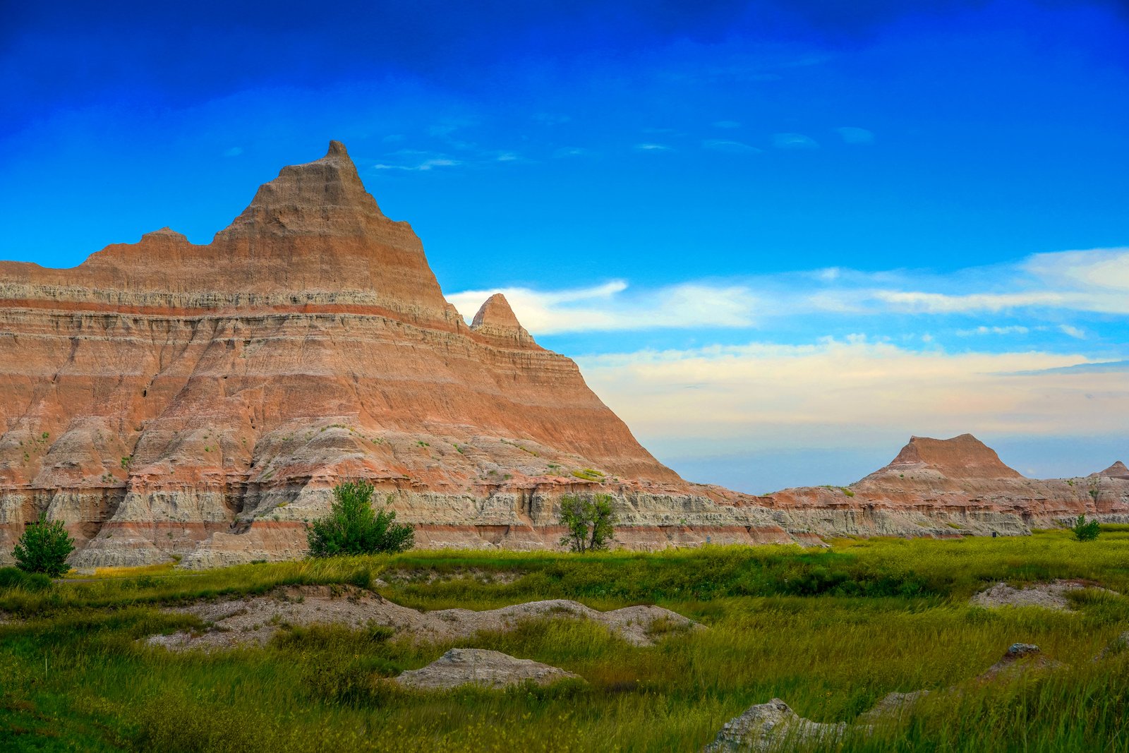
Badlands Norbeck Pass
This photograph was taken at Norbeck Pass in the North Unit of Badlands National Park, South Dakota, looking across the striped buttes toward the mixed grass prairie below. The vantage point sits along the Badlands Loop Road, where jagged, banded peaks rise sharply above a green valley floor under a deep blue sky. Key Features: The Rock Layers: Deposition began roughly 75 million years ago, and the youngest major rock layers were deposited about 28 million years ago, creating the striped pinnacles seen here. The Fossil Record: The White River Badlands have developed an international reputation as a fossil-rich area, containing the richest deposits of Oligocene mammals known. The Setting: Badlands National Park protects sharply eroded buttes, pinnacles, and spires blended with the largest undisturbed mixed grass prairie in the United States. The Pass: Norbeck Pass lies along the park's scenic loop road, offering one of the classic overlooks of these eroded formations meeting open grassland.
Prints from $14Downloads from $19