


Photographer
Rick Billings, Master Photographer
Orlando, Florida
I've been a professional photographer since I graduated high school in 1978. I'm bringing over four decades of professional photography experience and offering images I captures as beautiful display prints in your home or office.
Collections
All photos by Rick Billings, Master Photographer
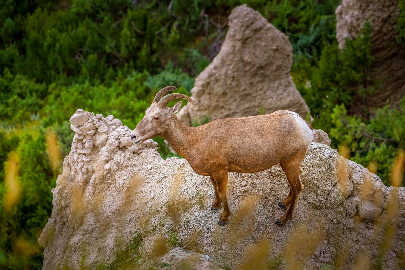
Badlands Bighorn Sheep Ridge
This photograph was taken in Badlands National Park in southwestern South Dakota, where a bighorn sheep stands atop one of the park's eroded clay pinnacles, framed by prairie grasses in the foreground and dense juniper growth behind. The animal's alert stance and elevated perch are typical of these surefooted mountain sheep as they survey the rugged terrain from the park's characteristic buttes. Key Features: The Badlands Terrain: Layered sedimentary rock and clay have eroded over millions of years into the park's signature spires, ridges, and pinnacles. Bighorn Comeback: In 1964, 22 Rocky Mountain bighorn sheep were translocated from Pikes Peak, Colorado, to Badlands National Park in southwestern South Dakota, after the species had been wiped out in the region decades earlier. Wildlife Habitat: The mix of grassland and juniper woodland pictured here provides cover and forage that allow the reintroduced herds to thrive among the park's steep formations.
Prints from $14Downloads from $19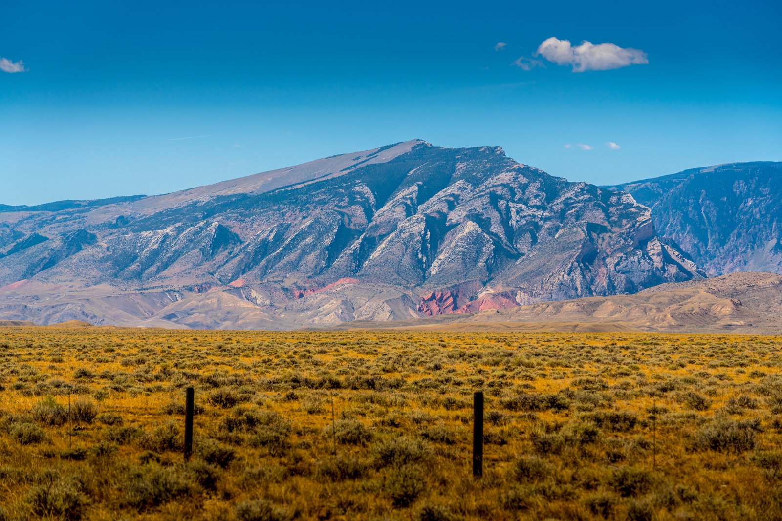
Clark's Fork Cody Wyoming
Prints from $14Downloads from $19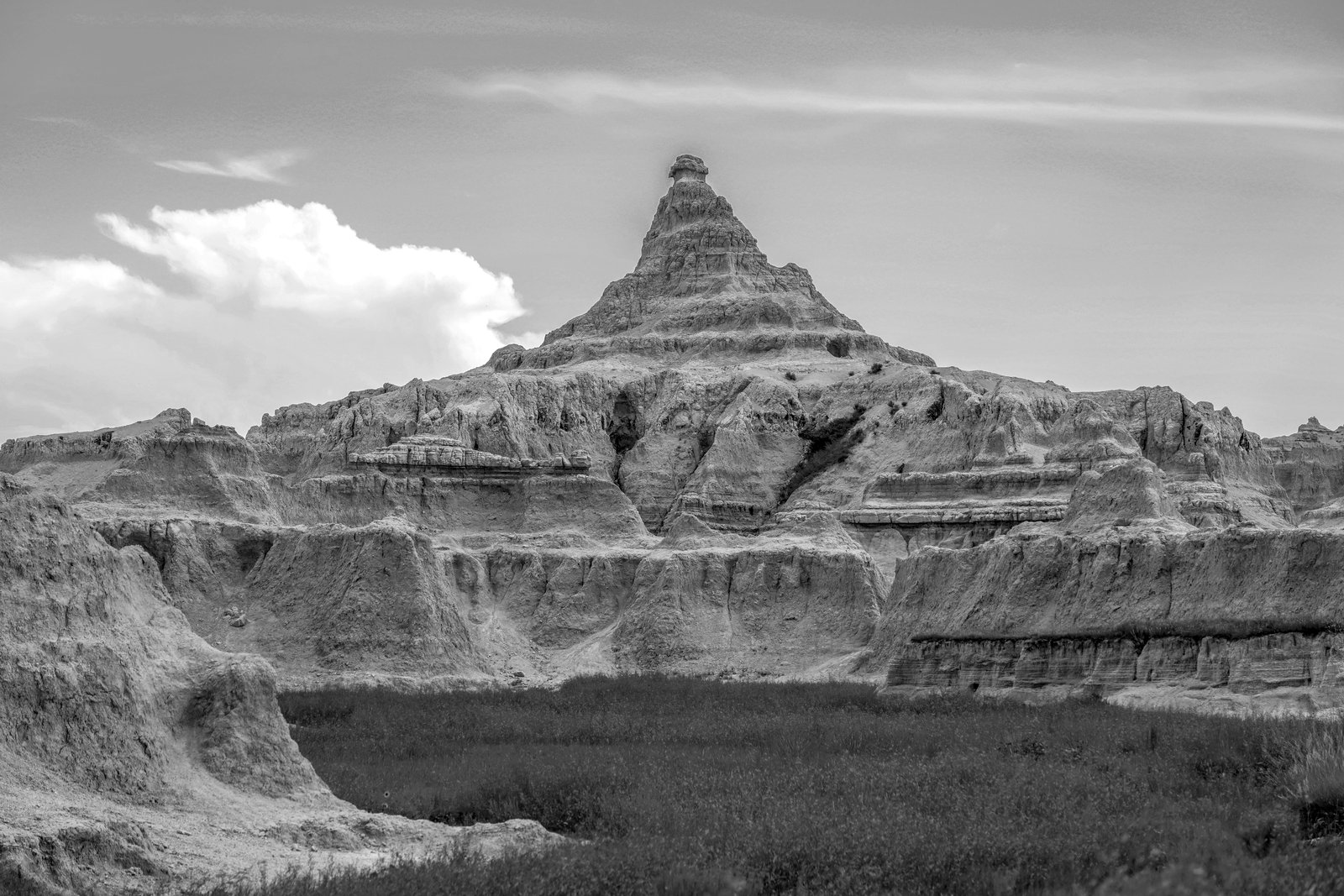
Badlands Peak B&W
This photograph captures a striking pyramidal butte rising from the eroded terrain of Badlands National Park in southwestern South Dakota. Taken from a low vantage point across a grass filled basin, the image frames the layered spire against a wide sky, with softer rounded formations and sharp ridgelines fanning out below it. Key Features: The Rock Layers: The geology comprising the Badlands National Park in southwestern South Dakota is a colorful layer-cake of various sedimentary rocks deposited between 28 to 75 million years ago by shallow seas, rivers, and wind. The Shaping Forces: The word badlands applies to any region where erosion in poorly consolidated sediments creates a rugged and barren landscape. The Deposition Story: These rocks were deposited by a number of natural forces which range from shallow inland seas to rivers to wind. The Setting: The grassy prairie floor in the foreground contrasts with the bare, wind carved peaks behind it, a hallmark of this South Dakota landscape.
Prints from $14Downloads from $19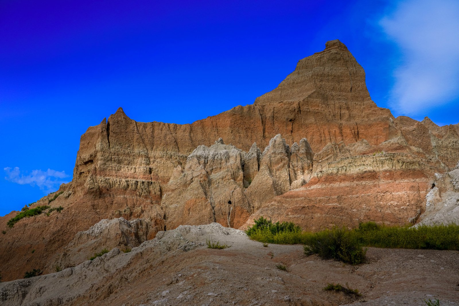
Badlands Twin Peaks
The photograph looks up at a jagged badlands formation in Badlands National Park, South Dakota, where two eroded pinnacles rise against a deep blue sky above layered clay buttes. The vantage point sits low on a rubble slope near the base of the ridge, with sparse grass and sagebrush in the foreground and the striped, sculpted rock walls filling the frame. Key Features: The Badlands Wall: This 60-mile stretch of tens-of-million-year-old rock forms a barrier between the upper and lower prairies. The Rock Layers: Deposited 28 to 34 million years ago, the soil that forms these two formations was supplied by volcanic eruptions, and today the Sharps and Brule Formation form sharply eroded rugged peaks of the Badlands including the Badlands Wall. The Fossil Record: These striking geologic deposits contain one of the world's richest fossil beds, with ancient horses and rhinos once roaming here. The Wildlife: The park's 244,000 acres protect an expanse of mixed-grass prairie where bison, bighorn sheep, prairie dogs, and black-footed ferrets live today.
Prints from $14Downloads from $19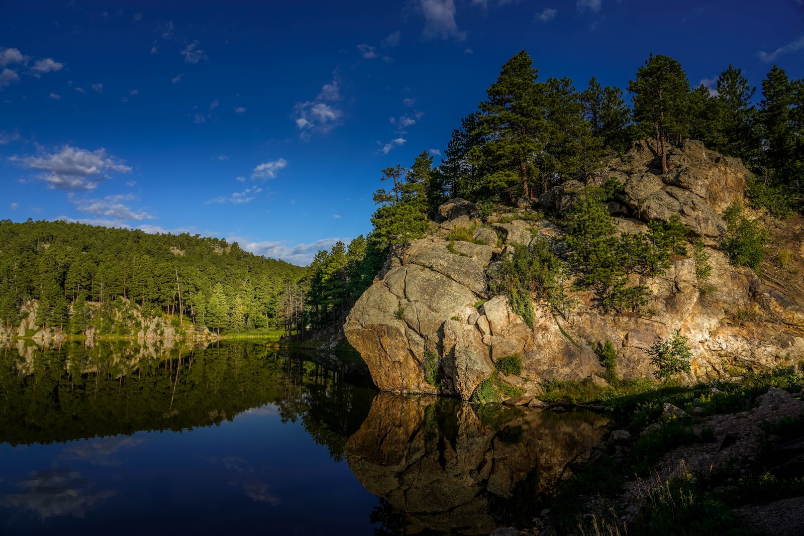
Rocky Water Lake
Deep in the Black Hills of South Dakota, this quiet cove of Horsethief Lake reflects a sunlit granite outcrop crowned with ponderosa pines. The photograph looks across the still water from the shoreline, capturing the mirrored symmetry of rock, tree line, and blue sky just two miles from Mount Rushmore. Key Features: The Setting: Horsethief Lake Campground is a beautiful lakeside spot nestled among towering ponderosa and lodgepole pines in the central Black Hills. The Landscape: The Horsethief Lake area takes users through granite peaks and twisting spires that poke through the thick forest canopy. Nearby Landmark: What's better than seeing Mt. Rushmore for the first time? Camping nearby next to a beauty of a lake among the pines is a popular choice, only two miles from Mt. Rushmore. Recreation: Because of the towering granite spires in the area around Horsethief Lake and elsewhere in the Black Elk Wilderness, rock climbing is quite popular.
Prints from $14Downloads from $19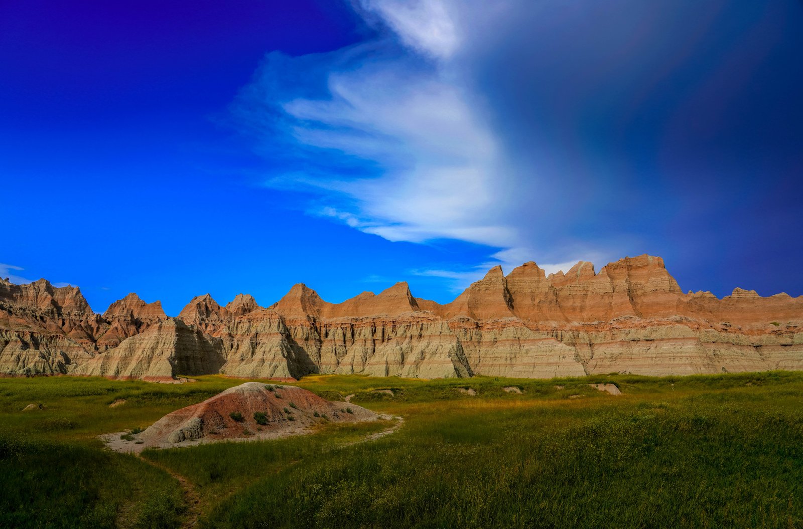
Badlands Sharps Formation
Badlands National Park in South Dakota, viewed from a grassy trailside where a small eroded knoll gives way to a rugged wall of jagged spires and striped buttes rising sharply from the prairie floor. A dramatic sky with a passing storm cloud frames the scene, highlighting the pale, banded rock and the greenery of the surrounding mixed grass prairie. Key Features: The Sharp Ridges: These peaks belong to the Sharps Formation, whose base layer, the Rockyford Ash, formed from volcanic tuff created by ash from eruptions in the Great Basin region. The Layered Rock: The formations display striking horizontal banding of sedimentary layers in varied shades of color. The Surrounding Landscape: The park protects sharply eroded buttes and pinnacles alongside the largest undisturbed mixed grass prairie in the United States. The Terrain: The land breaks apart into a maze of sharply eroded buttes, pinnacles, ridges, canyons, and striped rock formations.
Prints from $14Downloads from $19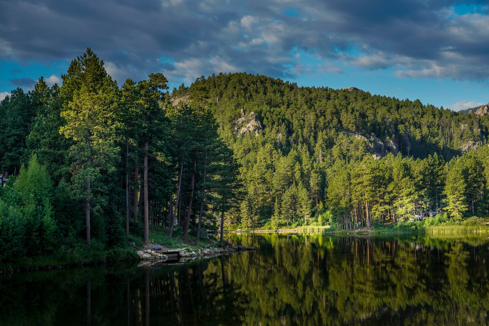
1018 Rocky Water Lake
This tranquil lake sits within the Black Hills National Forest of South Dakota, where granite outcrops rise above dense stands of ponderosa pine along the water's edge. A small wooden dock and lakeside bench mark a quiet swimming spot in the foreground, while a campground with tents and trailers lines the far shore. The still water perfectly mirrors the pine covered slopes and the rocky, sunlit ridge beyond. Key Features: The Black Hills: An ancient, isolated mountain range rising from the Great Plains, known for its dark pine forests and exposed granite formations. Granite Outcrops: The pale rock domes and spires visible on the ridge are typical of the region's weathered Harney Peak granite, famous nearby in the Needles and Cathedral Spires. Recreational Use: Small lakes like this one serve as popular campground and picnic sites within the National Forest, offering swimming, fishing and canoeing. Forest Setting: Ponderosa pine woodland surrounds the shoreline, giving the Black Hills their name from their dark green, almost black appearance from a distance.
Prints from $14Downloads from $19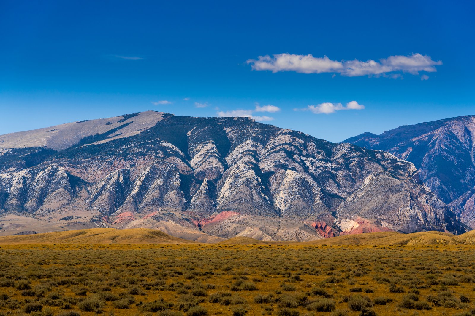
Clark's Fork Cody Wyoming
The photograph looks north from the sagebrush flats near the mouth of Clarks Fork Canyon, roughly 35 miles north of Cody, Wyoming, toward the jagged front of the Absaroka and Beartooth mountain front. The pale, saw toothed peaks are uplifted Paleozoic limestone and dolomite, while the band of deep red rock along their base is exposed Triassic Chugwater Formation, folded and tilted by the same uplift that raised the range. Key Features: The Skyline: Sharp, triangular summits of ancient carbonate rock rise abruptly above the plain, a signature of the Beartooth Front's dramatic uplift. The Red Beds: At the mouth of Clarks Fork Canyon, the Chugwater Formation has been folded by the uplift of the Beartooth Mountains, producing the vivid red bands visible below the gray peaks. The Setting: The area is semi-arid high desert sagebrush plains with little rain or snowfall, averaging less than 10 inches per year, as the bordering mountains squeeze much of the moisture from the atmosphere. The Region: The canyon lies just north of Cody within the Shoshone National Forest, where the Clarks Fork River cuts through the range toward the Bighorn Basin.
Prints from $14Downloads from $19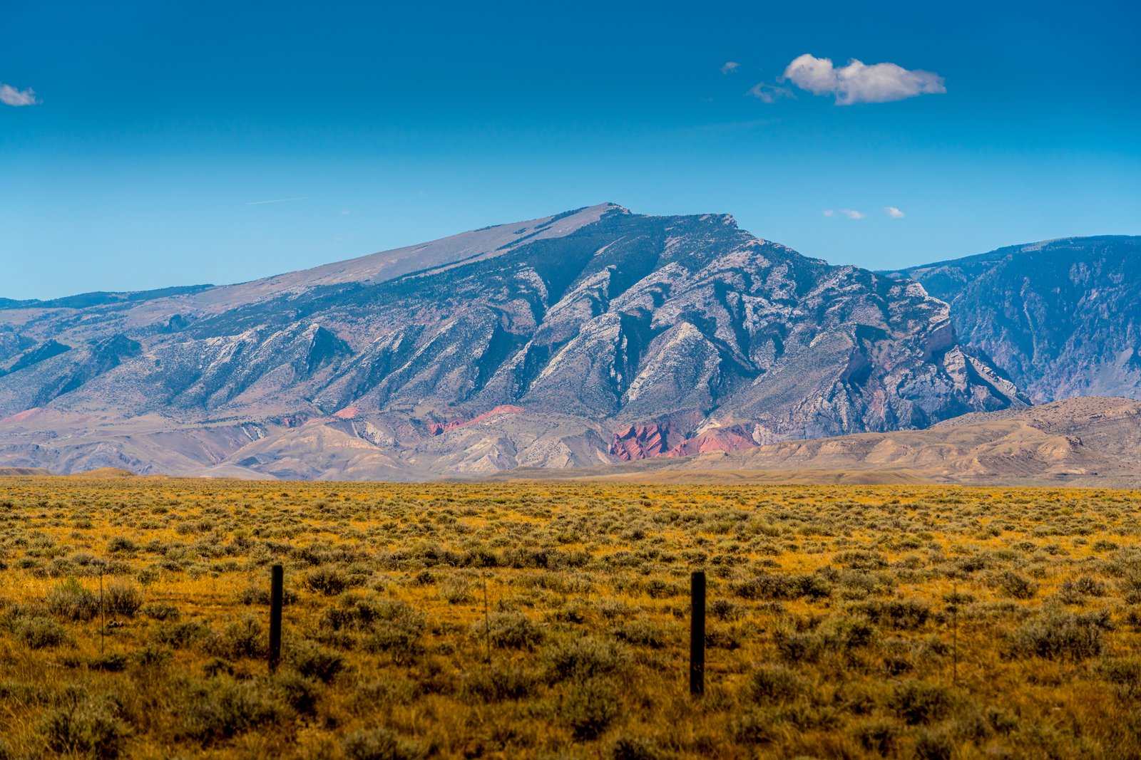
Clark's Fork Cody Wyoming
The photograph looks north from the sagebrush flats toward the mouth of Clarks Fork Canyon near Cody, Wyoming, where the Clarks Fork of the Yellowstone cuts through the front of the Beartooth Mountains. The Clarks Fork of the Yellowstone flows through the Shoshone National Forest through the awesome Clarks Fork Canyon into BLM-administered public lands, located just inside the mouth of the canyon. The tilted, weathered ridges and streaks of red rock in the foothills mark the folded strata where the mountain front meets the open plain. Key Features: The Location: Clarks Fork Canyon lies roughly forty miles north of Cody, Wyoming, at the edge of the Beartooth Range. The Geology: This canyon is at the intersection of the Laramide age Cody Arch and Beartooth Uplift, and the Eocene Absaroka Volcanic Province. The Terrain: The area is semi-arid high desert sagebrush plains with little rain or snowfall, as the bordering mountains squeeze moisture from passing storms. The Significance: Geologists consider the canyon one of the most striking exposures of ancient tilted rock layers in the region.
Prints from $14Downloads from $19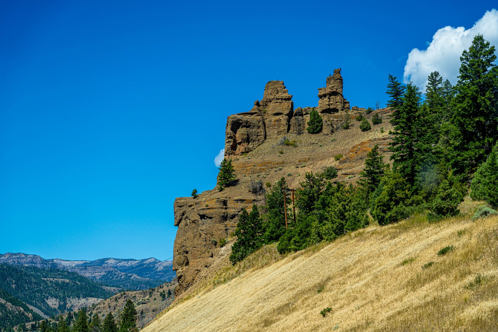
Yellowstone Hillside
The photograph looks north across a grassy, sage covered hillside in the northern reaches of Yellowstone country toward a weathered outcrop of eroded volcanic rock that has been sculpted by wind and time into castle like turrets. A stand of lodgepole and Douglas fir climbs the slope beneath the formation, while a faint line of old wooden utility poles follows what was likely a backcountry road, and the layered peaks of the Absaroka Range fade into the distance under a deep blue summer sky. Key Features: The Rock Formation: The jagged spires are remnants of ancient volcaniclastic conglomerate, hardened ash and debris flows from the region's Eocene era volcanic activity that erode unevenly into pinnacles and knobs. The Setting: The scene sits within Yellowstone's northern range, an area shaped by both volcanism and later glaciation, producing its mix of open grassland and forested slopes. The Backdrop: The Absaroka Range, visible on the horizon, forms the eastern boundary of the Yellowstone Plateau and is itself built from layers of ancient volcanic rock. The Season: Golden, cured grasses suggest the dry heat of late summer, a season when the park's hillsides turn from green to amber.
Prints from $14Downloads from $19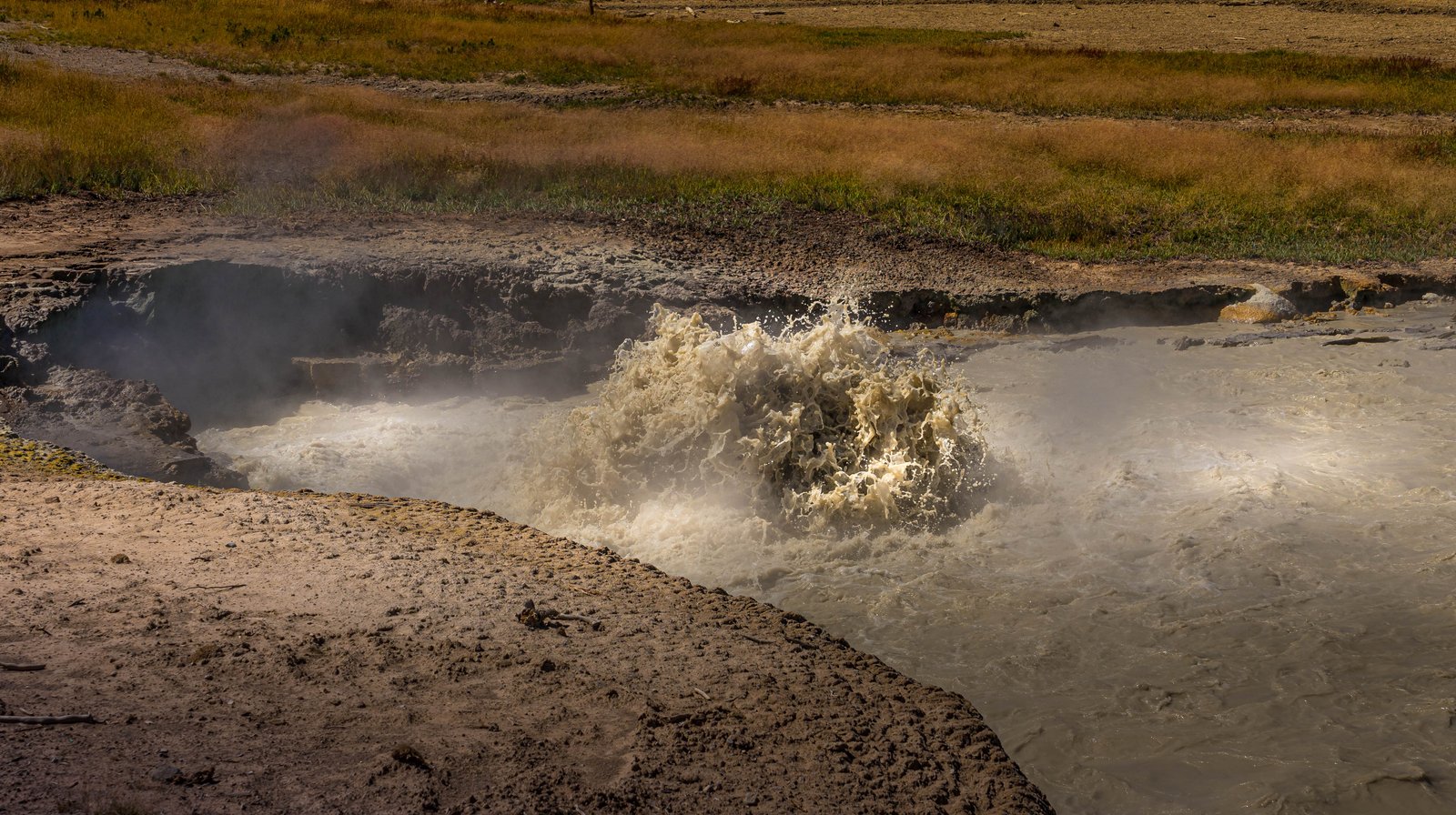
Churning Caldron
Churning Cauldron is a large, boiling mud pool in the Mud Volcano thermal area of Yellowstone National Park, along the eastern edge of Hayden Valley near Yellowstone Lake. The photo looks across a steaming, muddy pool where cloudy, mineral-laden water erupts and splashes at the center, framed by scorched, sandy ground and a strip of prairie grass beyond. Key Features: The Setting: This pool sits within the Mud Volcano Group, a cluster of acidic hot springs, fumaroles, and mud pots on a resurgent dome of the Yellowstone Caldera. The Eruption History: This spring was much cooler and covered with colorful microbial mats until earthquake activity in 1978-79 superheated the waters and destroyed the mats, and in 1996 it began throwing water 3 to 5 feet high. The Water Temperature: This once cool pool now averages 164 degrees Fahrenheit (73 degrees Celsius). The Smell: The area is marked by the strong odor of rotten eggs caused by hydrogen sulfide gas escaping from the ground atop this resurgent dome.
Prints from $14Downloads from $19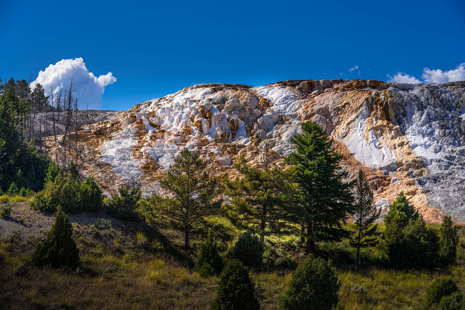
Mammoth Hot Springs
This photograph shows the travertine terraces of Mammoth Hot Springs in Yellowstone National Park, Wyoming, viewed from below along one of the hillside boardwalks that wind through the area. The frame captures the layered white and orange mineral formations rising above a foreground of lodgepole pines and sagebrush meadow, with a bright cumulus cloud drifting over the ridge under a deep blue sky. Key Features: The Terraces: Mammoth Hot Springs is an extensive mass of travertine terraces that have been forming over thousands of years, created as mineral-rich hot water flows over the hillside. The Rock Type: Travertine is a crystalline limestone that forms in mineral springs saturated with dissolved calcium carbonate, giving the terraces their sculpted, cascading look. A Living Landscape: rates of travertine deposition at Mammoth Hot Springs are very high, about 3 millimeters per day, compared to other calcium carbonate systems, so the terraces are constantly reshaping themselves, shifting color and form year to year. Discovery: Early explorers during the Washburn, Hayden, and Hague expeditions of the 1870s were astonished by the massive terraces and pools of hot-spring limestone, a feature notably different from Yellowstone's other geothermal areas.
Prints from $14Downloads from $19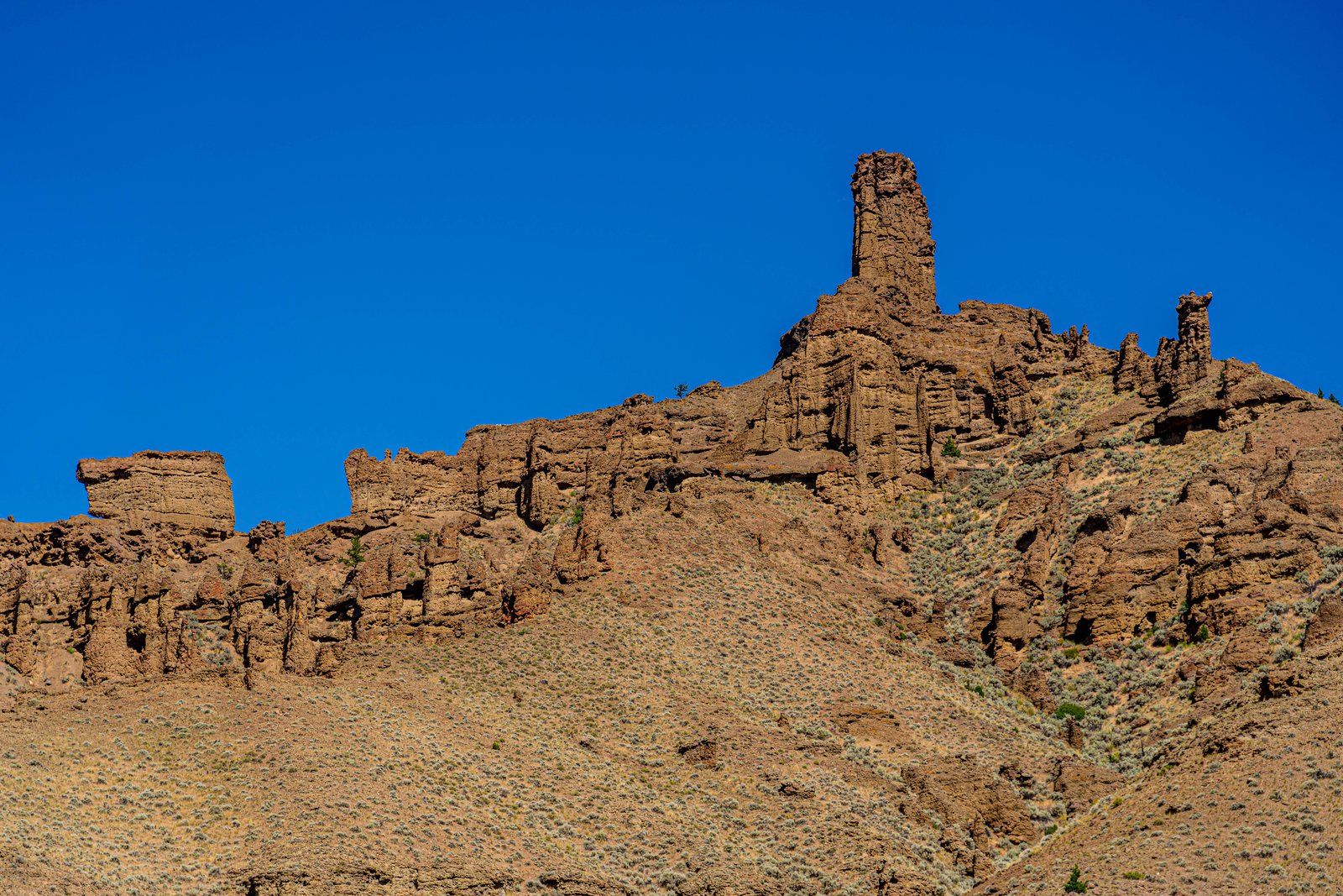
Yellowstone Peaks
Rising above a sage covered slope in Yellowstone National Park's remote northeast corner, this weathered spire and its companion rock towers are carved from ancient volcanic breccia in the Absaroka Range. The formation sits atop a ridge exposing thick layers of hardened ash, mud, and rock debris, with a single tall pinnacle standing above a jagged line of smaller hoodoos under a clear summer sky. Key Features: Volcanic Origins: These layers were created over time as successive eruptions from ancient volcanoes repeatedly buried standing trees under waves of ash and debris. The Rugged Terrain: Extensive erosion has exposed more than 1000 vertical meters of these volcanics and has created a rugged topography. Famous Fossil Ground: The classic petrified forests are found on Specimen Ridge and Mt. Amethyst, both located in the northeast sector of Yellowstone National Park. Erosional Sculptures: The soft breccia weathers into these grotesque spires and pillars, a striking contrast to the park's famous geothermal features.
Prints from $14Downloads from $19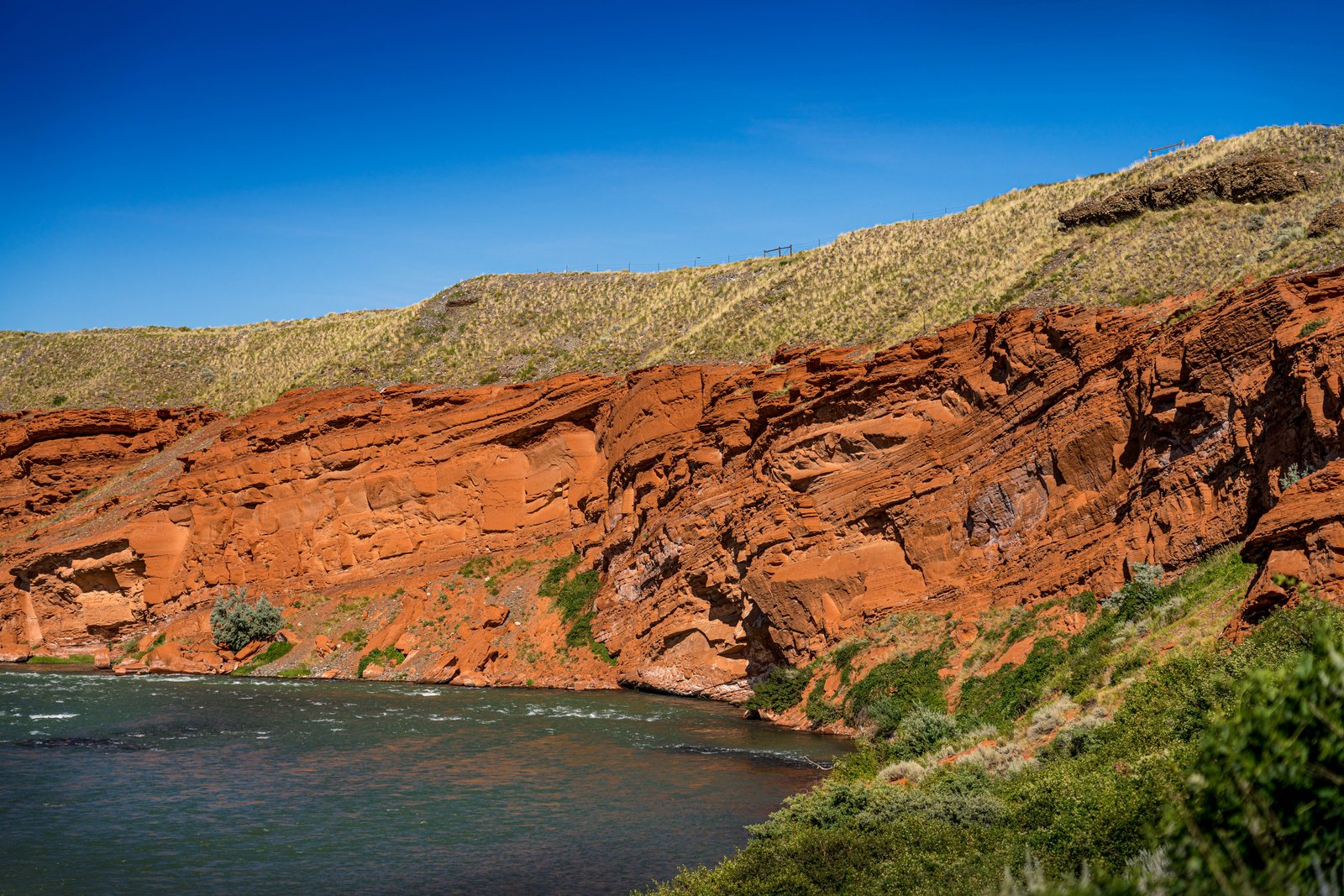
Shoshone Canyon River
This photograph captures the Shoshone River as it cuts through Shoshone Canyon near Cody, Wyoming, framed by the towering red sandstone cliffs of Rattlesnake and Cedar Mountains. The vantage point looks down along the water's edge, with sagebrush covered slopes rising above the layered red rock and grassy ridgelines meeting a clear blue sky. Key Features: The River Route: The Shoshone River runs from the Buffalo Bill Dam through an awesome canyon bordered by Cedar and Rattlesnake Mountains through Cody, Wyoming The Red Rock Canyon: This section of river winds through the Red Rock Canyon, a scenic stretch popular with rafters Gateway to Yellowstone: Shoshone Canyon is a popular route to the East Entrance of Yellowstone National Park Geologic Character: The towering cliffs of the canyon rise over the Shoshone River, providing an awe inspiring backdrop, formed over millions of years
Prints from $14Downloads from $19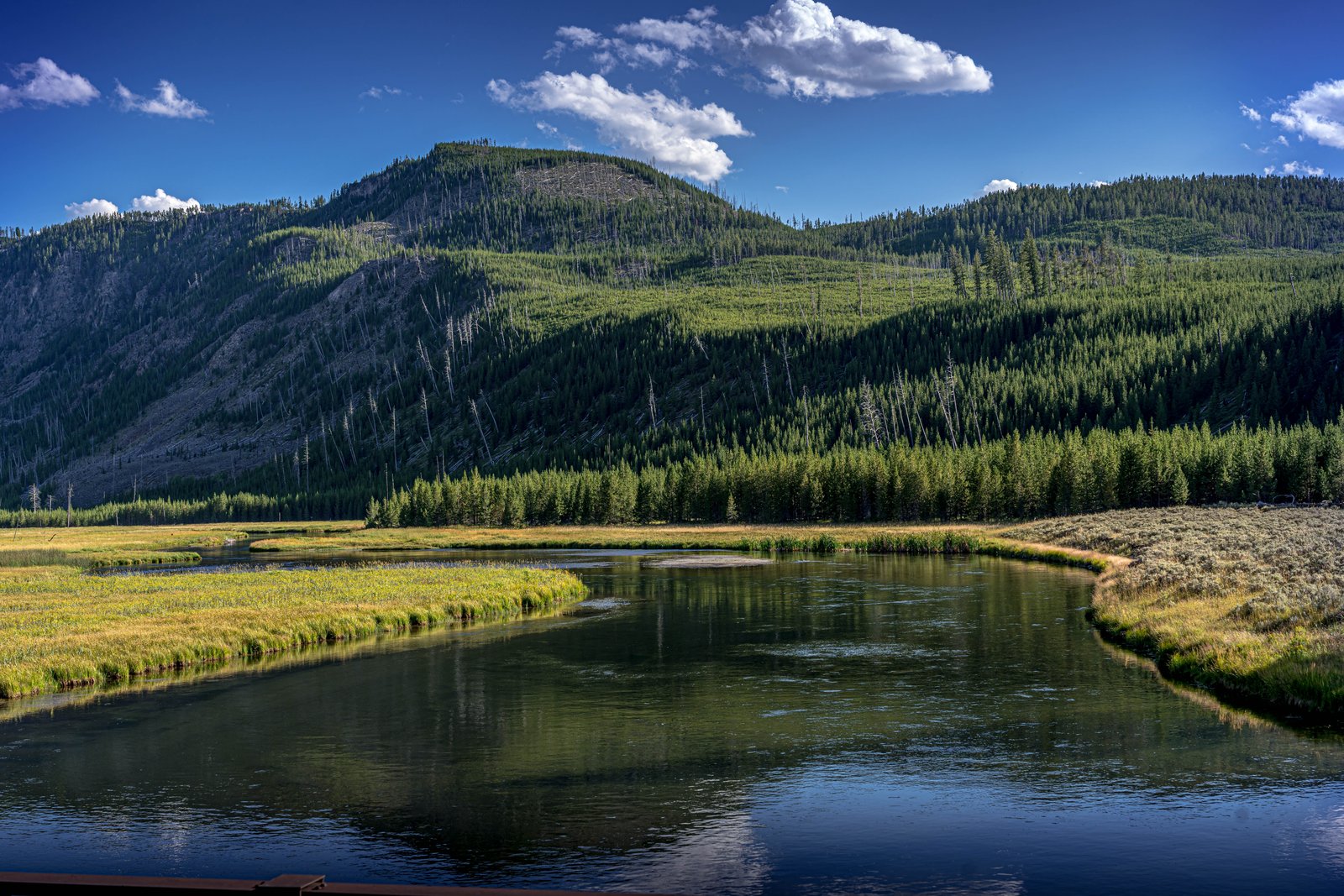
Yellowstone River Range
The image shows the Yellowstone River winding in broad, glassy loops through the open grasslands of Hayden Valley, inside Yellowstone National Park. The vantage point looks north across the marshy meadow toward a forested ridge and a bare, rounded summit, with standing dead snags among the live lodgepole pines marking the scars of past wildfires. Key Features: The Valley Floor: Hayden Valley sits between the north shore of Yellowstone Lake and the Grand Canyon of the Yellowstone, home to a meandering river bordered by grassy banks. Why It Stays Open: Because the glacial till in the valley contains many different grain sizes, including clay and a thin layer of lake sediments, water cannot percolate readily into the ground, keeping the area marshy with little tree growth. Elevation and Setting: At nearly 8,000 feet in elevation, Hayden Valley is a striking exception to the dense lodgepole pine forests that cover much of Yellowstone. Fire History: The scattered dead pine snags visible on the surrounding slopes are remnants of past forest fires that periodically sweep through Yellowstone's high country, part of a natural cycle shaping the landscape.
Prints from $14Downloads from $19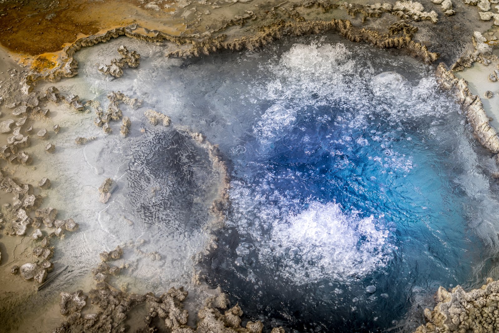
Blue Star Springs
Now I have enough information to write the story.This close up view looks straight down into Blue Star Spring, a hot spring pool on Geyser Hill in the Upper Geyser Basin of Yellowstone National Park, Wyoming. The frame captures the pool's deep indigo center where superheated water surges and bubbles, ringed by pale mineral sinter and rust colored bacterial mats. Key Features: Geyser Hill Location: The spring sits within the Upper Geyser Basin near Old Faithful, one of the densest concentrations of hydrothermal features on Earth. The Name: It is named for its distinctive star shaped vent and vivid blue color, caused by clear, mineral rich water scattering light. Rare Activity: Though usually a quiet pool, Blue Star has occasionally erupted as a geyser, with its last recorded eruption in 2002. Extreme Heat: The water averages nearly 191 degrees Fahrenheit, keeping it in constant, gentle motion.
Prints from $14Downloads from $19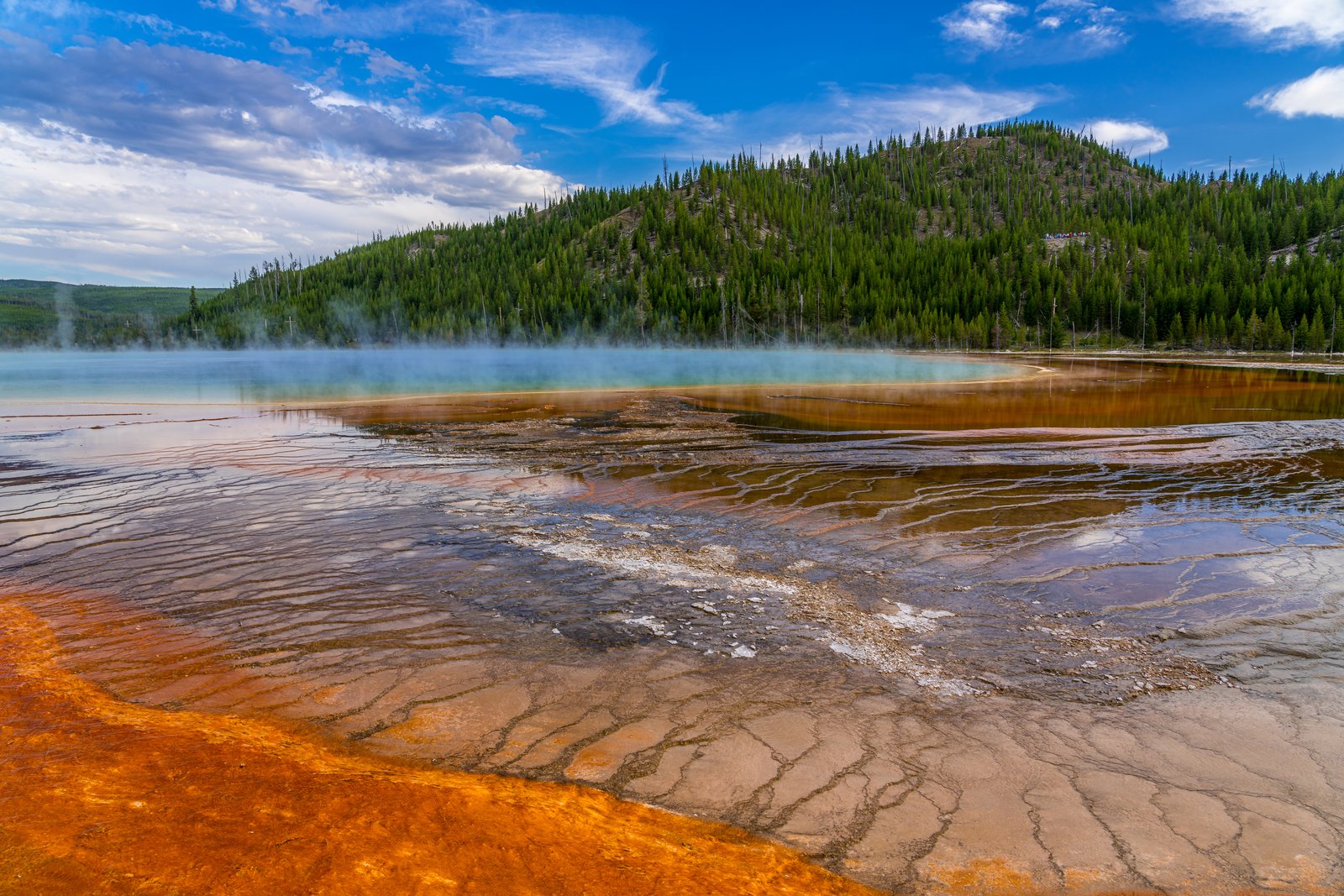
Grand Prismatic Spring
Grand Prismatic Spring lies in the Midway Geyser Basin of Yellowstone National Park, Wyoming, photographed from a boardwalk close to its steaming, mineral-crusted edge. The image shows the spring's deep turquoise heart fading into bands of amber and orange bacterial mats, with wisps of vapor drifting across the water and a forested ridge rising behind the basin. Key Features: The Spring's Size: Its size makes it the world's third-largest hot spring, with bands of orange, yellow, and green ringing the deep blue waters. The Colors: The vivid colors in the spring result from pigmented bacteria in microbial mats growing around the edges of the mineral-rich water, producing hues from green to red. The Setting: The spring sits within Yellowstone's Midway Geyser Basin, between the park's Lower and Upper Geyser Basins, surrounded by lodgepole pine forest. Historic Note: The area was explored by early expeditions in the 1870s that documented its thermal features for the newly designated national park.
Prints from $14Downloads from $19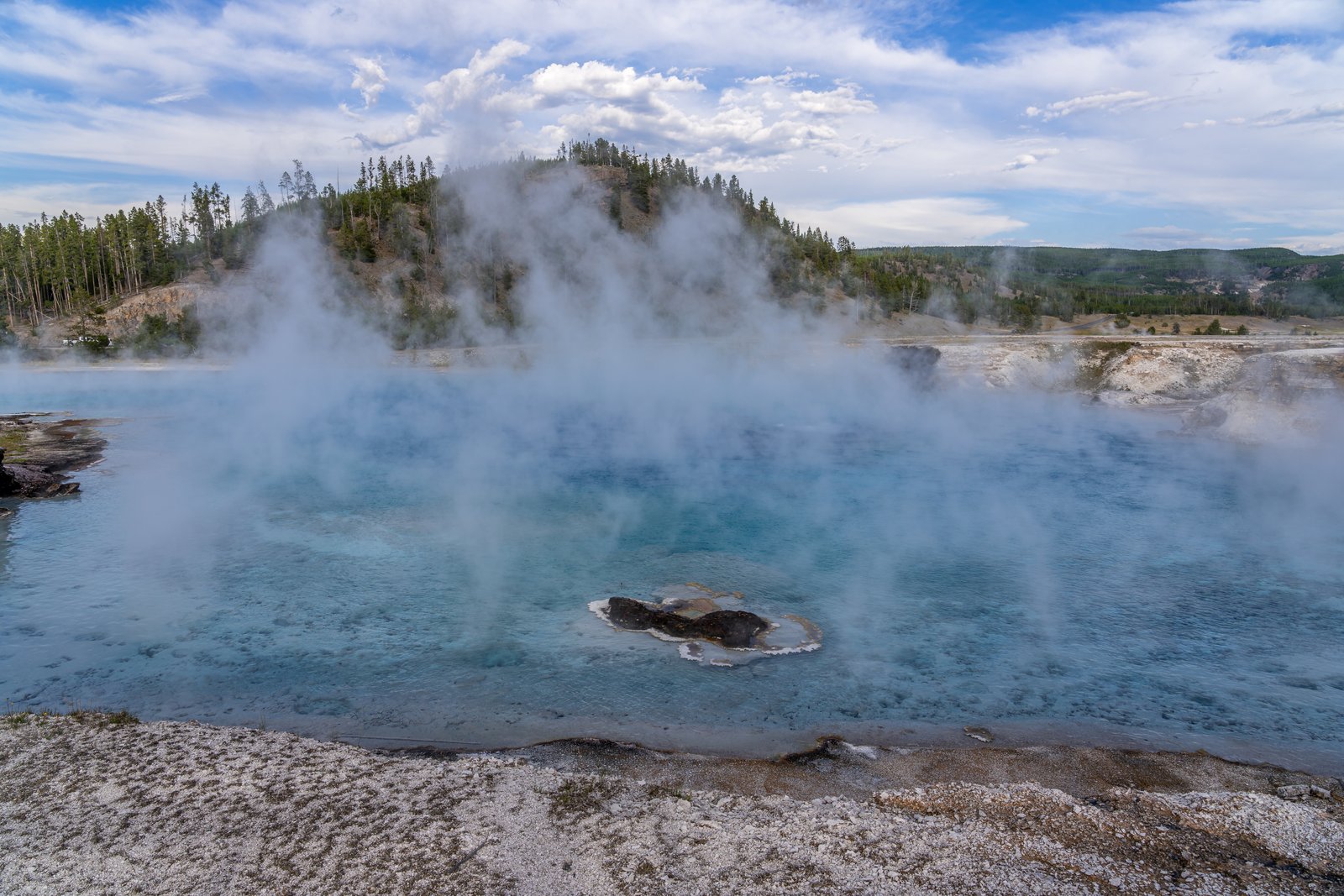
Excelsior Geyser Crater
This photograph shows Excelsior Geyser Crater in the Midway Geyser Basin of Yellowstone National Park, Wyoming, viewed from the boardwalk along its rim as steam billows off the turquoise pool and drifts across a pine covered ridge above the Firehole River valley. Key Features: The Crater: Excelsior Geyser Crater is a 200 x 300 foot crater that constantly discharges more than 4,000 gallons of water per minute into the Firehole River. Historic Eruptions: In the 1880s Excelsior Geyser erupted in bursts 50 to 300 feet high, and the thermal violence formed the jagged crater and apparently ruptured the geyser's underground system, causing eruptions to cease after 1890. Renewed Activity: Excelsior Geyser erupted on September 14, 1985, to the height of 55 feet and lasted 46 hours, with the last known eruption occurring in 1888. The Setting: The crater sits within Midway Geyser Basin, near Grand Prismatic Spring, along the road between Madison and Old Faithful in central Yellowstone.
Prints from $14Downloads from $19