


Photographer
Rick Billings, Master Photographer
Orlando, Florida
I've been a professional photographer since I graduated high school in 1978. I'm bringing over four decades of professional photography experience and offering images I captures as beautiful display prints in your home or office.
Collections
All photos by Rick Billings, Master Photographer
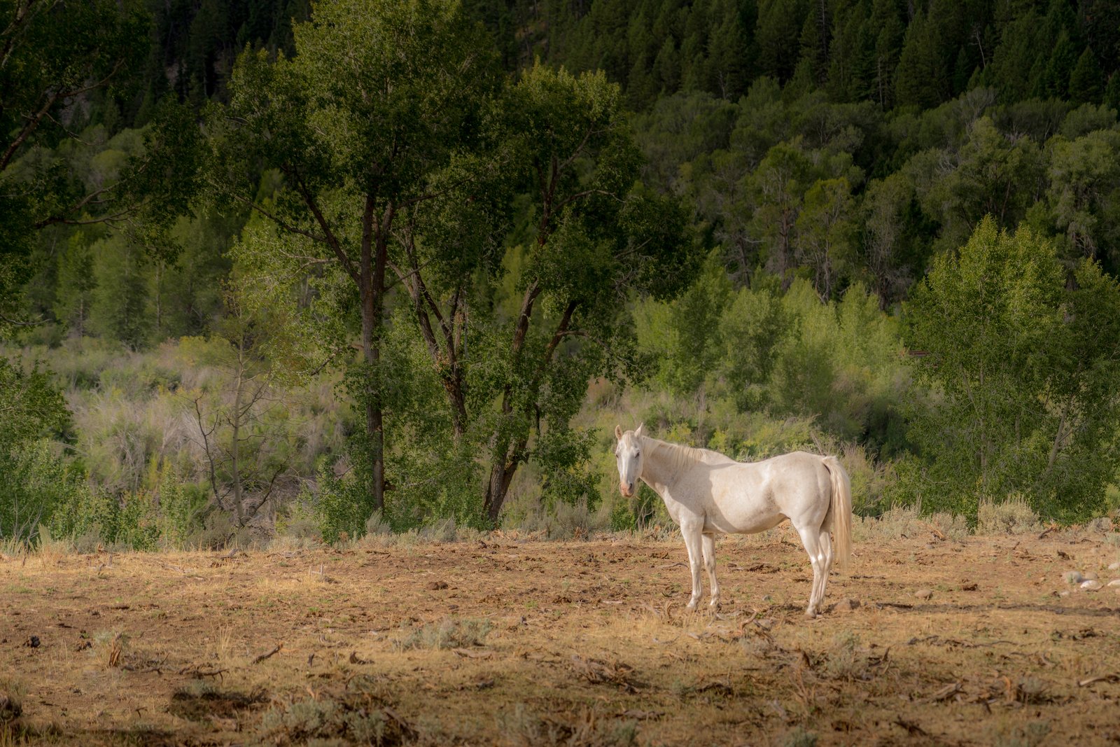
Jackson White Horse
The photo was taken in the Jackson Hole valley of northwestern Wyoming, in the cottonwood and conifer bottomlands that line the Snake River drainage below the Teton and Gros Ventre ranges. A pale cream colored horse stands alone in a sun dried meadow, its coat catching the late afternoon light against a dense backdrop of cottonwoods and dark evergreens climbing the hillside behind it. Key Features: The Setting: Jackson Hole is a high mountain valley where working cattle and horse ranches sit along the Snake River corridor beneath forested slopes. The Vegetation: Cottonwood trees flowering in spring and turning yellow and orange in fall are common throughout the valley, forming the thick greenery seen behind the horse. The Ranching Tradition: Large historic ranches in the area, some of the biggest deeded properties in the region, have grazed livestock along these river bottoms for generations. The Moment: The image captures a quiet, unposed pause in a grazing horse's day, framed by the wild, untamed character that still defines much of the Jackson Hole landscape.
Prints from $14Downloads from $19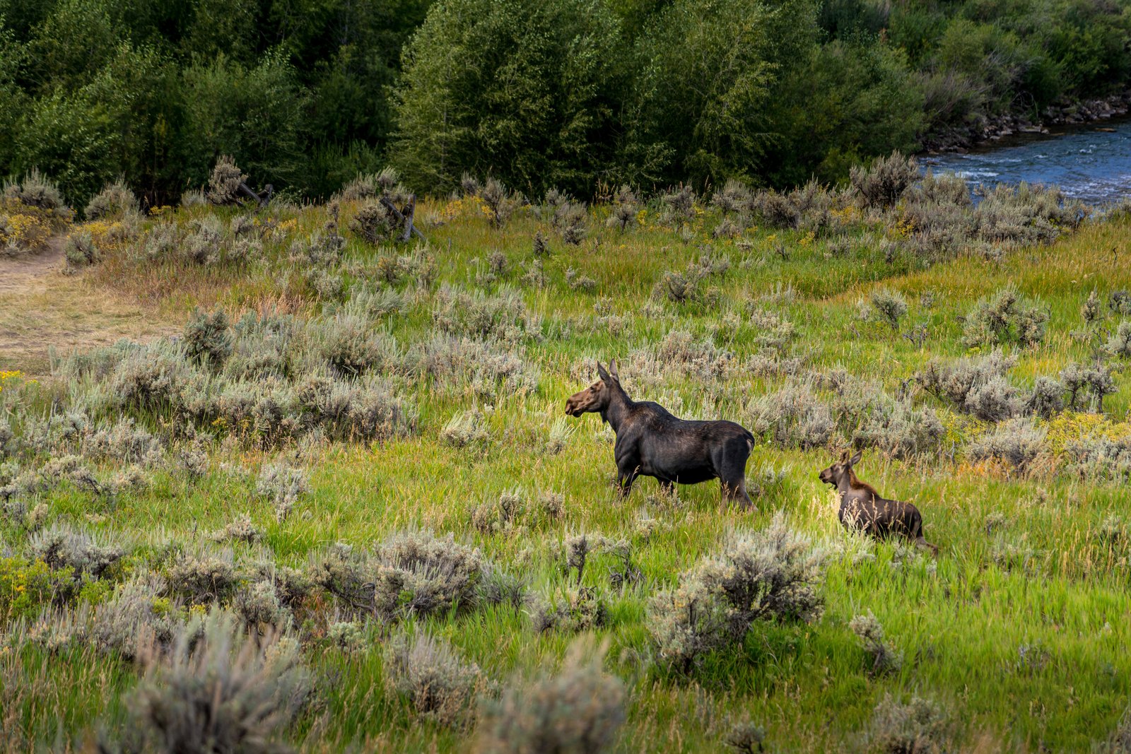
Yellowstone Moose Baby
The photograph was taken in Yellowstone National Park, likely along one of the park's river corridors such as the Lamar Valley, where a cow moose and her calf move through a sagebrush meadow near flowing water lined with dense willows and conifers. The vantage point looks down across an open grassy flat toward the riverbank, capturing the pair pausing in the tall grass as the calf follows close behind its mother. Key Features: Rare Sighting: Moose are among the least common large mammals in the park, with fewer than 100 individuals living there. The Habitat: Sagebrush flats bordered by river willows and conifer forest provide the cover and browse moose favor, especially in warmer months. Mother and Calf: Cow moose stay close to their calves through summer, teaching them to forage in wet meadows and streamside vegetation. The Setting: Yellowstone's river corridors, shaped by volcanic and glacial history, create the mosaic of grassland, brush, and forest seen here.
Prints from $14Downloads from $19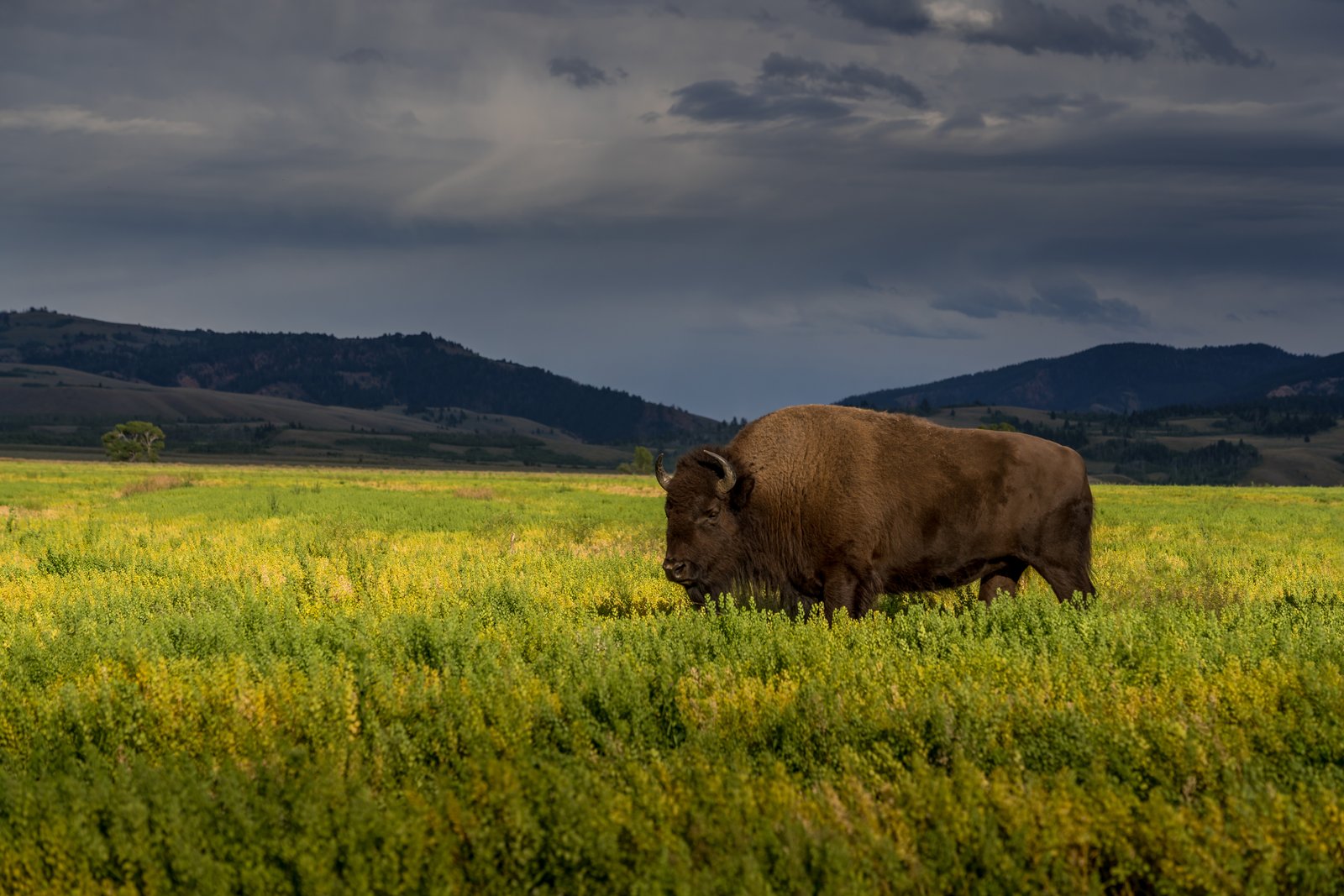
Buffalo Range
The photo shows a lone American bison standing in a lush meadow of wildflowers, likely captured in Yellowstone National Park's Lamar Valley beneath a gathering storm. The vantage point is low and open, placing the animal against a backdrop of the Absaroka Mountains and darkening sky, emphasizing the scale and wildness of the landscape. This valley is renowned as prime bison habitat, and the title nods to the historic buffalo ranch established here to protect the species. Key Features: The Lamar Valley: The Lamar River meanders through the valley and is flanked by the impressive Absaroka Mountains Bison Conservation: The ranch was established in 1907 when 28 bison were moved there from Fort Yellowstone, with the purpose of helping preserve one of the last free-roaming bison herds in the United States Wildlife Haven: Yellowstone National Park maintains a population of around 3,000 bison, preserving one of the last genetically pure herds of the American Buffalo Nickname: This broad valley is bison central, where visitors often see herds grazing and lounging along the wide Yellowstone River
Prints from $14Downloads from $19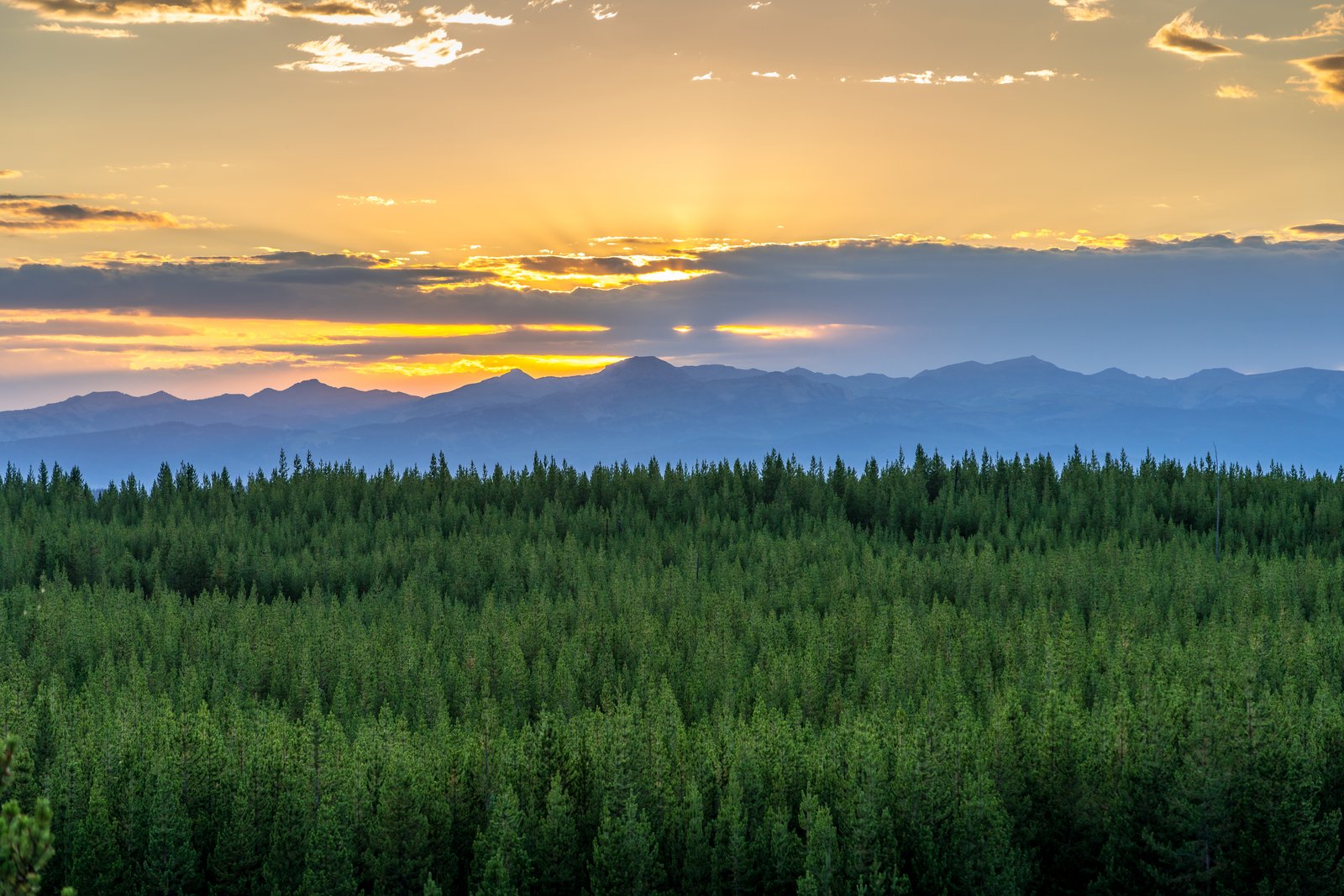
Yellowstone Sunset
The photograph looks across a dense sea of lodgepole pine toward the layered ridgelines of the Rocky Mountains within Yellowstone National Park, with the sun sinking behind a bank of clouds along the horizon. The vantage point appears to be an elevated overlook or ridge road pullout, giving an unobstructed sweep from the darkening forest canopy in the foreground to the hazy blue mountain ranges receding into the distance under a sky streaked gold and violet. Key Features: The Forest Canopy: Forests cover roughly 80% of the park, with lodgepole pine forming miles of continuous cover, especially within the Yellowstone Caldera. The Terrain: Yellowstone sits atop a high volcanic plateau ringed by rugged subranges of the Rocky Mountains, producing the layered, hazy peaks visible fading into the distance. The Light: The golden crepuscular rays breaking through cloud cover are typical of high altitude sunsets over the plateau, where thin air and long sightlines intensify color at dusk. The Setting: The scene reflects the park's vast, largely undeveloped backcountry, where uninterrupted timber stands stretch for miles between mountain ranges.
Prints from $14Downloads from $19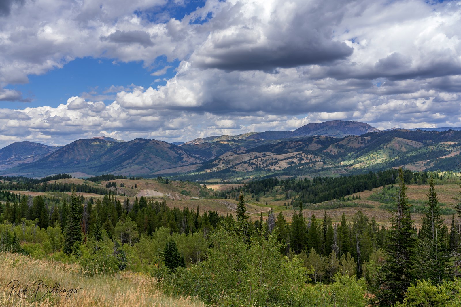
Jackson WY Scenic
The photograph looks southeast across the high country outside Jackson, Wyoming, toward the rounded, timbered summits of the Gros Ventre Range. The vantage point is an elevated overlook above a broad sagebrush basin, where a ranch road winds through open meadows before the land rises into dense stands of lodgepole pine and aspen and finally into the distant peaks beneath a sky filled with towering summer cumulus. Key Features: The Gros Ventre Range: These mountains east of Jackson Hole are known for rounded, sedimentary peaks rather than the jagged granite of the nearby Teton Range. The Valley Floor: Jackson Hole sits at roughly 6,200 feet, with surrounding ridgelines and foothills rising through mixed conifer and aspen forest. Ranching Heritage: Dirt roads and open meadows in the foreground reflect the area's continued use for grazing and rural homesteads amid protected forest land. Weather Patterns: Dramatic afternoon cumulus buildup, as seen here, is common in the Rockies during summer months, often preceding brief mountain thunderstorms.
Prints from $14Downloads from $19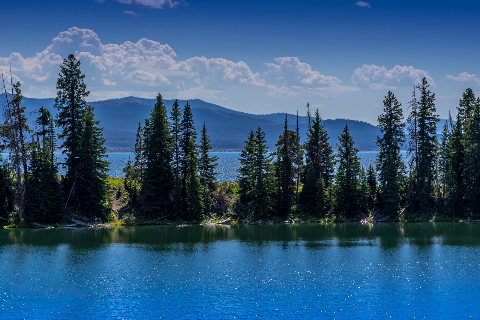
Lake Cody Wyoming
The photograph looks across a small, tree lined pond toward a much larger lake, with the ridgelines of the Absaroka Range rising hazily beyond, a scene characteristic of the high country west of Cody, Wyoming. This rugged terrain belongs to the Shoshone National Forest, where dense stands of lodgepole pine frame countless backcountry lakes and reservoirs tucked below the mountains. The vantage point appears to be from the near shore of a small forest pool, looking through a screen of conifers toward open water and distant peaks softened by summer haze. Key Features: The Shoshone National Forest: America's first national forest, established in 1891, sits just outside Cody and holds thousands of mountain lakes and ponds within its boundaries. The Absaroka Range: The layered blue peaks in the distance form part of this volcanic mountain range along the edge of the Greater Yellowstone Ecosystem. The Setting: A foreground pond bordered by lodgepole pine opens onto a larger lake, a common double layered composition found throughout this backcountry region. The Region's Character: Cody serves as a gateway town to this remote high country, prized for fishing, camping, and undeveloped alpine scenery.
Prints from $14Downloads from $19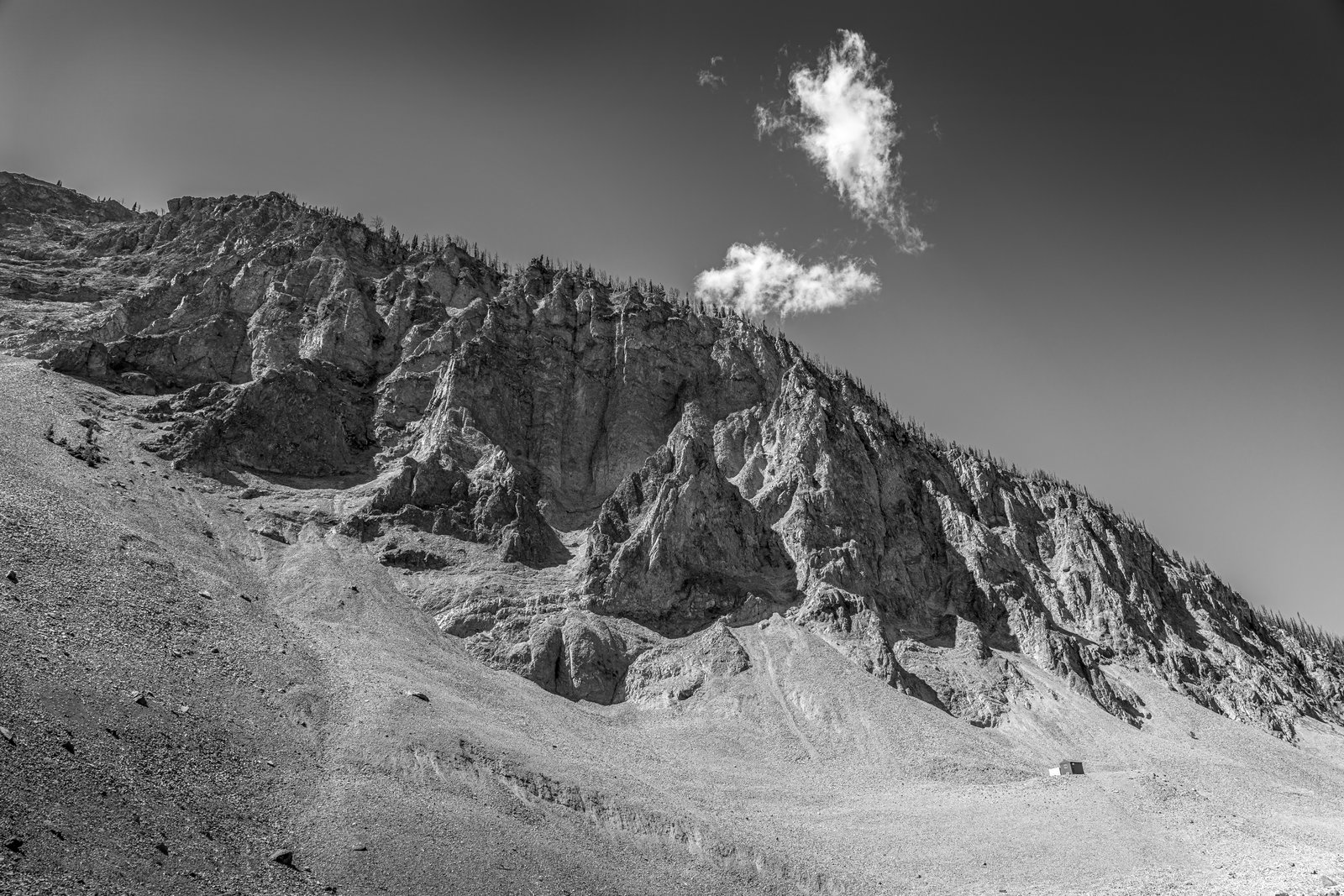
Cody Wyoming Mountains B&W
This image captures the crumbling flank of Cedar Mountain, also called Spirit Mountain, in the Absaroka Range just west of Cody, Wyoming. Shot from the scree-covered base looking up, the frame shows deeply eroded volcanic spires and gullies rising to a ridgeline, a single small cabin dwarfed at the foot of the slope, and a lone cloud drifting past the summit. Key Features: The Name: Crow tradition called this peak the mountain of spirits, and settlers reported Native tree burials on its slopes. The Geology: The mountain is built of volcanic breccia, weathering into the jagged, crumbling pinnacles seen here. The Setting: It stands across the Shoshone River gorge from Rattlesnake Mountain, near Buffalo Bill Reservoir. The Legend: Local lore holds it as a possible burial site tied to showman Buffalo Bill Cody.
Prints from $14Downloads from $19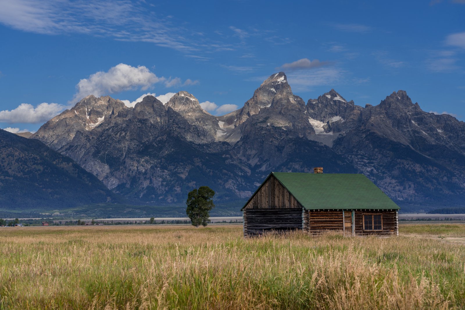
Grand Teton Barn
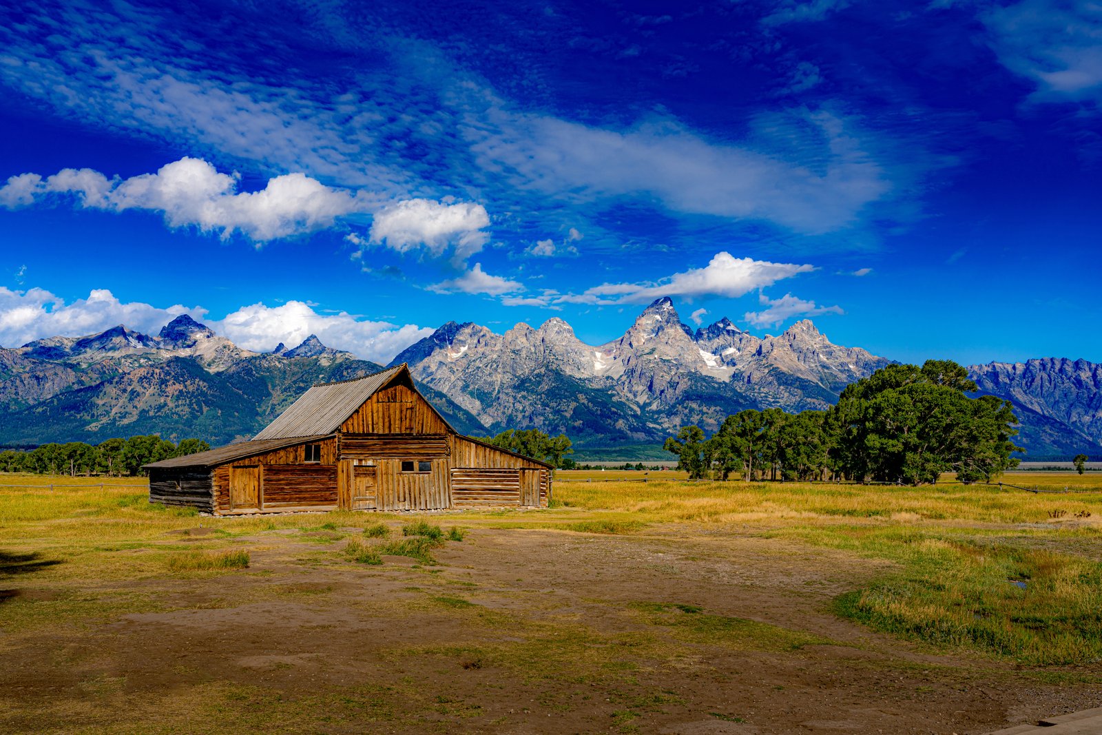
This photograph looks across Mormon Row in Grand Teton National Park, Wyoming, where the historic T.A. Moulton Barn stands alone in a grassy homestead field with its distinctive green shingled roof and weathered log walls. The view faces west toward the jagged granite spires of the Teton Range, their upper slopes still streaked with summer snow beneath scattered clouds. Key Features: Homestead History: Mormon settlers arriving from Idaho in the late 1800s and early 1900s built barns and farmhouses along this row after crossing Teton Pass into Jackson Hole. Alma began work on his barn in 1912 to shelter his horses, and it took decades before he considered it fully complete. Protected Landmark: In the mid-1900s Mormon Row was acquired to expand Grand Teton National Park, and in 1997 the district was added to the National Register of Historic Places. The Mountain Backdrop: The rugged Teton peaks rise abruptly from the valley floor with no foothills, creating one of the most photographed mountain silhouettes in the American West. Ongoing Preservation: Contracted crews and volunteers, including members of the Moulton family, have carried out repairs to the barn's steeply pitched roof to keep the historic structure standing.
Prints from $14Downloads from $19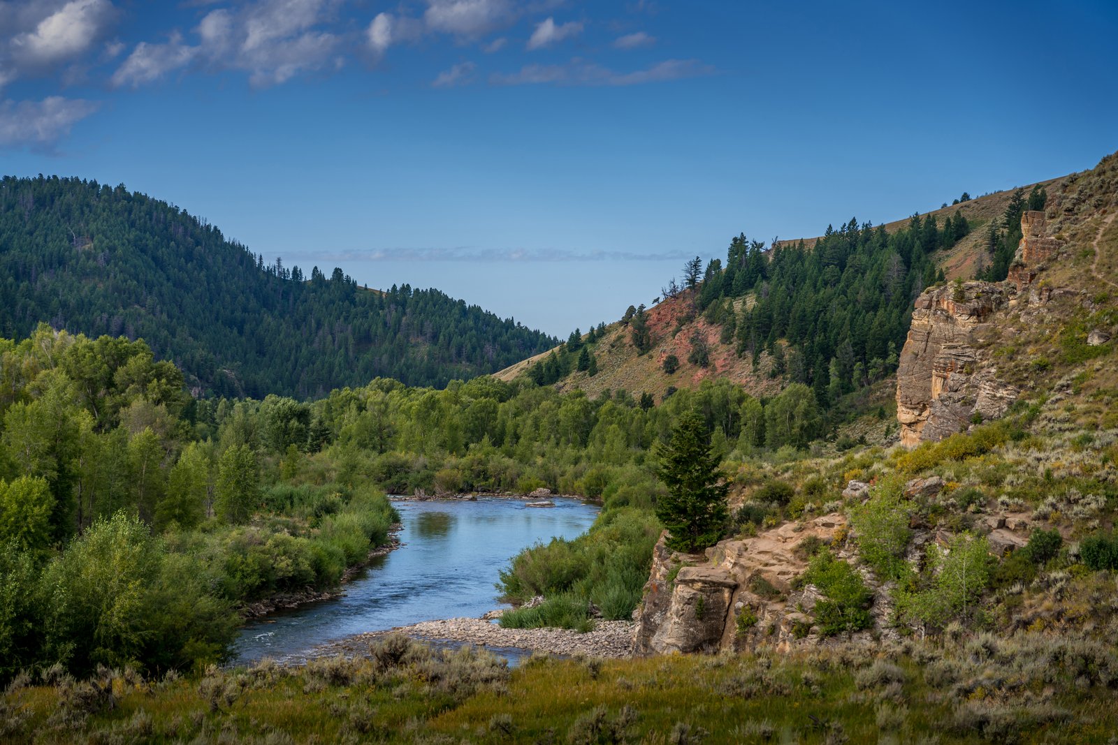
Jackson Hole River
This photograph looks out over the Gros Ventre River as it winds through its forested canyon east of Jackson Hole, Wyoming, in the Bridger-Teton National Forest. The vantage point sits on a grassy bluff above the water, framing a bend of the river between cottonwood-lined banks, a sagebrush slope, and a weathered sandstone outcrop rising on the right, with pine-covered ridges receding toward the horizon under a clear summer sky. Key Features: The River: winding its way down from Slide Lake through beautiful, multicolored terrain, the Gros Ventre carves a scenic canyon east of Grand Teton National Park. The Rock Formations: the Gros Ventre River eroding through the overlying Tensleep Sandstone produced a "free side" with no support holding it in place, shaping the cliffs seen along the canyon. The Wilderness Setting: the Gros Ventre is a landscape of contrasts, from big, lush meadows to steep pinnacles of limestone, with spectacular views of the Teton Range. Historic Note: the canyon lies near the site of the 1925 Gros Ventre landslide, one of the region's most notable geologic events.
Prints from $14Downloads from $19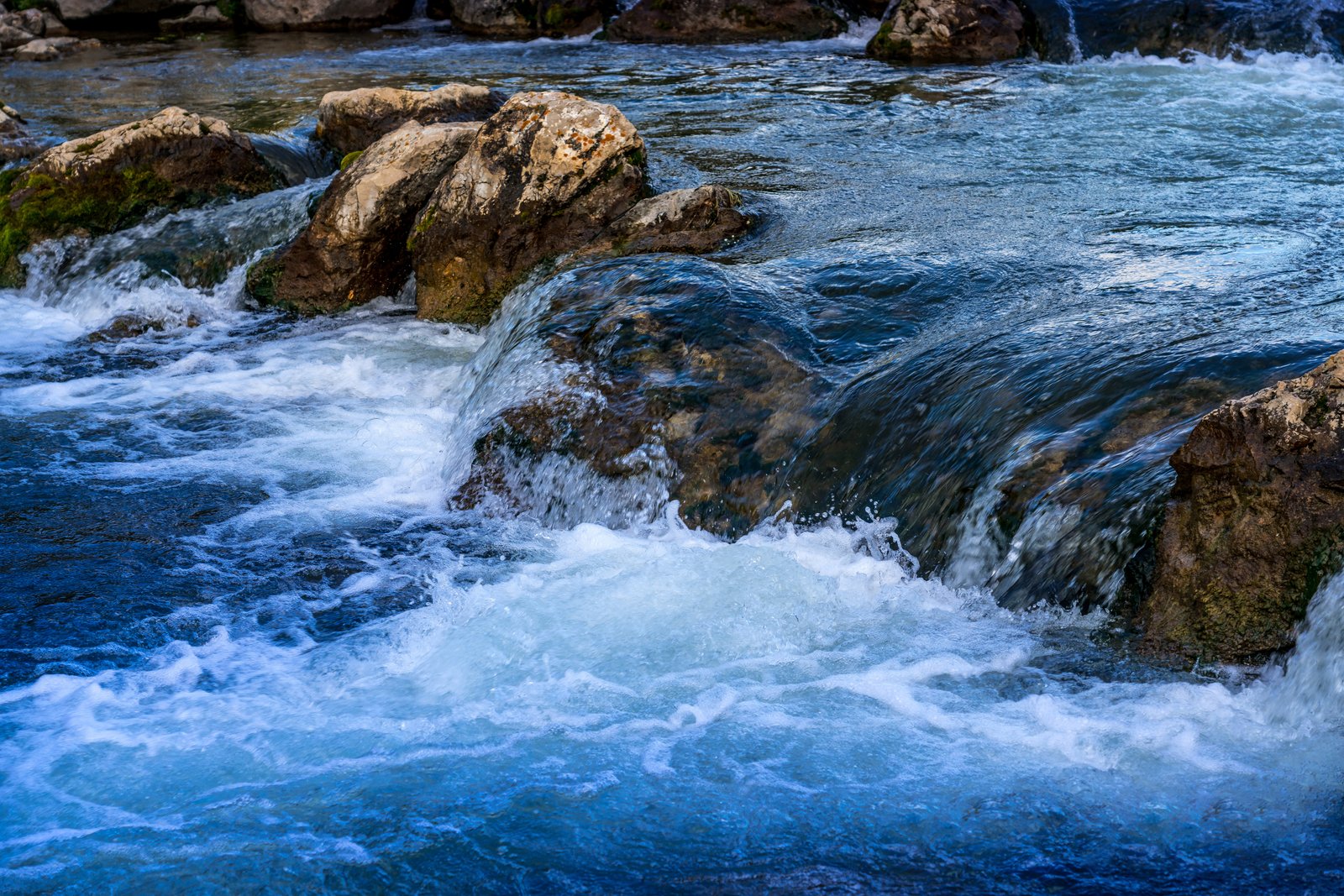
Black Hills Stream
This close up view captures a rushing stream tumbling over weathered limestone boulders in the Black Hills of South Dakota, taken low to the water so the eye follows the current as it churns into whitewater against the rock. The composition frames only the water and stone, emphasizing the motion and texture of a small cascade rather than any wider landmark. Key Features: The Black Hills Region: This range of forested mountains rising from the northern prairie is known for its granite and limestone formations shaped by centuries of flowing water. Trout Waters: Black Hills streams and lakes are home to rainbow, brown, and brook trout, with tiger trout introduced to a couple of area lakes, making the clear, fast moving water in scenes like this vital habitat. Natural Character: Streams here are managed for naturally reproducing populations, reflecting the largely untouched, rugged beauty of the area's waterways. The Vantage Point: The tight, ground level framing highlights the force and clarity of the current rather than a broader landscape, focusing attention on the interplay of rock and rushing water.
Prints from $14Downloads from $19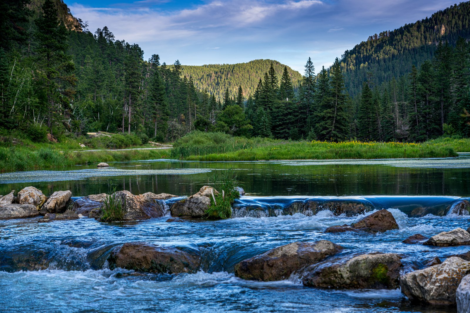
Black Hills Stream
The photograph captures a quiet stretch of stream in South Dakota's Black Hills, where clear water tumbles over a low rock ledge into a still, tannin-dark pool before continuing downstream. The vantage point sits low at the water's edge, framing tumbled granite boulders in the foreground against a backdrop of Ponderosa pine ridgelines and a wide, grassy meadow bordering the far bank. Key Features: The Black Hills: An isolated range of ancient granite peaks rising from the northern Great Plains, prized for their dense pine forests and cold, spring fed streams. The Cascade: A small natural or beaver built ledge creates the gentle waterfall, a common feature on Black Hills creeks that support trout fisheries. The Forest Setting: Ponderosa pine and spruce blanket the surrounding hillsides, typical of the region's National Forest lands used for hiking, fishing, and camping. The Light: Soft, overcast toned skies suggest the scene was captured near dawn or dusk, lending the water its deep blue green cast.
Prints from $14Downloads from $19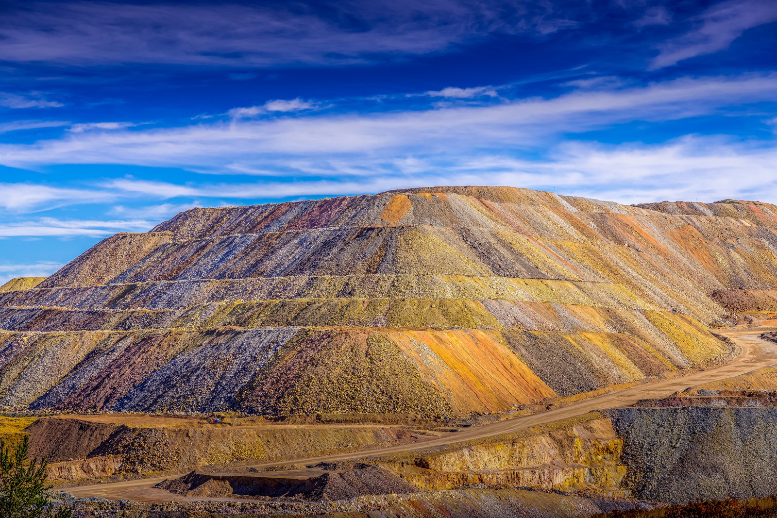
Cripple Creek CO
The Cripple Creek and Victor Gold Mine sits in the mountains southwest of Colorado Springs, where the historic Cripple Creek Mining District was reborn in the 1990s as a large modern open pit operation. This image looks across a terraced waste rock pile, its layered benches stained in bands of gold, rust, and gray by the mineralized rock, with a haul road curling along the valley floor below the slope. Key Features: The Cripple Creek and Victor gold mine lies southwest of Colorado Springs in the US state of Colorado, and for many years the Cripple Creek Mining District was a series of underground mines. Modern Operation: Following 40 years of inactivity, the district roared back to life in the 1990s with a modern open-pit mine that is still producing gold each year. Historic Roots: The town of Cripple Creek was founded after an 1892 gold strike. Colorful Waste Piles: The banded orange, gray, and yellow terraces reflect the varied mineral content of rock removed to reach the ore, stacked in graded benches typical of large scale surface mining.
Prints from $14Downloads from $19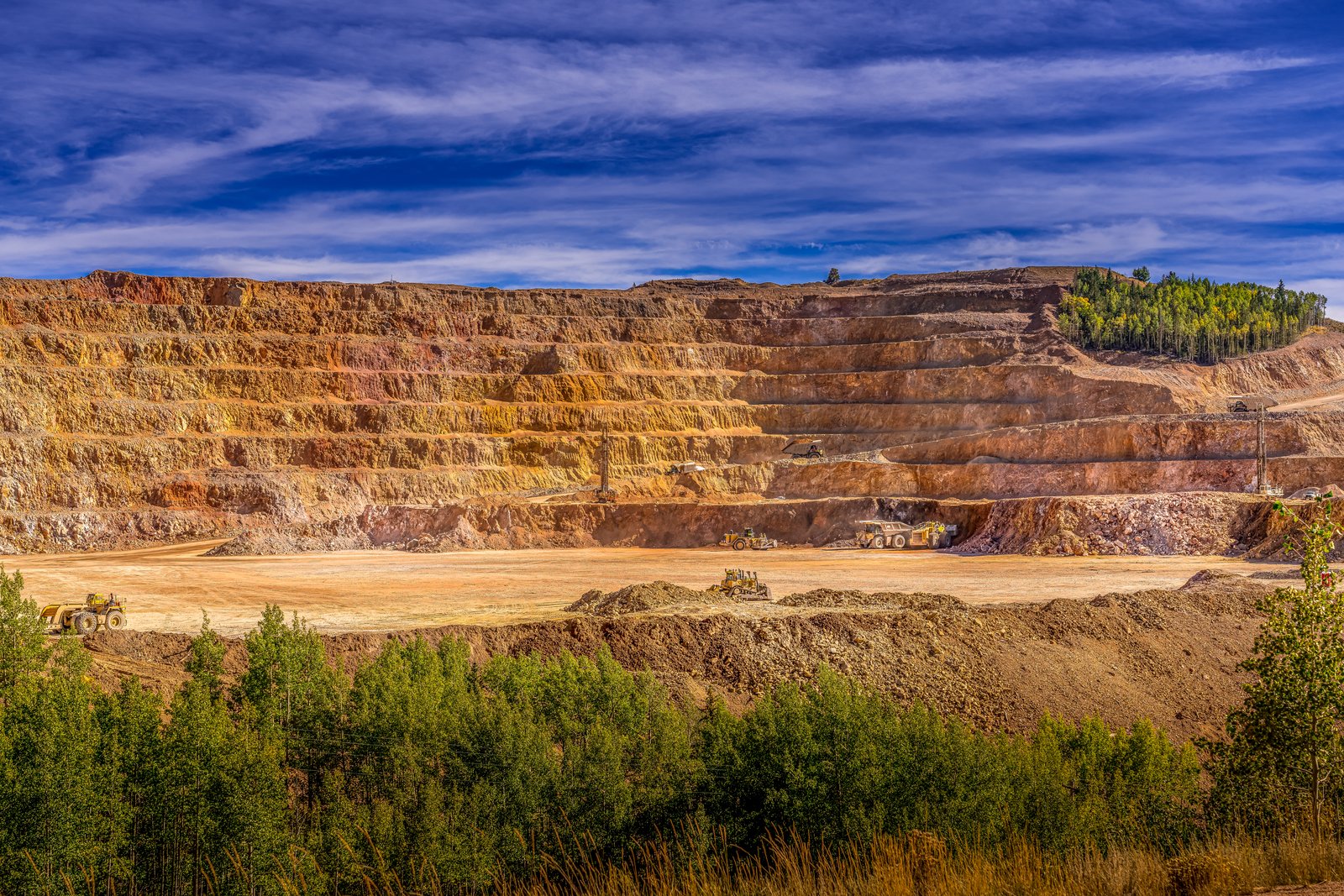
Cripple Creek Gold Mine
This photograph looks down into the massive open pit of the Cripple Creek and Victor Gold Mine, cut into the mountains of Teller County, Colorado. Terraced benches of oxidized, rust colored rock rise in stacked tiers above a wide gravel floor where haul trucks, loaders and dozers work amid clouds of dust, with a stand of golden aspen framing the pit's rim under a bright blue sky. Key Features: The Discovery: Gold was found here in 1890, sparking a rush that made this district one of the richest gold camps in the American West. The Operation: This mine is the richest gold mine in Colorado history and the only remaining significant producer of gold in the state, now run as a large open pit. The Scale: The pit reaches a greatest depth of about 2,750 feet and was first opened in 1892, expanding into modern open pit operations in 1994. The Setting: Terraced benches expose colorful mineralized rock, while surrounding stands of aspen and pine mark the high Rocky Mountain terrain around Cripple Creek and Victor.
Prints from $14Downloads from $19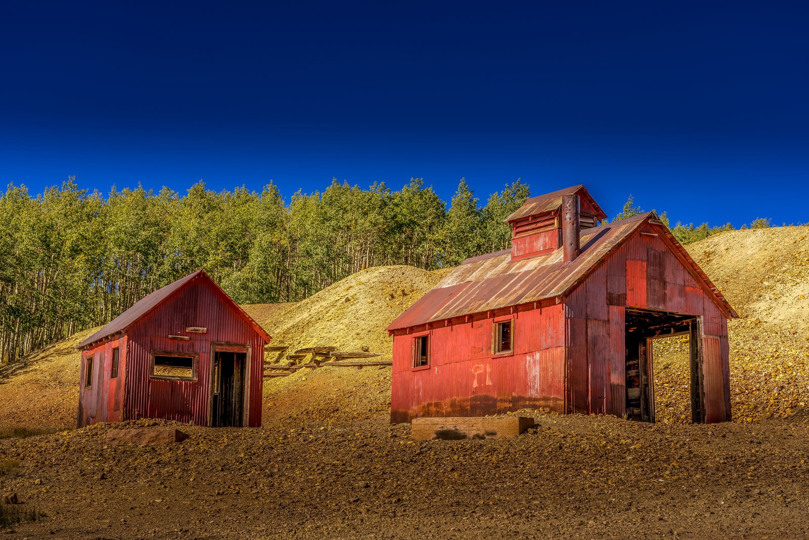
Cripple Creek Gold Mine Country
This photograph was taken in the historic Cripple Creek mining district on the west side of Pikes Peak in central Colorado, where weathered red corrugated metal buildings still stand among the tailings piles left from the region's gold boom. The view captures two rusted ore or hoist houses set against a golden slope of mine waste rock, with a stand of aspen framing the scene beneath a deep blue high altitude sky. Key Features: The Gold Rush: In December 1890, a man named Bob Womack really did discover gold, sparking Colorado's last and richest gold rush. The Historic Landmark: Cripple Creek Historic District is a U.S. National Register of Historic Places and U.S. National Historic Landmark District, preserving its mining era structures. The Setting: The district sits at high elevation near Pikes Peak, where old headframes, mills and storage sheds remain scattered across the hillsides of tailings and rock waste. The Legacy: gold mining operations remove rock with traces of gold from the old mines even today, keeping the district's mining heritage alive.
Prints from $14Downloads from $19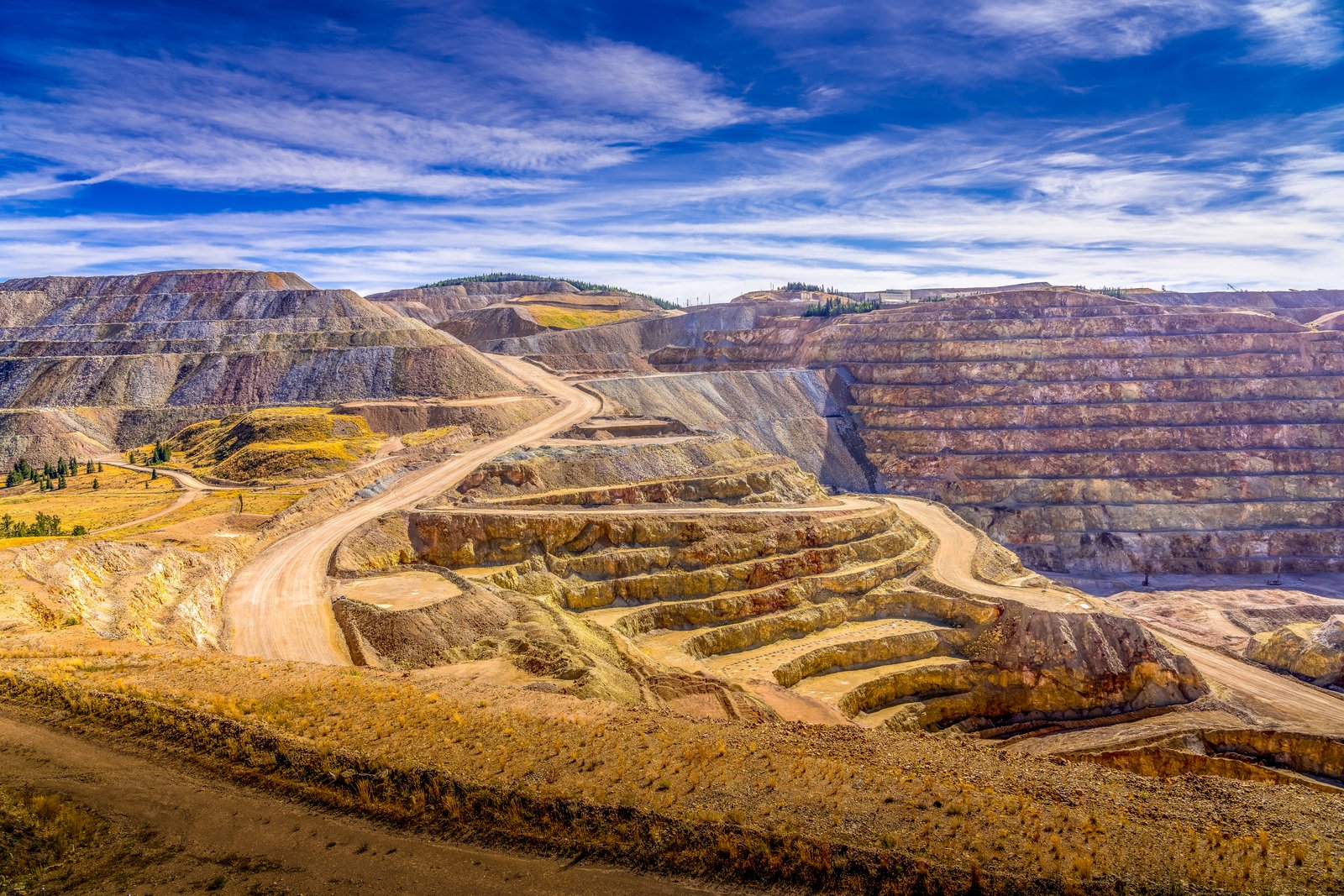
Cripple Creek Gold Mine
The photograph looks down into the vast open pit of the Cripple Creek and Victor Gold Mine, high in the Colorado mining district near Victor and Cripple Creek in Teller County. Terraced benches of blasted rock spiral downward in tan, rust, and gray bands while switchback haul roads climb the slopes, and distant timbered ridges frame the excavation under a wide Rocky Mountain sky. Key Features: The Mine's Legacy: This is the richest gold mine in Colorado history, and the only remaining significant producer of gold in the state. The Shift to Open Pit: The mine was originally opened in 1892, then fell into decline when the gold ran out and finally closed in 1962, before open pit operations began later. Modern Scale: In 1994 the Cripple Creek & Victor Gold Mine started large scale pit operations, and by the 2000s it was producing hundreds of thousands of ounces of gold and silver per year. Historic District: Cripple Creek is one of the few historic boomtowns in the American West with an active mine.
Prints from $14Downloads from $19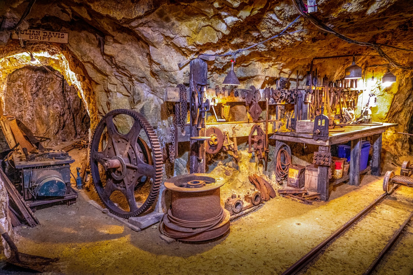
Cripple Creek 1000 Feet Down
This confirms the location matches the title "Cripple Creek 1000 Feet Down" , the Mollie Kathleen Gold Mine, a working gold mine turned tourist attraction where visitors descend 1,000 feet underground.This underground scene shows a working level of the Mollie Kathleen Gold Mine near Cripple Creek, Colorado, reached by descending a vertical shaft 1,000 feet into the mountain. The wooden sign overhead marks the "Julian Davis Drift," one of the mine's named tunnels, and the frame is filled with the drilling gear, cable spool, gear wheels, and rail cart tracks left in place from the mine's working decades. Key Features: The Discovery: The mine takes its name from Mollie Kathleen Gortner, who in 1891 became the first woman in the Cripple Creek gold camp to discover gold and strike a claim in her own name. The Depth: The mine shaft descends 1,000 feet into the mountain, a depth roughly equal to the height of the Empire State Building. The Tour: The site is now the only 1,000 foot vertical shaft gold mine tour in the U.S., preserving original drills, winches, and tunnel drifts for visitors.
Prints from $14Downloads from $19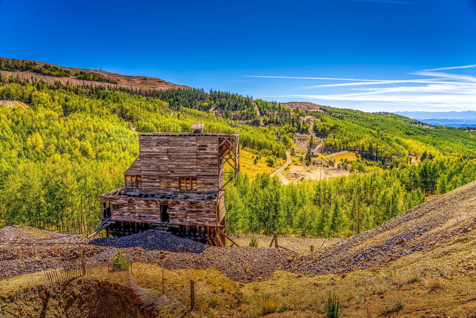
Cripple Creek CO
The photograph looks down into a wooded gulch on the southwestern flank of Pikes Peak, in the historic Cripple Creek Mining District of central Colorado. A weathered timber headframe and ore house, remnants of one of the district's turn of the century gold mines, stands amid gravel tailings piles, with slopes of golden aspen and evergreen forest rolling toward distant peaks under a deep blue sky. Key Features: The Gold Camp: At the lofty elevation of 10,000 feet on the southwest shoulder of Colorado's iconic Pikes Peak, it is the world's highest major gold-mining district. The Mine Structures: Timber headframes and ore houses like this one once hoisted ore from underground shafts and remain scattered across the district's hillsides. The Landscape: Surrounding slopes of aspen and pine, tinged gold in autumn, now reclaim the tailings piles and old wagon roads left behind by decades of mining. The Legacy: Designated a National Historic Landmark in 1963, Cripple Creek bills itself as "the World's Greatest Gold Camp."
Prints from $14Downloads from $19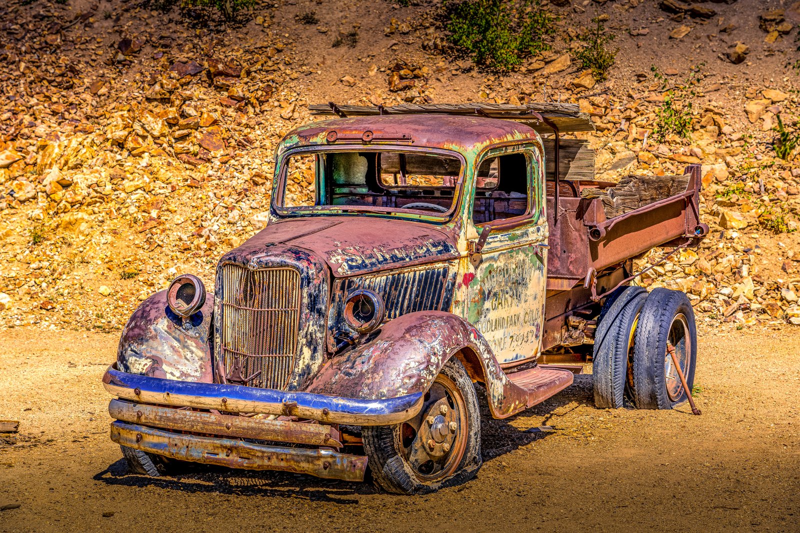
Cripple Creek CO
Set among the weathered rock and waste piles of the Cripple Creek mining district in central Colorado, this image frames the rusted hulk of a vintage flatbed dump truck left to decay in the sun. Faded lettering on its door still reads a garage sign from nearby Woodland Park, Colorado, a reminder of the small service shops that once kept mining-era vehicles running through these hills. The truck sits low on flat, weather-cracked tires, its cab windows shattered and its body streaked with rust, blue paint, and patches of green oxidation, set against a slope of tumbled ore-colored rock typical of the district's old mine dumps. Key Features: The Location: Cripple Creek, a historic Colorado gold camp built high in the Rockies southwest of Colorado Springs. Mining Heritage: Cripple Creek was named a National Historic Landmark in 1961, preserving its gold rush era character. The Setting: The rocky, rust toned backdrop resembles waste rock and tailings piles common throughout the district's mines. The Truck: A discarded work vehicle bearing a Woodland Park garage sign, now serving as a rustic relic of the area's mining transport history.
Prints from $14Downloads from $19