


Photographer
Rick Billings, Master Photographer
Orlando, Florida
I've been a professional photographer since I graduated high school in 1978. I'm bringing over four decades of professional photography experience and offering images I captures as beautiful display prints in your home or office.
Collections
All photos by Rick Billings, Master Photographer
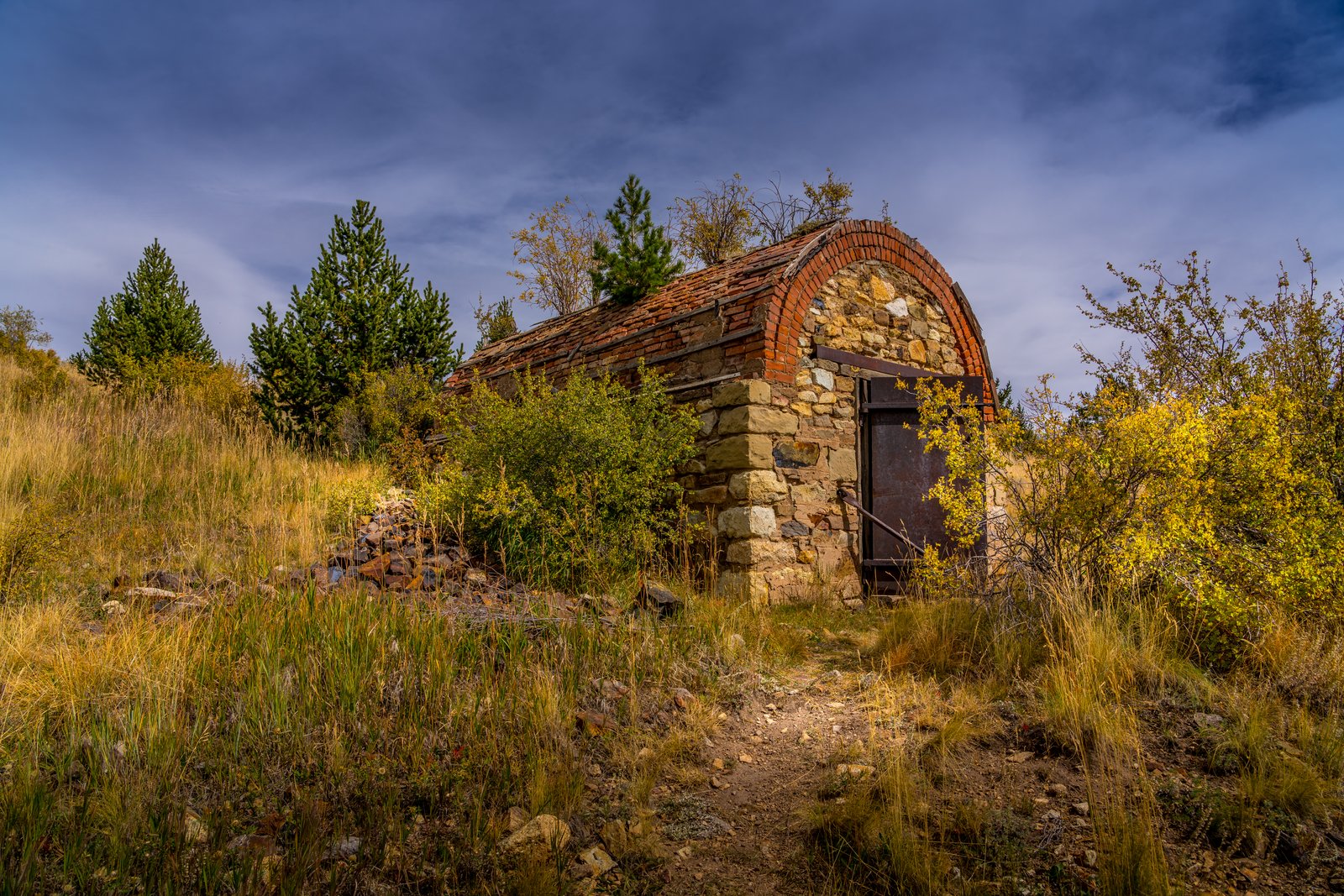
Cripple Creek CO
Based on the stone and brick barrel-arched structure with its heavy rusted iron door set into a hillside, this is a historic powder magazine, a small fireproof vault used to store dynamite and blasting caps safely away from the mine workings. It sits in the Cripple Creek Mining District of Teller County, Colorado, high in the hills near Cripple Creek and Victor, photographed among autumn grasses and pines along an old mining trail. Key Features: The Structure: Larger mines in the district used magazines built of brick in which to store explosives, with a heavy metal door locked to prevent theft. The Purpose: Mines typically kept separate magazines, one for dynamite and another for the primers used in detonation, isolating the volatile materials from the working shafts. The District: Gold was discovered in Victor in the late 19th century, and with Cripple Creek the mining district became the second largest gold mining district in the country. The Setting: Weathered stone walls, a curved tile and brick roof, and surrounding scrub oak and pine mark this as one of the district's many abandoned mine relics left in the Colorado high country.
Prints from $14Downloads from $19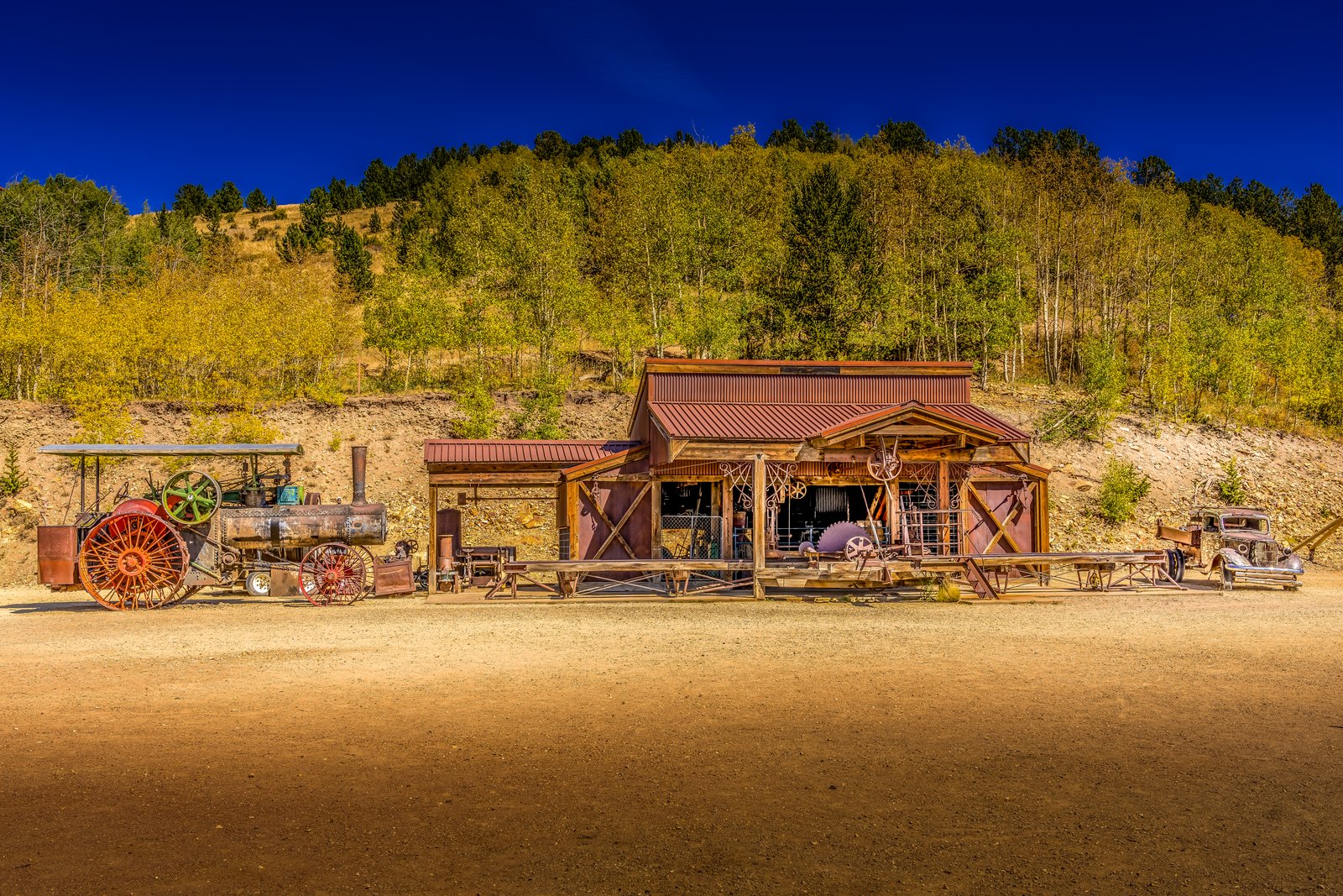
Cripple Creek Colorado
The photograph was taken at Victor's Gold Camp AG and Mining Museum in the historic Cripple Creek and Victor mining district of Colorado. The frame shows an old wooden garage building with a rust colored corrugated roof, flanked by a vintage steam powered farm tractor with large red wheels on one side and an antique automobile on the other, all set against a hillside of golden aspen trees turning color in the fall beneath a deep blue mountain sky. Key Features: The Museum Setting: This rugged three-story museum does more than showcase tractors, vehicles and old pulleys and equipment, this museum is also a working garage. The Machinery: Visitors can watch a complex system of pulleys and belts that power extremely large machines and equipment that would have been found in a large garage like this. The Blacksmith Shop: An old blacksmith forge is complete with a hammer and anvil and still used at this garage today. The Region: The site sits within the Cripple Creek and Victor gold mining district, a high alpine mining region in Teller County, Colorado renowned for its 1890s gold rush history.
Prints from $14Downloads from $19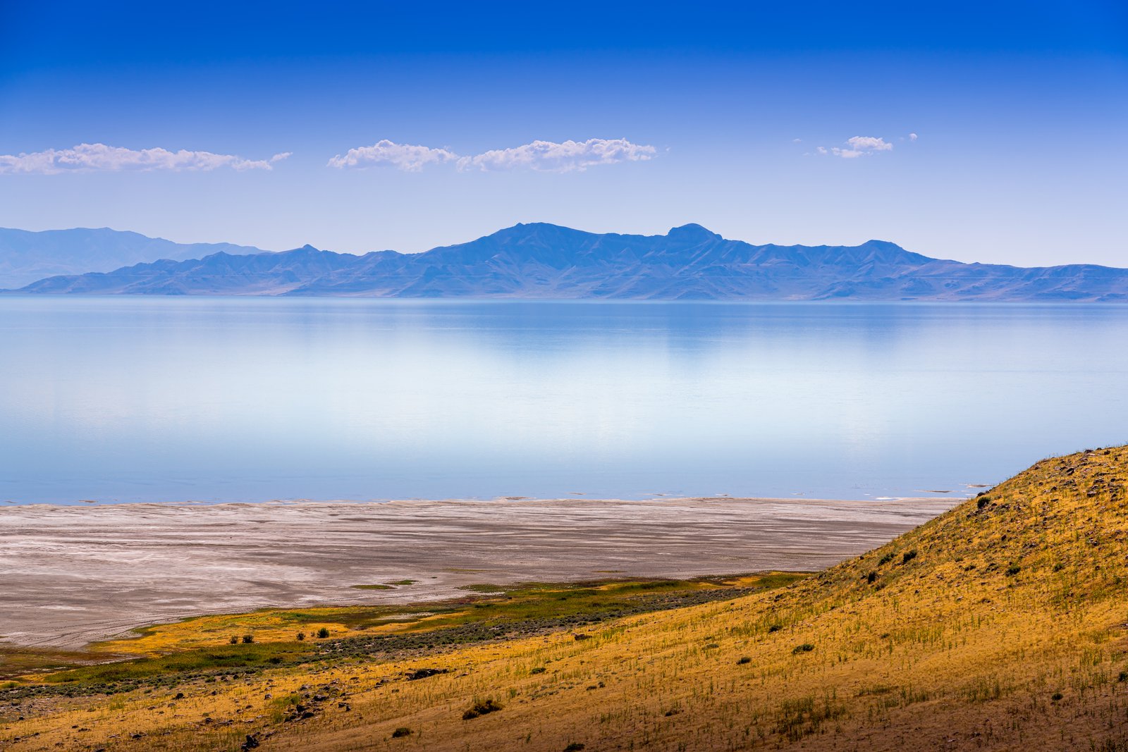
Farmington Bay Utah
Farmington Bay stretches across the eastern arm of Utah's Great Salt Lake, and this image looks out from the golden grass and sage covered slopes of Antelope Island toward the calm, mirror still waters of the bay. In the distance the jagged peaks of the Wasatch Range rise above a thin haze, their reflection doubling the mountain line in the pale blue water below. Key Features: The Vantage Point: The photograph is taken from the elevated terrain of Antelope Island, the largest island in the Great Salt Lake, looking east across Farmington Bay. The Water: The Wasatch Mountains rise up on the far side of the water at Farmington Bay, beyond the continuous suburbia of Clearfield, Layton, Farmington and Bountiful, giving the lake its mirrored mountain backdrop. The Island Terrain: Antelope Island runs north and south for about fifteen miles, shielding Farmington Bay, with elevations ranging from 4,200 to 6,600 feet. The Ecosystem: A great hike on the island provides an elevated look across the park, the lake, and the surrounding mountains, making it a favored spot for capturing this kind of layered desert and water landscape.
Prints from $14Downloads from $19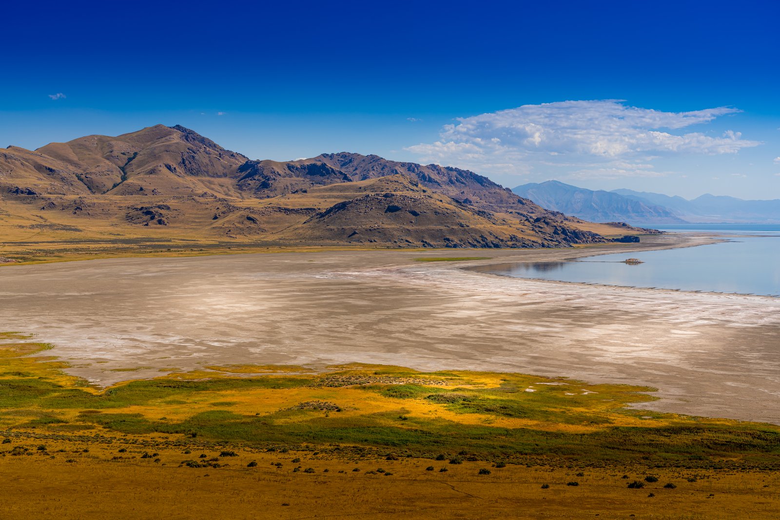
Farmington Bay Utah
Based on the confirmed research, here's the story: This photograph looks across Farmington Bay on Utah's Great Salt Lake, likely captured from an elevated ridge on Antelope Island State Park. The wide tan expanse in the middle of the frame is exposed lakebed left behind as the bay's shoreline has retreated, with grassy wetland flats in the foreground and the rugged, arid slopes of the island's mountains rising to the north and west. Key Features: The Setting: The Wasatch Mountains rise up on the far side of the water, Farmington Bay, beyond the continuous suburbia of Clearfield, Layton, Farmington and Bountiful. The Island: Antelope Island is the largest island on Great Salt Lake, part of the Basin and Range province stretching from the Wasatch Mountains to the Sierra Nevada. The Vantage Point: A great hike to take in the views is Buffalo Point Trail, providing an elevated look across the park, lake and surrounding mountains. The Shrinking Lake: Declining water levels have left an exposed lakebed, contributing to poor air quality as storms whip up toxic, heavy metal laden dust across the region.
Prints from $14Downloads from $19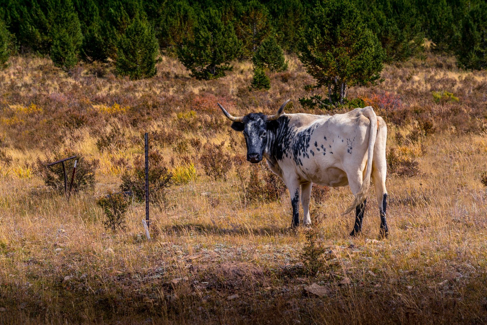
Cripple Creek CO
The photo was taken in the high country around Cripple Creek, a former gold rush town in the mountains west of Colorado Springs, sitting at an elevation of roughly 9,375 feet. The image looks across a hillside pasture of autumn grasses and scrub toward a stand of young lodgepole pines, with a black and white spotted longhorn type cow standing near an old fence post, gazing directly at the camera. Key Features: The Setting: Cripple Creek's high valley elevation, gold history, and small mountain population have all played roles in shaping the city's story. The Land Before Gold: Cripple Creek was at that time a cattle range, long before the gold discovery that made the town famous. Ranching Roots: The Cripple Creek area was cattle and ranching land for several years before mining took over the region. The Scene: A lone spotted bovine still grazes these same open slopes today, a quiet echo of the ranching life that predated the district's mining boom.
Prints from $14Downloads from $19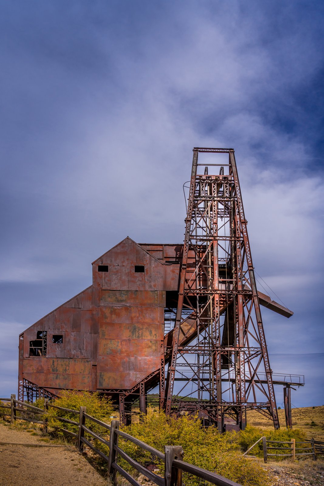
Cripple Creek CO
The photograph shows the Ajax Mine, a historic gold mine on the lower slopes of Squaw Mountain just northwest of Victor, Colorado, within the Cripple Creek Mining District. The image is taken from ground level along a fenced trail, framing the mine's weathered steel headframe and corrugated hoist house against a wide Colorado sky, with autumn brush and open rangeland surrounding the site. Key Features: The Mine's History: The Ajax mine was one of the more productive mines in the Cripple Creek Victor District and one of the last significant underground operations. Rehabilitation Era: West of the Strong Mine, the Ajax Mine, built in 1895, has a restabilized headframe and a new hoist, part of a 1970s rehabilitation program for one of the last gold mines, which did not close until the 1980s. The Setting: The headframe and ore house stand on Squaw Mountain above Victor, part of the larger Cripple Creek Mining District, once one of the richest gold camps in the American West. The Structure: The tall steel headframe lowered miners into the shaft and hoisted ore up an angled chute into the rusted corrugated metal ore bin still standing beside it.
Prints from $14Downloads from $19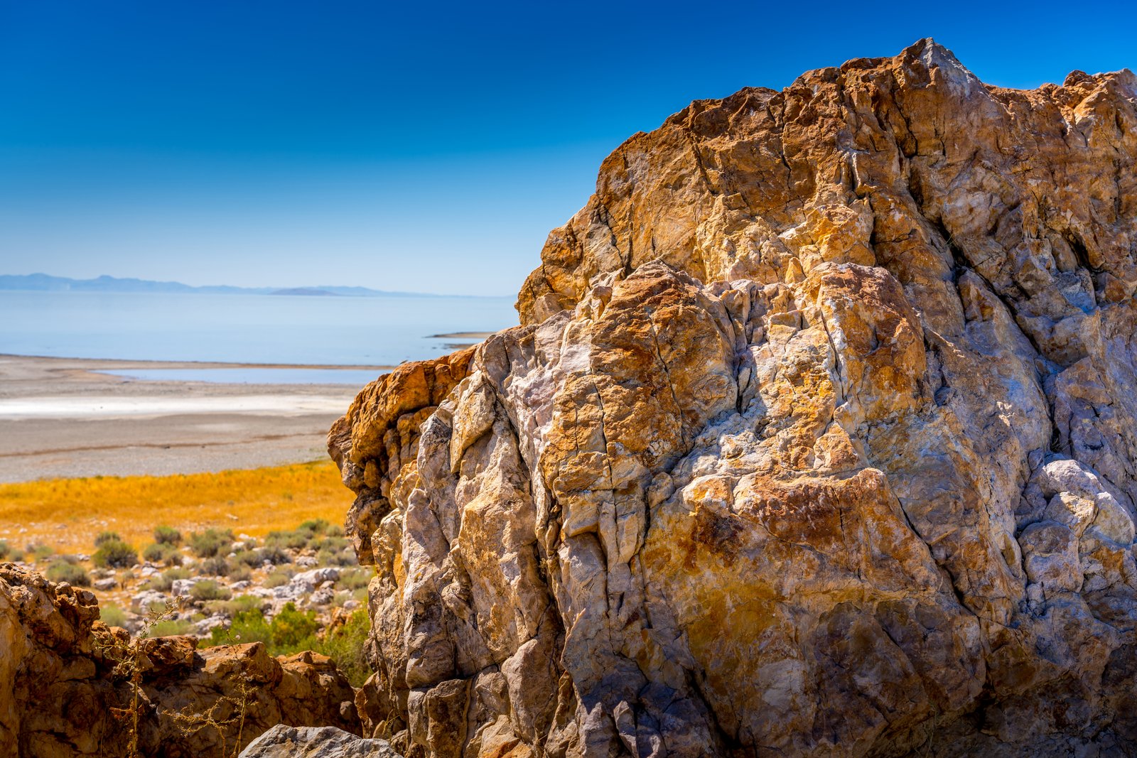
Farmington UT
Perched on the rugged shoreline of Antelope Island, this photograph looks northeast across the shimmering waters of the Great Salt Lake toward Farmington Bay, with distant mountain ridgelines fading into haze on the horizon. In the foreground, a weathered outcrop of ancient banded rock frames a landscape of salt flats, golden grasses, and hardy desert shrubs that define this island preserve in Davis County, Utah. Key Features: The Rock Formation: This outcrop is part of the Farmington Canyon Complex, extremely banded and contorted metamorphic rock among the oldest exposed rock in Utah, shaped by ancient compressional forces. The Setting: Antelope Island is the largest island in the Great Salt Lake, reached via a narrow road spanning seven miles from mainland to island. The View: Pullouts near this shoreline overlook Farmington Bay, where visitors can see the Wasatch Mountains rising in the distance across the water. Wildlife and Recreation: The park supports bison herds and offers birdwatching, hiking, and photography along its rocky, arid terrain.
Prints from $14Downloads from $19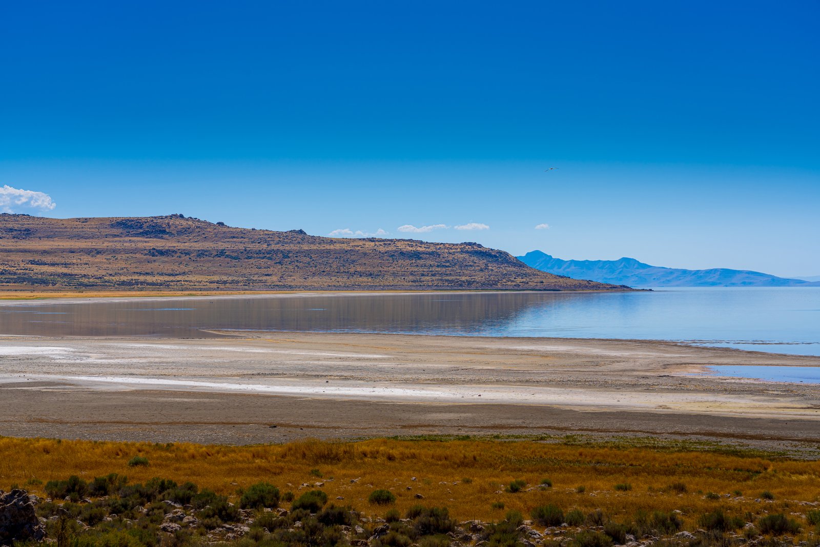
Farmington Bay Utah
Farmington Bay lies on the southeastern arm of the Great Salt Lake, where the low ridgeline of Antelope Island rises across the water. The photograph looks out from the marshy mainland shore, past bands of exposed salt flats and sunbaked mudflat left by receding water, toward the island's rugged silhouette on the horizon. Key Features: The Bay: Farmington Bay is the part of the Lake in between Antelope Island and the southeast corner of the Lake, where the Jordan River deposits water from Utah Lake. Wildlife Value: Thanks to the fresh water from the Jordan, Farmington Bay is one of only two places in the Lake where fish can be found, making it an important stopover point for migratory waterfowl. The Island: Antelope Island, with an area of 42 square miles, is the largest of ten islands located within the Great Salt Lake in Utah, lying in the southeastern portion of the lake near Salt Lake City and Davis County. Shifting Shoreline: The pale crust visible along the water's edge marks mineral deposits left behind as the shallow, saline lake level fluctuates with the seasons.
Prints from $14Downloads from $19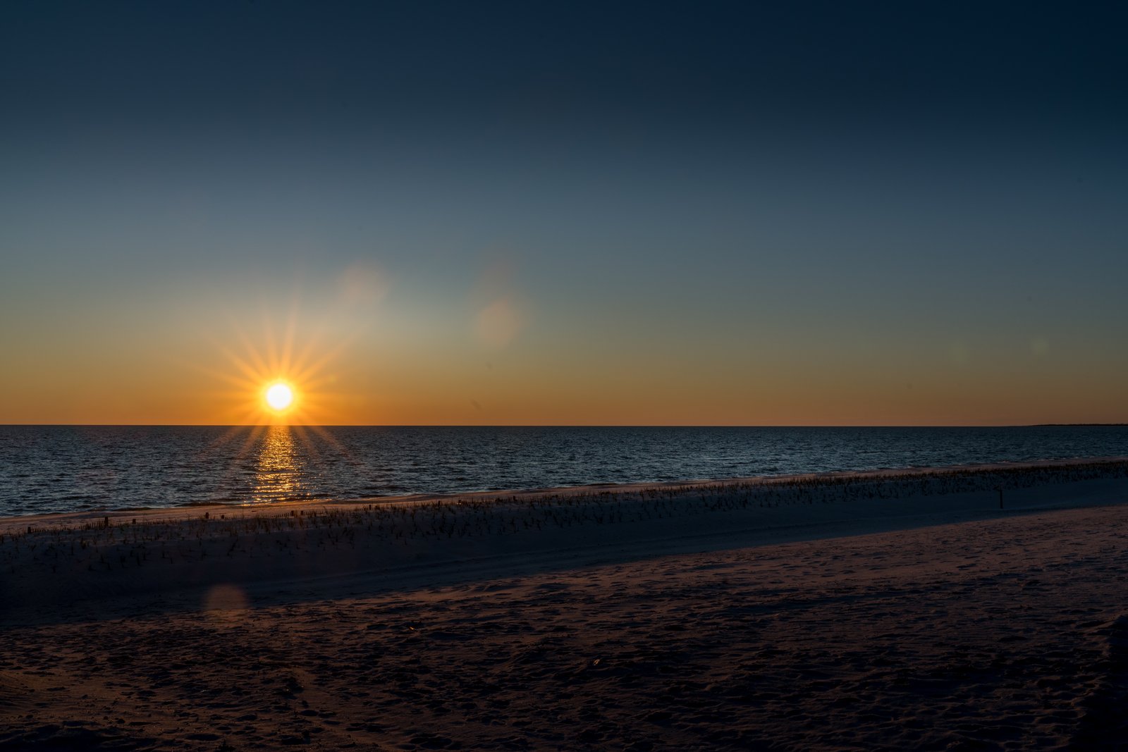
Mississippi Gulf Coast
This sunset was captured along the Mississippi Gulf Coast, looking south across the calm waters of the Mississippi Sound as the sun drops toward the horizon. The vantage point is low on the wide, gently sloping beach that runs along the shoreline near Highway 90, with a line of scattered marsh grass and driftwood marking the tideline and a faint sandbar or spit visible far to the right. Key Features: The Beach: stretching along the Mississippi Gulf Coast is this beautiful sand beach, 26 miles long and 300 feet wide, making it one of the largest man-made beaches in the world. The Roadway: U.S. Highway 90, known as the Old Spanish Trail, runs directly alongside this stretch of coastline, giving travelers a continuous ocean view. The Waters: The gentle waves belong to the Mississippi Sound, a shallow, protected body of water shielded from the open Gulf by a chain of barrier islands. The Setting: The soft color gradient and low sun angle suggest either early morning or evening light, a time when the wide, uncrowded beach takes on a quiet, expansive character.
Prints from $14Downloads from $19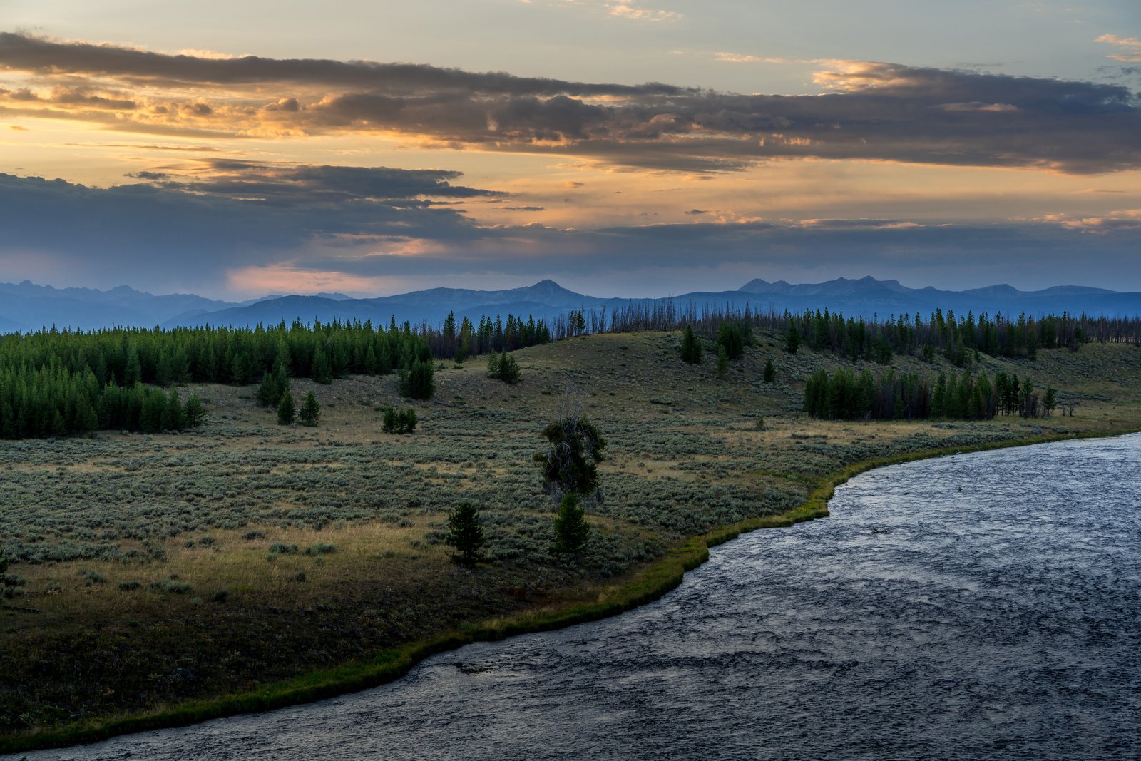
Long Horn Zion National Park Utah
This photograph looks toward Hayden Valley in Yellowstone National Park, taken from a roadside overlook above a wide bend of the Yellowstone River at dusk. Rolling sagebrush meadows and stands of lodgepole pine, some scarred by past wildfires, stretch toward the hazy blue ridgelines of the park's interior mountains beneath a glowing, cloud streaked sky. Key Features: The Valley Floor: The valley floor along the river is an ancient lake bed from a time when Yellowstone Lake was much larger. Wildlife Habitat: The valley, nine miles long and six miles wide, is the year-round home for nearly a thousand bison. Naming and Origin: The valley takes its name from Ferdinand V. Hayden, leader of the 1871 survey expedition that helped establish the park. Scenic Overlooks: Turnouts along the park road above the winding river offer sweeping views of the meadows and distant peaks, especially prized at sunrise and sunset.
Prints from $14Downloads from $19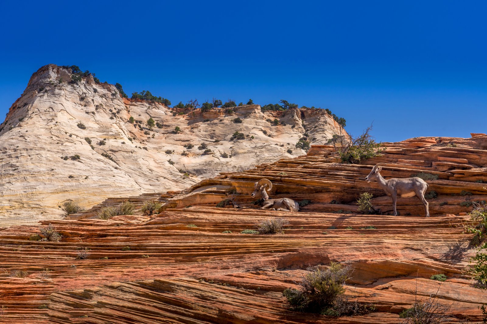
Long Horn Zion National Park Utah
The photograph was taken along the Zion Mount Carmel Highway in the eastern section of Zion National Park, Utah, where the road winds through slickrock terrain near Checkerboard Mesa. The frame shows a pair of desert bighorn sheep resting and standing on layered red Navajo sandstone ledges, with a pale, cross bedded sandstone dome rising against a deep blue sky in the background. Key Features: The Rock Formation: the checkerboard design has been created by weathering and erosion in the upper portion of the Navajo Formation The Terrain: This stretch of slickrock lies near Checkerboard Mesa, which towers above the Zion Mount Carmel Highway on the park's east side. The Wildlife: Desert bighorn sheep frequent this eastern plateau, drawn to seasonal water pockets in the surrounding canyons and using the rugged ledges as natural lookout points. The Setting: The contrast between the white Navajo sandstone dome and the striated red rock in the foreground reflects the varied mineral staining found throughout this part of the park.
Prints from $14Downloads from $19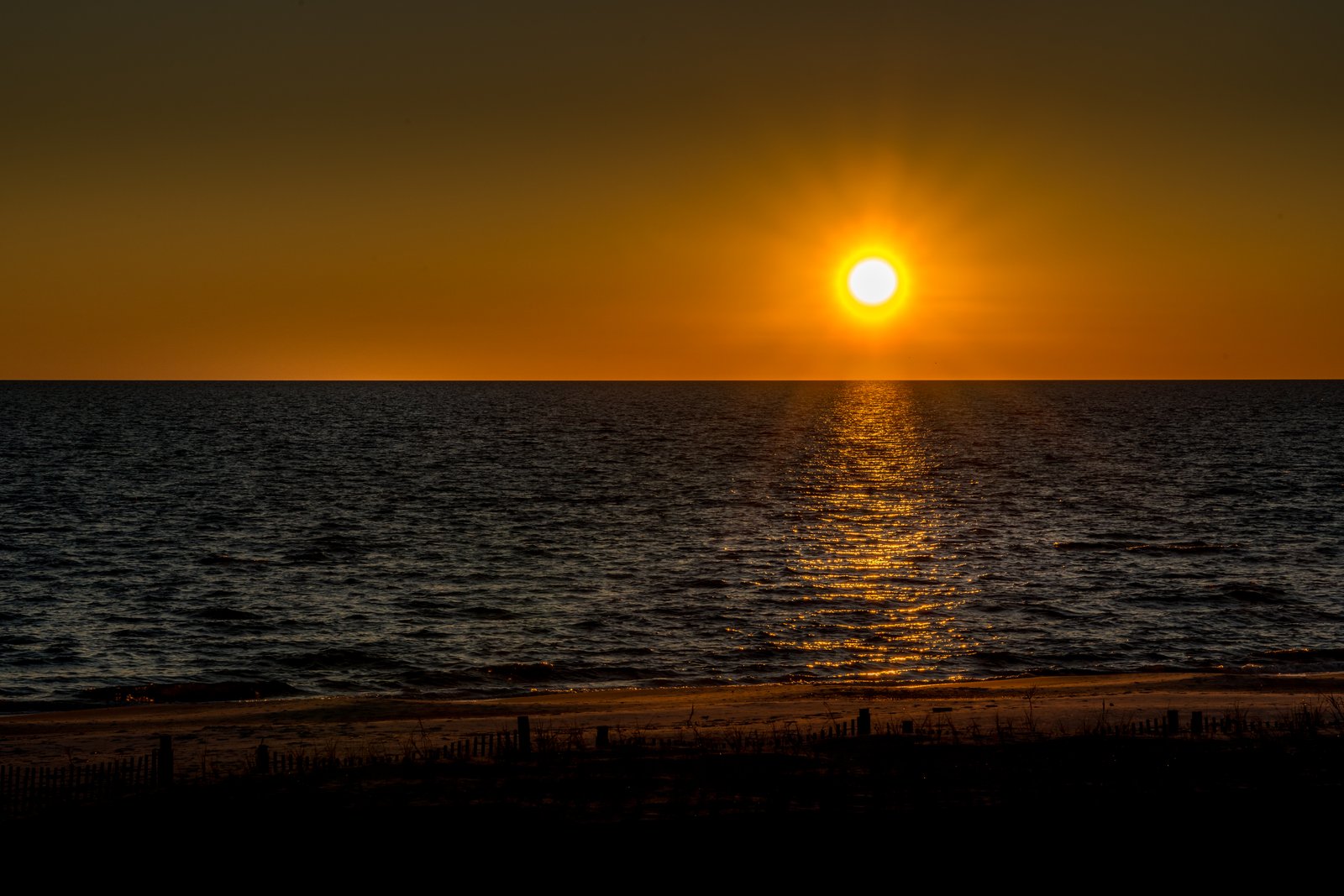
Gulf Coast Mississippi
The photograph looks south across the Mississippi Sound from one of the sand beaches lining Mississippi's Gulf Coast, likely near Biloxi, Gulfport, or another town along Highway 90. The vantage point is at the edge of the dunes, with wooden sand fencing and beach grass in silhouette in the foreground, sandy shoreline below, and the sun setting low over calm water, its reflection forming a bright path across the surface. Key Features: The Beach: This stretch of coastline forms part of what is often called the world's largest man-made beach, stretching across 26 miles of Coastal Mississippi. The Water: The gentle water shown here is typical of barrier islands that sit several miles offshore, acting as a natural buffer between the open Gulf of Mexico and the mainland shoreline, keeping wave action calm along the coast. The Dune Fencing: Wooden slat fences and native grasses seen in the foreground are used along the coast to trap sand and stabilize the dunes against erosion. The Light: The sun's reflection stretching across the water toward the shore is characteristic of low sun angles at dawn or dusk along this east-west running coastline.
Prints from $14Downloads from $19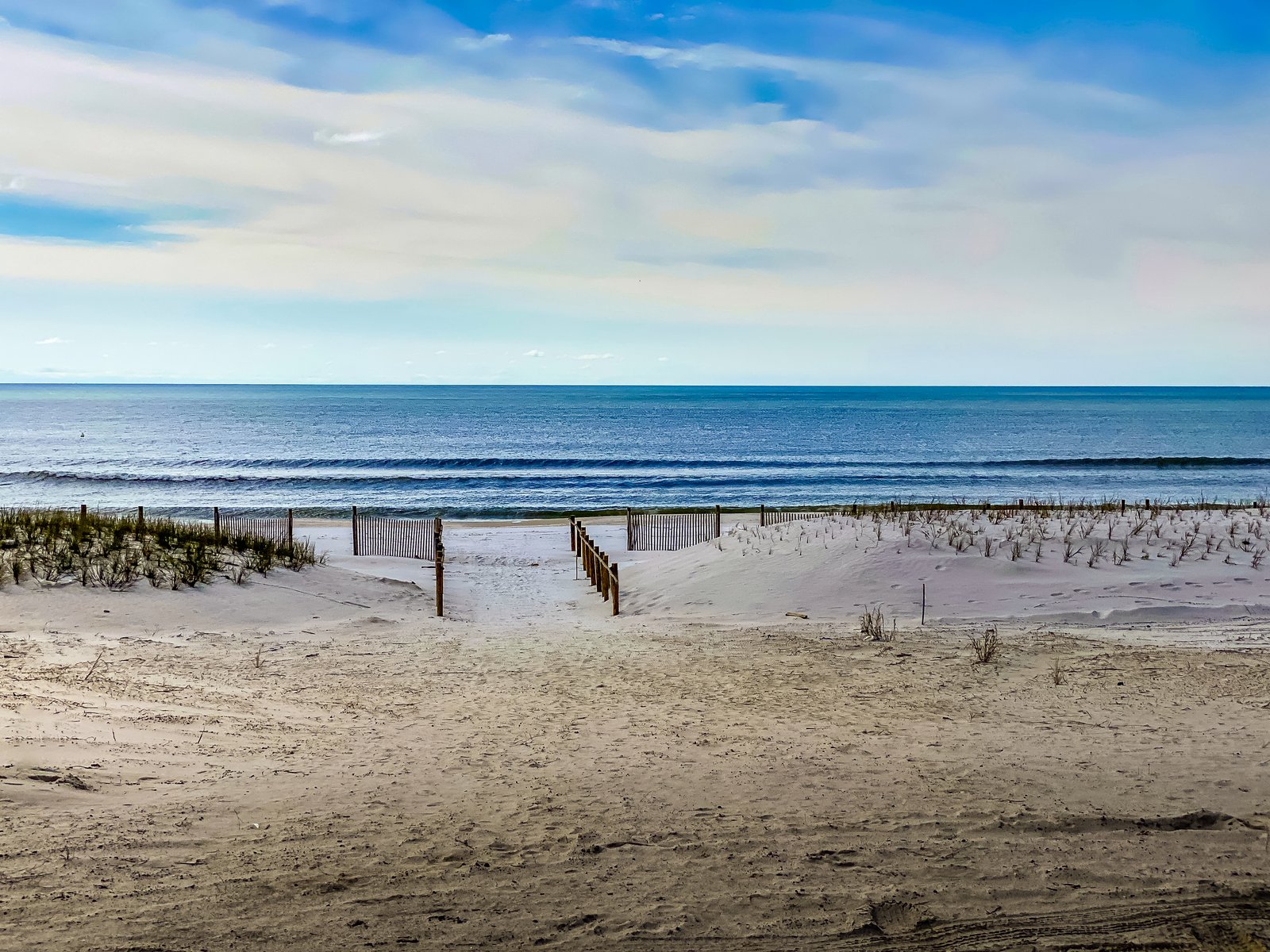
Florida Panhandle
Mexico Beach, Florida
The photograph looks toward the Gulf of Mexico from a public beach access point in Mexico Beach, on Florida's Panhandle. A wooden sand fence lines a walkway cut through low dunes planted with sea oats and beach grasses, leading the eye past a narrow strip of white sand to gentle breaking waves and open water beyond. Key Features: The Coastline: Mexico Beach sits along the Gulf of Mexico in Bay County, known for its quiet, undeveloped shoreline compared to larger panhandle resort towns. Dune Restoration: Volunteers and city leaders have worked to rejuvenate the dune system to keep beaches available while protecting the town from future storms, using slatted fencing to trap sand and encourage sea oat growth. Storm Recovery: The small resort community bore the brunt of Hurricane Michael, a Category 5 storm that made landfall in October 2018, and its dunes have since been rebuilt as part of the town's ongoing recovery.
Prints from $14Downloads from $19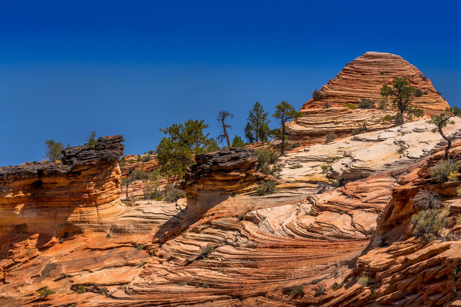
Zion National Park Utah
The photograph was taken along the east side of Zion National Park in southern Utah, likely near the slickrock terraces along the Zion Mount Carmel Highway. The image looks up a sweeping slope of pale orange Navajo Sandstone, its surface etched with fine cross bedded lines, rising toward a rounded dome capped by wind sculpted layers. Scattered pinyon pines and junipers cling to cracks in the rock beneath a deep cloudless sky. Key Features: The Rock Layers: The wavy striped patterns are cross bedding, fossilized traces of ancient sand dunes preserved in the Navajo Sandstone formation. The Formation's Scale: This sandstone is one of the most prominent formations exposed in Zion Canyon, with some of its highest exposures forming towering cliffs and monoliths. The Desert Origin: The rock records a time when shifting winds and desert sand dunes covered a vast area during deposition, later cemented into stone. The Setting: Hardy pines and shrubs root directly in the slickrock, typical of the high desert plateau country surrounding Zion.
Prints from $14Downloads from $19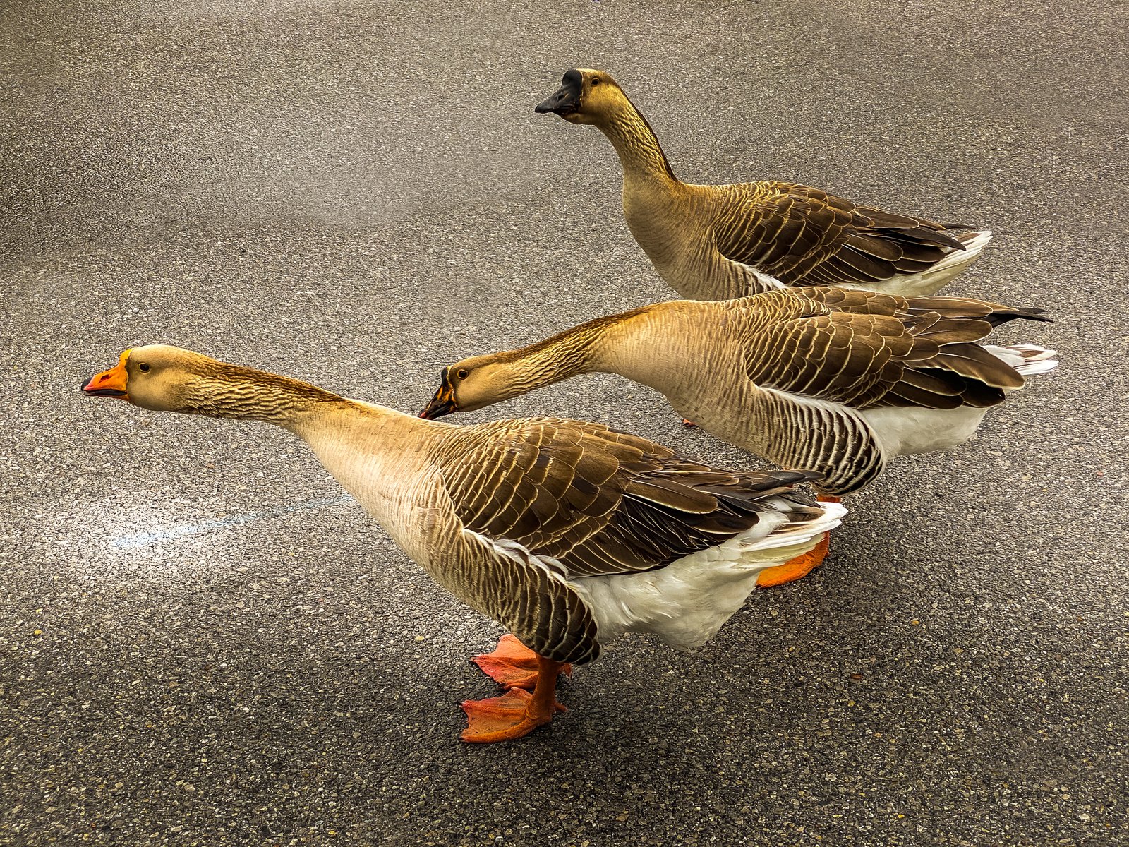
Gulf Coast Ducks
Panama City, Florida
The photo was taken along the Gulf Coast in Panama City, Florida, where a small trio of domestic geese ambles across a quiet paved lane, likely near one of the area's coastal parks or waterside neighborhoods where these birds are known to roam freely. The image is framed low and close, putting the viewer at goose level as the lead bird's bright orange bill and feet stand out against the muted gray asphalt. Key Features: The Birds: These are farmyard type geese, larger and heavier bodied than wild Canada geese, with the buff brown plumage and orange bill and legs typical of domestic breeds kept around ponds and parks in Florida. The Setting: Panama City sits on the Gulf of Mexico in the Florida Panhandle, an area known for its beaches, bayous and waterside parks that attract resident waterfowl. The Composition: Shooting from ground level along their line of travel gives the three geese a sense of single file motion, turning an everyday roadside crossing into a striking study of texture and color.
Prints from $14Downloads from $19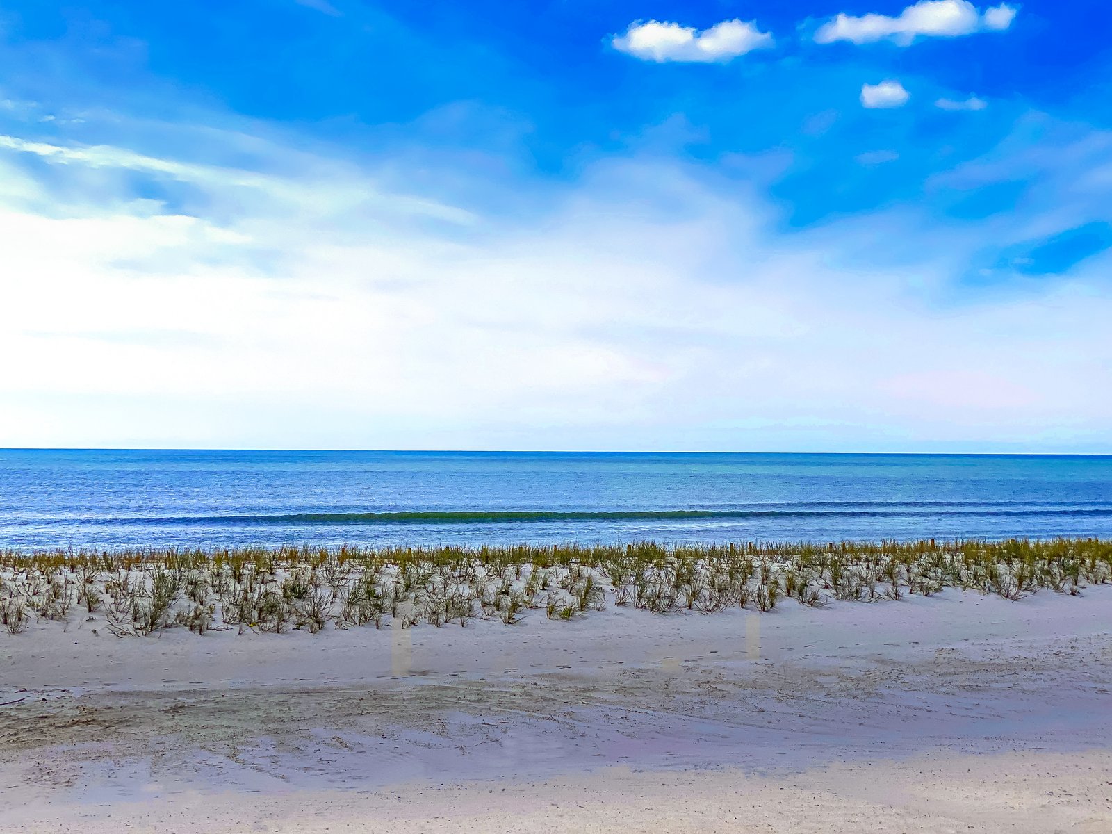
Gulf Coast Mississippi
Mexico Beach, Florida
The photograph looks along an undeveloped stretch of shoreline on the Florida Panhandle near Mexico Beach, on the Gulf of Mexico. The view is taken from the open beach looking seaward across a low foredune planted with sea oats and beach grasses that stabilize the sand, with a gentle wave line breaking just offshore under a wide, partly clouded sky. Key Features: The Setting: Mexico Beach sits on the northwest Florida coast in Bay County, a small Gulf-front community known for white sand beaches and clear water. The Town's Character: Located on the east end of Bay County, Mexico Beach captures the essence of the Panhandle with white sandy beaches, clear emerald waters and a small-town vibe. The History: The city was officially founded and incorporated in 1967, and took the name Mexico Beach, becoming known for its excellent sport fishing grounds. Resilience: Hurricane Michael struck the Florida panhandle in 2018, and the small town of Mexico Beach bore the brunt of the devastation, still recovering years later. Native dune grasses like those pictured remain vital to rebuilding the shoreline's natural defenses.
Prints from $14Downloads from $19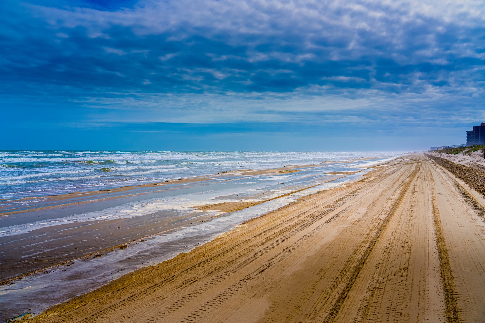
1182 Corpus Christi TX
Long stretches of the Texas Gulf Coast near Corpus Christi are known for allowing vehicles directly onto the sand, and this image looks north or south along one of those drivable beaches, likely near North Padre Island or Mustang Island. The vantage point is low and close to the shoreline, showing rolling surf and foam on the left, a wide packed sand track scored with tire ruts running toward the horizon, and a line of low dunes and beachfront condominium buildings fading into haze on the right. Key Features: Driveable Shoreline: Corpus Christi's Gulf beaches are among the few in the country where cars can drive right onto the sand, a practice residents and visitors rely on for beach access. The Coastal Setting: The image sits along the barrier islands fronting Corpus Christi Bay, part of a chain that includes Mustang Island and Padre Island. Developed Beachfront: The distant high rise buildings mark the more developed resort stretch of the coast, contrasting with the undeveloped dunes and open sand in the foreground. Weather and Light: Heavy cloud cover with breaks of blue sky and visible sea spray suggest a breezy, changeable Gulf Coast day typical of the region's coastal climate.
Prints from $14Downloads from $19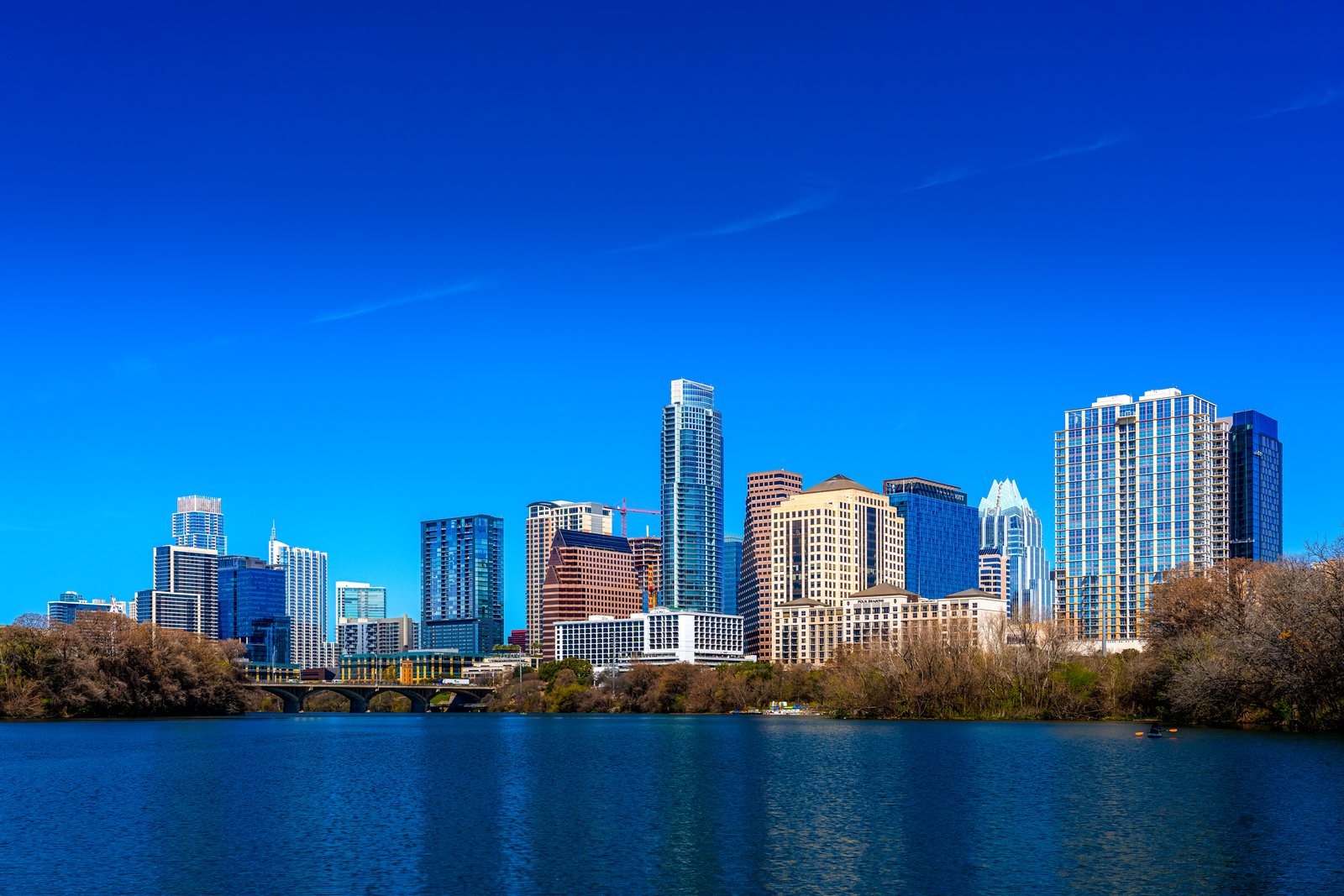
1179 Austin Texas
Downtown Austin, Texas, rises along the north bank of Lady Bird Lake, the dammed stretch of the Colorado River that curves through the heart of the city. The photograph is taken from the water's edge on the south shore, likely near Auditorium Shores or the Butler Hike and Bike Trail, looking north across the lake toward the skyline with a low pedestrian bridge crossing the water in the foreground and bare winter trees lining the bank. Key Features: The Skyline Mix: The frame includes several of Austin's tallest towers, among them the Frost Bank Tower, the Austonian, and the Four Seasons. Lady Bird Lake: The lake is actually the Colorado River, dammed in 1960 for flood control and power generation. Rapid Growth: A flurry of hotels and residential towers filled in the downtown skyline, including the Four Seasons Residences and the Austonian, once the city's tallest building for many years. The Vantage Point: Popular waterfront viewpoints along this stretch include Butler Metro Park and the Lou Neff Point area near Zilker Park, offering classic photo views of the downtown skyline over the river.
Prints from $14Downloads from $19