

Collection
USA
By · 138 photos
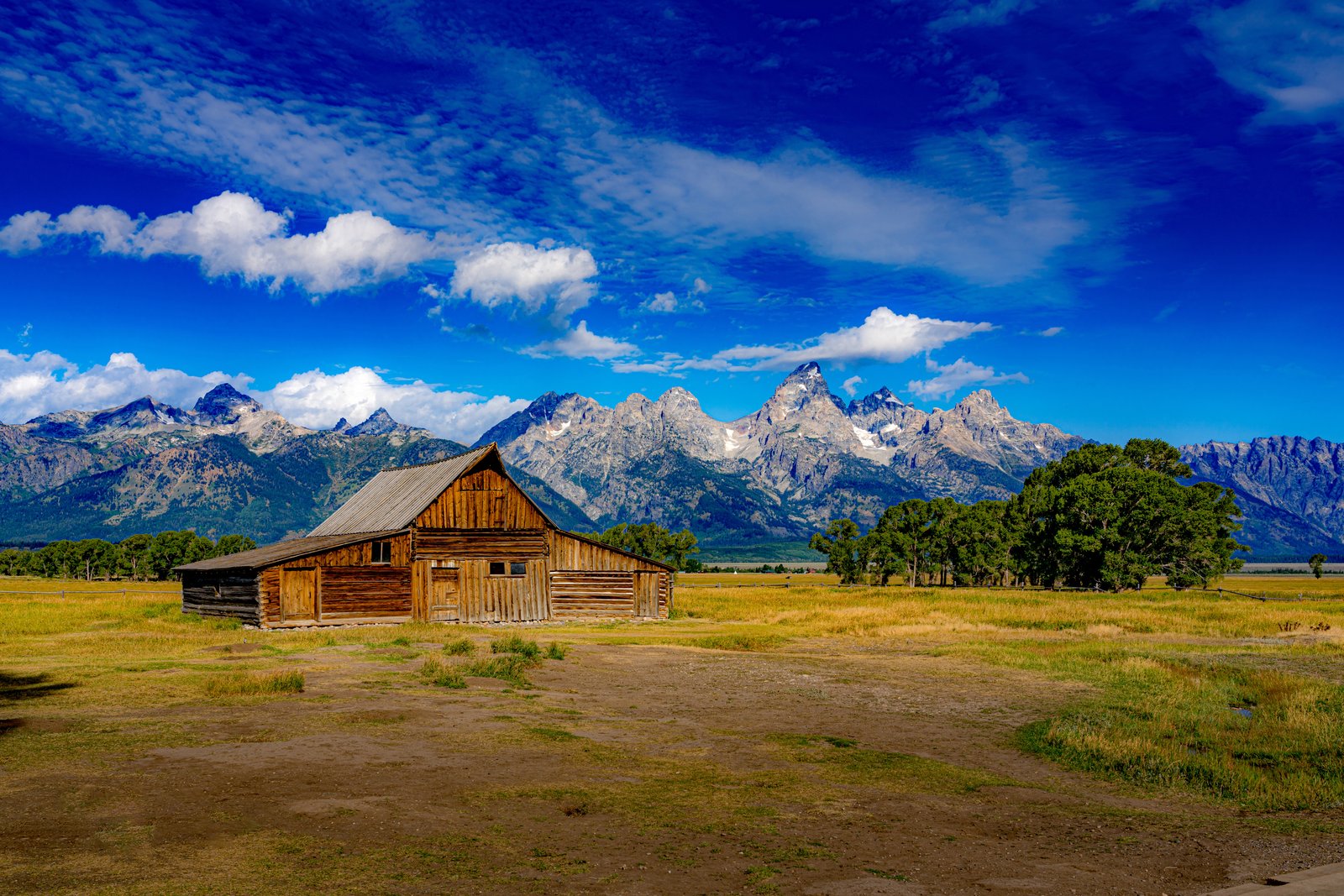
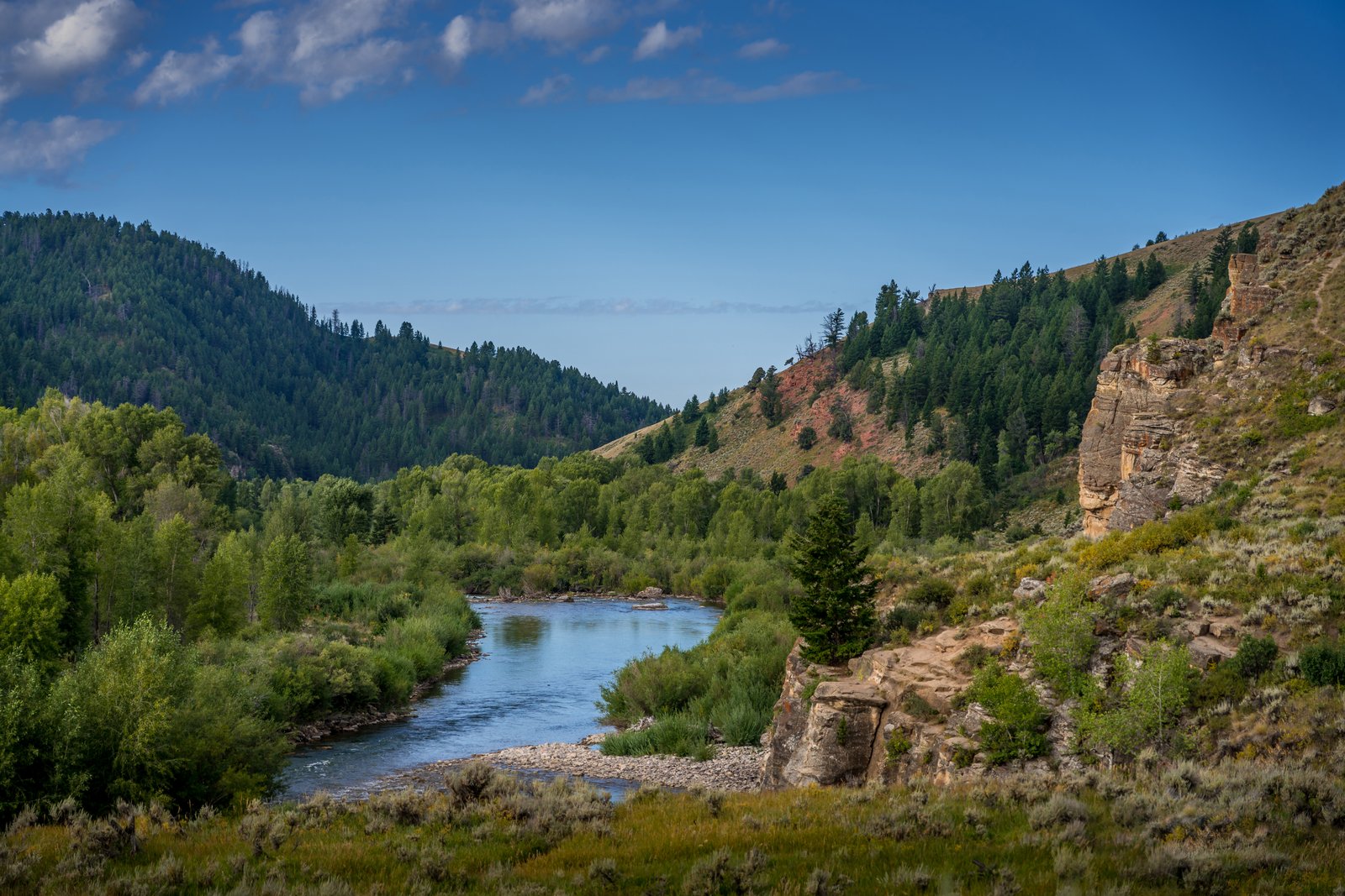
Jackson Hole River
This photograph looks out over the Gros Ventre River as it winds through its forested canyon east of Jackson Hole, Wyoming, in the Bridger-Teton National Forest. The vantage point sits on a grassy bluff above the water, framing a bend of the river between cottonwood-lined banks, a sagebrush slope, and a weathered sandstone outcrop rising on the right, with pine-covered ridges receding toward the horizon under a clear summer sky. Key Features: The River: winding its way down from Slide Lake through beautiful, multicolored terrain, the Gros Ventre carves a scenic canyon east of Grand Teton National Park. The Rock Formations: the Gros Ventre River eroding through the overlying Tensleep Sandstone produced a "free side" with no support holding it in place, shaping the cliffs seen along the canyon. The Wilderness Setting: the Gros Ventre is a landscape of contrasts, from big, lush meadows to steep pinnacles of limestone, with spectacular views of the Teton Range. Historic Note: the canyon lies near the site of the 1925 Gros Ventre landslide, one of the region's most notable geologic events.
Prints from $14Downloads from $19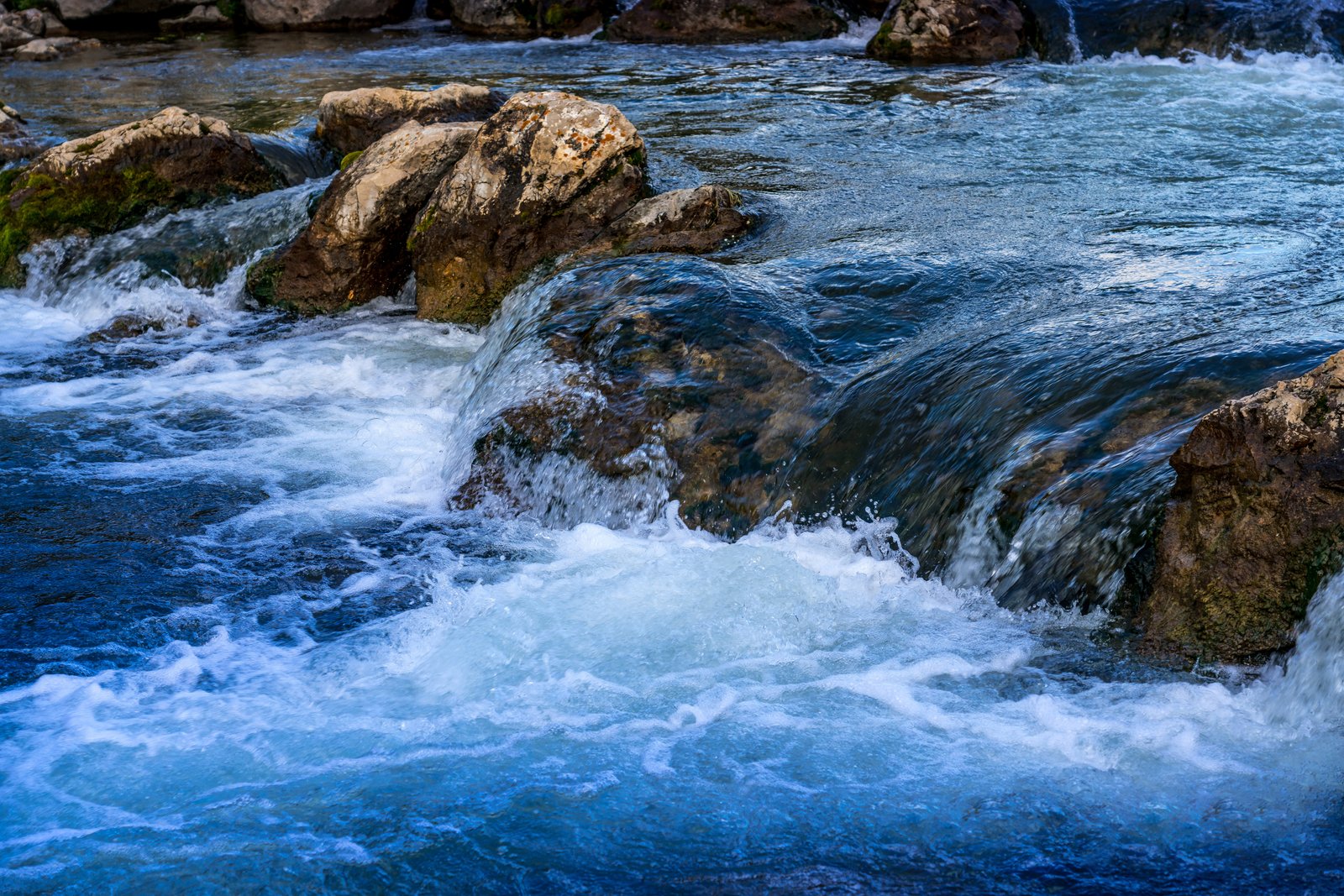
Black Hills Stream
This close up view captures a rushing stream tumbling over weathered limestone boulders in the Black Hills of South Dakota, taken low to the water so the eye follows the current as it churns into whitewater against the rock. The composition frames only the water and stone, emphasizing the motion and texture of a small cascade rather than any wider landmark. Key Features: The Black Hills Region: This range of forested mountains rising from the northern prairie is known for its granite and limestone formations shaped by centuries of flowing water. Trout Waters: Black Hills streams and lakes are home to rainbow, brown, and brook trout, with tiger trout introduced to a couple of area lakes, making the clear, fast moving water in scenes like this vital habitat. Natural Character: Streams here are managed for naturally reproducing populations, reflecting the largely untouched, rugged beauty of the area's waterways. The Vantage Point: The tight, ground level framing highlights the force and clarity of the current rather than a broader landscape, focusing attention on the interplay of rock and rushing water.
Prints from $14Downloads from $19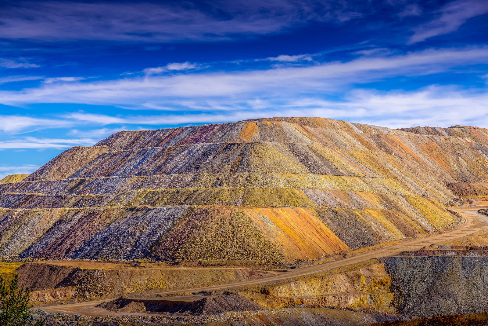
Cripple Creek CO
The Cripple Creek and Victor Gold Mine sits in the mountains southwest of Colorado Springs, where the historic Cripple Creek Mining District was reborn in the 1990s as a large modern open pit operation. This image looks across a terraced waste rock pile, its layered benches stained in bands of gold, rust, and gray by the mineralized rock, with a haul road curling along the valley floor below the slope. Key Features: The Cripple Creek and Victor gold mine lies southwest of Colorado Springs in the US state of Colorado, and for many years the Cripple Creek Mining District was a series of underground mines. Modern Operation: Following 40 years of inactivity, the district roared back to life in the 1990s with a modern open-pit mine that is still producing gold each year. Historic Roots: The town of Cripple Creek was founded after an 1892 gold strike. Colorful Waste Piles: The banded orange, gray, and yellow terraces reflect the varied mineral content of rock removed to reach the ore, stacked in graded benches typical of large scale surface mining.
Prints from $14Downloads from $19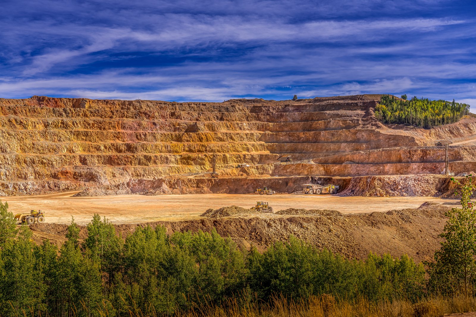
Cripple Creek Gold Mine
This photograph looks down into the massive open pit of the Cripple Creek and Victor Gold Mine, cut into the mountains of Teller County, Colorado. Terraced benches of oxidized, rust colored rock rise in stacked tiers above a wide gravel floor where haul trucks, loaders and dozers work amid clouds of dust, with a stand of golden aspen framing the pit's rim under a bright blue sky. Key Features: The Discovery: Gold was found here in 1890, sparking a rush that made this district one of the richest gold camps in the American West. The Operation: This mine is the richest gold mine in Colorado history and the only remaining significant producer of gold in the state, now run as a large open pit. The Scale: The pit reaches a greatest depth of about 2,750 feet and was first opened in 1892, expanding into modern open pit operations in 1994. The Setting: Terraced benches expose colorful mineralized rock, while surrounding stands of aspen and pine mark the high Rocky Mountain terrain around Cripple Creek and Victor.
Prints from $14Downloads from $19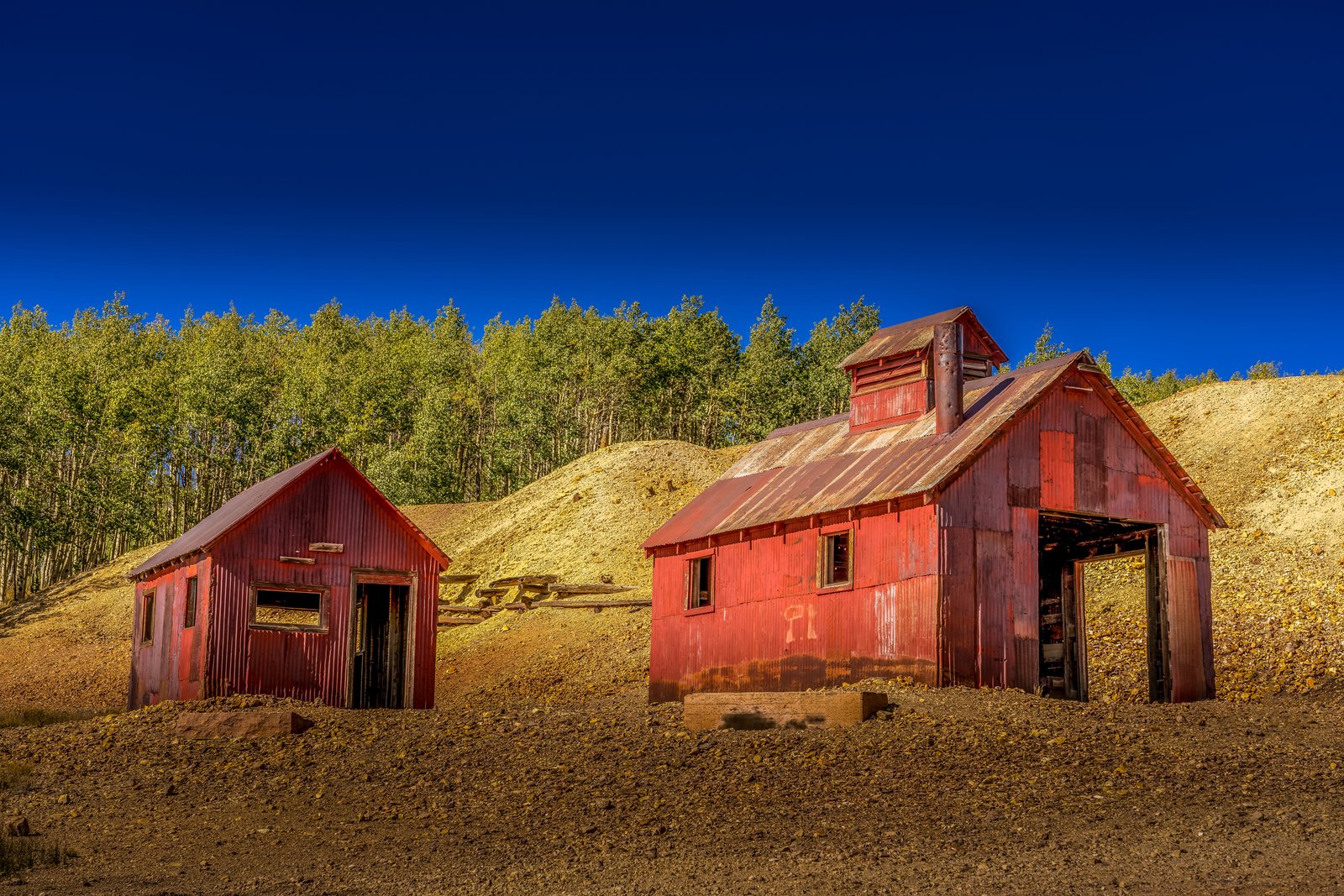
Cripple Creek Gold Mine Country
This photograph was taken in the historic Cripple Creek mining district on the west side of Pikes Peak in central Colorado, where weathered red corrugated metal buildings still stand among the tailings piles left from the region's gold boom. The view captures two rusted ore or hoist houses set against a golden slope of mine waste rock, with a stand of aspen framing the scene beneath a deep blue high altitude sky. Key Features: The Gold Rush: In December 1890, a man named Bob Womack really did discover gold, sparking Colorado's last and richest gold rush. The Historic Landmark: Cripple Creek Historic District is a U.S. National Register of Historic Places and U.S. National Historic Landmark District, preserving its mining era structures. The Setting: The district sits at high elevation near Pikes Peak, where old headframes, mills and storage sheds remain scattered across the hillsides of tailings and rock waste. The Legacy: gold mining operations remove rock with traces of gold from the old mines even today, keeping the district's mining heritage alive.
Prints from $14Downloads from $19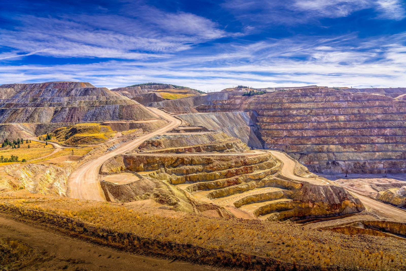
Cripple Creek Gold Mine
The photograph looks down into the vast open pit of the Cripple Creek and Victor Gold Mine, high in the Colorado mining district near Victor and Cripple Creek in Teller County. Terraced benches of blasted rock spiral downward in tan, rust, and gray bands while switchback haul roads climb the slopes, and distant timbered ridges frame the excavation under a wide Rocky Mountain sky. Key Features: The Mine's Legacy: This is the richest gold mine in Colorado history, and the only remaining significant producer of gold in the state. The Shift to Open Pit: The mine was originally opened in 1892, then fell into decline when the gold ran out and finally closed in 1962, before open pit operations began later. Modern Scale: In 1994 the Cripple Creek & Victor Gold Mine started large scale pit operations, and by the 2000s it was producing hundreds of thousands of ounces of gold and silver per year. Historic District: Cripple Creek is one of the few historic boomtowns in the American West with an active mine.
Prints from $14Downloads from $19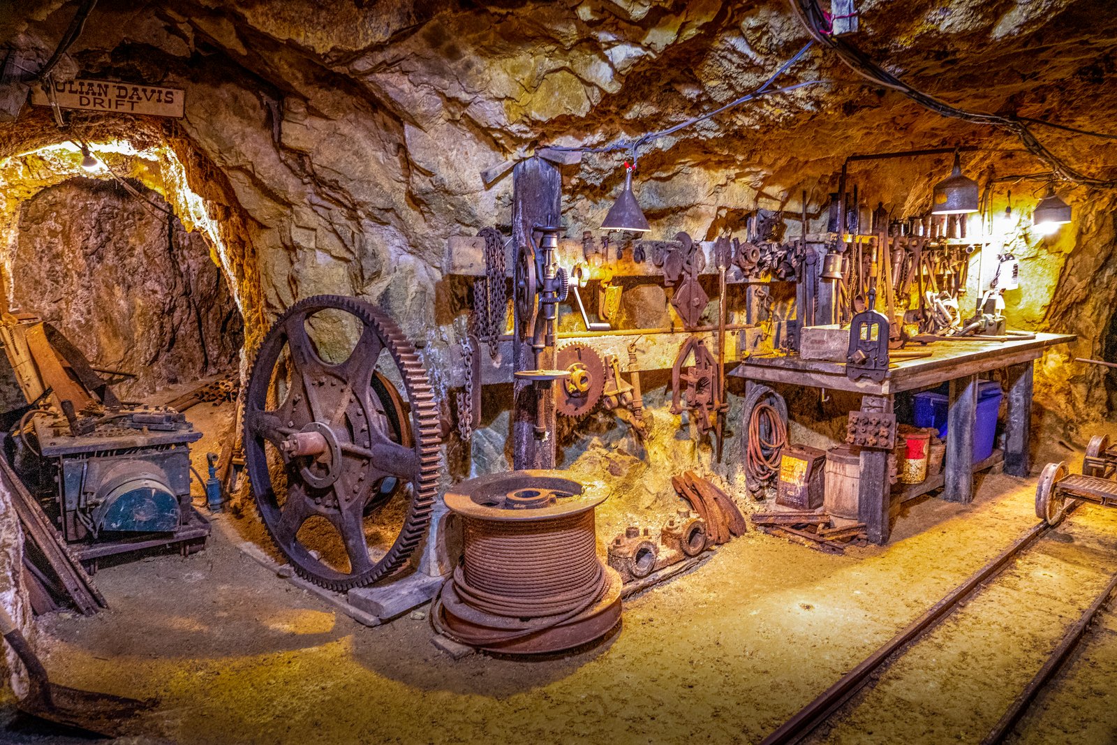
Cripple Creek 1000 Feet Down
This confirms the location matches the title "Cripple Creek 1000 Feet Down" , the Mollie Kathleen Gold Mine, a working gold mine turned tourist attraction where visitors descend 1,000 feet underground.This underground scene shows a working level of the Mollie Kathleen Gold Mine near Cripple Creek, Colorado, reached by descending a vertical shaft 1,000 feet into the mountain. The wooden sign overhead marks the "Julian Davis Drift," one of the mine's named tunnels, and the frame is filled with the drilling gear, cable spool, gear wheels, and rail cart tracks left in place from the mine's working decades. Key Features: The Discovery: The mine takes its name from Mollie Kathleen Gortner, who in 1891 became the first woman in the Cripple Creek gold camp to discover gold and strike a claim in her own name. The Depth: The mine shaft descends 1,000 feet into the mountain, a depth roughly equal to the height of the Empire State Building. The Tour: The site is now the only 1,000 foot vertical shaft gold mine tour in the U.S., preserving original drills, winches, and tunnel drifts for visitors.
Prints from $14Downloads from $19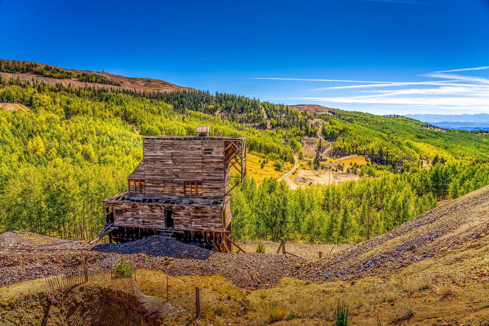
Cripple Creek CO
The photograph looks down into a wooded gulch on the southwestern flank of Pikes Peak, in the historic Cripple Creek Mining District of central Colorado. A weathered timber headframe and ore house, remnants of one of the district's turn of the century gold mines, stands amid gravel tailings piles, with slopes of golden aspen and evergreen forest rolling toward distant peaks under a deep blue sky. Key Features: The Gold Camp: At the lofty elevation of 10,000 feet on the southwest shoulder of Colorado's iconic Pikes Peak, it is the world's highest major gold-mining district. The Mine Structures: Timber headframes and ore houses like this one once hoisted ore from underground shafts and remain scattered across the district's hillsides. The Landscape: Surrounding slopes of aspen and pine, tinged gold in autumn, now reclaim the tailings piles and old wagon roads left behind by decades of mining. The Legacy: Designated a National Historic Landmark in 1963, Cripple Creek bills itself as "the World's Greatest Gold Camp."
Prints from $14Downloads from $19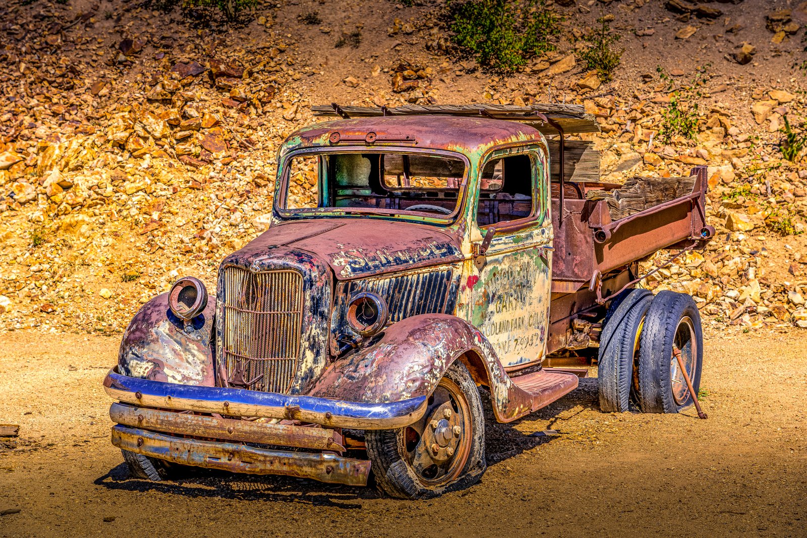
Cripple Creek CO
Set among the weathered rock and waste piles of the Cripple Creek mining district in central Colorado, this image frames the rusted hulk of a vintage flatbed dump truck left to decay in the sun. Faded lettering on its door still reads a garage sign from nearby Woodland Park, Colorado, a reminder of the small service shops that once kept mining-era vehicles running through these hills. The truck sits low on flat, weather-cracked tires, its cab windows shattered and its body streaked with rust, blue paint, and patches of green oxidation, set against a slope of tumbled ore-colored rock typical of the district's old mine dumps. Key Features: The Location: Cripple Creek, a historic Colorado gold camp built high in the Rockies southwest of Colorado Springs. Mining Heritage: Cripple Creek was named a National Historic Landmark in 1961, preserving its gold rush era character. The Setting: The rocky, rust toned backdrop resembles waste rock and tailings piles common throughout the district's mines. The Truck: A discarded work vehicle bearing a Woodland Park garage sign, now serving as a rustic relic of the area's mining transport history.
Prints from $14Downloads from $19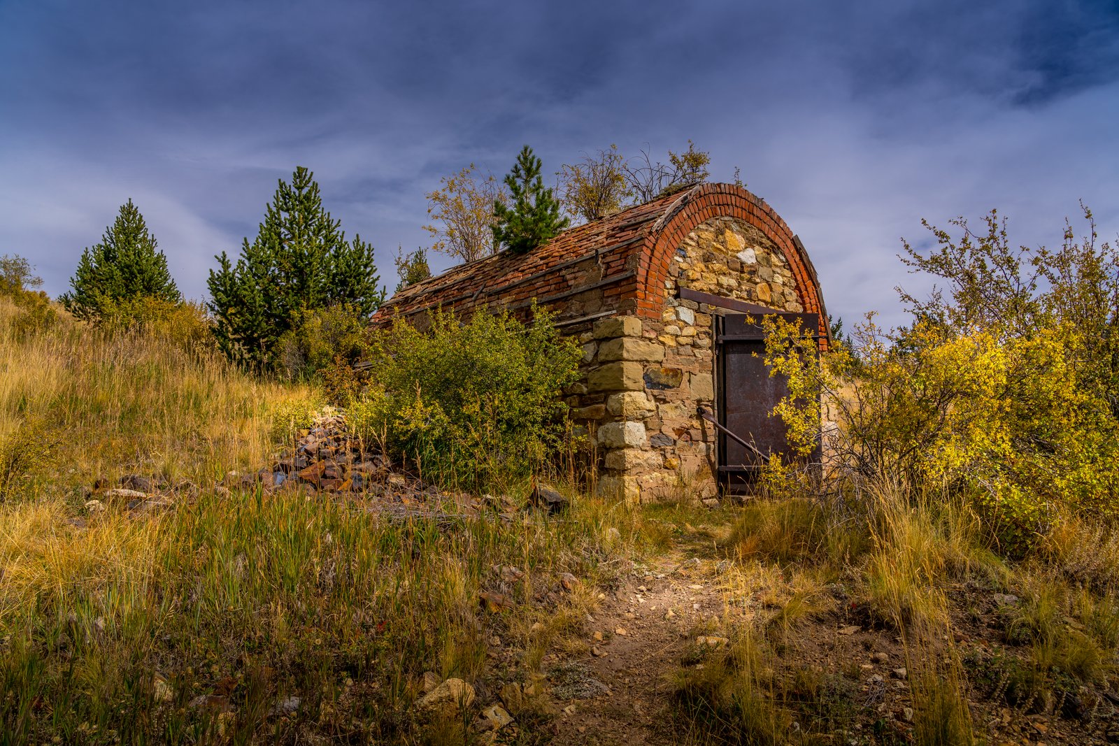
Cripple Creek CO
Based on the stone and brick barrel-arched structure with its heavy rusted iron door set into a hillside, this is a historic powder magazine, a small fireproof vault used to store dynamite and blasting caps safely away from the mine workings. It sits in the Cripple Creek Mining District of Teller County, Colorado, high in the hills near Cripple Creek and Victor, photographed among autumn grasses and pines along an old mining trail. Key Features: The Structure: Larger mines in the district used magazines built of brick in which to store explosives, with a heavy metal door locked to prevent theft. The Purpose: Mines typically kept separate magazines, one for dynamite and another for the primers used in detonation, isolating the volatile materials from the working shafts. The District: Gold was discovered in Victor in the late 19th century, and with Cripple Creek the mining district became the second largest gold mining district in the country. The Setting: Weathered stone walls, a curved tile and brick roof, and surrounding scrub oak and pine mark this as one of the district's many abandoned mine relics left in the Colorado high country.
Prints from $14Downloads from $19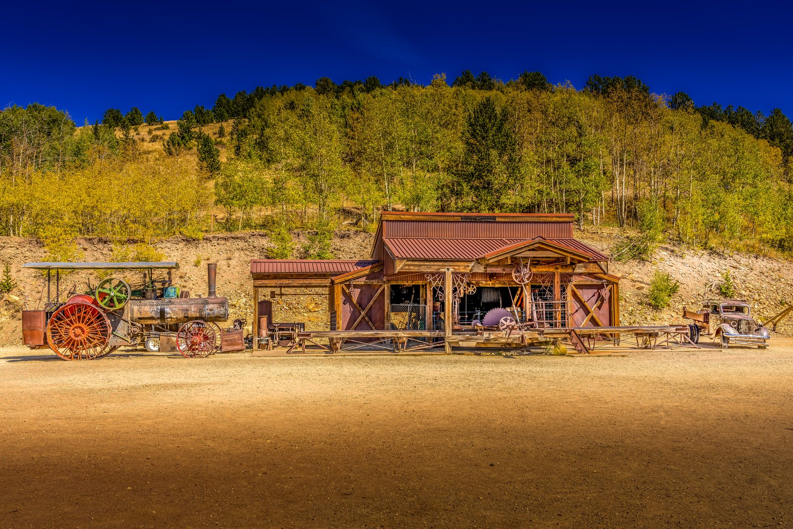
Cripple Creek Colorado
The photograph was taken at Victor's Gold Camp AG and Mining Museum in the historic Cripple Creek and Victor mining district of Colorado. The frame shows an old wooden garage building with a rust colored corrugated roof, flanked by a vintage steam powered farm tractor with large red wheels on one side and an antique automobile on the other, all set against a hillside of golden aspen trees turning color in the fall beneath a deep blue mountain sky. Key Features: The Museum Setting: This rugged three-story museum does more than showcase tractors, vehicles and old pulleys and equipment, this museum is also a working garage. The Machinery: Visitors can watch a complex system of pulleys and belts that power extremely large machines and equipment that would have been found in a large garage like this. The Blacksmith Shop: An old blacksmith forge is complete with a hammer and anvil and still used at this garage today. The Region: The site sits within the Cripple Creek and Victor gold mining district, a high alpine mining region in Teller County, Colorado renowned for its 1890s gold rush history.
Prints from $14Downloads from $19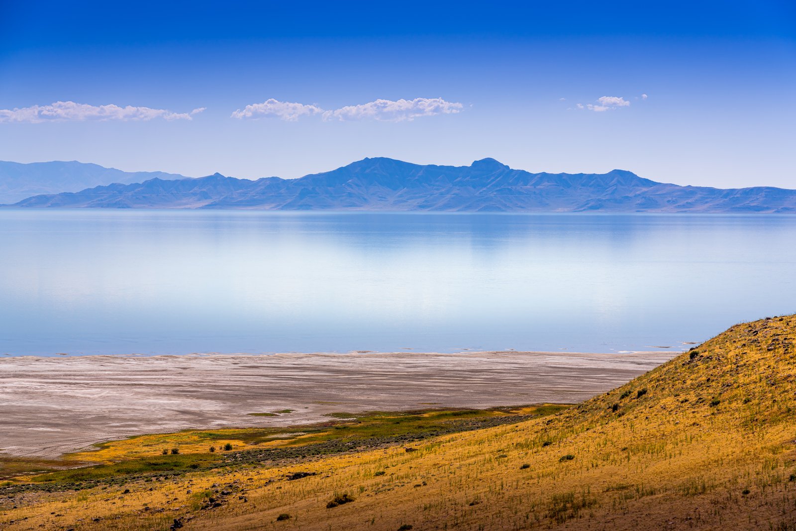
Farmington Bay Utah
Farmington Bay stretches across the eastern arm of Utah's Great Salt Lake, and this image looks out from the golden grass and sage covered slopes of Antelope Island toward the calm, mirror still waters of the bay. In the distance the jagged peaks of the Wasatch Range rise above a thin haze, their reflection doubling the mountain line in the pale blue water below. Key Features: The Vantage Point: The photograph is taken from the elevated terrain of Antelope Island, the largest island in the Great Salt Lake, looking east across Farmington Bay. The Water: The Wasatch Mountains rise up on the far side of the water at Farmington Bay, beyond the continuous suburbia of Clearfield, Layton, Farmington and Bountiful, giving the lake its mirrored mountain backdrop. The Island Terrain: Antelope Island runs north and south for about fifteen miles, shielding Farmington Bay, with elevations ranging from 4,200 to 6,600 feet. The Ecosystem: A great hike on the island provides an elevated look across the park, the lake, and the surrounding mountains, making it a favored spot for capturing this kind of layered desert and water landscape.
Prints from $14Downloads from $19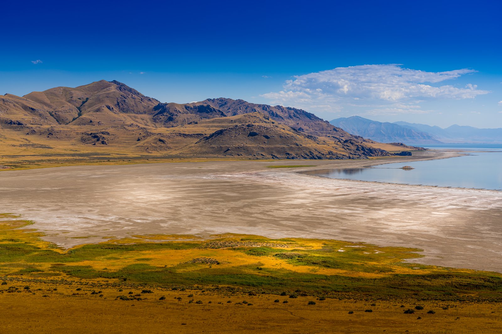
Farmington Bay Utah
Based on the confirmed research, here's the story: This photograph looks across Farmington Bay on Utah's Great Salt Lake, likely captured from an elevated ridge on Antelope Island State Park. The wide tan expanse in the middle of the frame is exposed lakebed left behind as the bay's shoreline has retreated, with grassy wetland flats in the foreground and the rugged, arid slopes of the island's mountains rising to the north and west. Key Features: The Setting: The Wasatch Mountains rise up on the far side of the water, Farmington Bay, beyond the continuous suburbia of Clearfield, Layton, Farmington and Bountiful. The Island: Antelope Island is the largest island on Great Salt Lake, part of the Basin and Range province stretching from the Wasatch Mountains to the Sierra Nevada. The Vantage Point: A great hike to take in the views is Buffalo Point Trail, providing an elevated look across the park, lake and surrounding mountains. The Shrinking Lake: Declining water levels have left an exposed lakebed, contributing to poor air quality as storms whip up toxic, heavy metal laden dust across the region.
Prints from $14Downloads from $19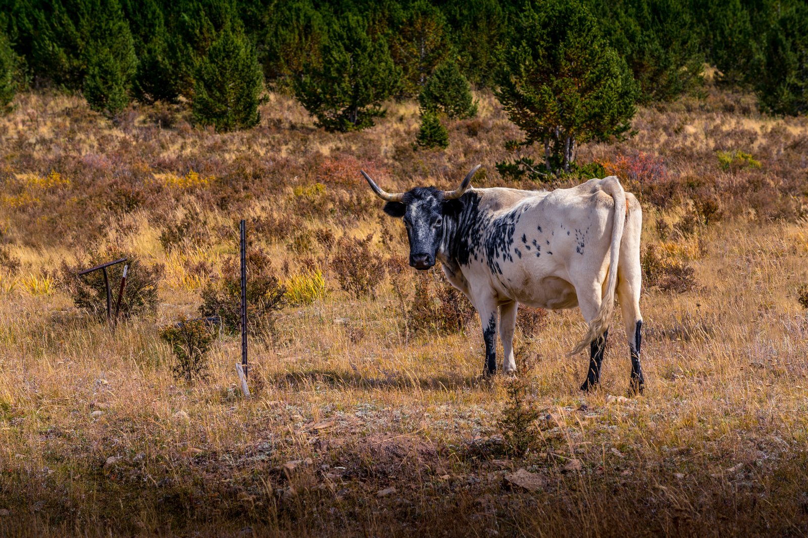
Cripple Creek CO
The photo was taken in the high country around Cripple Creek, a former gold rush town in the mountains west of Colorado Springs, sitting at an elevation of roughly 9,375 feet. The image looks across a hillside pasture of autumn grasses and scrub toward a stand of young lodgepole pines, with a black and white spotted longhorn type cow standing near an old fence post, gazing directly at the camera. Key Features: The Setting: Cripple Creek's high valley elevation, gold history, and small mountain population have all played roles in shaping the city's story. The Land Before Gold: Cripple Creek was at that time a cattle range, long before the gold discovery that made the town famous. Ranching Roots: The Cripple Creek area was cattle and ranching land for several years before mining took over the region. The Scene: A lone spotted bovine still grazes these same open slopes today, a quiet echo of the ranching life that predated the district's mining boom.
Prints from $14Downloads from $19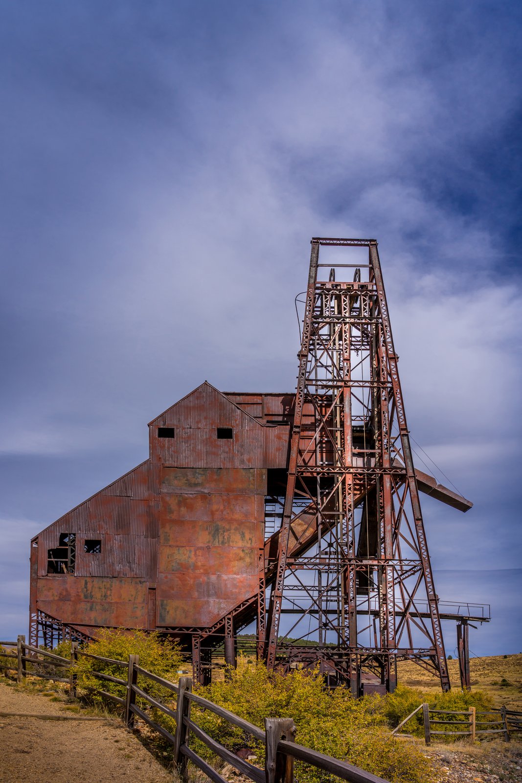
Cripple Creek CO
The photograph shows the Ajax Mine, a historic gold mine on the lower slopes of Squaw Mountain just northwest of Victor, Colorado, within the Cripple Creek Mining District. The image is taken from ground level along a fenced trail, framing the mine's weathered steel headframe and corrugated hoist house against a wide Colorado sky, with autumn brush and open rangeland surrounding the site. Key Features: The Mine's History: The Ajax mine was one of the more productive mines in the Cripple Creek Victor District and one of the last significant underground operations. Rehabilitation Era: West of the Strong Mine, the Ajax Mine, built in 1895, has a restabilized headframe and a new hoist, part of a 1970s rehabilitation program for one of the last gold mines, which did not close until the 1980s. The Setting: The headframe and ore house stand on Squaw Mountain above Victor, part of the larger Cripple Creek Mining District, once one of the richest gold camps in the American West. The Structure: The tall steel headframe lowered miners into the shaft and hoisted ore up an angled chute into the rusted corrugated metal ore bin still standing beside it.
Prints from $14Downloads from $19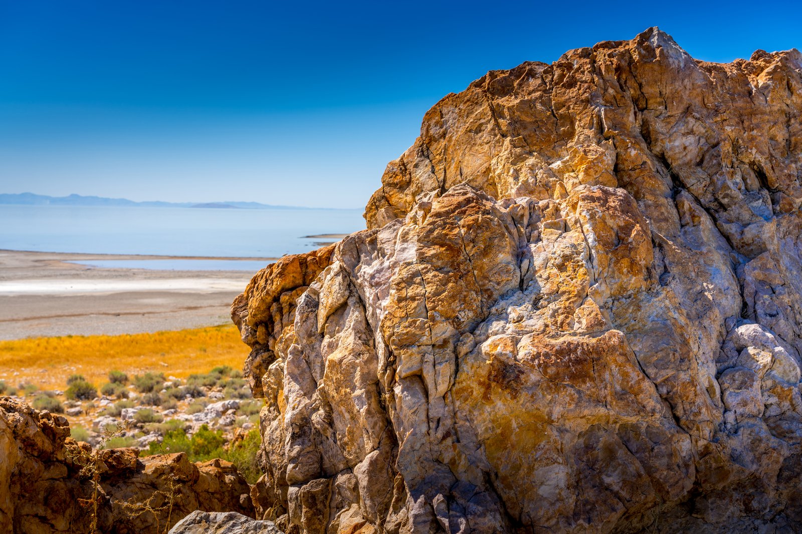
Farmington UT
Perched on the rugged shoreline of Antelope Island, this photograph looks northeast across the shimmering waters of the Great Salt Lake toward Farmington Bay, with distant mountain ridgelines fading into haze on the horizon. In the foreground, a weathered outcrop of ancient banded rock frames a landscape of salt flats, golden grasses, and hardy desert shrubs that define this island preserve in Davis County, Utah. Key Features: The Rock Formation: This outcrop is part of the Farmington Canyon Complex, extremely banded and contorted metamorphic rock among the oldest exposed rock in Utah, shaped by ancient compressional forces. The Setting: Antelope Island is the largest island in the Great Salt Lake, reached via a narrow road spanning seven miles from mainland to island. The View: Pullouts near this shoreline overlook Farmington Bay, where visitors can see the Wasatch Mountains rising in the distance across the water. Wildlife and Recreation: The park supports bison herds and offers birdwatching, hiking, and photography along its rocky, arid terrain.
Prints from $14Downloads from $19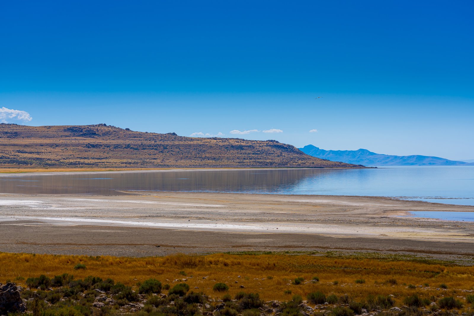
Farmington Bay Utah
Farmington Bay lies on the southeastern arm of the Great Salt Lake, where the low ridgeline of Antelope Island rises across the water. The photograph looks out from the marshy mainland shore, past bands of exposed salt flats and sunbaked mudflat left by receding water, toward the island's rugged silhouette on the horizon. Key Features: The Bay: Farmington Bay is the part of the Lake in between Antelope Island and the southeast corner of the Lake, where the Jordan River deposits water from Utah Lake. Wildlife Value: Thanks to the fresh water from the Jordan, Farmington Bay is one of only two places in the Lake where fish can be found, making it an important stopover point for migratory waterfowl. The Island: Antelope Island, with an area of 42 square miles, is the largest of ten islands located within the Great Salt Lake in Utah, lying in the southeastern portion of the lake near Salt Lake City and Davis County. Shifting Shoreline: The pale crust visible along the water's edge marks mineral deposits left behind as the shallow, saline lake level fluctuates with the seasons.
Prints from $14Downloads from $19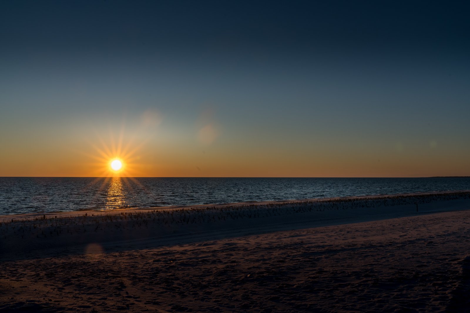
Mississippi Gulf Coast
This sunset was captured along the Mississippi Gulf Coast, looking south across the calm waters of the Mississippi Sound as the sun drops toward the horizon. The vantage point is low on the wide, gently sloping beach that runs along the shoreline near Highway 90, with a line of scattered marsh grass and driftwood marking the tideline and a faint sandbar or spit visible far to the right. Key Features: The Beach: stretching along the Mississippi Gulf Coast is this beautiful sand beach, 26 miles long and 300 feet wide, making it one of the largest man-made beaches in the world. The Roadway: U.S. Highway 90, known as the Old Spanish Trail, runs directly alongside this stretch of coastline, giving travelers a continuous ocean view. The Waters: The gentle waves belong to the Mississippi Sound, a shallow, protected body of water shielded from the open Gulf by a chain of barrier islands. The Setting: The soft color gradient and low sun angle suggest either early morning or evening light, a time when the wide, uncrowded beach takes on a quiet, expansive character.
Prints from $14Downloads from $19