

Collection
USA
By · 138 photos
Long Horn Zion National Park Utah
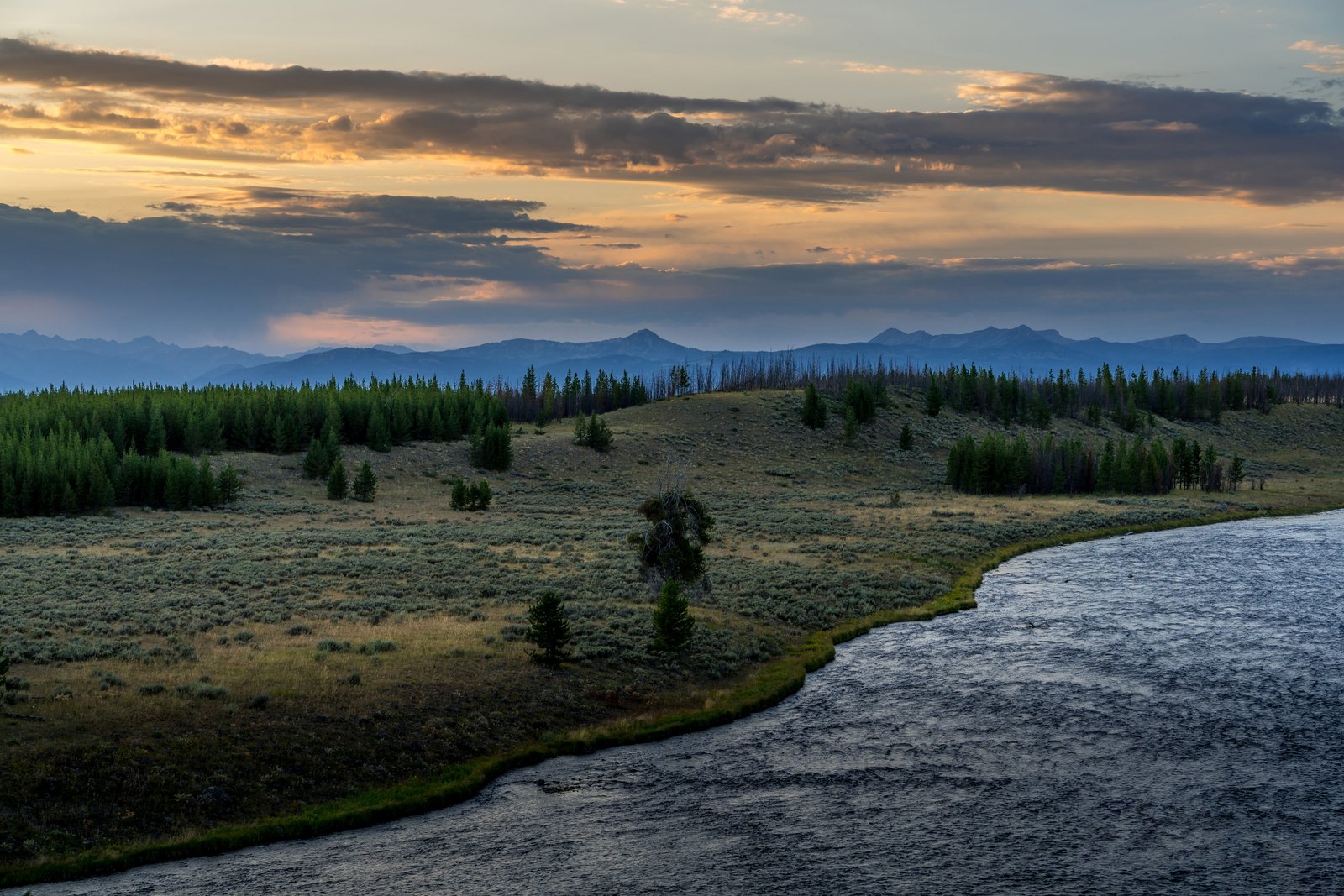
This photograph looks toward Hayden Valley in Yellowstone National Park, taken from a roadside overlook above a wide bend of the Yellowstone River at dusk. Rolling sagebrush meadows and stands of lodgepole pine, some scarred by past wildfires, stretch toward the hazy blue ridgelines of the park's interior mountains beneath a glowing, cloud streaked sky. Key Features: The Valley Floor: The valley floor along the river is an ancient lake bed from a time when Yellowstone Lake was much larger. Wildlife Habitat: The valley, nine miles long and six miles wide, is the year-round home for nearly a thousand bison. Naming and Origin: The valley takes its name from Ferdinand V. Hayden, leader of the 1871 survey expedition that helped establish the park. Scenic Overlooks: Turnouts along the park road above the winding river offer sweeping views of the meadows and distant peaks, especially prized at sunrise and sunset.
Prints from $14Downloads from $19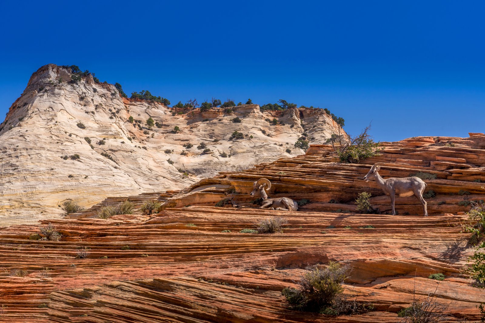
Long Horn Zion National Park Utah
The photograph was taken along the Zion Mount Carmel Highway in the eastern section of Zion National Park, Utah, where the road winds through slickrock terrain near Checkerboard Mesa. The frame shows a pair of desert bighorn sheep resting and standing on layered red Navajo sandstone ledges, with a pale, cross bedded sandstone dome rising against a deep blue sky in the background. Key Features: The Rock Formation: the checkerboard design has been created by weathering and erosion in the upper portion of the Navajo Formation The Terrain: This stretch of slickrock lies near Checkerboard Mesa, which towers above the Zion Mount Carmel Highway on the park's east side. The Wildlife: Desert bighorn sheep frequent this eastern plateau, drawn to seasonal water pockets in the surrounding canyons and using the rugged ledges as natural lookout points. The Setting: The contrast between the white Navajo sandstone dome and the striated red rock in the foreground reflects the varied mineral staining found throughout this part of the park.
Prints from $14Downloads from $19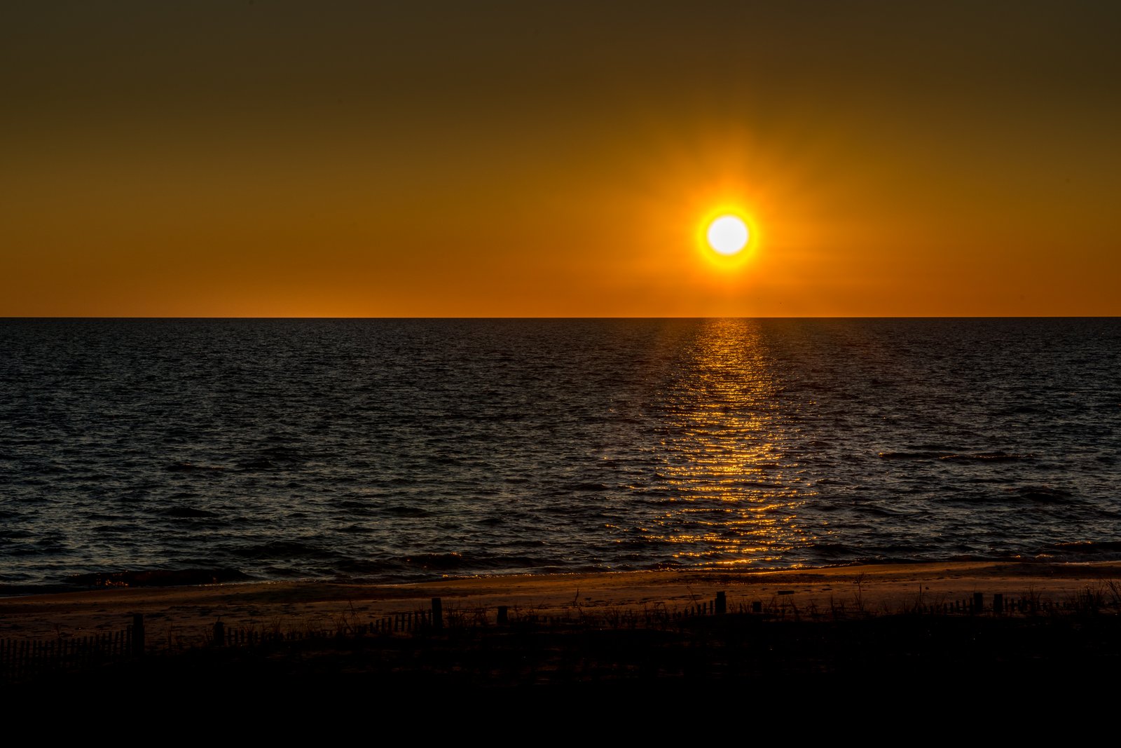
Gulf Coast Mississippi
The photograph looks south across the Mississippi Sound from one of the sand beaches lining Mississippi's Gulf Coast, likely near Biloxi, Gulfport, or another town along Highway 90. The vantage point is at the edge of the dunes, with wooden sand fencing and beach grass in silhouette in the foreground, sandy shoreline below, and the sun setting low over calm water, its reflection forming a bright path across the surface. Key Features: The Beach: This stretch of coastline forms part of what is often called the world's largest man-made beach, stretching across 26 miles of Coastal Mississippi. The Water: The gentle water shown here is typical of barrier islands that sit several miles offshore, acting as a natural buffer between the open Gulf of Mexico and the mainland shoreline, keeping wave action calm along the coast. The Dune Fencing: Wooden slat fences and native grasses seen in the foreground are used along the coast to trap sand and stabilize the dunes against erosion. The Light: The sun's reflection stretching across the water toward the shore is characteristic of low sun angles at dawn or dusk along this east-west running coastline.
Prints from $14Downloads from $19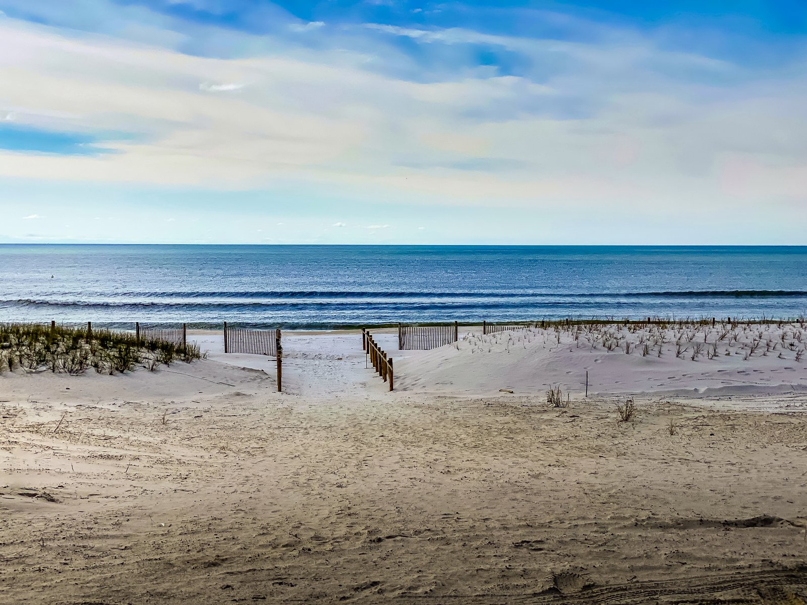
Florida Panhandle
Mexico Beach, Florida
The photograph looks toward the Gulf of Mexico from a public beach access point in Mexico Beach, on Florida's Panhandle. A wooden sand fence lines a walkway cut through low dunes planted with sea oats and beach grasses, leading the eye past a narrow strip of white sand to gentle breaking waves and open water beyond. Key Features: The Coastline: Mexico Beach sits along the Gulf of Mexico in Bay County, known for its quiet, undeveloped shoreline compared to larger panhandle resort towns. Dune Restoration: Volunteers and city leaders have worked to rejuvenate the dune system to keep beaches available while protecting the town from future storms, using slatted fencing to trap sand and encourage sea oat growth. Storm Recovery: The small resort community bore the brunt of Hurricane Michael, a Category 5 storm that made landfall in October 2018, and its dunes have since been rebuilt as part of the town's ongoing recovery.
Prints from $14Downloads from $19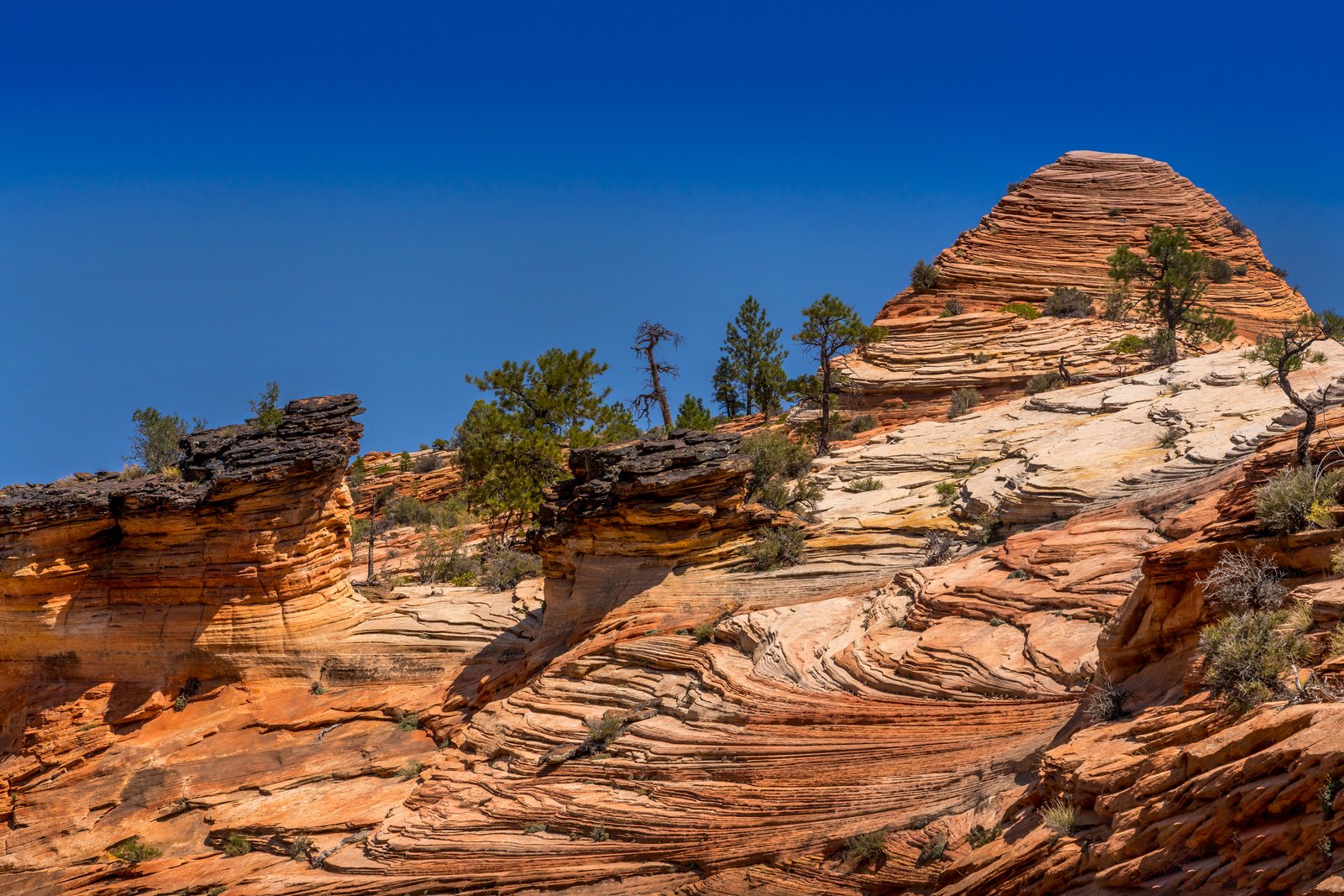
Zion National Park Utah
The photograph was taken along the east side of Zion National Park in southern Utah, likely near the slickrock terraces along the Zion Mount Carmel Highway. The image looks up a sweeping slope of pale orange Navajo Sandstone, its surface etched with fine cross bedded lines, rising toward a rounded dome capped by wind sculpted layers. Scattered pinyon pines and junipers cling to cracks in the rock beneath a deep cloudless sky. Key Features: The Rock Layers: The wavy striped patterns are cross bedding, fossilized traces of ancient sand dunes preserved in the Navajo Sandstone formation. The Formation's Scale: This sandstone is one of the most prominent formations exposed in Zion Canyon, with some of its highest exposures forming towering cliffs and monoliths. The Desert Origin: The rock records a time when shifting winds and desert sand dunes covered a vast area during deposition, later cemented into stone. The Setting: Hardy pines and shrubs root directly in the slickrock, typical of the high desert plateau country surrounding Zion.
Prints from $14Downloads from $19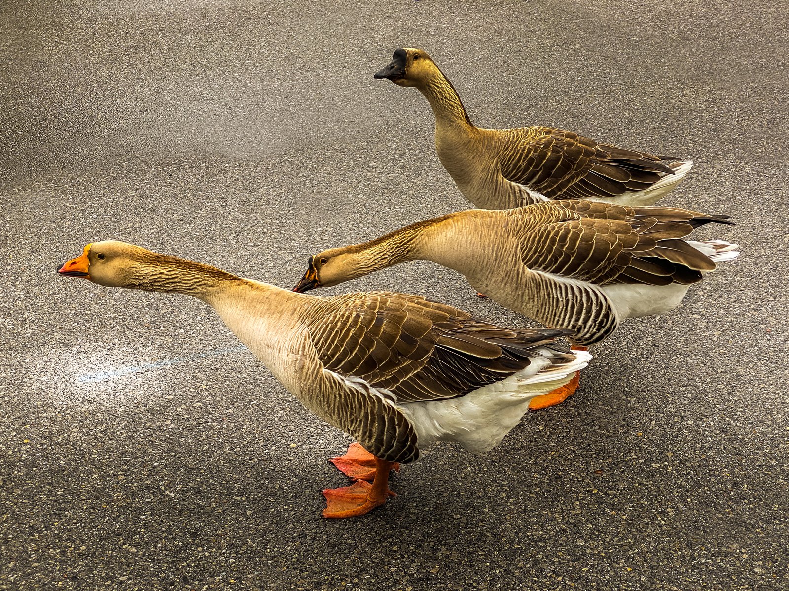
Gulf Coast Ducks
Panama City, Florida
The photo was taken along the Gulf Coast in Panama City, Florida, where a small trio of domestic geese ambles across a quiet paved lane, likely near one of the area's coastal parks or waterside neighborhoods where these birds are known to roam freely. The image is framed low and close, putting the viewer at goose level as the lead bird's bright orange bill and feet stand out against the muted gray asphalt. Key Features: The Birds: These are farmyard type geese, larger and heavier bodied than wild Canada geese, with the buff brown plumage and orange bill and legs typical of domestic breeds kept around ponds and parks in Florida. The Setting: Panama City sits on the Gulf of Mexico in the Florida Panhandle, an area known for its beaches, bayous and waterside parks that attract resident waterfowl. The Composition: Shooting from ground level along their line of travel gives the three geese a sense of single file motion, turning an everyday roadside crossing into a striking study of texture and color.
Prints from $14Downloads from $19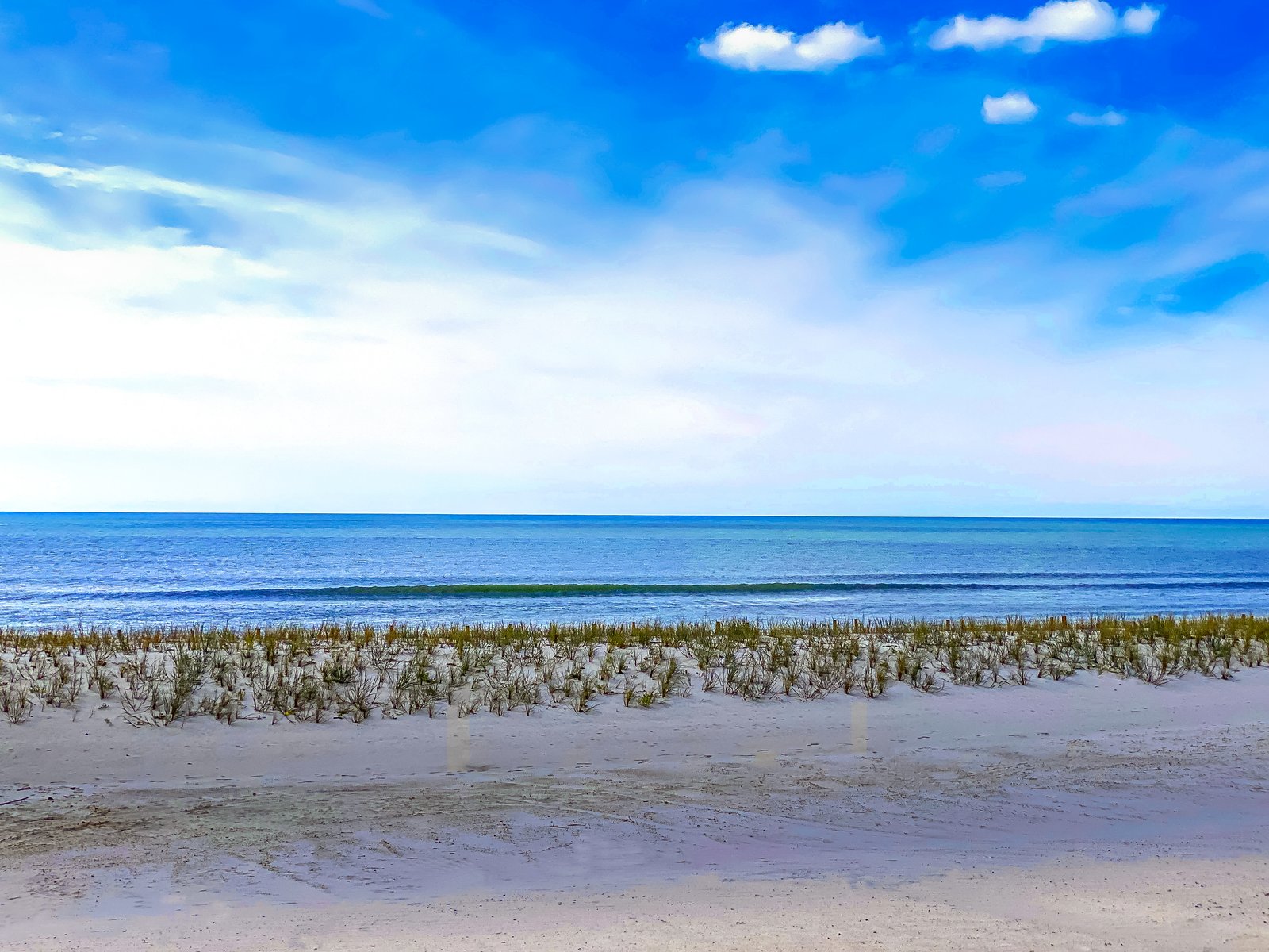
Gulf Coast Mississippi
Mexico Beach, Florida
The photograph looks along an undeveloped stretch of shoreline on the Florida Panhandle near Mexico Beach, on the Gulf of Mexico. The view is taken from the open beach looking seaward across a low foredune planted with sea oats and beach grasses that stabilize the sand, with a gentle wave line breaking just offshore under a wide, partly clouded sky. Key Features: The Setting: Mexico Beach sits on the northwest Florida coast in Bay County, a small Gulf-front community known for white sand beaches and clear water. The Town's Character: Located on the east end of Bay County, Mexico Beach captures the essence of the Panhandle with white sandy beaches, clear emerald waters and a small-town vibe. The History: The city was officially founded and incorporated in 1967, and took the name Mexico Beach, becoming known for its excellent sport fishing grounds. Resilience: Hurricane Michael struck the Florida panhandle in 2018, and the small town of Mexico Beach bore the brunt of the devastation, still recovering years later. Native dune grasses like those pictured remain vital to rebuilding the shoreline's natural defenses.
Prints from $14Downloads from $19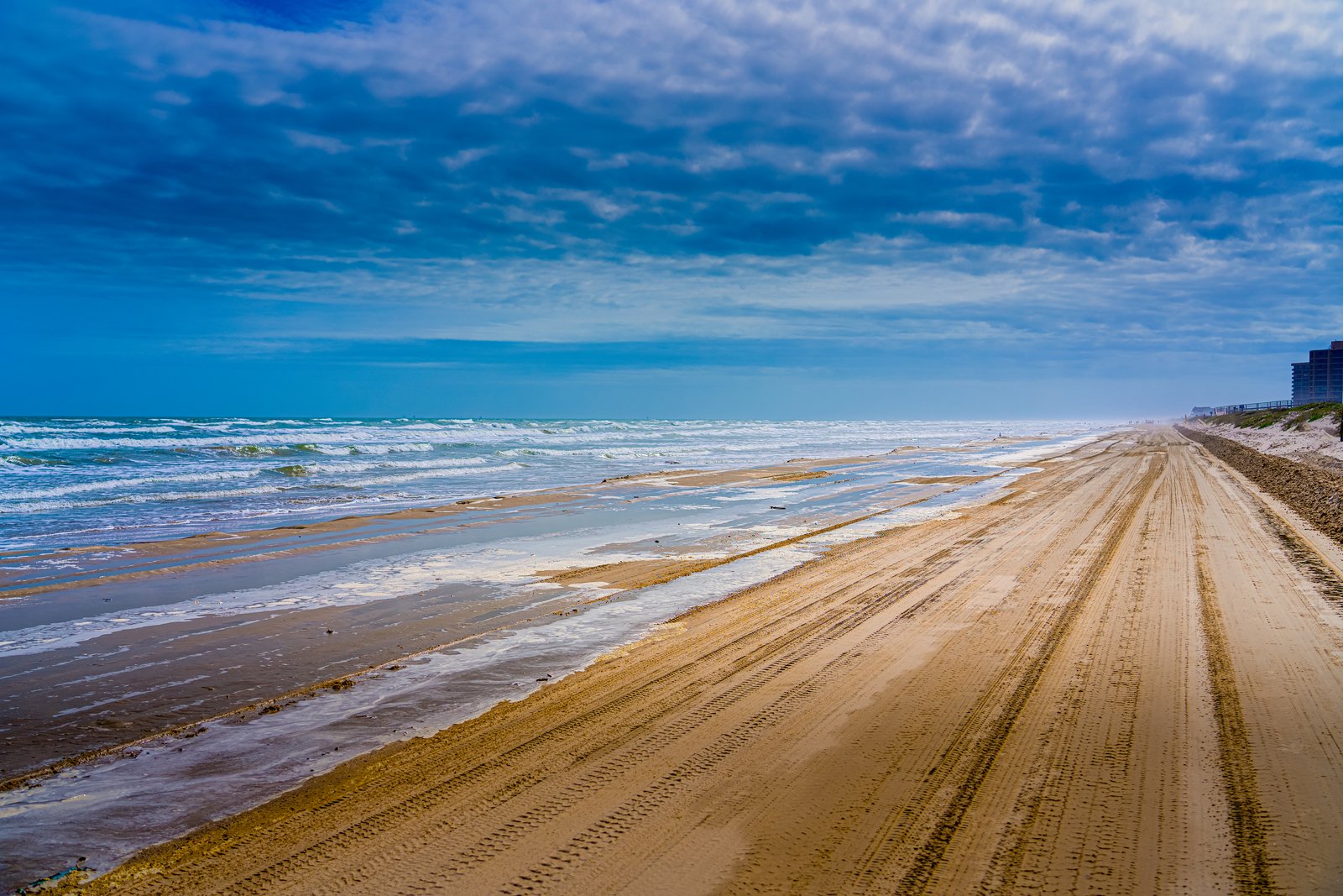
1182 Corpus Christi TX
Long stretches of the Texas Gulf Coast near Corpus Christi are known for allowing vehicles directly onto the sand, and this image looks north or south along one of those drivable beaches, likely near North Padre Island or Mustang Island. The vantage point is low and close to the shoreline, showing rolling surf and foam on the left, a wide packed sand track scored with tire ruts running toward the horizon, and a line of low dunes and beachfront condominium buildings fading into haze on the right. Key Features: Driveable Shoreline: Corpus Christi's Gulf beaches are among the few in the country where cars can drive right onto the sand, a practice residents and visitors rely on for beach access. The Coastal Setting: The image sits along the barrier islands fronting Corpus Christi Bay, part of a chain that includes Mustang Island and Padre Island. Developed Beachfront: The distant high rise buildings mark the more developed resort stretch of the coast, contrasting with the undeveloped dunes and open sand in the foreground. Weather and Light: Heavy cloud cover with breaks of blue sky and visible sea spray suggest a breezy, changeable Gulf Coast day typical of the region's coastal climate.
Prints from $14Downloads from $19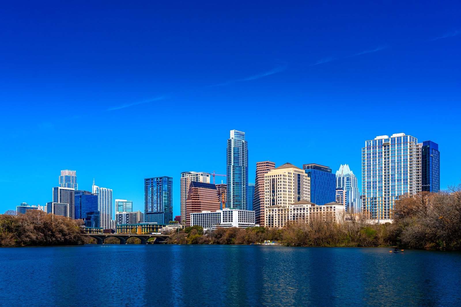
1179 Austin Texas
Downtown Austin, Texas, rises along the north bank of Lady Bird Lake, the dammed stretch of the Colorado River that curves through the heart of the city. The photograph is taken from the water's edge on the south shore, likely near Auditorium Shores or the Butler Hike and Bike Trail, looking north across the lake toward the skyline with a low pedestrian bridge crossing the water in the foreground and bare winter trees lining the bank. Key Features: The Skyline Mix: The frame includes several of Austin's tallest towers, among them the Frost Bank Tower, the Austonian, and the Four Seasons. Lady Bird Lake: The lake is actually the Colorado River, dammed in 1960 for flood control and power generation. Rapid Growth: A flurry of hotels and residential towers filled in the downtown skyline, including the Four Seasons Residences and the Austonian, once the city's tallest building for many years. The Vantage Point: Popular waterfront viewpoints along this stretch include Butler Metro Park and the Lou Neff Point area near Zilker Park, offering classic photo views of the downtown skyline over the river.
Prints from $14Downloads from $19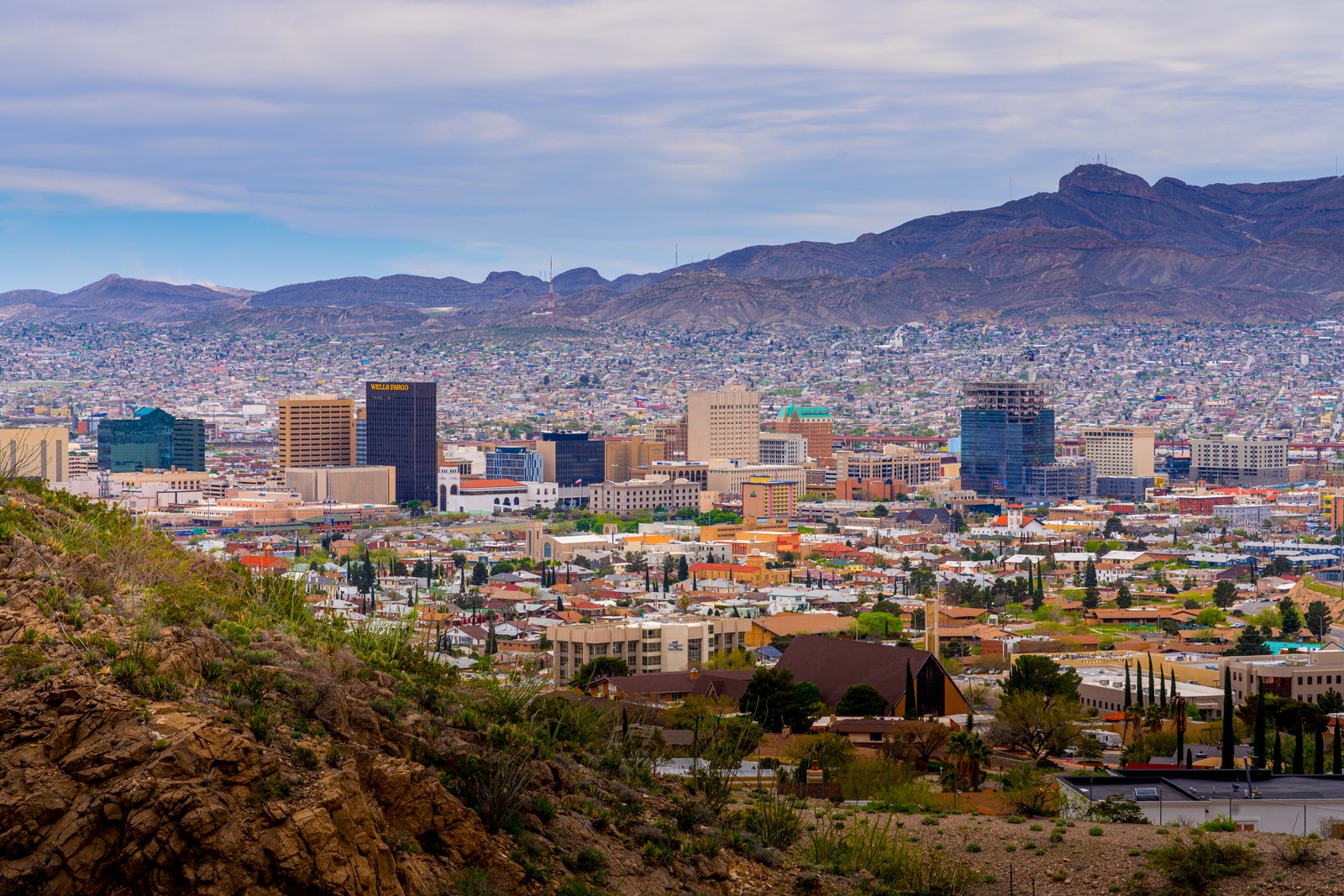
Glance into Mexica from El Paso, Texas
The photograph looks south over downtown El Paso, Texas, taken from a rocky overlook along Scenic Drive in the foothills of the Franklin Mountains. In the foreground, desert scrub and boulders give way to a dense grid of rooftops, church spires, and mid rise towers including the Wells Fargo building, while the rugged Franklin Mountains rise behind the city and the sprawling neighborhoods of Ciudad Juarez, Mexico, stretch across the haze in the distance. Key Features: The Vantage Point: This view is captured from the winding overlooks of Scenic Drive, a two-lane roadway that climbs to a point 500 feet above the city and the Rio Grande. The Sister Cities: The overlooks along this route are popular because they offer breathtaking views of the El Paso skyline, Juarez, and nearby areas. The Landscape: Just north of downtown, the Franklin Mountains begin to rise, and along both Rim Road and Scenic Drive there are many overlooks of the city and Ciudad Juarez. The Border City: El Paso sits directly across the Rio Grande from Juarez, making this one of the largest binational metropolitan areas in the Western Hemisphere, visible in a single sweeping frame from the hillside.
Prints from $14Downloads from $19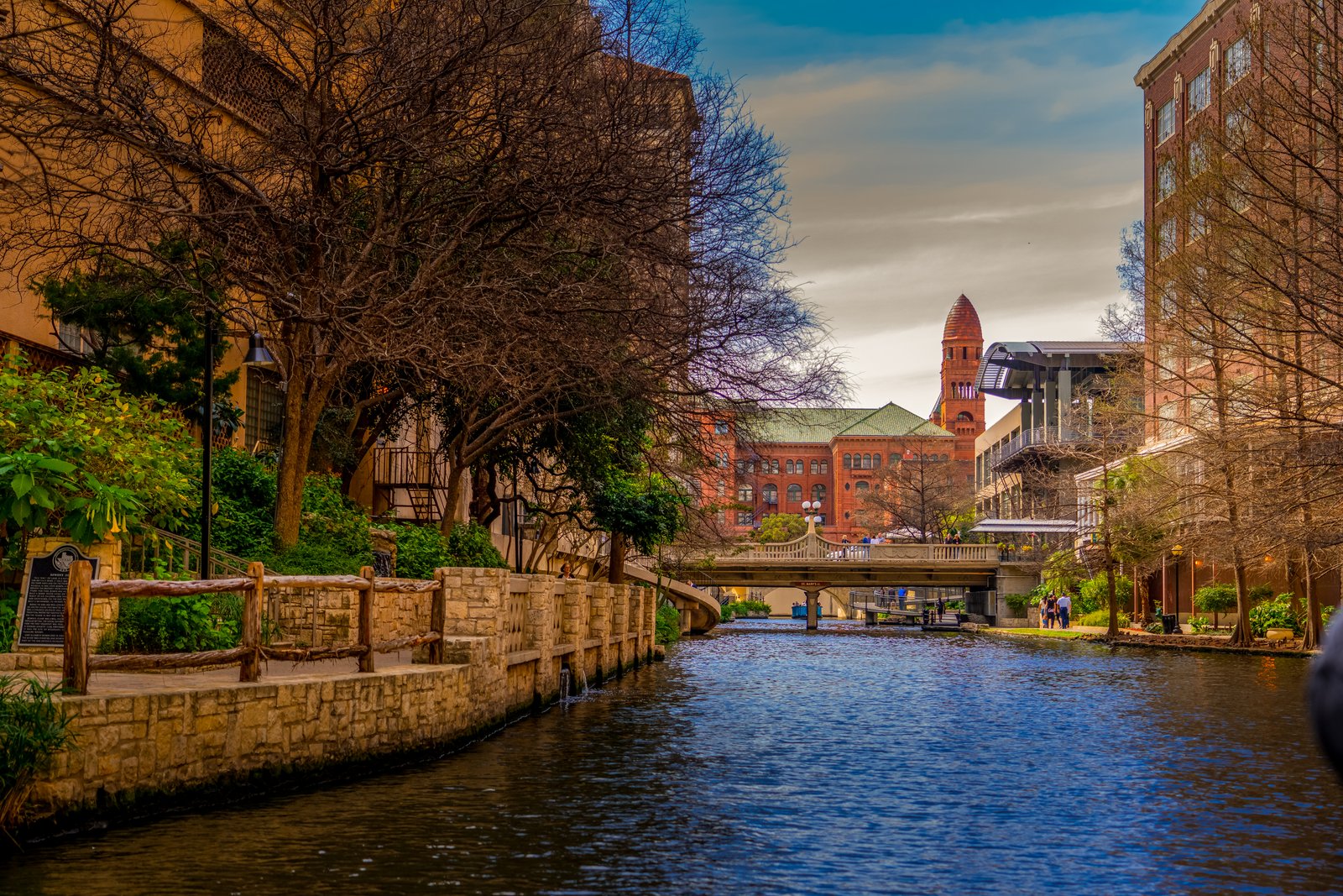
San Antonio, Texas
The photo captures a quiet stretch of the San Antonio River Walk in downtown San Antonio, Texas, framed by stone retaining walls, bald cypress trees, and a curved pedestrian bridge crossing the water. In the distance, the red sandstone tower and green tile roof of the Bexar County Courthouse rise above the surrounding buildings, marking the historic heart of the city just beyond the riverside path. Key Features: The River Walk: A network of landscaped walkways lining the San Antonio River one level below the downtown streets, lined with cypress trees, stone footbridges, and cafes. The Courthouse Tower: Constructed of red sandstone, with one of its towers capped by a pyramid-shaped, green tile roof, the largest and oldest continuously operated courthouse in Texas consumes an entire city block. Architectural Style: Designed in the distinctive Romanesque Revival style by renowned architect James Riely Gordon, its cornerstone was laid in 1892 and the grand courthouse was completed in 1897. The Setting: The courthouse sits on Main Plaza near the river's downtown bend, giving passing walkers and boat tours a glimpse of its tower above the tree canopy.
Prints from $14Downloads from $19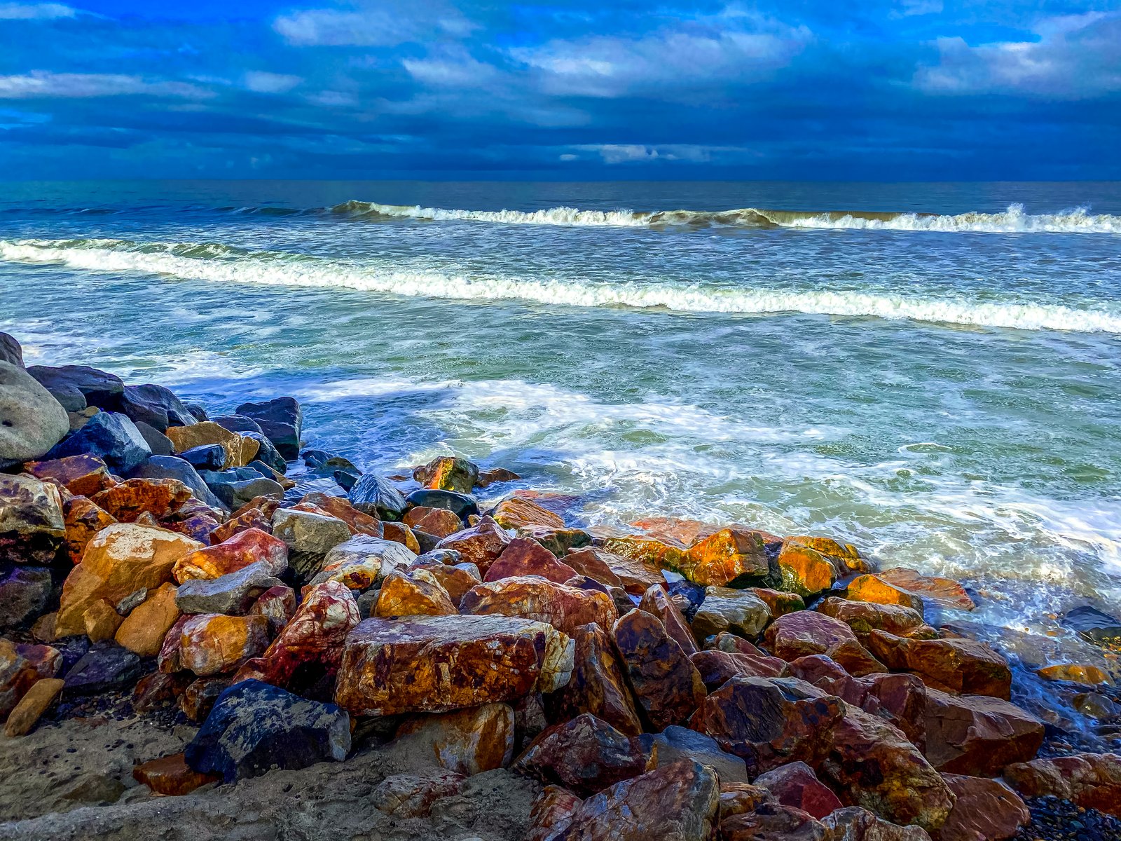
Carlsbad, California
Oceanside, California
The photo shows a stretch of Pacific coastline at Carlsbad, California, near the city's border with Oceanside, where a low sun catches a jumble of red and gold riprap boulders along the shore. Taken from ground level right at the water's edge, the image looks out across foamy incoming surf toward a line of breaking waves under a heavy, blue-toned sky. Key Features: The Rock Revetment: Large boulder riprap has been placed along this shoreline to slow erosion, since the beaches here belong to the Oceanside littoral cell, a sand system stretching from Dana Point to La Jolla that is artificially divided by a jetty at Oceanside harbor. Vanishing Sand: Stretches of Carlsbad beach have lost their sand cover during storm swells, exposing the underlying riprap and leaving only a narrow strip of beach for visitors. The Town's Origin: Carlsbad began as a cattle station along the old Spanish Camino Real settled by Anglo ranchers in the late 1860s, first called Frazier's Station. A Resort Reborn: It was later renamed in 1883 after its mineral waters were found to resemble those of the European spa town of the same name.
Prints from $14Downloads from $19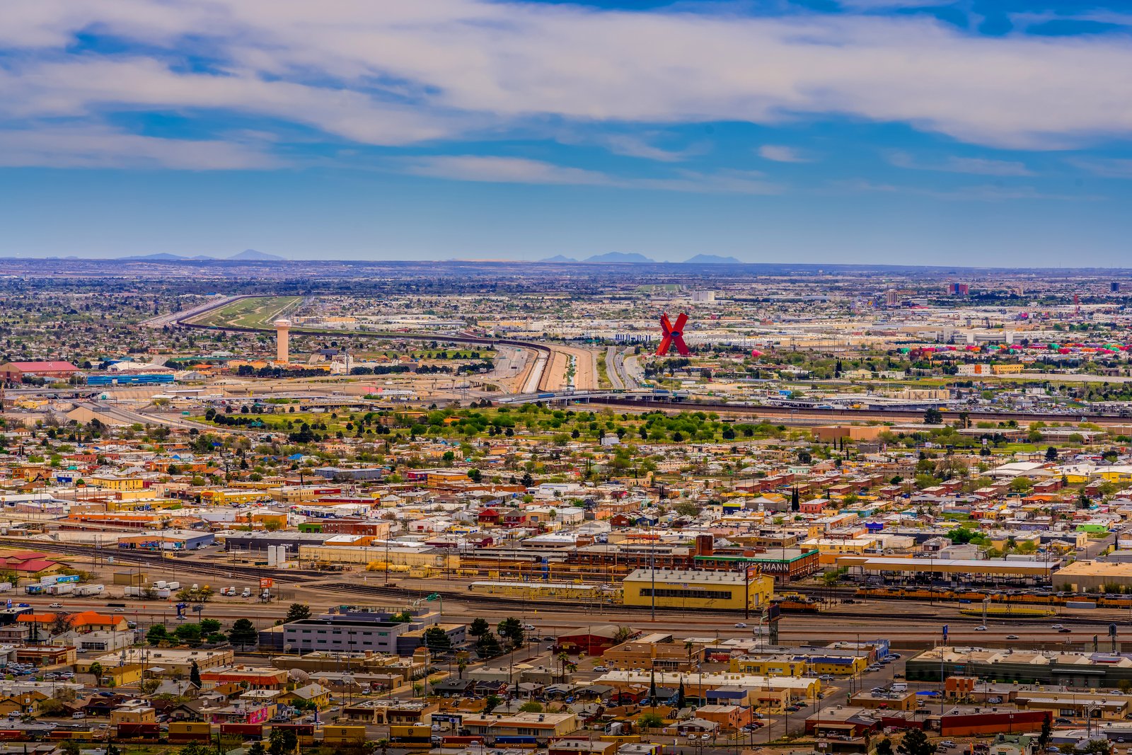
Looking Across into Mexica from El Paso TX
This aerial view looks south from a high vantage point in El Paso, Texas, across the Rio Grande and the international border fence into Ciudad Juarez, Mexico. Dominating the middle distance is the towering red "X," a landmark sculpture rising above the dense grid of colorful rooftops, rail yards, and the highway corridor that traces the borderline itself. Key Features: The Monument: The Monumento a la Mexicanidad, also referred to as La X or La Equis, is a 64-meter tall monument built in the shape of a red letter X. The Designer: Designed by Mexican sculptor Enrique Carbajal Gonzalez, also known as Sebastian, the two towers intersecting in an X shape represent the merging of two cultures. The Location: Situated along the border between Ciudad Juarez and El Paso, the sculpture stands as a symbol of a more hopeful cause, located on the south bank of the Rio Grande. The Skyline: The sprawling twin cities stretch to the desert mountains on the horizon, with rail lines, warehouses, and packed residential blocks filling the valley floor on both sides of the border.
Prints from $14Downloads from $19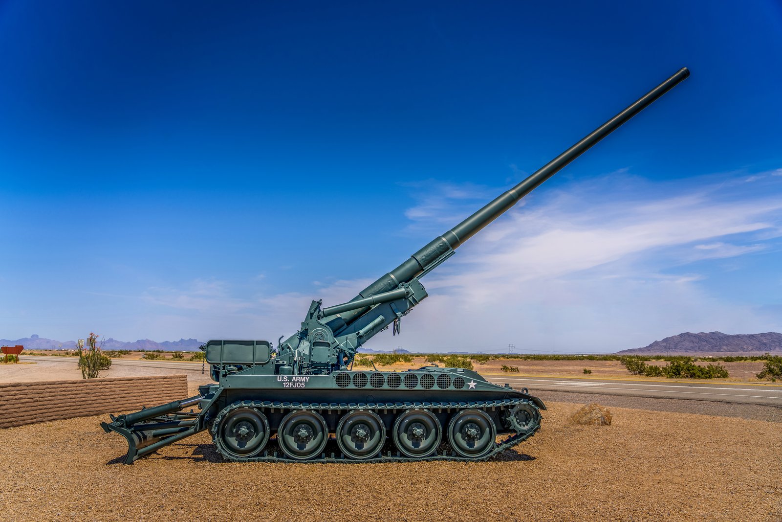
US ARMY Yuma AZ
The photograph was taken along a desert roadside near Yuma, Arizona, at the entrance to the U.S. Army Yuma Proving Ground, one of the Army's largest military testing installations. The image shows a retired M110 self-propelled howitzer mounted as a static display, its long 8-inch barrel raised skyward against a deep blue sky, with distant desert mountain ranges and a paved highway stretching across the flat Sonoran Desert floor. Key Features: The Weapon: The vehicle is an M110 8-inch (203mm) self-propelled howitzer, a tracked artillery piece the U.S. Army fielded from the 1960s through the Cold War era for long-range fire support. The Setting: Yuma Proving Ground has served the Army since the 1940s as a vast desert range for testing weapons, vehicles and equipment in extreme heat and open terrain. The Display: Retired artillery pieces like this one are commonly placed as roadside monuments near military installations, honoring the units that once operated them. The Landscape: The surrounding flat, arid desert and rugged mountain backdrop are characteristic of the lower Colorado River desert region of southwestern Arizona.
Prints from $14Downloads from $19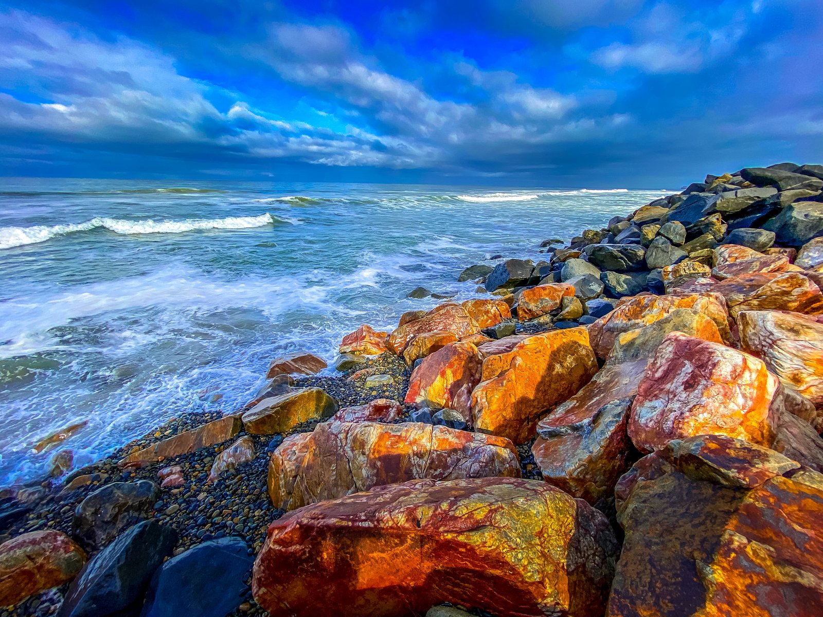
Carlsbad California
Oceanside, California
The photograph looks north along a rugged rock jetty at the mouth of Buena Vista Lagoon, the boundary line where Carlsbad meets Oceanside on the San Diego County coast. Sunset light rakes across the boulders, turning their surfaces deep rust and gold while cool blue surf breaks against a pebble shoreline beyond. Key Features: The Border Jetty: The 350-acre freshwater lagoon is on the border between Carlsbad and Oceanside. The Lagoon Outlet: Fishing is permitted only at the rock jetties at the mouth of the lagoon, the same rugged stones seen catching the evening light in this frame. A Rare Habitat: Buena Vista Lagoon is the only freshwater lagoon in California, and its 350 acres are home to dozens of varieties of migrant and resident waterfowl. The Coastal Palette: Iron minerals in the imported boulders create the warm rust tones that contrast with the cold Pacific blues beyond the rocks.
Prints from $14Downloads from $19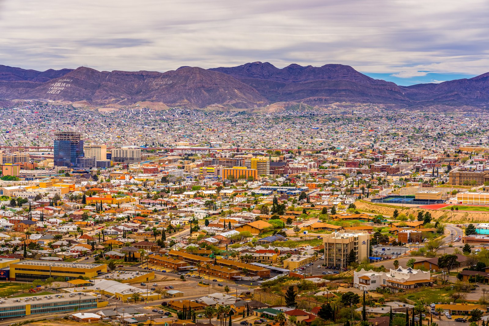
El Paso Texas - Cojuarez Mexico
I now have solid confirmation of location and details. The photo looks south from a high point on the Franklin Mountains above El Paso, Texas, taking in the densely packed rooftops of the city as they blend into Ciudad Juarez, Mexico across the Rio Grande. On the far ridge in Mexico, whitewashed letters spell out a religious message, while downtown El Paso's office towers rise on the left amid the sprawling desert basin below. Key Features: The Border Message: the mountainside reading "CD Juarez. La Biblia es la Verdad. Leela," meaning "City of Juarez. The Bible is the Truth. Read It," marks Cerro Bola Mountain in Ciudad Juarez. Twin Border Cities: Interstate 10 roughly follows the Rio Grande, the river dividing El Paso from Juarez, and together the two cities form one of the largest metropolitan areas along the entire U.S.-Mexico border. The Mountain Gap: El Paso sits where the Rio Grande emerges from the Rocky Mountains at the foothills of the Franklin Mountains. The Overlook: A drive up Rim Road to Scenic Drive offers a dusk view down on El Paso and Juarez lying in a horseshoe, with downtown El Paso to one side and Juarez climbing the hills opposite.
Prints from $14Downloads from $19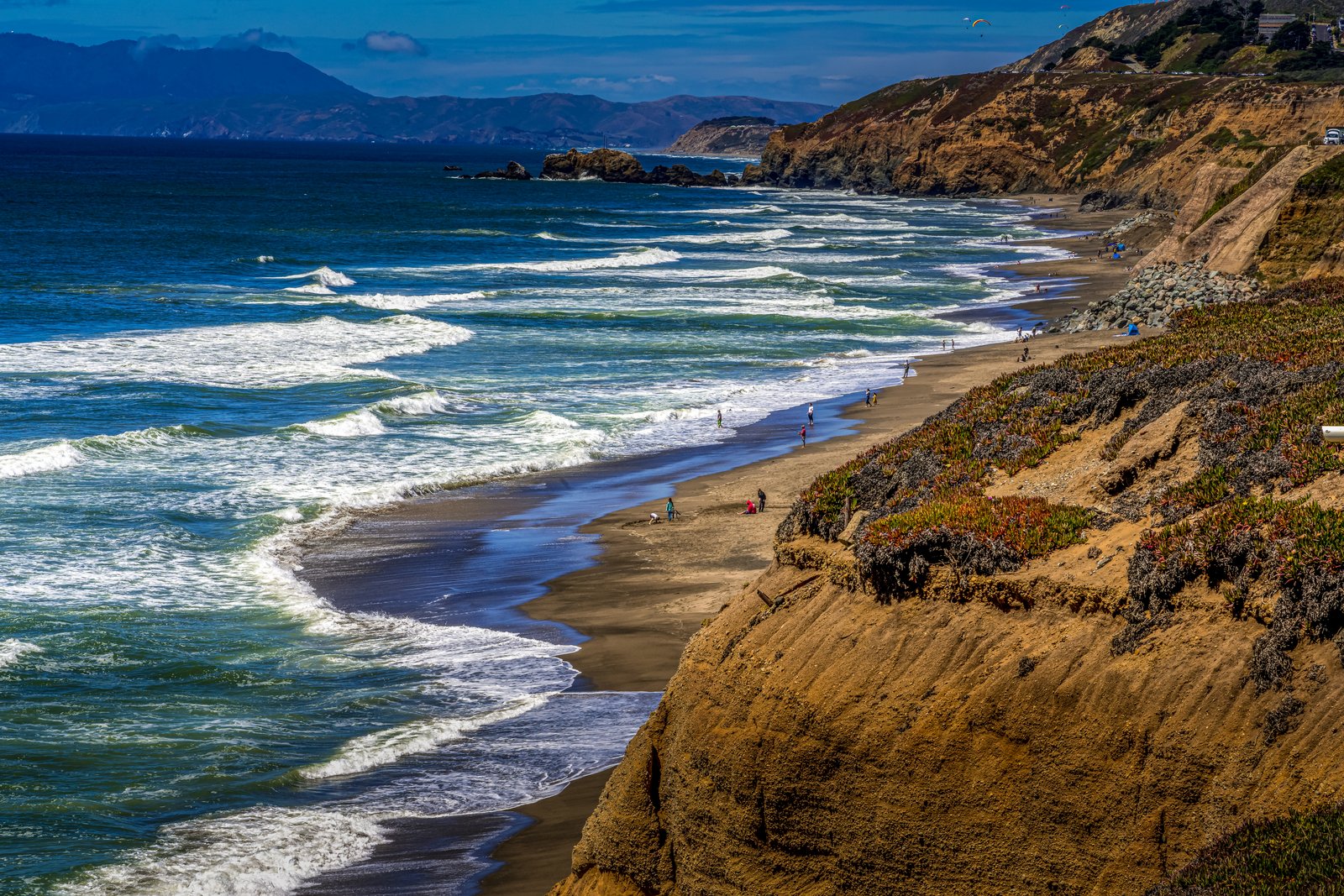
Pacificia California Coast
The photograph looks north along the San Mateo County coastline from the sandstone bluffs near Mori Point, above Rockaway Beach in Pacifica, California. Waves roll onto a wide sandy beach dotted with beachcombers while paragliders drift over a nearby headland, and the hazy silhouette of the Marin Headlands rises across the bay in the distance. Key Features: The Bluffs: Mori Point's eroded sandstone cliffs, part of the Golden Gate National Recreation Area, drop steeply to the shoreline and are a popular hiking and biking spot above Pacifica's beaches. The Paragliders: The coastal headlands north of Pacifica, including Mussel Rock in Daly City, are well known local launch sites for hang gliders and paragliders riding the ocean updrafts. The Wider View: On clear days the bluffs offer sweeping sightlines up the coast past San Francisco toward the Marin Headlands and Mount Tamalpais on the far side of the Golden Gate. The Setting: Pacifica sits on the Pacific shoreline just south of San Francisco, prized for its rugged sea cliffs, tide-washed rocks, and long sandy beaches.
Prints from $14Downloads from $19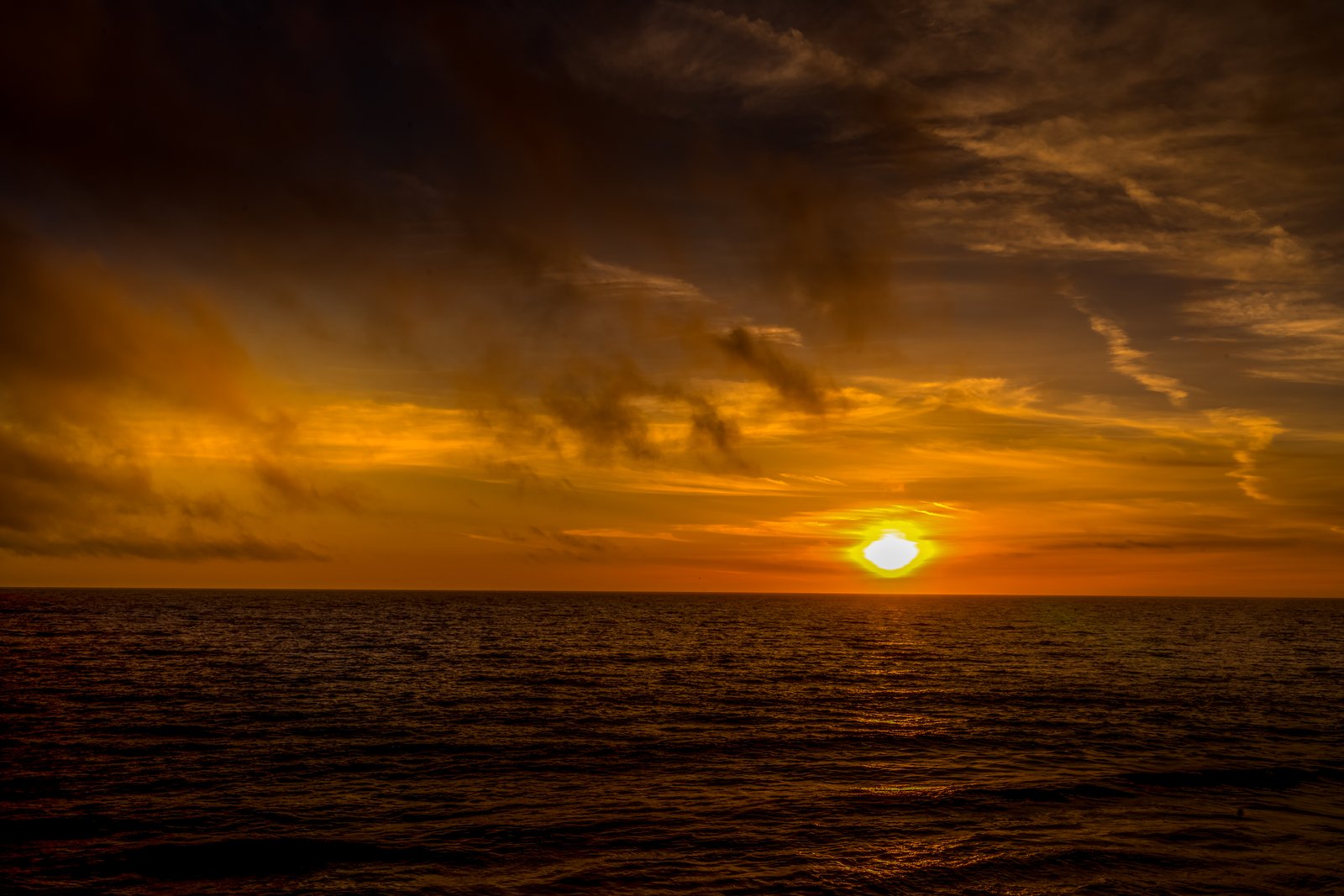
1208 Pacific Ocean Sunset
The photo shows a wide open ocean horizon at dusk, with the sun sinking low into a bank of clouds and setting the sky ablaze in shades of orange, gold, and deep brown. Taken from a vantage point along the Pacific coastline, the frame is dominated entirely by sky and water, capturing the moment the sun nearly touches the sea. Key Features: The Pacific Ocean: One of the largest bodies of water on Earth, the Pacific Ocean stretches along the western edge of the Americas and is famed for its dramatic sunset views. Coastal Sunsets: Because the Pacific coast faces west, sunsets over the water are a common and celebrated sight, often producing vivid color displays as the sun drops toward the horizon. Atmospheric Conditions: The layered clouds and warm color palette in this image result from sunlight scattering through the atmosphere at low angles, a hallmark of golden hour photography over open water. Minimalist Composition: With no land or structures in view, the photograph emphasizes the vastness of sea and sky, a favored approach among fine art seascape photographers.
Prints from $14Downloads from $19