

Collection
USA
By · 80 photos
 Painterly
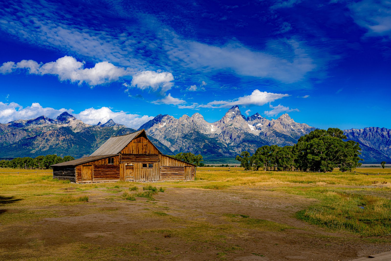
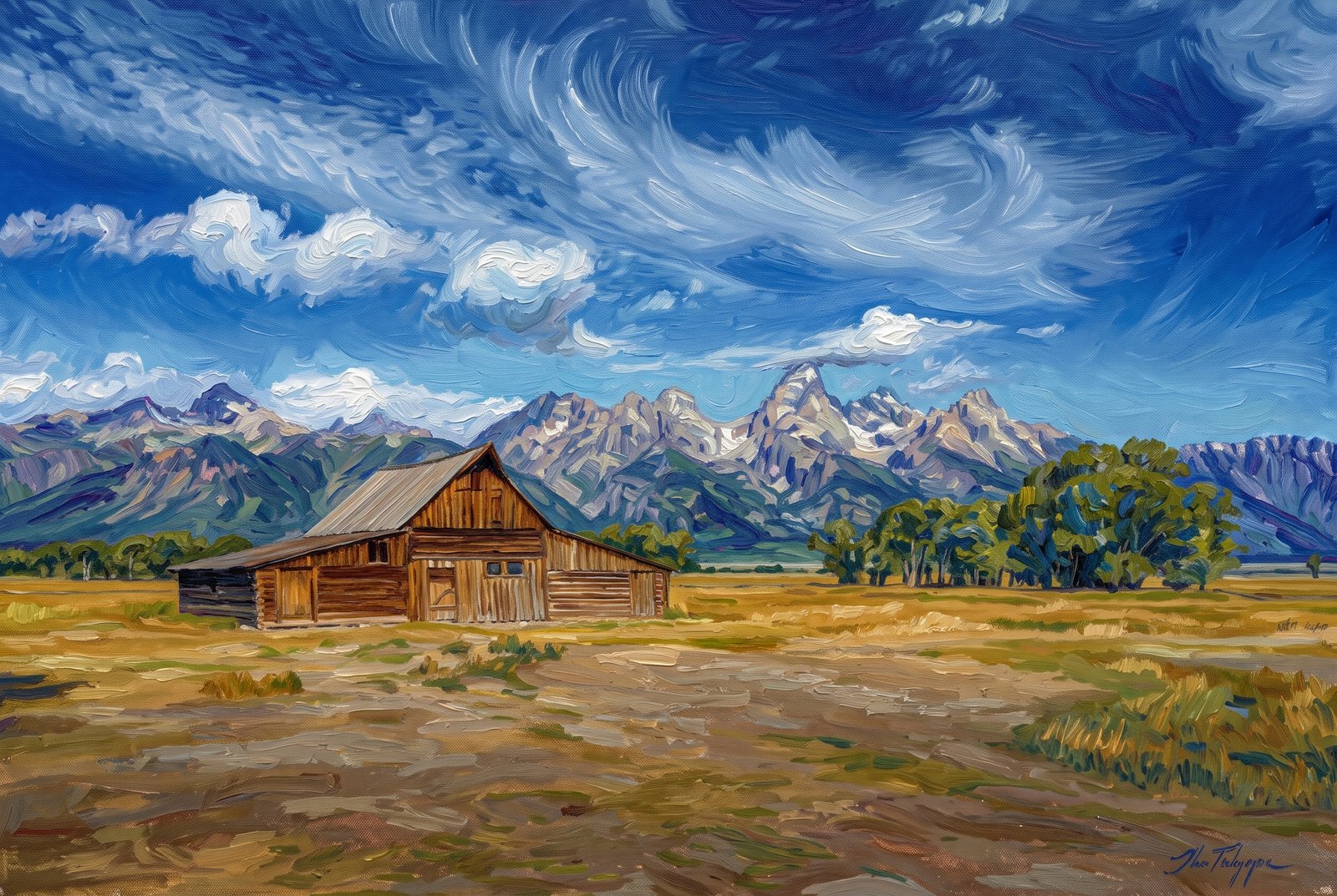
T.A. Moulton Barn, Mormon Row Within Grand Teton National Park In Wyoming
The T.A. Moulton Barn stands on Mormon Row in Grand Teton National Park, and it is one of the most photographed barns in the United States. Key Features: The History: Thomas Alma Moulton, one of the Mormon homesteaders who settled the valley, built the barn between 1912 and 1945. The Backdrop: The jagged Teton Range rises behind it, with the pointed summit of Grand Teton directly over the roofline. Mormon Row Historic District: The barn is part of a district on the National Register of Historic Places, a cluster of early 20th-century homesteads that shows the valley's farming past.
Prints from $41Prints only
US Capital
The United States Capitol rises above manicured lawns and mature trees at the east end of the National Mall in Washington, D.C., its white dome and columned west front doubled in the still water of the Capitol Reflecting Pool, with the equestrian statue of the Ulysses S. Grant Memorial in front. Key Features: The Dome: A cast-iron dome crowned by the Statue of Freedom, the defining silhouette of the seat of Congress. The Grant Memorial: Grant on horseback faces west over the Reflecting Pool toward the Lincoln Memorial, which honors his wartime president. The National Mall: The pool marks the eastern end of the ceremonial park that stretches to the Lincoln Memorial. The Reflection: The still water doubles the facade and sky.
Prints from $22Downloads from $19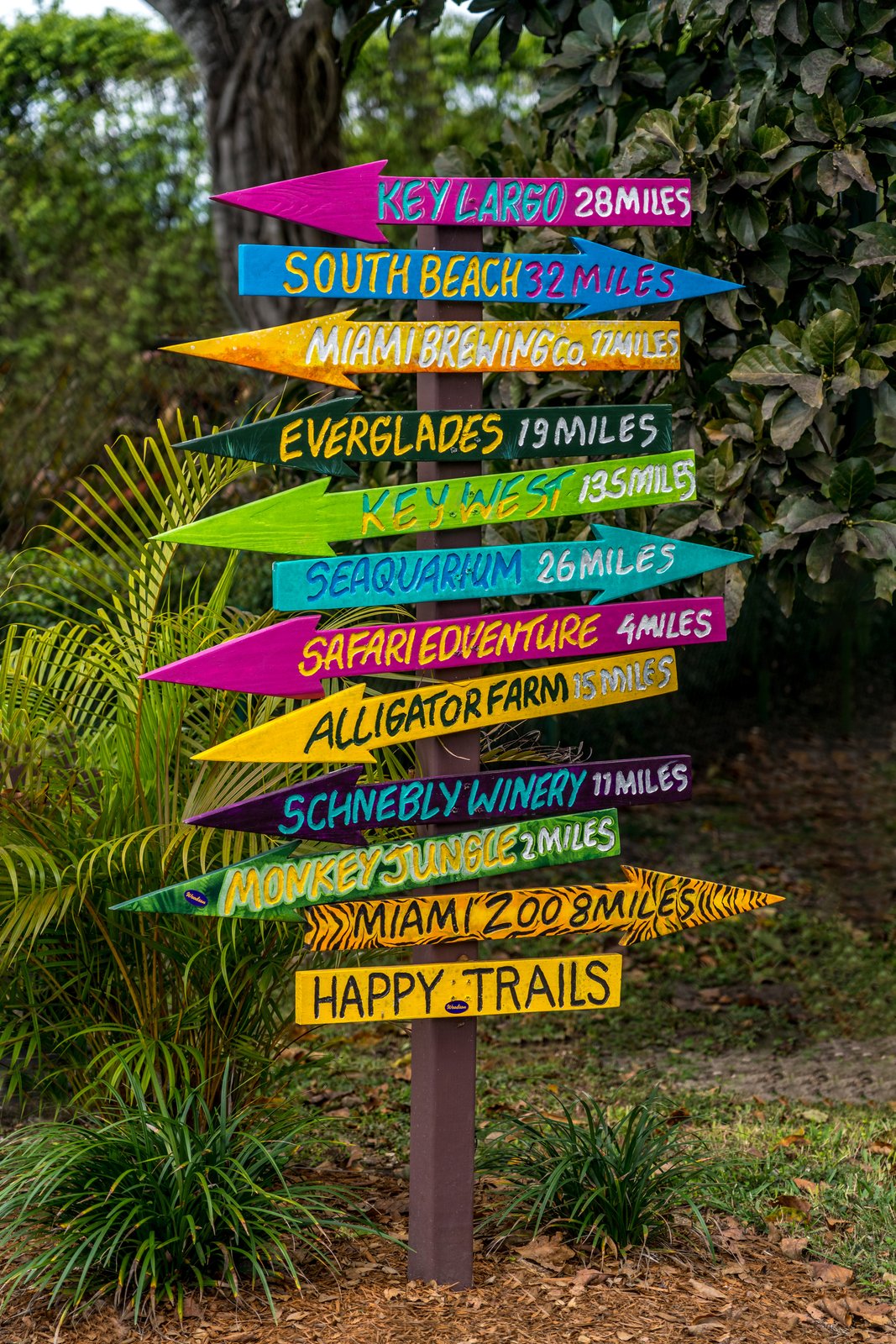
Handcrafted Multi-Arrow
A handcrafted signpost of hand-painted arrows stands among palms and broadleaf shrubs in the Redland farming district of South Miami-Dade County, Florida, each plank stacked on a single post and pointing travelers toward nearby attractions, with dense greenery and a mulched bed behind. Key Features: The Redland: Known as the rural outback south of Miami, the district mixes citrus groves, nurseries and tropical fruit stands with family-run attractions. The Destinations: The arrows point to real places a short drive from Homestead, among them Monkey Jungle, Schnebly Redland's Winery, the Everglades Alligator Farm and Zoo Miami. A Roadside Tradition: Playful signposts like this guide visitors along the Redland Tropical Trail between orchards, wildlife parks and tasting rooms. The Look: Bright tropical colors and tilted hand lettering give the sign a folk art charm.
Prints from $22Downloads from $19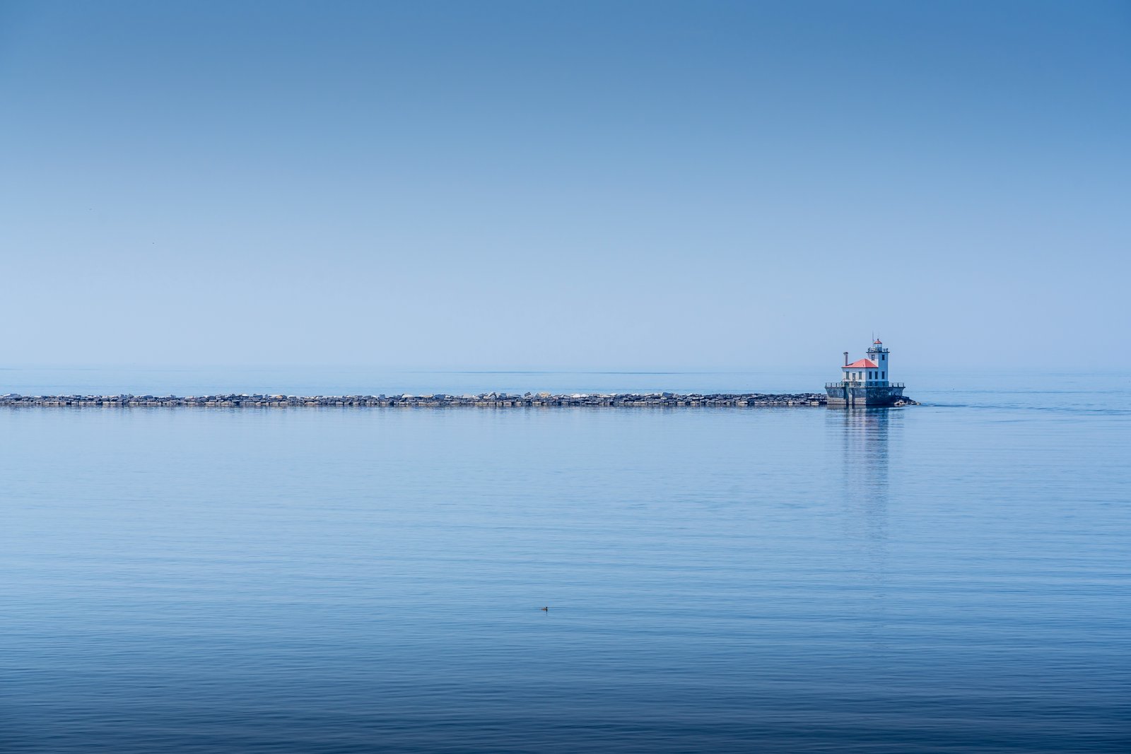
Oswego West Pierhead Lighthouse
The Oswego West Pierhead Lighthouse stands at the end of a long stone breakwater on Lake Ontario in Oswego, New York, its white tower and red roof mirrored almost perfectly in the still lake, seen from the shore. Key Features: The Lighthouse: A steel and cast-iron tower, white with a red roof and green trim, marking the entrance to Oswego Harbor. The Breakwater: The light stands about half a mile from shore at the end of the breakwater. Historic Status: The lighthouse is listed on the National Register of Historic Places.
Prints from $22Downloads from $19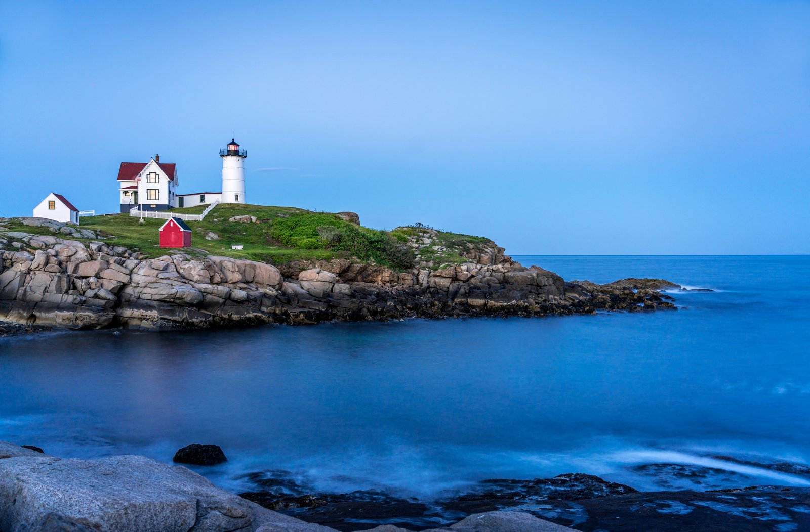
Cape Neddick Light, Nubble Lighthouse
Cape Neddick Light, known to everyone as Nubble Light, stands on its small rocky island just off York Beach in southern Maine, the white tower, red-roofed Victorian keeper's house and little red oil house set on a grassy outcrop above the granite shore as sky and sea turn deep blue at dusk. Key Features: The Island: The light sits on a rocky nub of an island, hence the name, about 100 yards off York Beach. The Vantage Point: Sohier Park, across the narrow channel, draws an estimated 500,000 visitors a year to see it. Construction: President Hayes authorized the light in 1879. Maritime Danger: Many ships were wrecked here before the light was built, the Isidore in 1842 the most famous.
Prints from $22Downloads from $19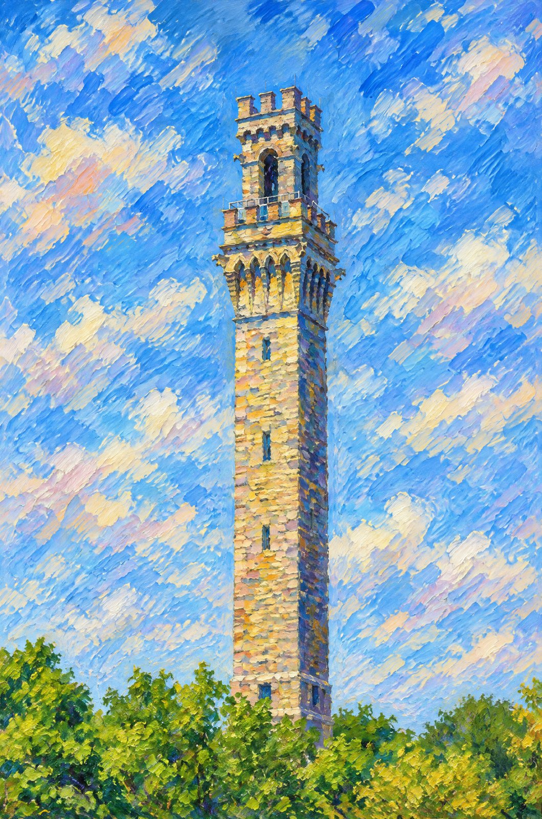 Impressionist
High Pole Hill Is The Pilgrim Monument
The Pilgrim Monument rises above the treeline on High Pole Hill in Provincetown, Massachusetts, seen from below from its rough granite blocks to the arched belfry openings and battlements of its Italian Renaissance crown, against a clear summer sky with green Cape Cod foliage at its base. Key Features: The Landmark: Designed by Willard T. Sears, the granite tower rises 252 feet 7.5 inches, 350 feet above sea level, the tallest all-granite structure in the United States. The History: Built from 1907 to 1910, it honors the Pilgrims' first landfall in 1620 and the signing of the Mayflower Compact in Provincetown Harbor. Presidents: Theodore Roosevelt laid its cornerstone in 1907, and William H. Taft dedicated it. The View: From the top you can see the curl of the Cape's arm, a sandbar between Cape Cod Bay and the Atlantic.
Prints from $41Prints only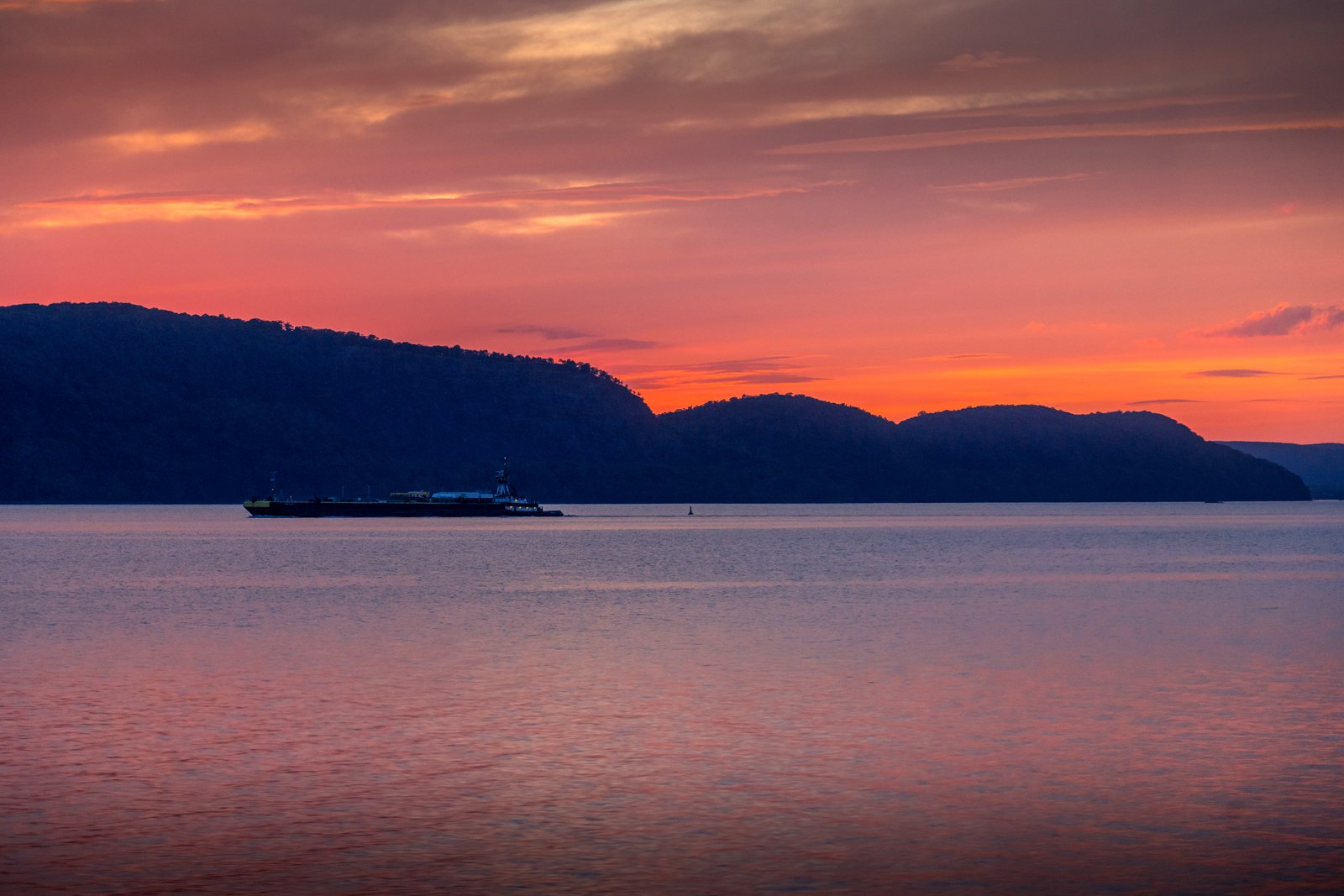
Sunset Of The Hudson
A tugboat pushes a barge along the calm Hudson River in New York State at sunset, the sky and water glowing orange and pink where the river narrows between low, forested hills turned to dark silhouettes. Key Features: River Commerce: Tugs and barges still carry fuel, stone and other cargo on the Hudson, a working tradition centuries old. Light and Water: The still surface mirrors the sunset colors, the Hudson Valley light that inspired generations of painters and photographers. The Hills: Rounded, wooded hills crowd close along this stretch of the river.
Prints from $22Downloads from $19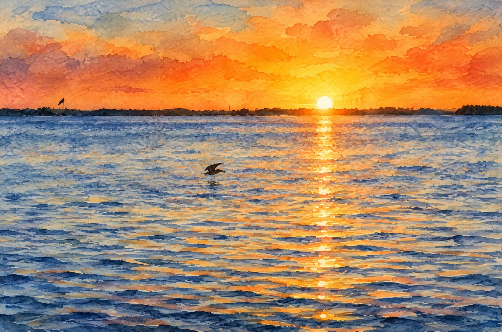 Watercolor
Sunset In Tampa Bay
The sun sets straight over a low line of mangrove islands on Tampa Bay, Florida, laying a bright path across the calm water as a brown pelican glides low in silhouette and a small flagpole on a far point gives the only sign of people. Key Features: The Setting: Tampa Bay is Florida's largest open-water estuary, lined with mangrove shores that make these dark, low horizons at dusk. The Wildlife: Brown pelicans fish the shallow, sheltered bays and nest on mangrove islands, a common sight here at sunset. The Light: The sun's reflection stretches in a single column across the water, the golden-hour moment Gulf Coast photographers wait for. The Mood: Warm orange sky and quiet ripples hold the stillness of an evening on the bay.
Prints from $41Prints only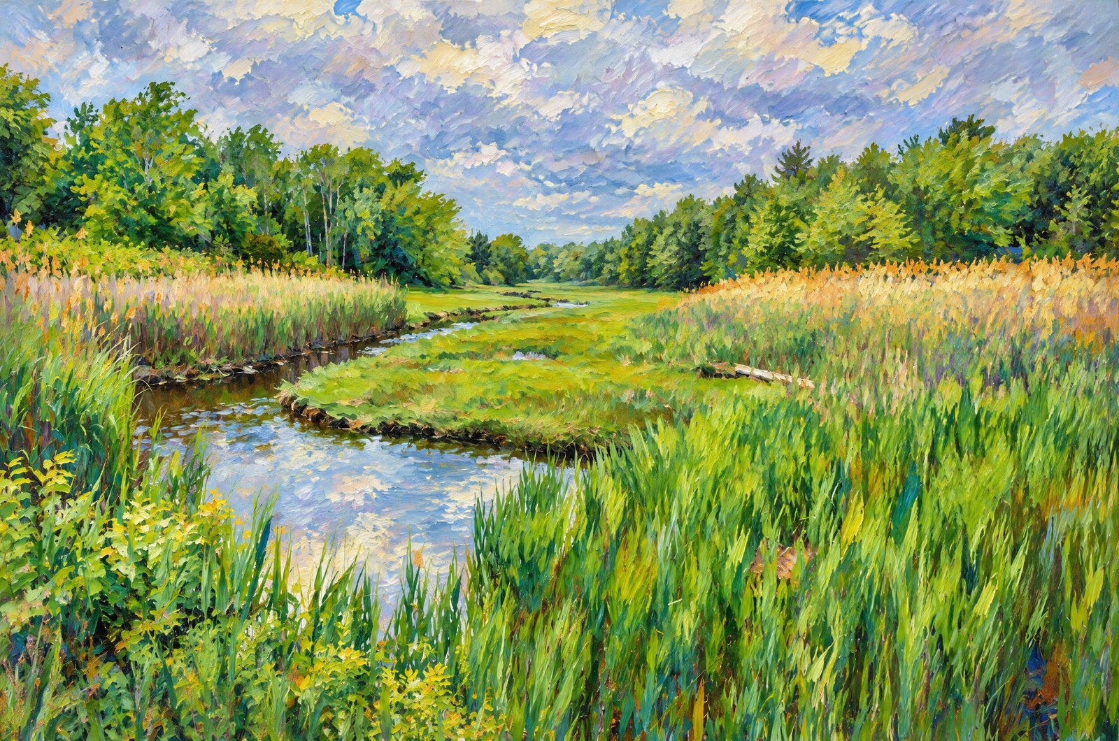 Impressionist
Tranquil Grass Lands
A tidal creek winds through a lush coastal salt marsh between bright green marsh grass and taller golden reeds, curving toward a distant tree line of dense hardwood forest under a heavy, overcast summer sky. Key Features: The Marsh: Salt marshes form where tidal creeks meet coastal forest, rich habitat for fish, birds and shellfish. The Grasses: Vivid green cordgrass by the water and taller reeds along the banks show the layered zones of a healthy estuary. The Light: Heavy cloud spreads the light evenly, deepening the greens of marsh and water. Conservation Value: Marshes buffer the coast against floods and erosion and filter runoff before it reaches open water.
Prints from $41Prints only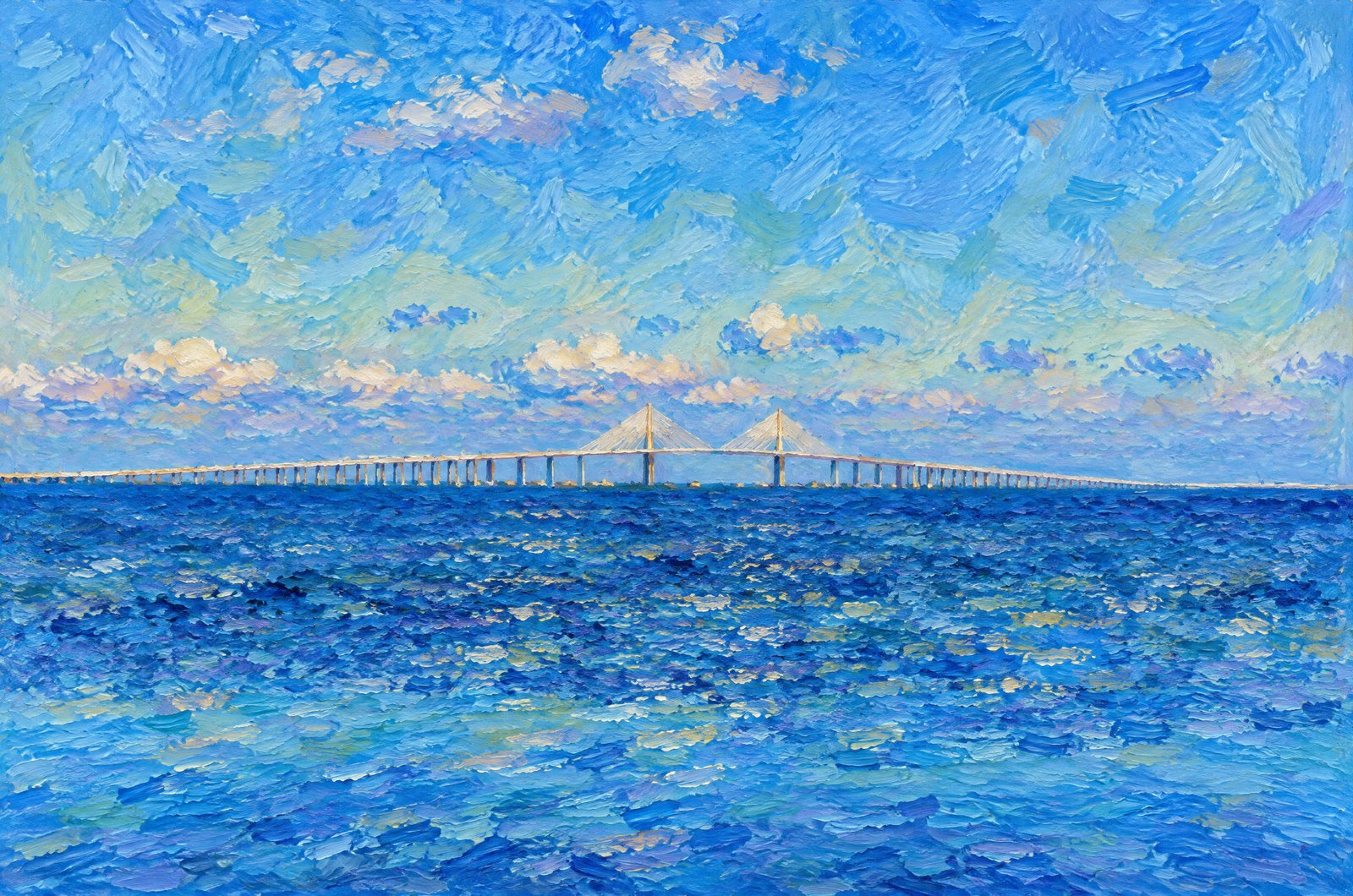 Impressionist
1348 Sunshine Skyway Bridge Tampa Bay
The twin golden cable towers of the Sunshine Skyway Bridge rise against a clear sky across the mouth of Tampa Bay in western Florida, the bridge's long, gently curving profile stretching toward the horizon between St. Petersburg and the Bradenton area, seen low across the open water. Key Features: The Span: A cable-stayed concrete bridge running more than four miles across the mouth of Tampa Bay, linking Pinellas and Manatee counties. A Record: When it opened it was the longest cable-stayed concrete bridge in the world. A Tragic Past: In 1980 the freighter Summit Venture struck a support of the old bridge, and about 1,200 feet of it fell into the bay. The Rebuilt Crossing: The new bridge, with its cable-stayed main span, opened in 1987.
Prints from $41Prints only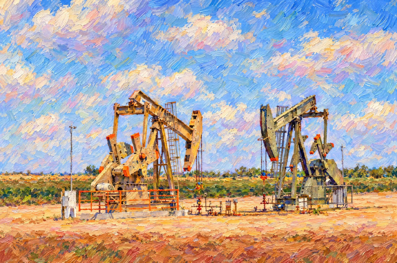 Impressionist
Permian Basin Oil Riggs
Two pumpjacks, the nodding donkeys of the oil patch, draw crude from wells set in reddish sandy soil in a West Texas oil field in the Permian Basin, with wellhead piping and valves in front and green irrigated farmland bordering the site beyond. Key Features: The Permian Basin: A vast sedimentary basin under much of West Texas and southeastern New Mexico, one of the most productive oil and gas regions in the country. The Pumpjack: A rocking-beam pump that lifts oil to the surface, the best-known symbol of American onshore oil. The Landscape: Flat rangeland and farmland dotted with wellheads and roads, where energy and agriculture share the same ground. Everyday Scenery: Pumpjacks stand beside crops and pasture across the Permian Basin as part of daily life.
Prints from $41Prints only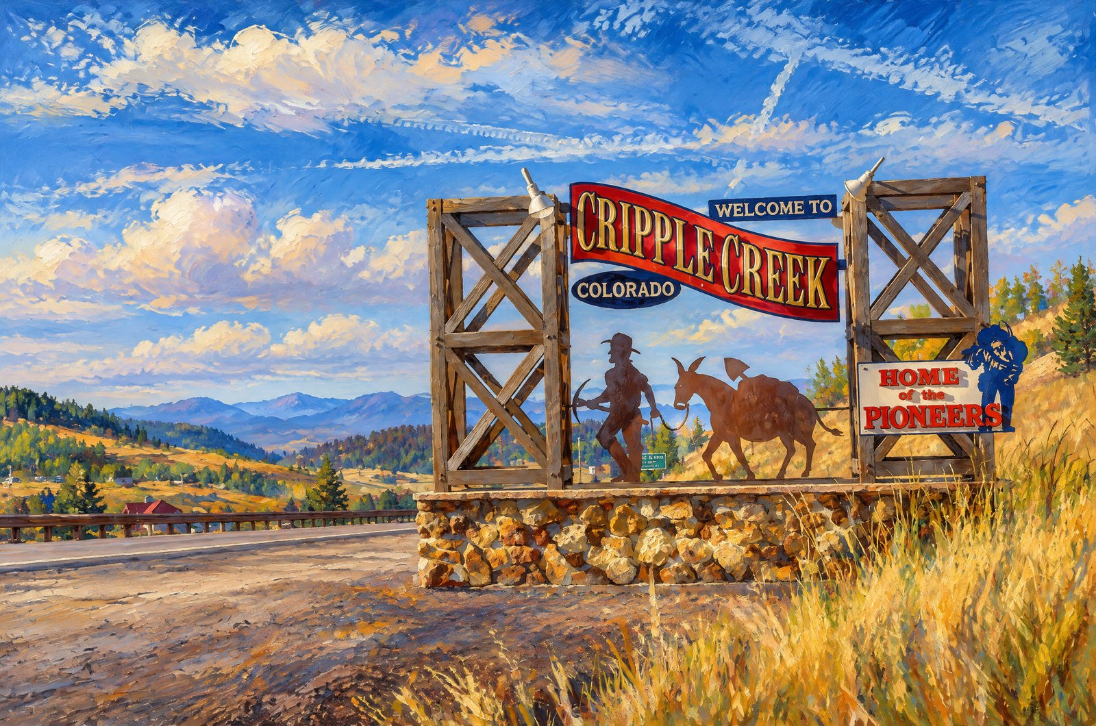 Painterly
Cripple Creek Colorado
A hand-painted welcome sign on rough timber posts and a stone base greets visitors to Cripple Creek, Colorado, a former gold mining town high in the Rockies southwest of Pikes Peak, its silhouetted prospector and pack mule beside the words "Home of the Pioneers," with mountain ridges fading into haze and a small highway marker noting the town's 9,494-foot elevation. Key Features: The Gold Rush: Prospectors poured into the district after Winfield Scott Stratton struck the Independence lode, one of the great gold strikes in history. High Country: At 9,494 feet, Cripple Creek's valley was little more than cattle pasture before the gold rush. The Mines: More than 500 mines in the district eventually produced some 21 million ounces of gold. Today: The town offers mining history, scenic train rides and lively casinos.
Prints from $41Prints only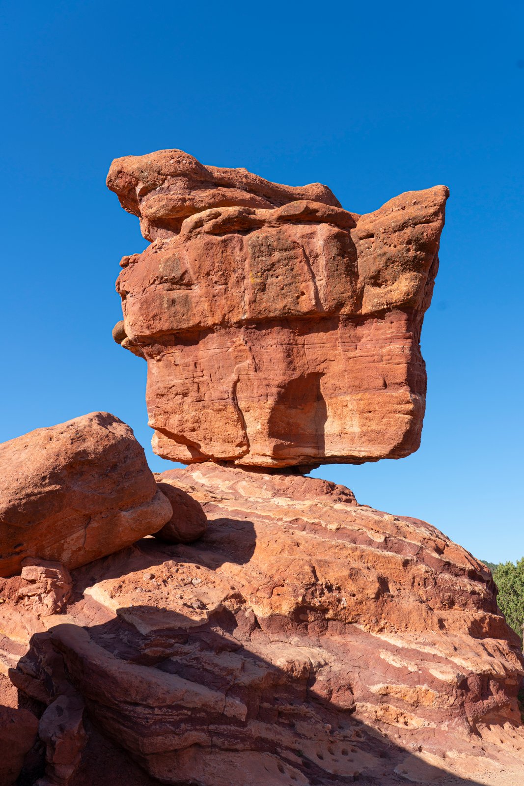
Garden Of Gods Colorado
Balanced Rock towers overhead at the southern entrance of Garden of the Gods near Colorado Springs, Colorado, its massive red sandstone form perched on a narrow base atop a larger sloping rock, the layered bands of the Fountain Formation clear against a brilliant blue sky. Key Features: The Formation: A 35-foot sandstone boulder weighing about 1.4 million pounds, seemingly defying gravity on its small base. The Location: It stands near the park's southern entrance. The Geology: The Fountain Formation sandstone was tilted up from deep underground and then shaped over the ages by rivers, wind and rain. The Draw: Poised above the park road, it is one of Garden of the Gods' favorite photo stops.
Prints from $22Downloads from $19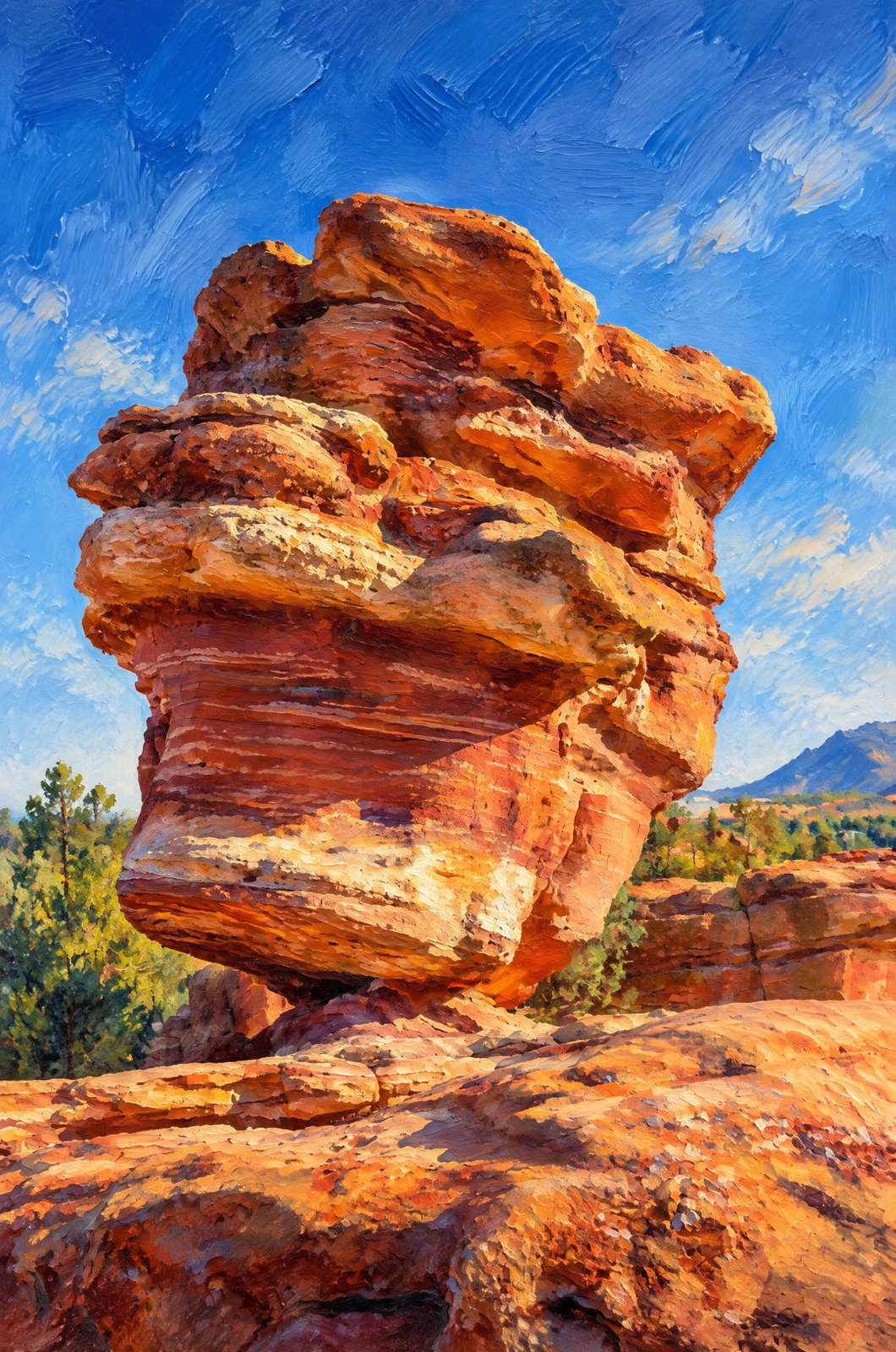 Painterly
Garden Of Gods Colorado
Soft morning light falls on Balanced Rock near the south entrance of Garden of the Gods in Colorado Springs, Colorado, seen from low so the massive boulder looms on its narrow base, its weathered red and cream bands above scrubby junipers and the Rocky Mountain foothills beyond. Key Features: The Formation: A 35-foot sandstone boulder weighing about 1.4 million pounds, balanced on a small base. How It Formed: Over the last two or three million years, a soft layer at its base wore away faster than the hard sandstone above, leaving the boulder perched on a narrow pedestal. The Park: Balanced Rock is a free roadside landmark and one of the best known in the Colorado Springs area.
Prints from $41Prints only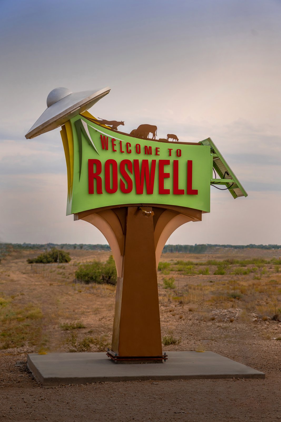
Welcome To Roswell New Mexico
A whimsical highway sign on US 285 welcomes travelers to Roswell, New Mexico, a flying saucer hovering over a line of cattle and beaming them up above bold red letters, with flat desert scrub stretching to the horizon. Key Features: The Signs: Roswell paid a design company $120,000 for three saucer-themed welcome signs on the main roads into town. The 1947 Legend: Visitors come because of the 1947 Roswell incident, when reports of a crashed flying saucer made the town famous. Design Variety: Finished in May 2017 for the 70th anniversary, each sign is different: a hovering saucer, a crashed saucer, or one lifting an unlucky Roswell cow. After Dark: Each sign is solar-powered, lighting its saucer in colorful blinking LEDs at night.
Prints from $22Downloads from $19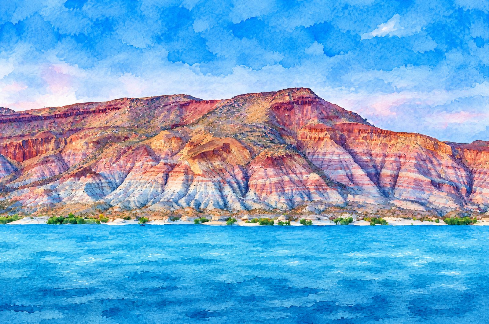 Watercolor
Quail Creek Reservoir Utah
Turquoise water fills Quail Creek Reservoir in the Virgin River valley of southwestern Utah, just north of St. George, below banded cliffs whose folded red, white and orange layers belong to the Virgin Anticline. Key Features: The Reservoir: Once a river valley, the reservoir was finished in 1985 to supply St. George, with most of its water diverted from the Virgin River. The Geology: It sits in the eroded core of the Virgin Anticline, a great fold in the rock that runs through Washington County. The Colors: Clear turquoise water framed by red, white and orange cliffs makes Quail Creek State Park look like a postcard. The 1989 Flood: The collapse of the reservoir's south dike in 1989 sent a torrent downstream that scoured the Moenkopi Formation layers still visible today.
Prints from $41Prints only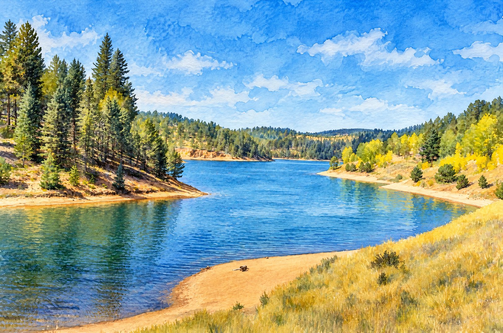 Watercolor
Crystal Creek Reservoir
Golden aspen and ponderosa pine frame the deep blue water of Crystal Creek Reservoir on the northwest flank of Pikes Peak in Colorado's Pike National Forest, above sandy, rust-colored banks. Key Features: The Reservoir: At about 9,230 feet, it covers roughly 136 acres, fed by Crystal Creek. The Setting: Crystal Creek Dam holds the lake near the Teller and El Paso county line, within Pike National Forest around Pikes Peak. The Season: Mixed pine and aspen turn for a brief autumn show that draws visitors each fall. Recreation: Boating, fishing, hiking and camping beneath one of Colorado's famous fourteeners.
Prints from $41Prints only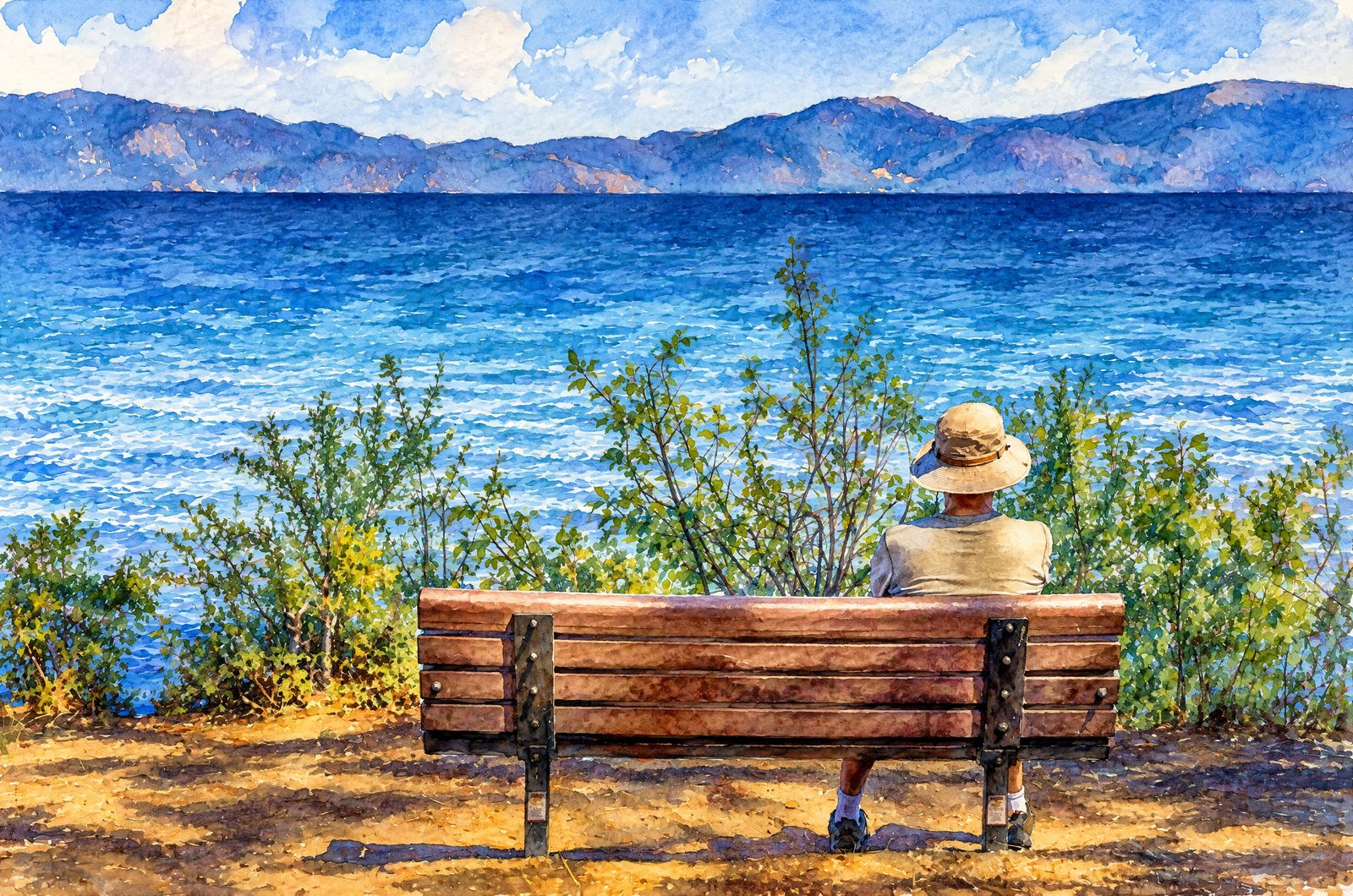 Watercolor
Lazy Day In Lake Tahoe
A lone visitor in a wide-brimmed hat sits on a quiet shoreline bench at Lake Tahoe, back to the camera and framed by lakeside shrubs, looking out across brilliant blue water to the Sierra Nevada peaks ringing the far shore on a clear day. Key Features: The Lake: Famous for its blue, Lake Tahoe straddles California and Nevada and is North America's largest alpine lake. The Depth: At 1,645 feet at its deepest, it is the second-deepest lake in the United States, after Crater Lake. The Color: Tahoe's blue depends largely on how little algae it holds; the less algae, the bluer the lake. The Setting: Ringed by peaks and clear mountain air, it is one of the country's most scenic places for a quiet moment by the water.
Prints from $41Prints only