

Fine Art Gallery
Fine Art Photographs, Printed Big And Signed.
Photographs by Rick Billings, printed by a professional photo lab on paper, art board, metal, canvas or acrylic. Every print carries Rick's signature, and every photo is also sold as a full-resolution download.
 Impressionist
Cripple Creek Colorado
by Rick Billings, M. Photog., Cr.
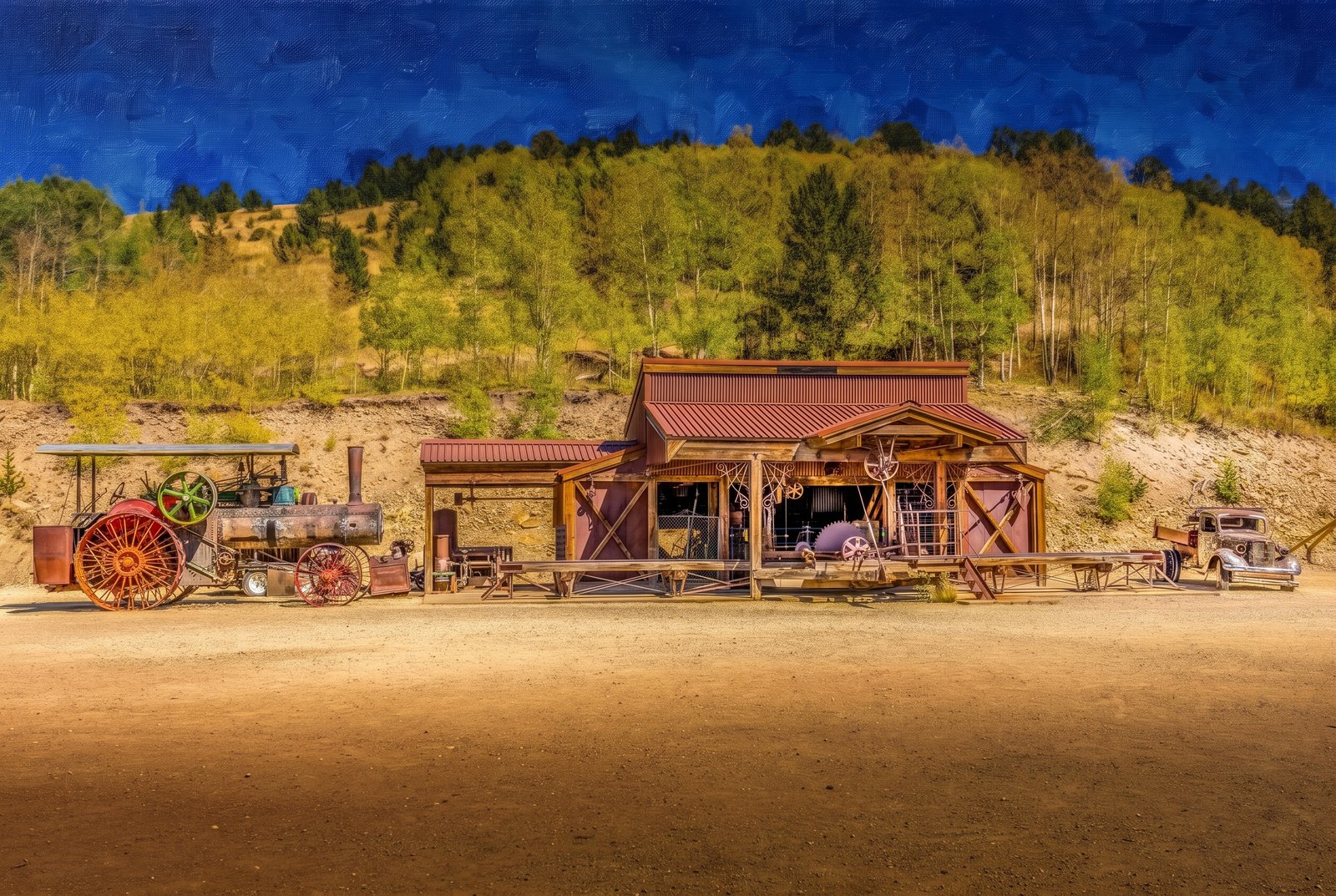
An old wooden garage with a rust-colored corrugated roof stands at Victor's Gold Camp Ag and Mining Museum, between a vintage steam tractor with big red wheels and an antique automobile, with golden aspen turning on the hillside behind under a deep blue mountain sky. Key Features: The Museum: More than a display of tractors, vehicles and old equipment, this rugged three-story museum is also a working garage. The Machinery: Visitors can watch a system of pulleys and belts drive the large machines a garage like this once used. The Blacksmith Shop: An old forge, with hammer and anvil, is still used here today. The Region: The museum sits in the Cripple Creek and Victor gold district of Teller County, famous for its 1890s gold rush.
Prints from $41Prints only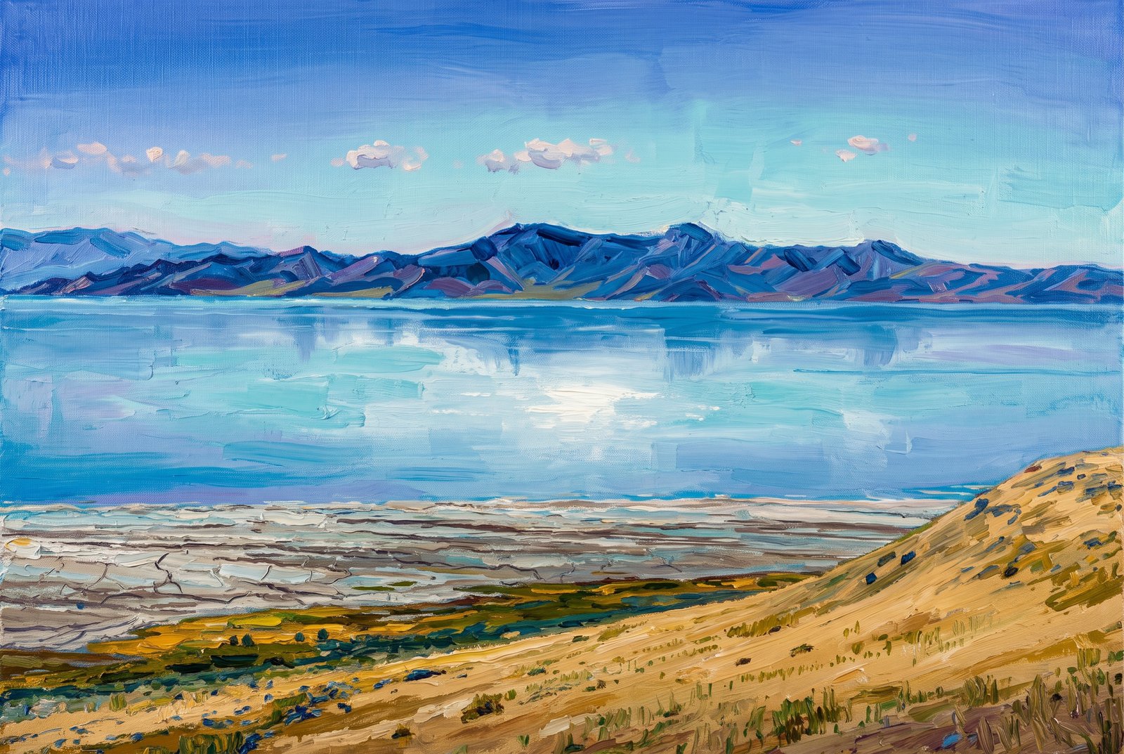 Painterly
Farmington Bay Utah
by Rick Billings, M. Photog., Cr.
From the golden grass and sage slopes of Antelope Island, Farmington Bay lies mirror-still across the eastern arm of Utah's Great Salt Lake, with the jagged Wasatch Range rising through a thin haze and doubled in the pale blue water. Key Features: Antelope Island: The largest island in the Great Salt Lake runs about fifteen miles north to south, shielding Farmington Bay, and rises from 4,200 to 6,600 feet. The Far Shore: Beyond the water, the Wasatch Mountains rise behind the towns of Clearfield, Layton, Farmington and Bountiful. The View: The island's trails give an elevated look across the lake and the surrounding mountains.
Prints from $41Prints only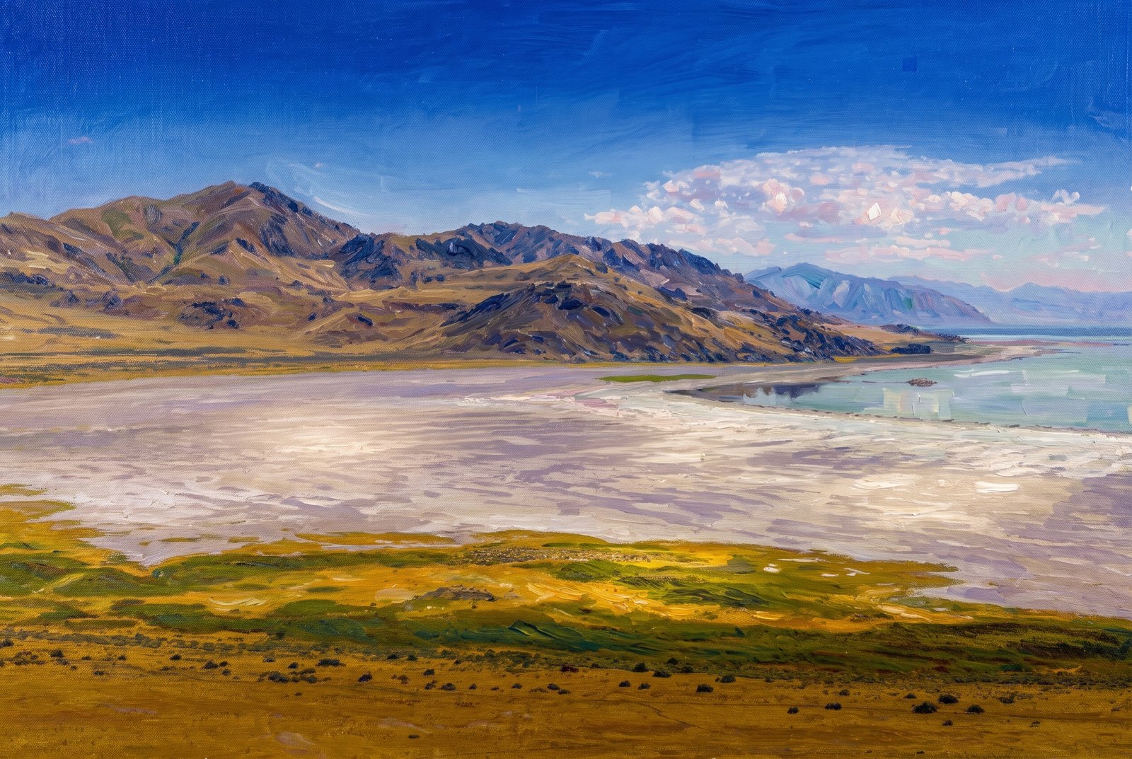 Impressionist
Farmington Bay Utah
by Rick Billings, M. Photog., Cr.
Across Farmington Bay on Utah's Great Salt Lake, a wide tan expanse of exposed lakebed lies where the shoreline has retreated, with grassy wetland flats in front and the arid slopes of Antelope Island's mountains rising to the north and west. Key Features: The Setting: The Wasatch Mountains rise on the far side of the bay, beyond Clearfield, Layton, Farmington and Bountiful. The Island: Antelope Island, the largest in Great Salt Lake, is part of the Basin and Range province that stretches from the Wasatch to the Sierra Nevada. The Shrinking Lake: Falling water levels have left the lakebed bare, and storms whip its dust, laden with heavy metals, across the region.
Prints from $41Prints only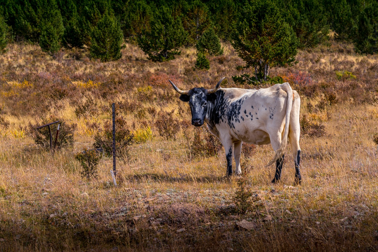
Cripple Creek CO
by Rick Billings, M. Photog., Cr.
A black and white spotted cow stands by an old fence post in a hillside pasture of autumn grass near Cripple Creek, Colorado, gazing straight at the camera in front of a stand of young lodgepole pines. Key Features: The Town: Cripple Creek, a former gold rush town in the mountains west of Colorado Springs, sits at about 9,375 feet. Before the Gold: The valley was cattle range for years before the gold strike that made the town famous. The Scene: Cattle still graze these open slopes, an echo of the ranching life that came before the mining boom.
Prints from $22Downloads from $19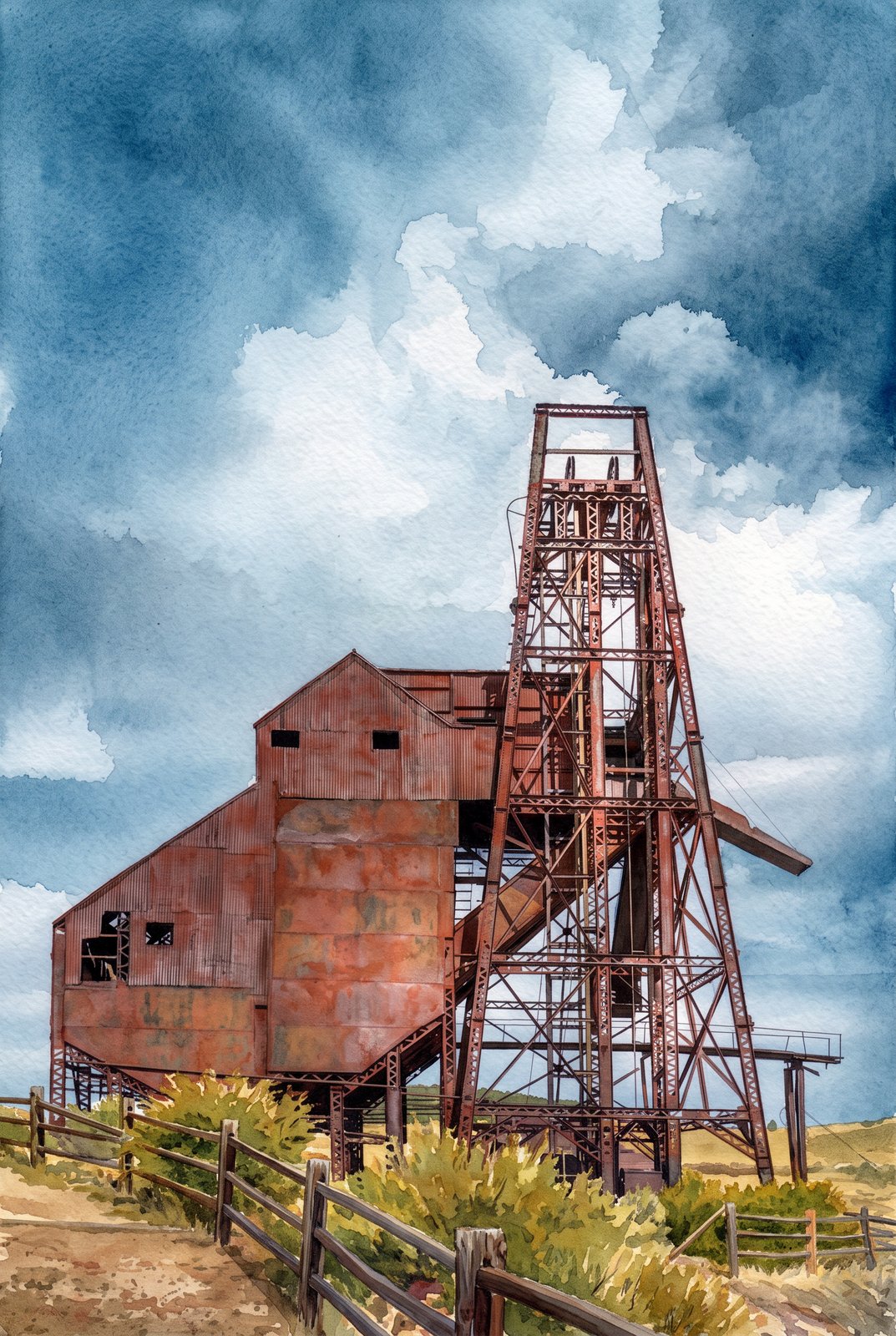 Watercolor
Cripple Creek CO
by Rick Billings, M. Photog., Cr.
The weathered steel headframe and corrugated hoist house of the Ajax Mine stand against a wide Colorado sky on the lower slopes of Squaw Mountain, just northwest of Victor in the Cripple Creek Mining District, surrounded by autumn brush and open range. Key Features: The Mine: Built in 1895, the Ajax was one of the district's more productive mines and one of its last big underground operations. Rehabilitation: In the 1970s its headframe was stabilized and a new hoist installed, and the mine kept working until the 1980s. The Setting: The mine stands above Victor, in what was once one of the richest gold camps in the American West. The Structure: The tall steel headframe lowered miners into the shaft and hoisted ore up to the rusted metal ore bin still standing beside it.
Prints from $41Prints only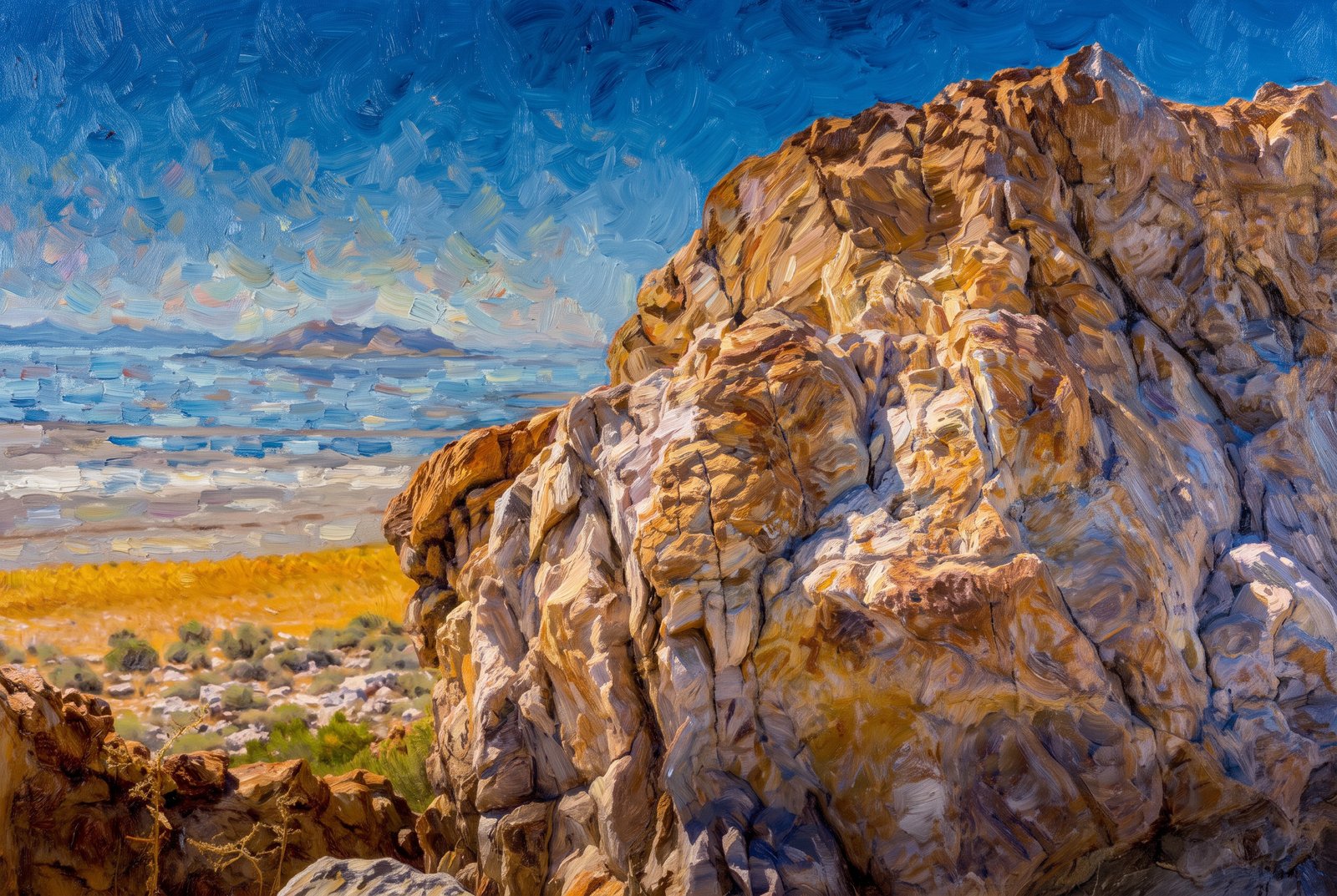 Impressionist
Farmington UT
by Rick Billings, M. Photog., Cr.
On the rugged shore of Antelope Island, a weathered outcrop of ancient banded rock frames a view northeast across the shimmering Great Salt Lake toward Farmington Bay, with salt flats, golden grass and hardy desert shrubs below and distant ridgelines fading into haze. Key Features: The Rock: The outcrop belongs to the Farmington Canyon Complex, banded and contorted metamorphic rock that is among the oldest exposed in Utah. The Island: Antelope Island, the largest in the Great Salt Lake, is reached by a seven-mile causeway road from the mainland. The View: Pullouts along this shore look across Farmington Bay to the Wasatch Mountains. Wildlife: The state park is home to bison herds and is known for birdwatching, hiking and photography.
Prints from $41Prints only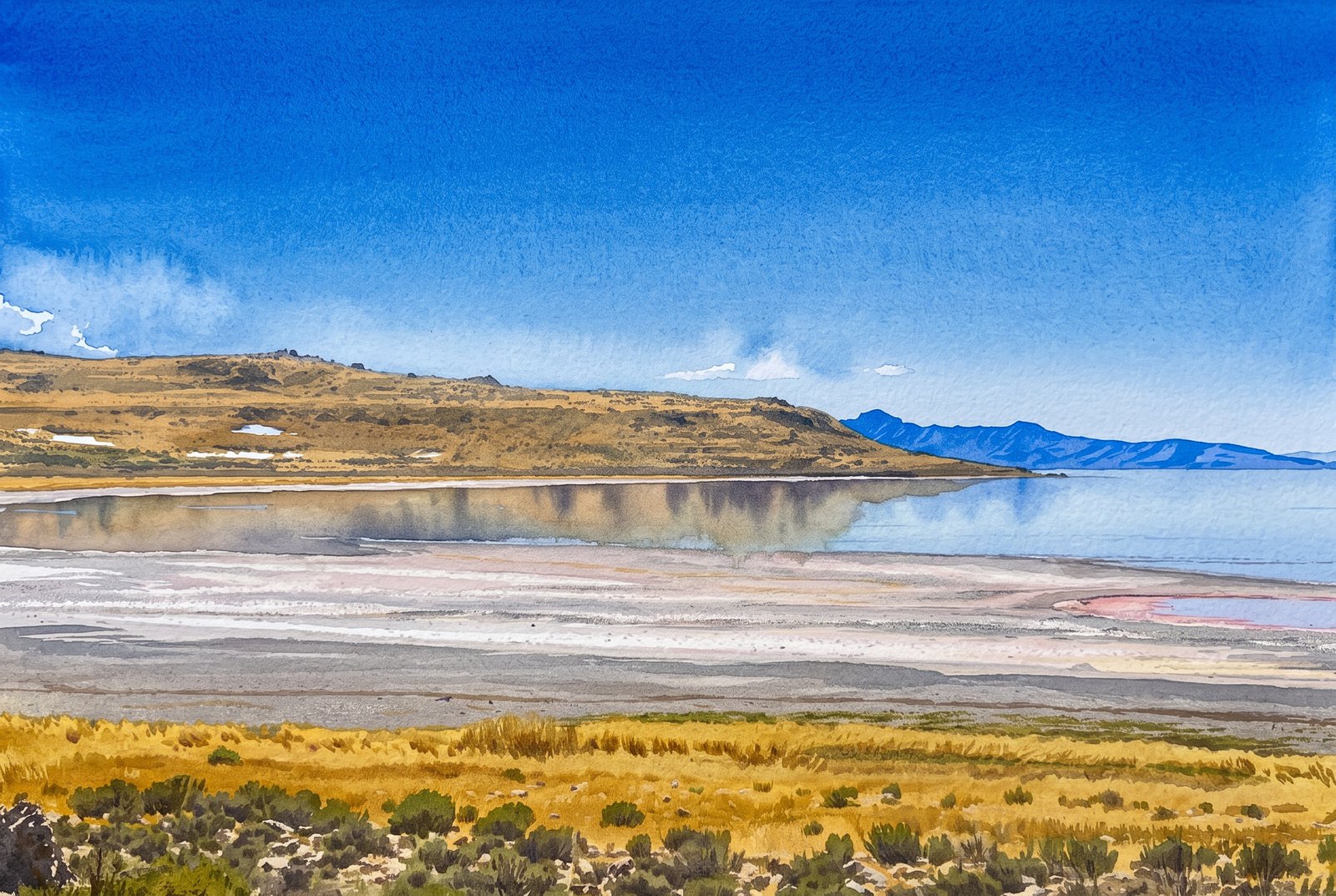 Watercolor
Farmington Bay Utah
by Rick Billings, M. Photog., Cr.
From the marshy mainland shore of Farmington Bay, bands of salt flat and sunbaked mud left by receding water lead out to the low, rugged silhouette of Antelope Island across the southeastern arm of the Great Salt Lake. Key Features: The Bay: Farmington Bay lies between Antelope Island and the lake's southeast corner, where the Jordan River brings in water from Utah Lake. Wildlife: Thanks to that fresh water, it is one of only two places in the lake where fish live, and an important stopover for migrating waterfowl. The Island: At 42 square miles, Antelope Island is the largest of the ten islands in the Great Salt Lake. The Shoreline: The pale crust at the water's edge is mineral left behind as the shallow, salty lake rises and falls with the seasons.
Prints from $41Prints only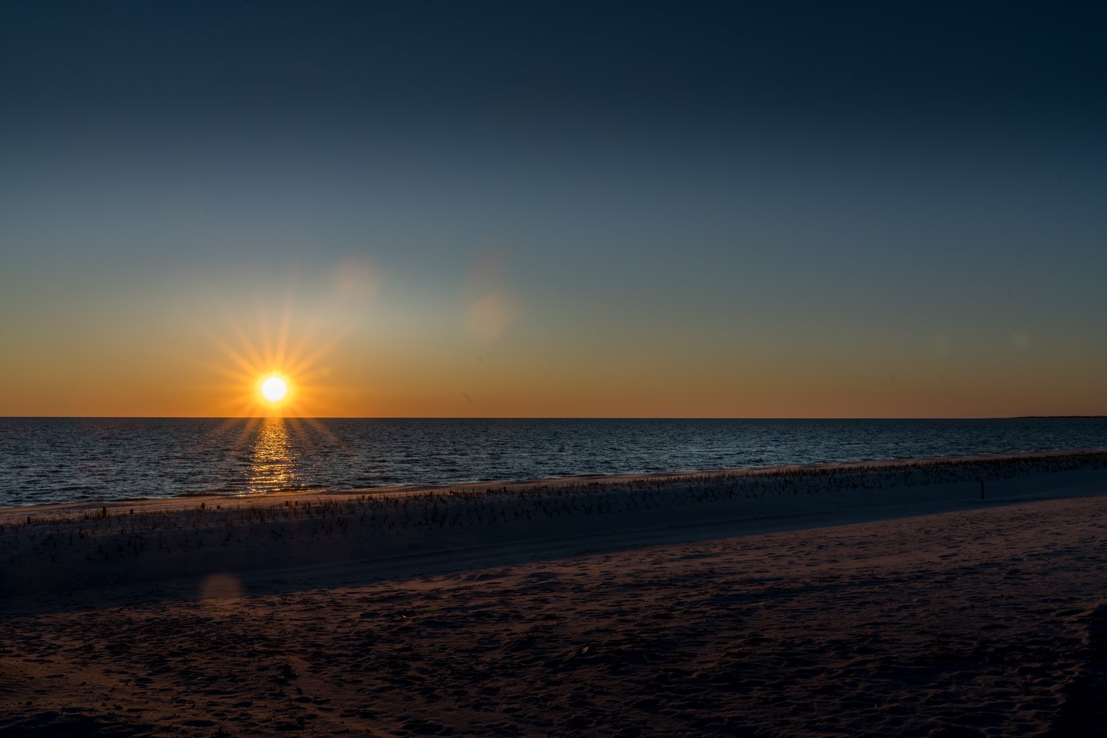
Mississippi Gulf Coast
by Rick Billings, M. Photog., Cr.
The sun drops toward the horizon over the calm Mississippi Sound, seen low from the wide, gently sloping beach along Highway 90, with marsh grass and driftwood marking the tideline and a faint sandbar far to the right. Key Features: The Beach: This sand beach runs 26 miles along the Mississippi Gulf Coast and is 300 feet wide, one of the largest man-made beaches in the world. The Roadway: U.S. Highway 90, the Old Spanish Trail, runs right alongside, with water views the whole way. The Waters: The Mississippi Sound is shallow and sheltered from the open Gulf by a chain of barrier islands, which keeps its waves gentle.
Prints from $22Downloads from $19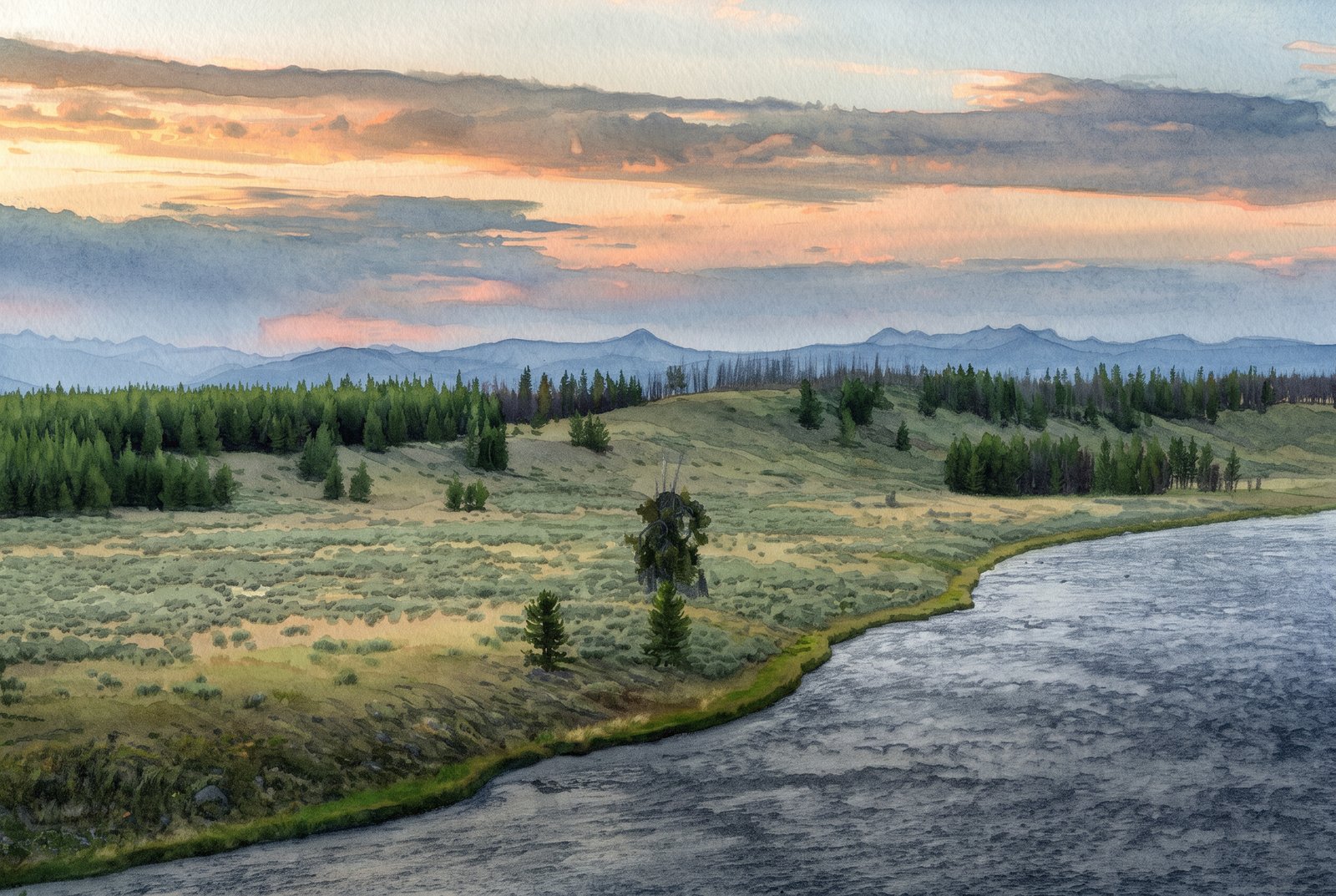 Watercolor
Long Horn Zion National Park Utah
by Rick Billings, M. Photog., Cr.
At dusk, a wide bend of the Yellowstone River sweeps past Hayden Valley's sagebrush meadows and stands of lodgepole pine, some scarred by past fires, toward hazy blue ridgelines under a glowing, cloud-streaked sky. Key Features: The Valley Floor: The meadows along the river are an ancient lake bed from a time when Yellowstone Lake was much larger. Wildlife: The valley, nine miles long and six wide, is year-round home to nearly a thousand bison. The Name: It is named for Ferdinand V. Hayden, who led the 1871 survey that helped create the park. The Overlooks: Turnouts above the winding river give sweeping views of the meadows and peaks, best at sunrise and sunset.
Prints from $41Prints only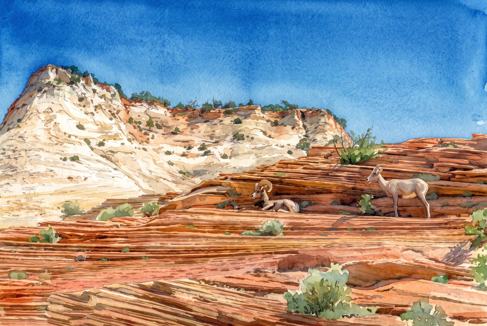 Watercolor
Long Horn Zion National Park Utah
by Rick Billings, M. Photog., Cr.
A pair of desert bighorn sheep rest and stand on ledges of layered red Navajo sandstone along the Zion-Mount Carmel Highway on the east side of Zion National Park, Utah, near Checkerboard Mesa, with a pale cross-bedded sandstone dome rising against a deep blue sky. Key Features: The Rock: Weathering and erosion in the upper Navajo Formation carved the checkerboard pattern that gives the nearby mesa its name. The Terrain: Checkerboard Mesa towers above the highway in this slickrock country on the park's east side. The Wildlife: Desert bighorn frequent this eastern plateau, drawn to seasonal water pockets in the canyons and using the ledges as lookouts. The Colors: The white sandstone dome and striped red rock below show the varied mineral staining found throughout this part of the park.
Prints from $41Prints only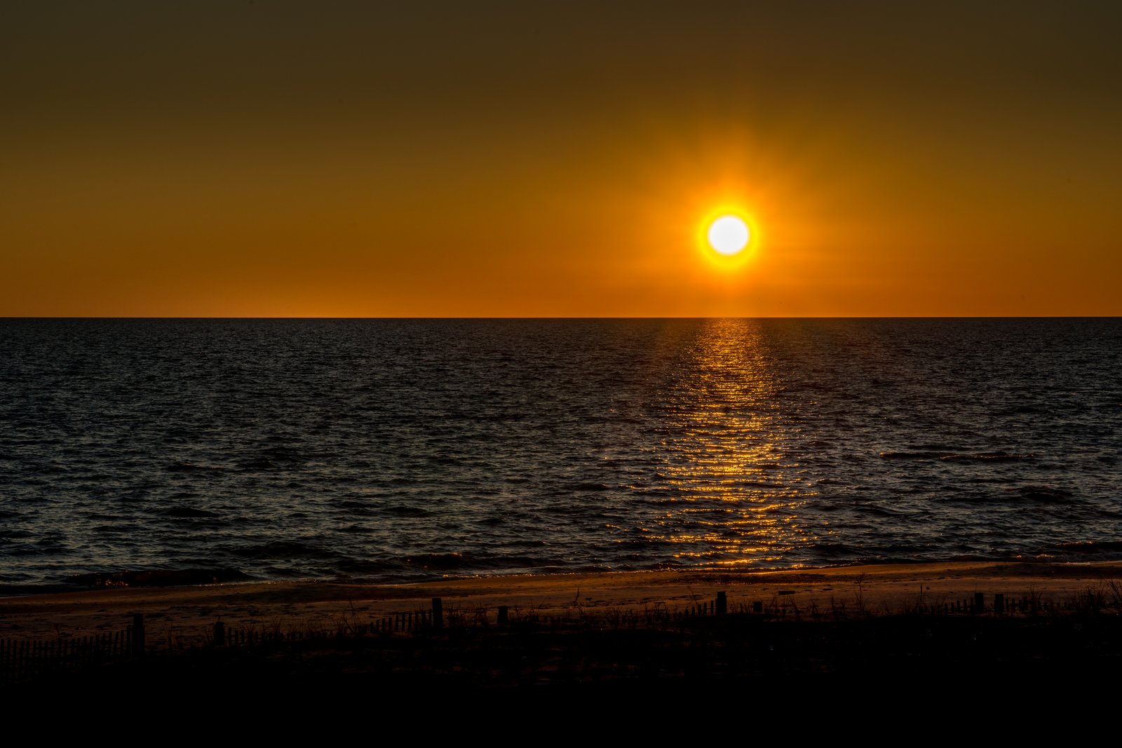
Gulf Coast Mississippi
by Rick Billings, M. Photog., Cr.
The setting sun lays a bright path across the calm Mississippi Sound, seen from the edge of the dunes on Mississippi's Gulf Coast, with wooden sand fencing and beach grass in silhouette above the shore. Key Features: The Beach: Part of what is often called the world's largest man-made beach, running 26 miles along coastal Mississippi. The Water: Barrier islands several miles offshore buffer the mainland from the open Gulf of Mexico, keeping the water calm. The Dune Fencing: Slat fences and native grasses trap sand and hold the dunes against erosion. The Light: This east-west coastline catches long reflections like this when the sun is low.
Prints from $22Downloads from $19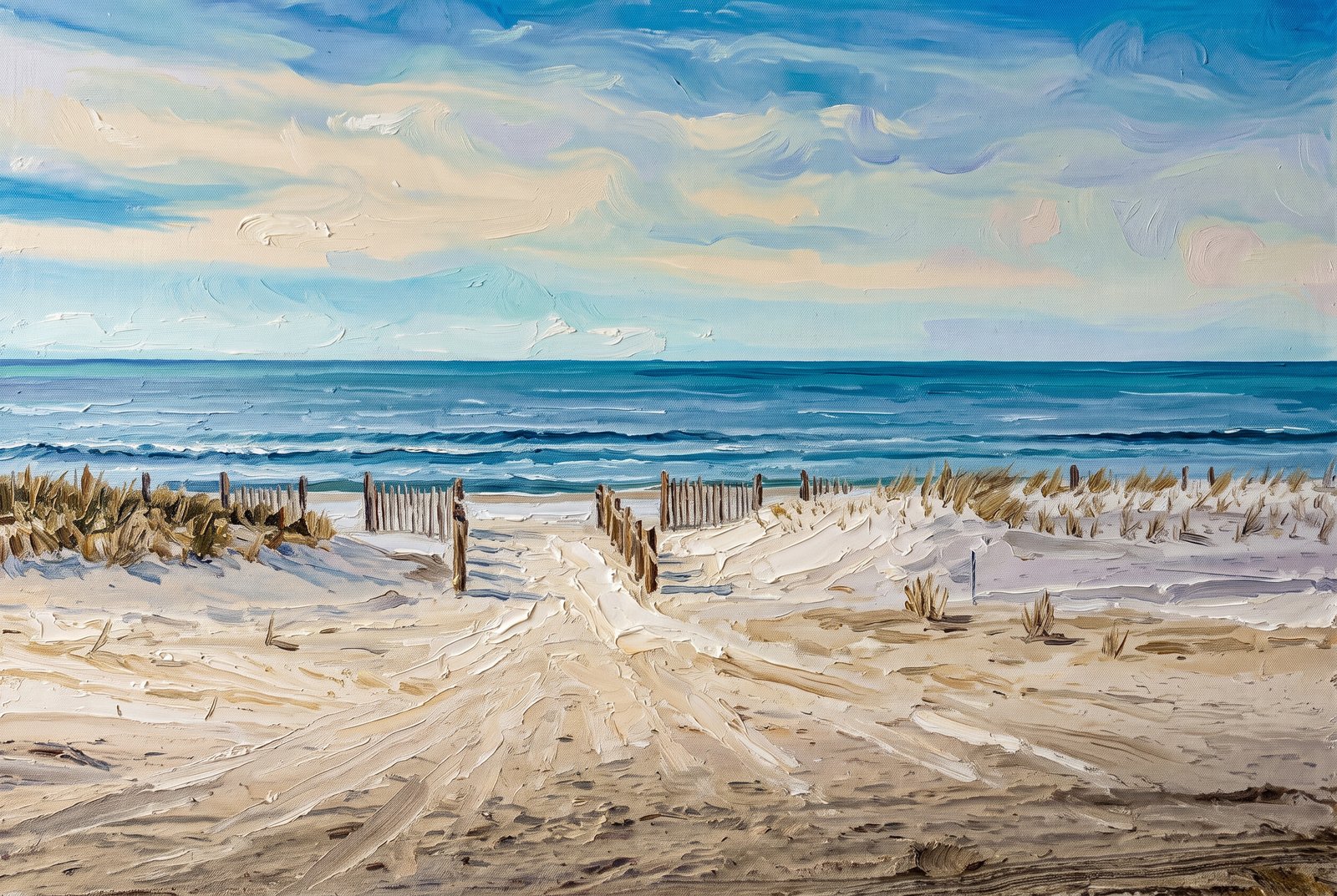 Painterly
Florida Panhandle
by Rick Billings, M. Photog., Cr.
Mexico Beach, Florida
A walkway cuts through low dunes of sea oats and beach grass to the Gulf of Mexico at a public beach access in Mexico Beach, on Florida's Panhandle, lined by a wooden sand fence that leads the eye past a strip of white sand to gentle breaking waves. Key Features: The Coastline: Mexico Beach, in Bay County, is known for a quiet, undeveloped shore compared with the Panhandle's bigger resort towns. Dune Restoration: Volunteers and city leaders have rebuilt the dunes with slatted fencing that traps sand and helps sea oats grow, keeping the beach open and the town protected from storms. Storm Recovery: The town took the brunt of Hurricane Michael, a Category 5 storm that came ashore in October 2018, and its dunes have been rebuilt as part of its recovery.
Prints from $41Prints only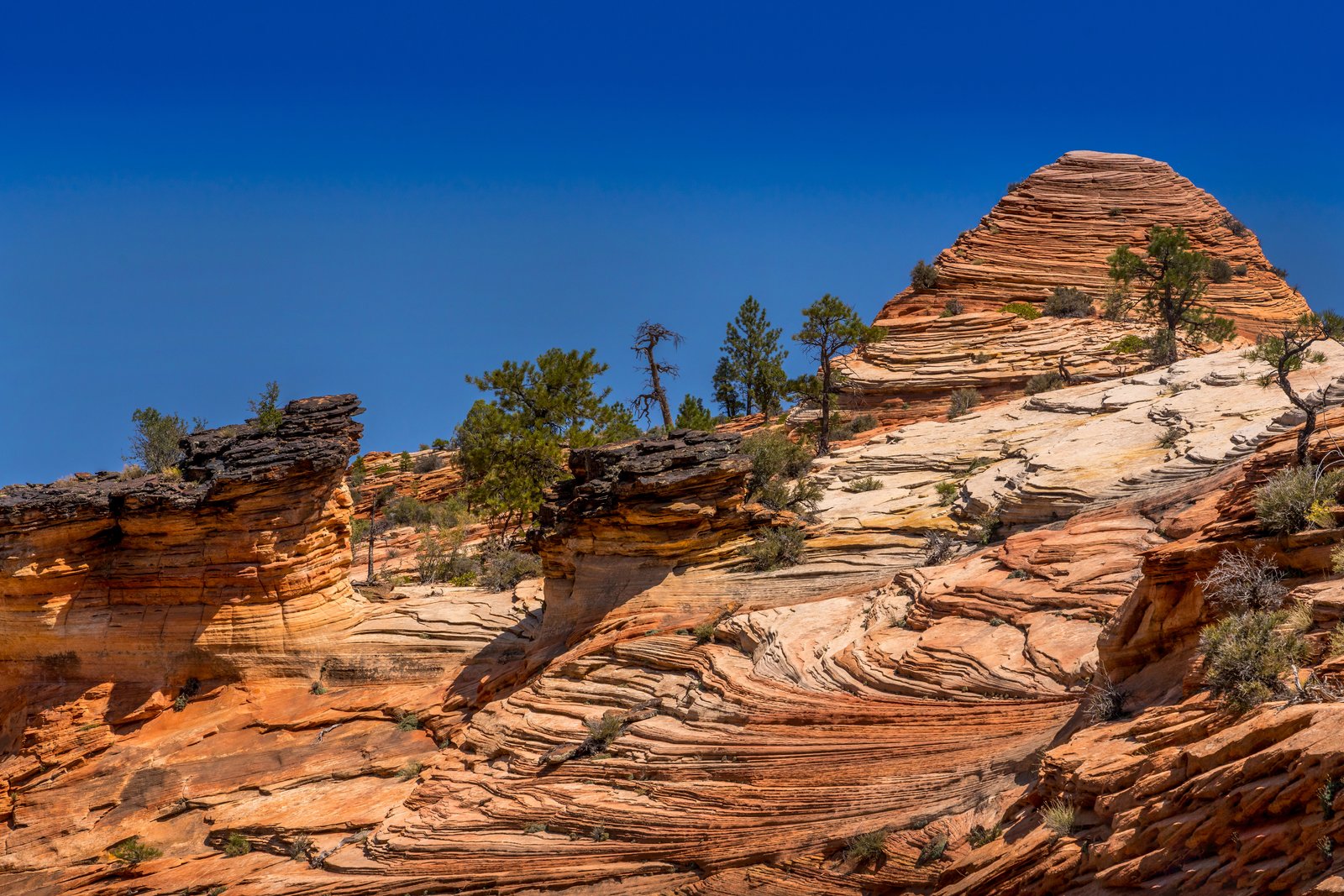
Zion National Park Utah
by Rick Billings, M. Photog., Cr.
A sweeping slope of pale orange Navajo Sandstone rises toward a rounded, wind-sculpted dome on the east side of Zion National Park in southern Utah, its surface etched with fine cross-bedded lines, with pinyon pine and juniper clinging to the cracks under a deep, cloudless sky. Key Features: The Rock Layers: The wavy stripes are cross-bedding, the fossil traces of ancient sand dunes preserved in the Navajo Sandstone. The Formation: Navajo Sandstone is one of Zion's most prominent formations, forming its towering cliffs and monoliths. The Desert Origin: The rock records a time when wind-driven dunes covered a vast area, later cemented into stone. The Setting: Hardy pines and shrubs root right in the slickrock of the high desert plateau around Zion.
Prints from $22Downloads from $19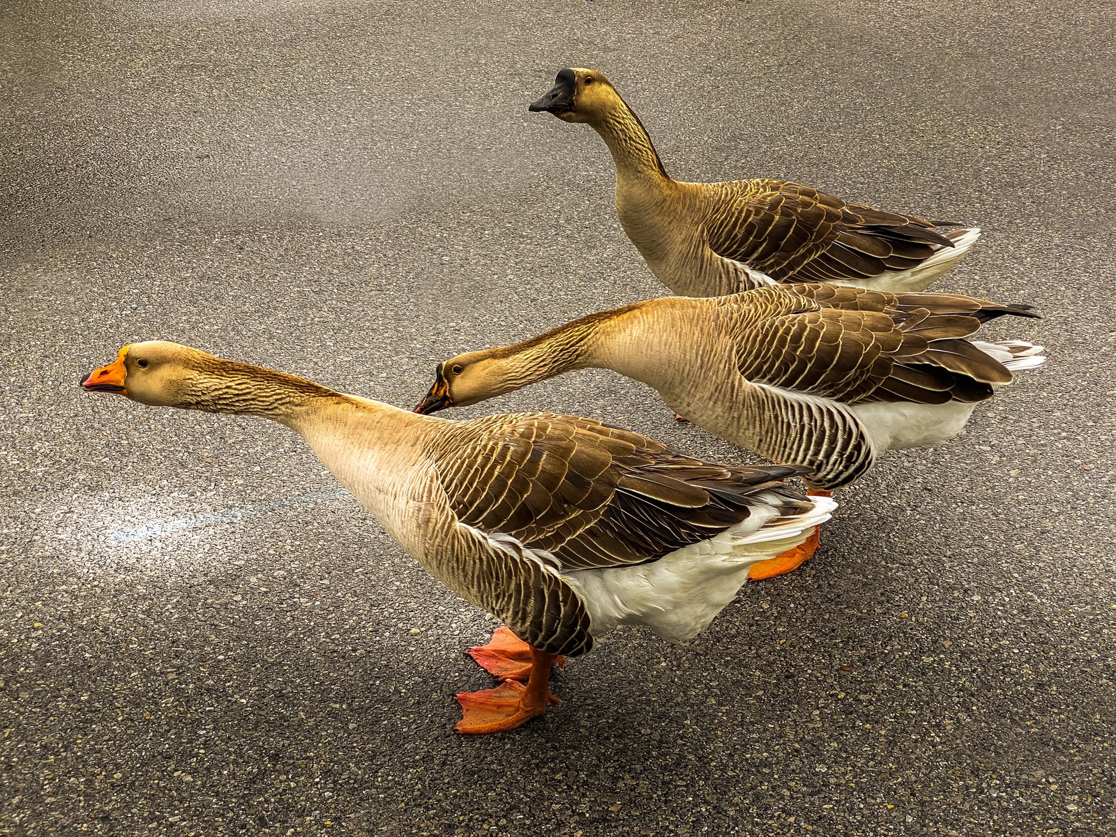
Gulf Coast Ducks
by Rick Billings, M. Photog., Cr.
Panama City, Florida
Three domestic geese amble single file across a quiet paved lane in Panama City, Florida, seen low and close at goose level, the lead bird's bright orange bill and feet standing out against the muted gray asphalt. Key Features: The Birds: Farmyard geese, heavier than wild Canada geese, with the buff brown feathers and orange bill and legs of domestic breeds kept around Florida's ponds and parks. The Setting: Panama City sits on the Gulf of Mexico in the Florida Panhandle, known for its beaches, bayous and waterside parks. The Composition: Shooting from the ground along their line of travel turns an everyday crossing into a study of texture and color.
Prints from $22Downloads from $19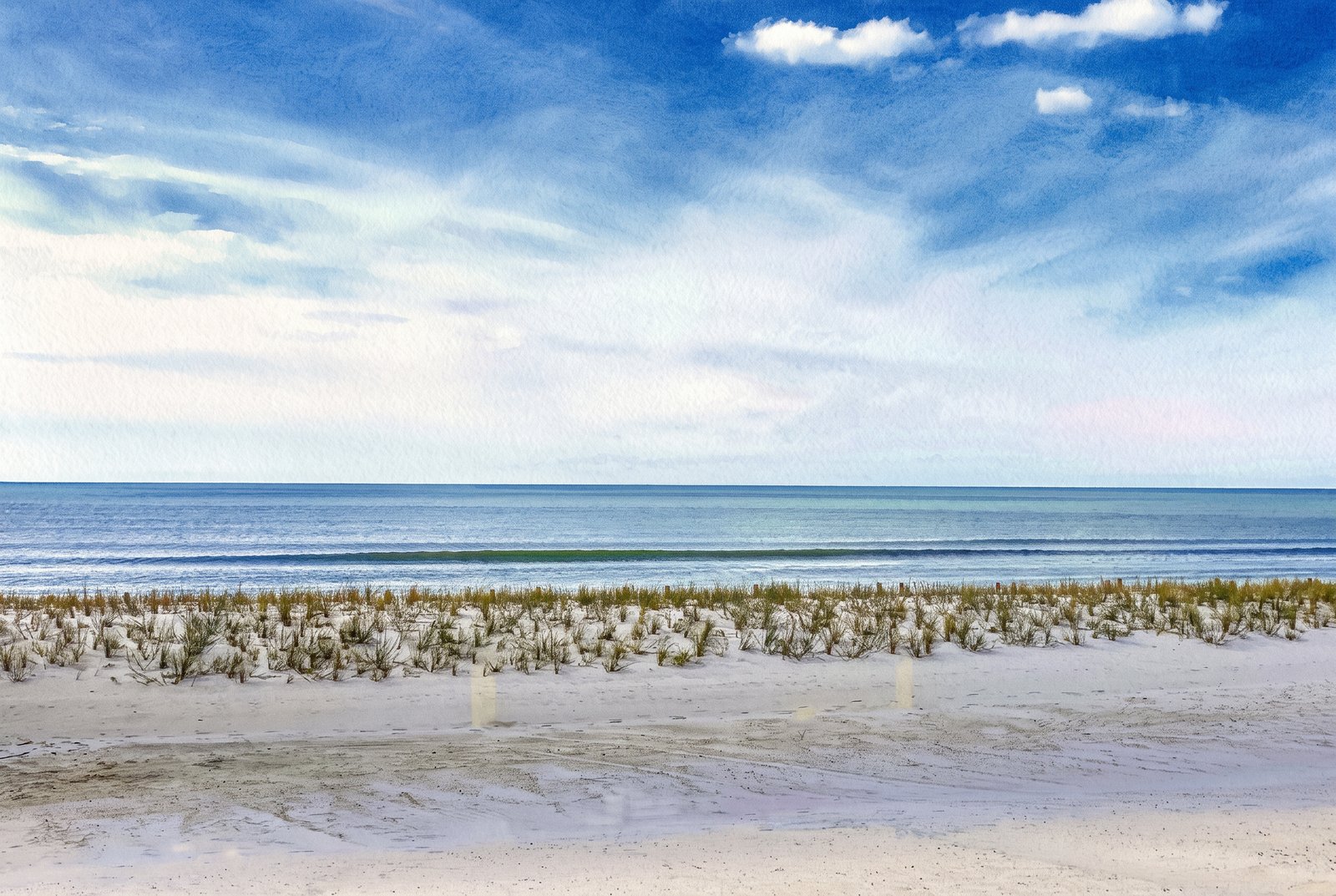 Watercolor
Gulf Coast Mississippi
by Rick Billings, M. Photog., Cr.
Mexico Beach, Florida
Sea oats and beach grass hold a low foredune along an undeveloped stretch of the Gulf Coast, looking seaward to a gentle wave line breaking just offshore under a wide, partly clouded sky. Key Features: The Dune Grasses: Sea oats and other native grasses trap blowing sand and anchor the dunes, the coast's first defense against storms. The Shore: Wide, quiet beaches like this one line much of the northern Gulf of Mexico. The Light: A soft, partly clouded sky keeps the sand, grass and water in gentle tones.
Prints from $41Prints only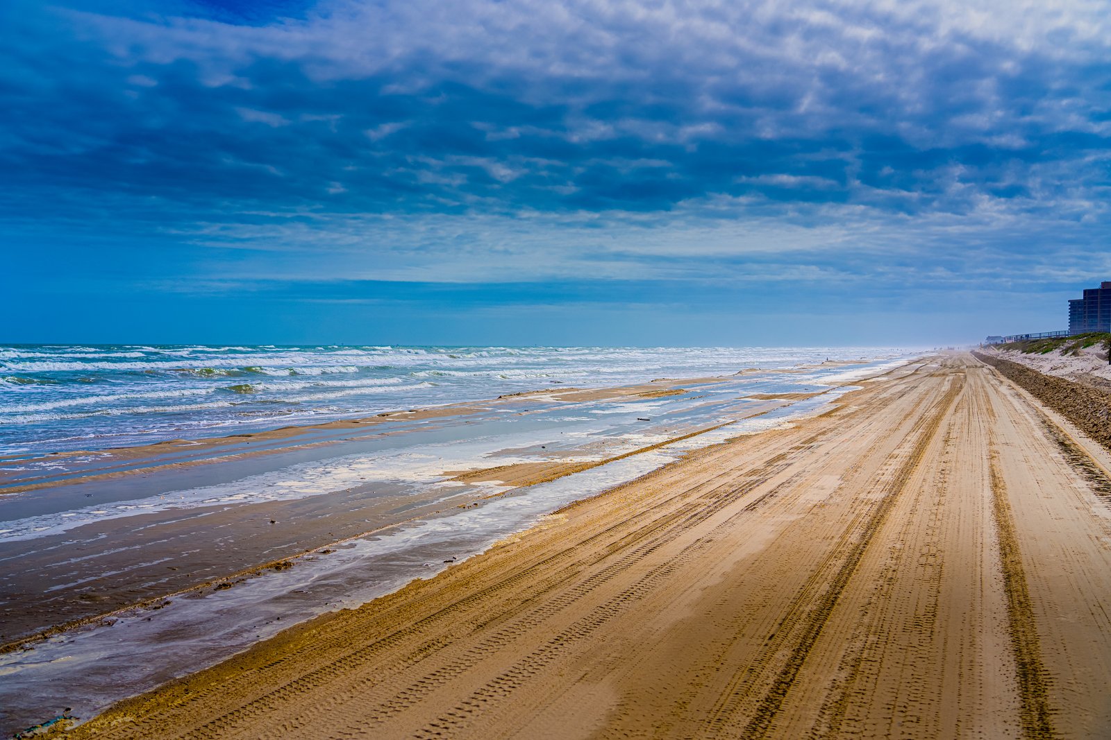
1182 Corpus Christi TX
by Rick Billings, M. Photog., Cr.
Surf rolls in beside a wide, packed-sand track scored with tire ruts on a drivable beach near Corpus Christi, Texas, running toward the horizon past low dunes and beachfront condominiums fading into haze. Key Features: Drivable Shoreline: Corpus Christi's Gulf beaches are among the few in the country where cars can drive right onto the sand. The Barrier Islands: The beaches face the Gulf from the chain of barrier islands in front of Corpus Christi Bay, including Mustang Island and Padre Island. The Beachfront: Distant high-rises mark the developed resort stretch, beyond the open sand and dunes in front. The Weather: Heavy cloud with breaks of blue and blowing sea spray make for a breezy, changeable Gulf day.
Prints from $22Downloads from $19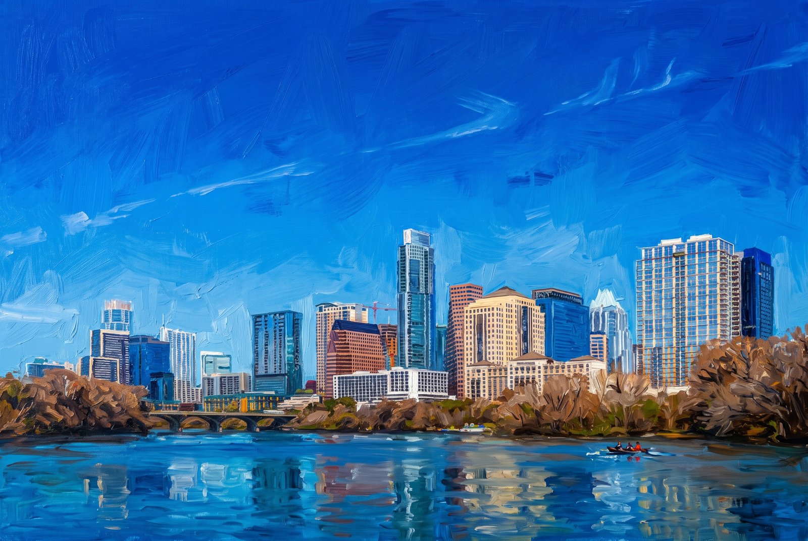 Painterly
1179 Austin Texas
by Rick Billings, M. Photog., Cr.
Downtown Austin, Texas, rises along the north bank of Lady Bird Lake, seen from the south shore across the water, with a low pedestrian bridge crossing in front and bare winter trees lining the bank. Key Features: The Skyline: Among the towers are several of Austin's tallest, including the Frost Bank Tower, the Austonian and the Four Seasons. Lady Bird Lake: The lake is the Colorado River, dammed in 1960, curving through the heart of the city. Rapid Growth: Hotels and residential towers have filled in the downtown skyline, among them the Austonian, for years the city's tallest building. The Waterfront: The trails and parks along the lake, from Butler Metro Park to Lou Neff Point near Zilker Park, are classic places to see the skyline over the river.
Prints from $41Prints only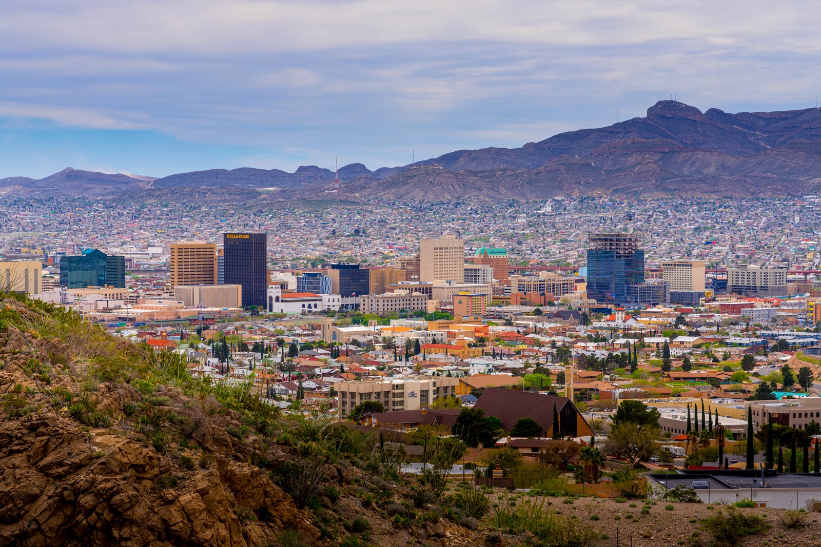
Glance Into Mexica From El Paso, Texas
by Rick Billings, M. Photog., Cr.
From a rocky overlook on Scenic Drive in the foothills of the Franklin Mountains, desert scrub and boulders give way to the rooftops, church spires and mid-rise towers of downtown El Paso, Texas, including the Wells Fargo building, with the neighborhoods of Ciudad Juarez, Mexico, spreading across the haze beyond. Key Features: The Vantage Point: Scenic Drive is a two-lane road that climbs to a point 500 feet above the city and the Rio Grande. The Sister Cities: Its overlooks take in the El Paso skyline, Juarez and the country around them. The Mountains: The Franklin Mountains rise just north of downtown, with overlooks along both Rim Road and Scenic Drive. The Border City: El Paso faces Juarez across the Rio Grande, together one of the largest binational metro areas in the Western Hemisphere.
Prints from $22Downloads from $19