

Collection
USA
By · 80 photos
 Impressionist
Cripple Creek Gold Mine
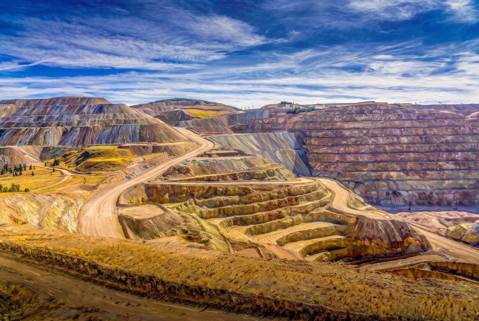
Terraced benches of blasted rock spiral down in tan, rust and gray bands into the vast open pit of the Cripple Creek and Victor Gold Mine in Teller County, Colorado, as switchback haul roads climb the slopes and timbered ridges frame the dig under a wide Rocky Mountain sky. Key Features: The Legacy: The richest gold mine in Colorado history and the state's only remaining major gold producer. Underground Years: Underground mining here declined as the gold ran out and stopped in 1962. The Open Pit: Large-scale pit mining began in 1994, and by the 2000s the mine was producing hundreds of thousands of ounces of gold a year. A Living Boomtown: Cripple Creek is one of the few historic boomtowns in the West with an active mine.
Prints from $41Prints only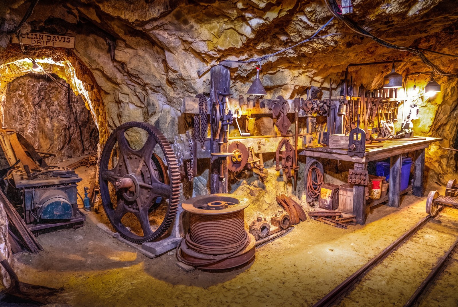 Painterly
Cripple Creek 1000 Feet Down
A thousand feet underground in the Mollie Kathleen Gold Mine near Cripple Creek, Colorado, a wooden sign marks the Julian Davis Drift, one of the mine's named tunnels, above the drilling gear, cable spool, gear wheels and rail tracks left from its working decades. Key Features: The Discovery: The mine is named for Mollie Kathleen Gortner, who in 1891 became the first woman in the Cripple Creek camp to discover gold and stake a claim in her own name. The Depth: The vertical shaft drops 1,000 feet, about the height of the Empire State Building. The Tour: It is the only 1,000-foot vertical shaft gold mine tour in the United States, with original drills, winches and drifts still in place.
Prints from $41Prints only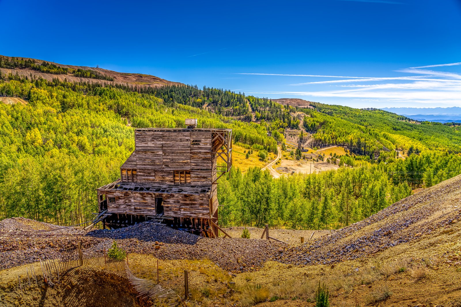
Cripple Creek CO
A weathered timber headframe and ore house from one of the district's turn-of-the-century gold mines stand among gravel tailings in a wooded gulch on the southwest flank of Pikes Peak, with golden aspen and evergreen slopes rolling toward distant peaks under a deep blue sky. Key Features: The Gold Camp: At about 10,000 feet on Pikes Peak's southwest shoulder, Cripple Creek is the world's highest major gold mining district. The Mine Structures: Headframes and ore houses like this hoisted ore from the shafts below and still dot the hillsides. The Landscape: Aspen and pine, gold in autumn, now reclaim the tailings and old wagon roads. The Legacy: A National Historic Landmark since 1961, Cripple Creek calls itself "the World's Greatest Gold Camp."
Prints from $22Downloads from $19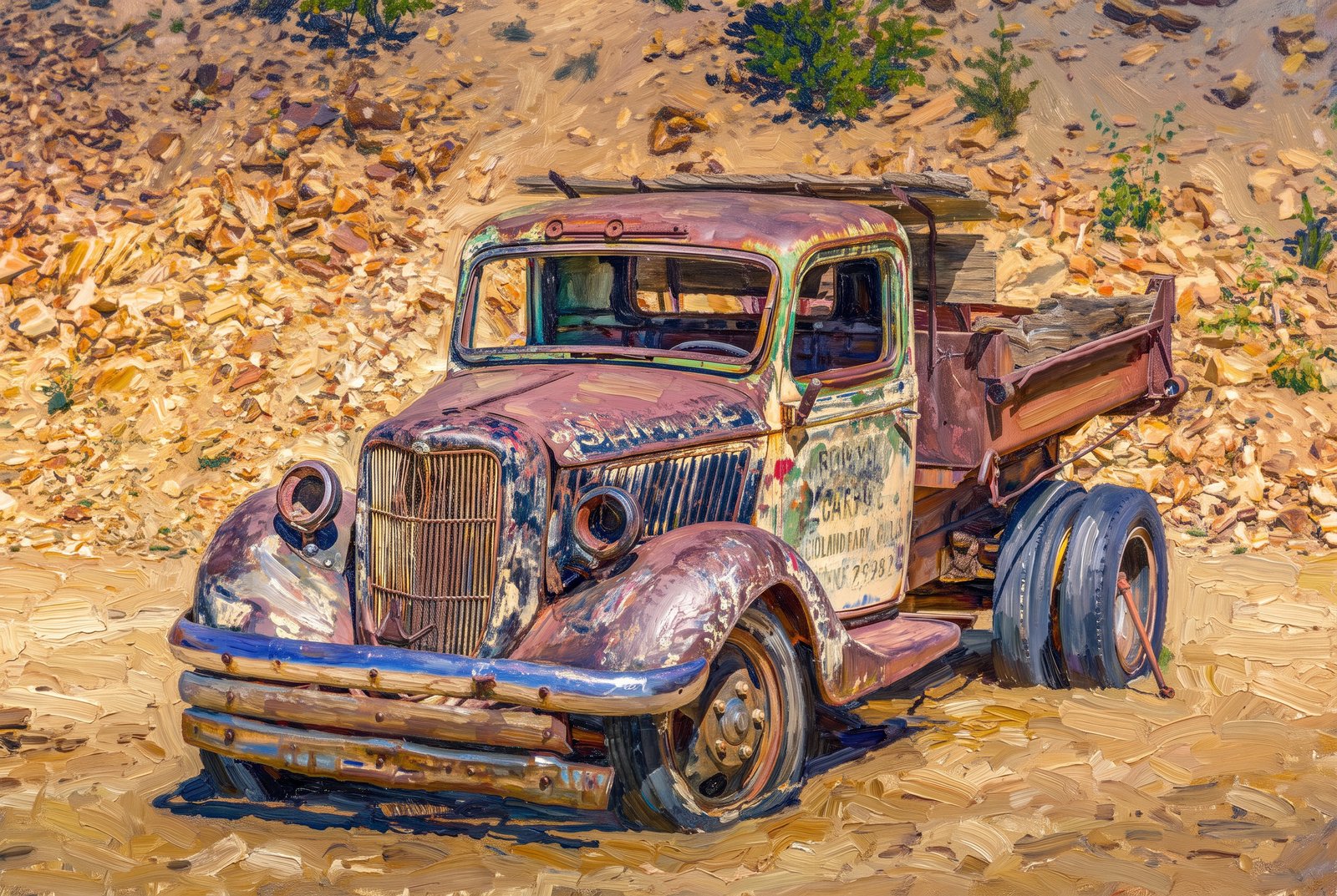 Impressionist
Cripple Creek CO
The rusted hulk of a vintage flatbed dump truck sits low on flat, cracked tires among the waste piles of the Cripple Creek mining district in central Colorado. Its cab windows are shattered and its body streaked with rust, blue paint and green oxidation, and faded lettering on the door still names a garage in nearby Woodland Park. Key Features: The Location: Cripple Creek, a historic gold camp high in the Rockies southwest of Colorado Springs. Mining Heritage: Cripple Creek was named a National Historic Landmark in 1961, preserving its gold rush character. The Truck: A retired work truck from a Woodland Park garage, now a relic of the hauling that kept the mines running.
Prints from $41Prints only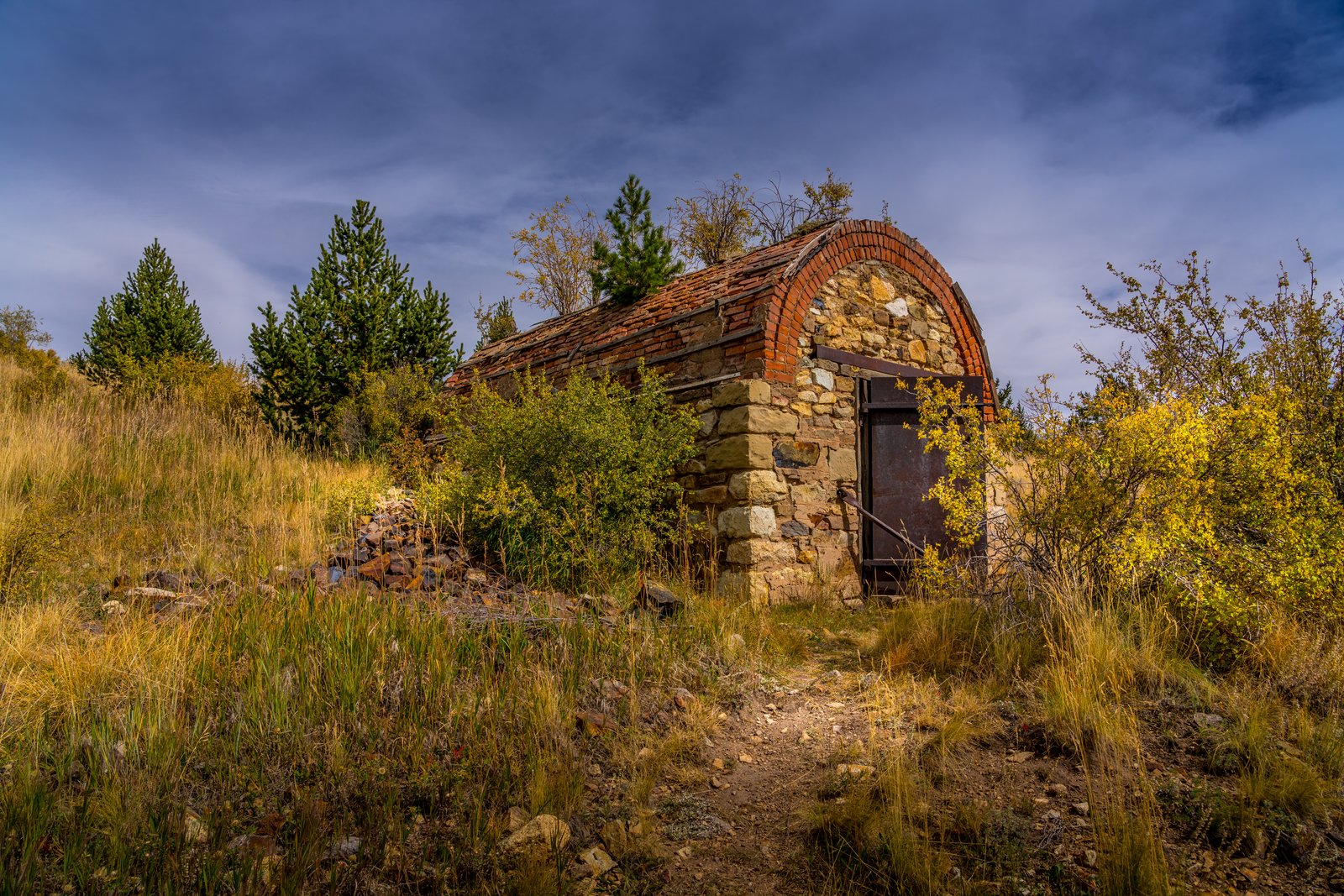
Cripple Creek CO
A stone and brick barrel-arched powder magazine with a heavy rusted iron door is set into a hillside in the Cripple Creek Mining District of Teller County, Colorado, among autumn grass and pines along an old mining trail. Small fireproof vaults like this kept dynamite and blasting caps safely away from the mine workings. Key Features: The Structure: Larger mines built brick magazines for their explosives, with heavy metal doors locked against theft. The Purpose: Mines often kept two, one for dynamite and one for the primers that set it off, apart from the working shafts. The District: With gold found at Victor and Cripple Creek in the late 1800s, this became the second-largest gold mining district in the country. The Setting: Weathered stone, a curved tile and brick roof, and scrub oak and pine make this one of the district's many mining relics in the Colorado high country.
Prints from $22Downloads from $19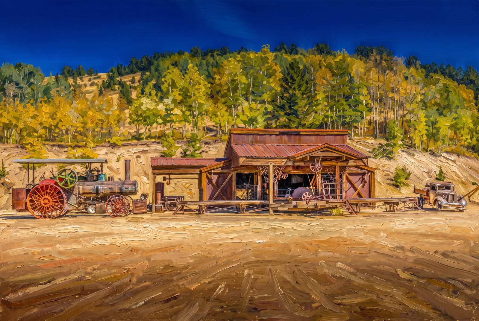 Painterly
Cripple Creek Colorado
An old wooden garage with a rust-colored corrugated roof stands at Victor's Gold Camp Ag and Mining Museum, between a vintage steam tractor with big red wheels and an antique automobile, with golden aspen turning on the hillside behind under a deep blue mountain sky. Key Features: The Museum: More than a display of tractors, vehicles and old equipment, this rugged three-story museum is also a working garage. The Machinery: Visitors can watch a system of pulleys and belts drive the large machines a garage like this once used. The Blacksmith Shop: An old forge, with hammer and anvil, is still used here today. The Region: The museum sits in the Cripple Creek and Victor gold district of Teller County, famous for its 1890s gold rush.
Prints from $41Prints only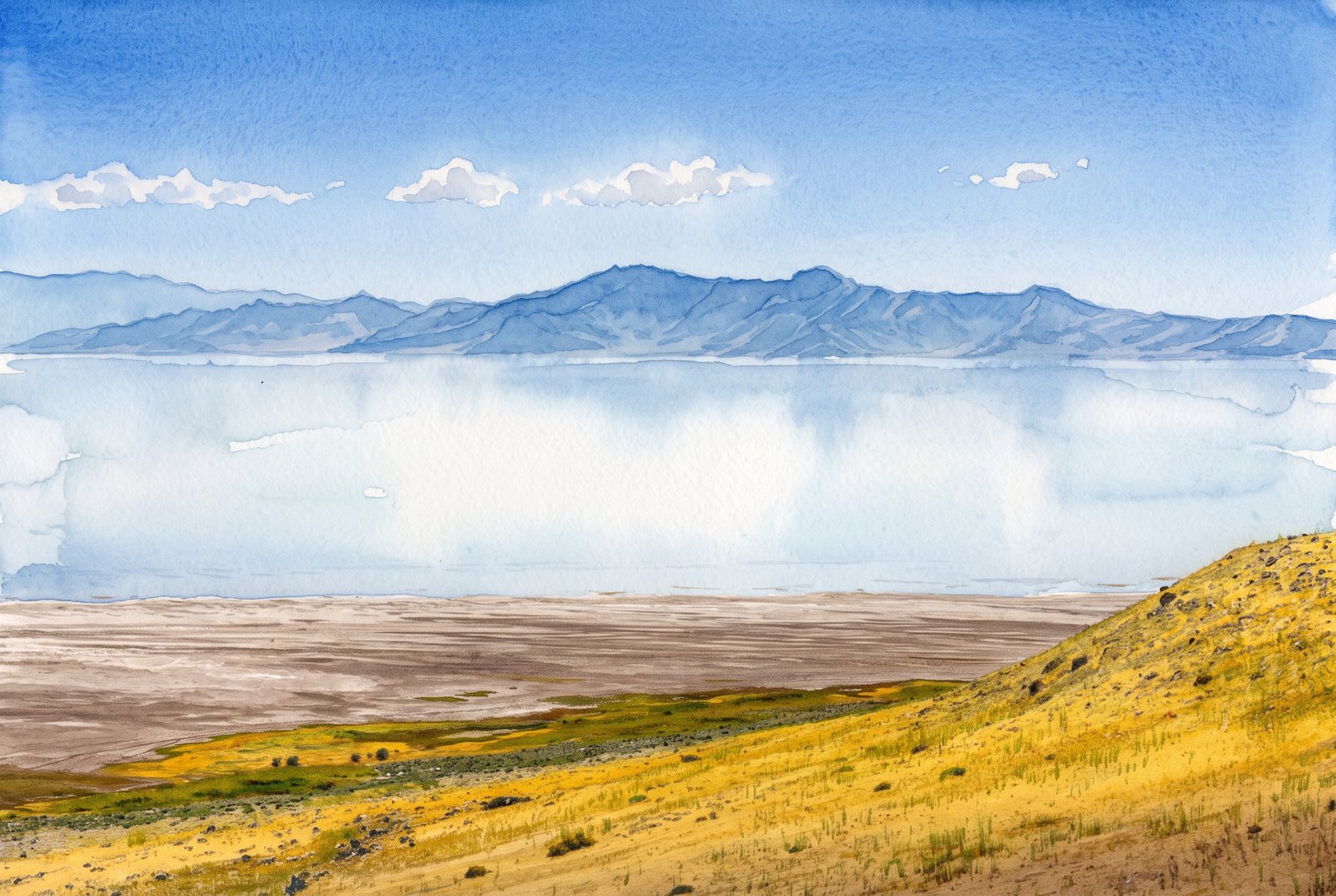 Watercolor
Farmington Bay Utah
From the golden grass and sage slopes of Antelope Island, Farmington Bay lies mirror-still across the eastern arm of Utah's Great Salt Lake, with the jagged Wasatch Range rising through a thin haze and doubled in the pale blue water. Key Features: Antelope Island: The largest island in the Great Salt Lake runs about fifteen miles north to south, shielding Farmington Bay, and rises from 4,200 to 6,600 feet. The Far Shore: Beyond the water, the Wasatch Mountains rise behind the towns of Clearfield, Layton, Farmington and Bountiful. The View: The island's trails give an elevated look across the lake and the surrounding mountains.
Prints from $41Prints only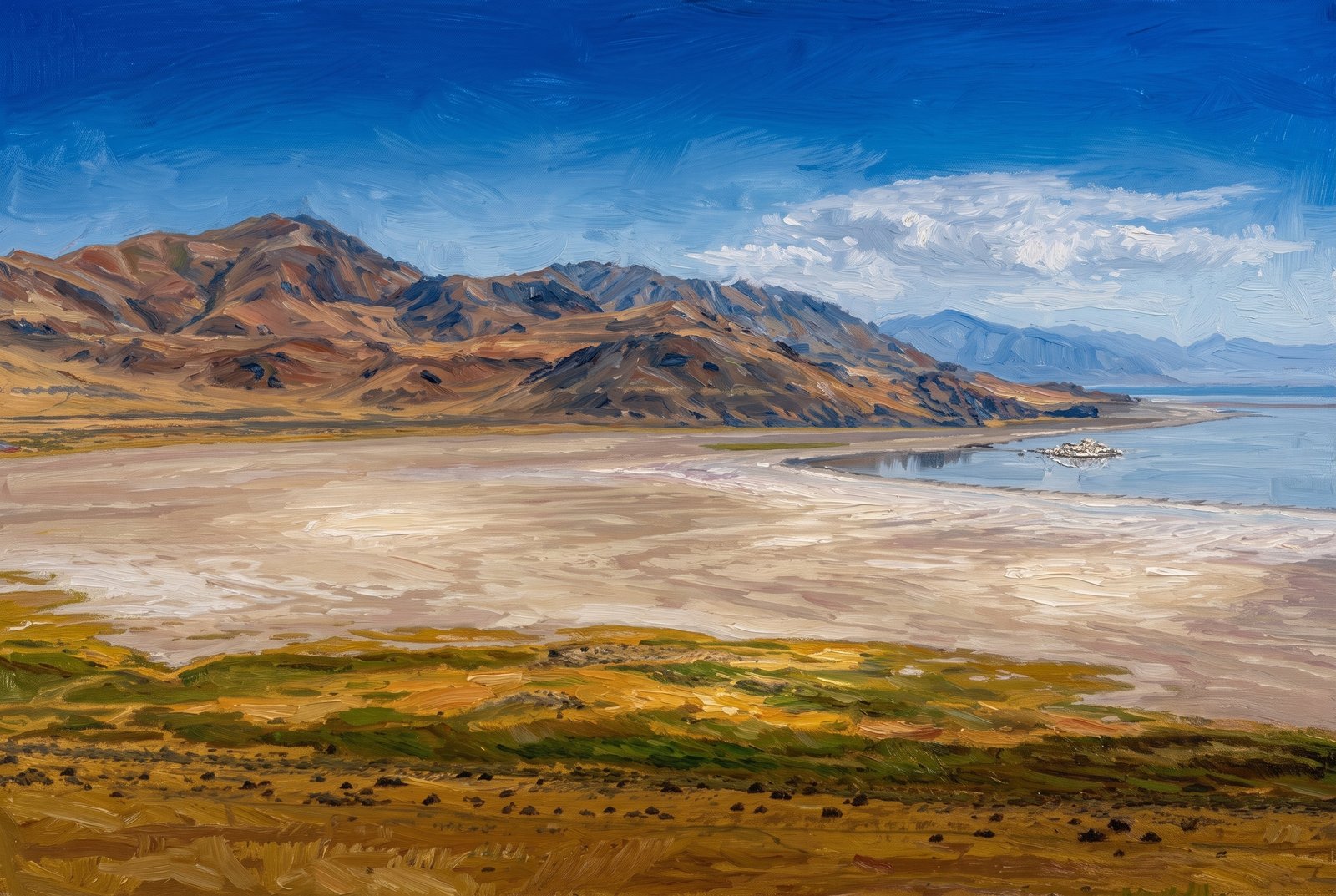 Painterly
Farmington Bay Utah
Across Farmington Bay on Utah's Great Salt Lake, a wide tan expanse of exposed lakebed lies where the shoreline has retreated, with grassy wetland flats in front and the arid slopes of Antelope Island's mountains rising to the north and west. Key Features: The Setting: The Wasatch Mountains rise on the far side of the bay, beyond Clearfield, Layton, Farmington and Bountiful. The Island: Antelope Island, the largest in Great Salt Lake, is part of the Basin and Range province that stretches from the Wasatch to the Sierra Nevada. The Shrinking Lake: Falling water levels have left the lakebed bare, and storms whip its dust, laden with heavy metals, across the region.
Prints from $41Prints only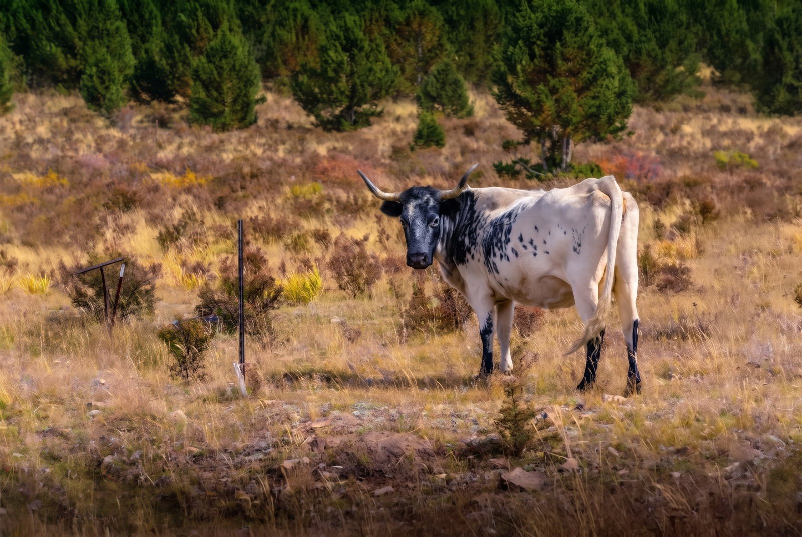 Impressionist
Cripple Creek CO
A black and white spotted cow stands by an old fence post in a hillside pasture of autumn grass near Cripple Creek, Colorado, gazing straight at the camera in front of a stand of young lodgepole pines. Key Features: The Town: Cripple Creek, a former gold rush town in the mountains west of Colorado Springs, sits at about 9,375 feet. Before the Gold: The valley was cattle range for years before the gold strike that made the town famous. The Scene: Cattle still graze these open slopes, an echo of the ranching life that came before the mining boom.
Prints from $41Prints only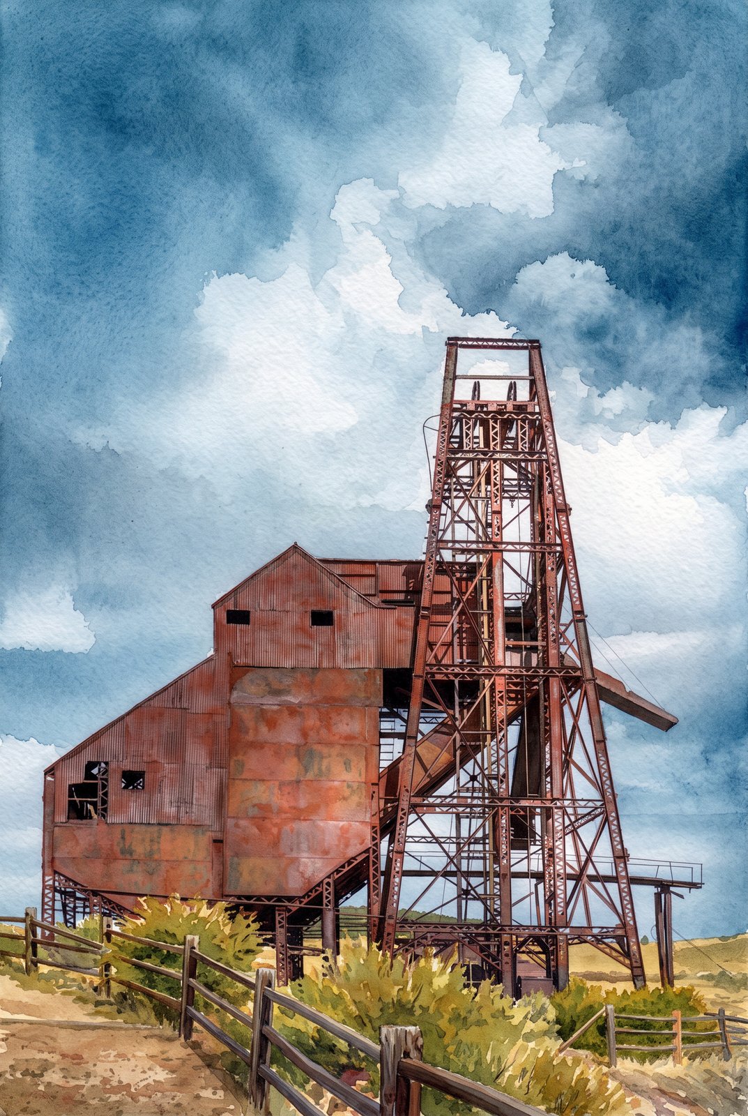 Watercolor
Cripple Creek CO
The weathered steel headframe and corrugated hoist house of the Ajax Mine stand against a wide Colorado sky on the lower slopes of Squaw Mountain, just northwest of Victor in the Cripple Creek Mining District, surrounded by autumn brush and open range. Key Features: The Mine: Built in 1895, the Ajax was one of the district's more productive mines and one of its last big underground operations. Rehabilitation: In the 1970s its headframe was stabilized and a new hoist installed, and the mine kept working until the 1980s. The Setting: The mine stands above Victor, in what was once one of the richest gold camps in the American West. The Structure: The tall steel headframe lowered miners into the shaft and hoisted ore up to the rusted metal ore bin still standing beside it.
Prints from $41Prints only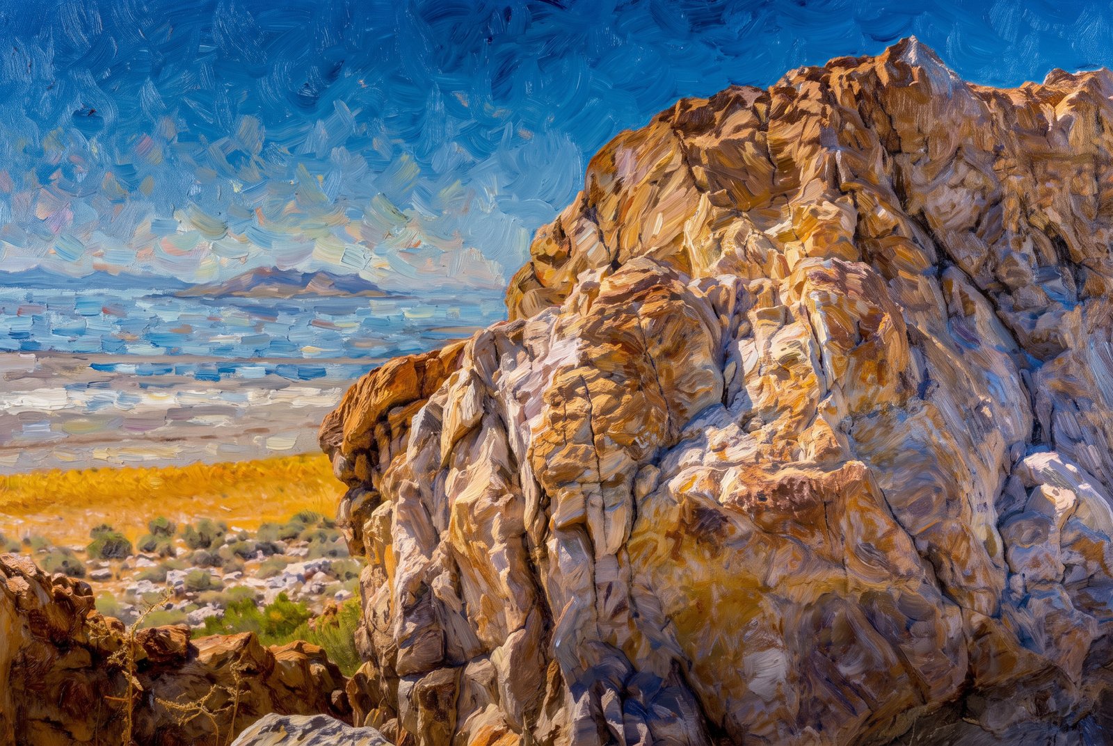 Impressionist
Farmington UT
On the rugged shore of Antelope Island, a weathered outcrop of ancient banded rock frames a view northeast across the shimmering Great Salt Lake toward Farmington Bay, with salt flats, golden grass and hardy desert shrubs below and distant ridgelines fading into haze. Key Features: The Rock: The outcrop belongs to the Farmington Canyon Complex, banded and contorted metamorphic rock that is among the oldest exposed in Utah. The Island: Antelope Island, the largest in the Great Salt Lake, is reached by a seven-mile causeway road from the mainland. The View: Pullouts along this shore look across Farmington Bay to the Wasatch Mountains. Wildlife: The state park is home to bison herds and is known for birdwatching, hiking and photography.
Prints from $41Prints only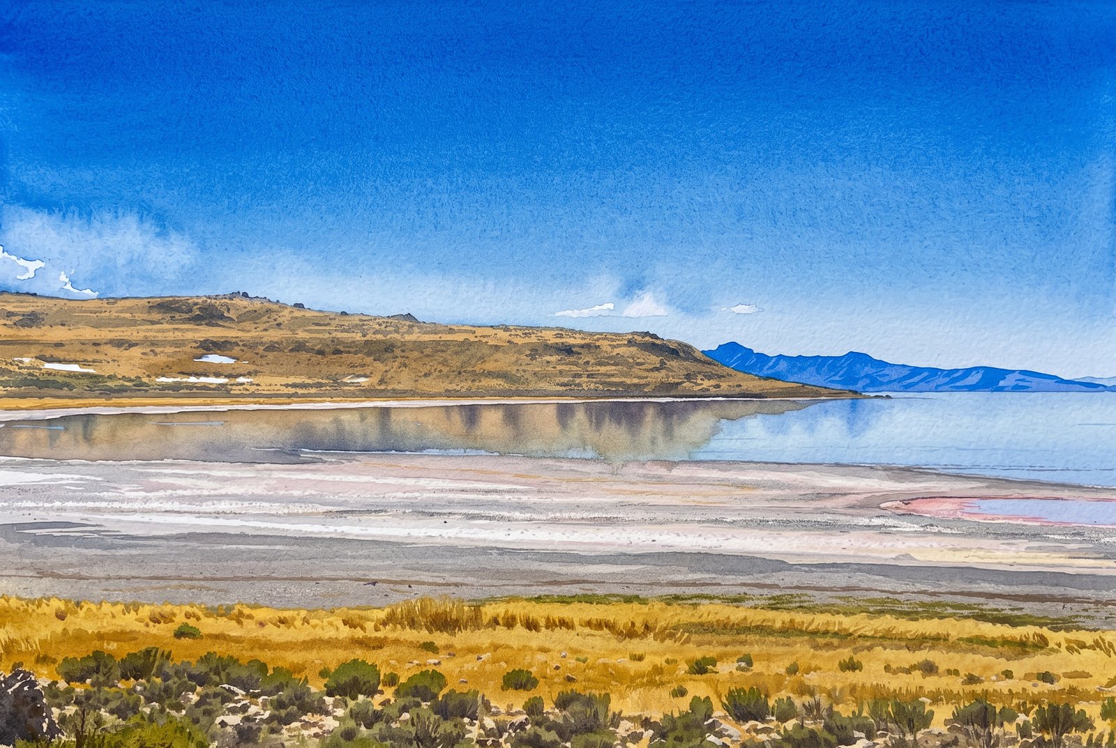 Watercolor
Farmington Bay Utah
From the marshy mainland shore of Farmington Bay, bands of salt flat and sunbaked mud left by receding water lead out to the low, rugged silhouette of Antelope Island across the southeastern arm of the Great Salt Lake. Key Features: The Bay: Farmington Bay lies between Antelope Island and the lake's southeast corner, where the Jordan River brings in water from Utah Lake. Wildlife: Thanks to that fresh water, it is one of only two places in the lake where fish live, and an important stopover for migrating waterfowl. The Island: At 42 square miles, Antelope Island is the largest of the ten islands in the Great Salt Lake. The Shoreline: The pale crust at the water's edge is mineral left behind as the shallow, salty lake rises and falls with the seasons.
Prints from $41Prints only Painterly
Mississippi Gulf Coast
The sun drops toward the horizon over the calm Mississippi Sound, seen low from the wide, gently sloping beach along Highway 90, with marsh grass and driftwood marking the tideline and a faint sandbar far to the right. Key Features: The Beach: This sand beach runs 26 miles along the Mississippi Gulf Coast and is 300 feet wide, one of the largest man-made beaches in the world. The Roadway: U.S. Highway 90, the Old Spanish Trail, runs right alongside, with water views the whole way. The Waters: The Mississippi Sound is shallow and sheltered from the open Gulf by a chain of barrier islands, which keeps its waves gentle.
Prints from $41Prints only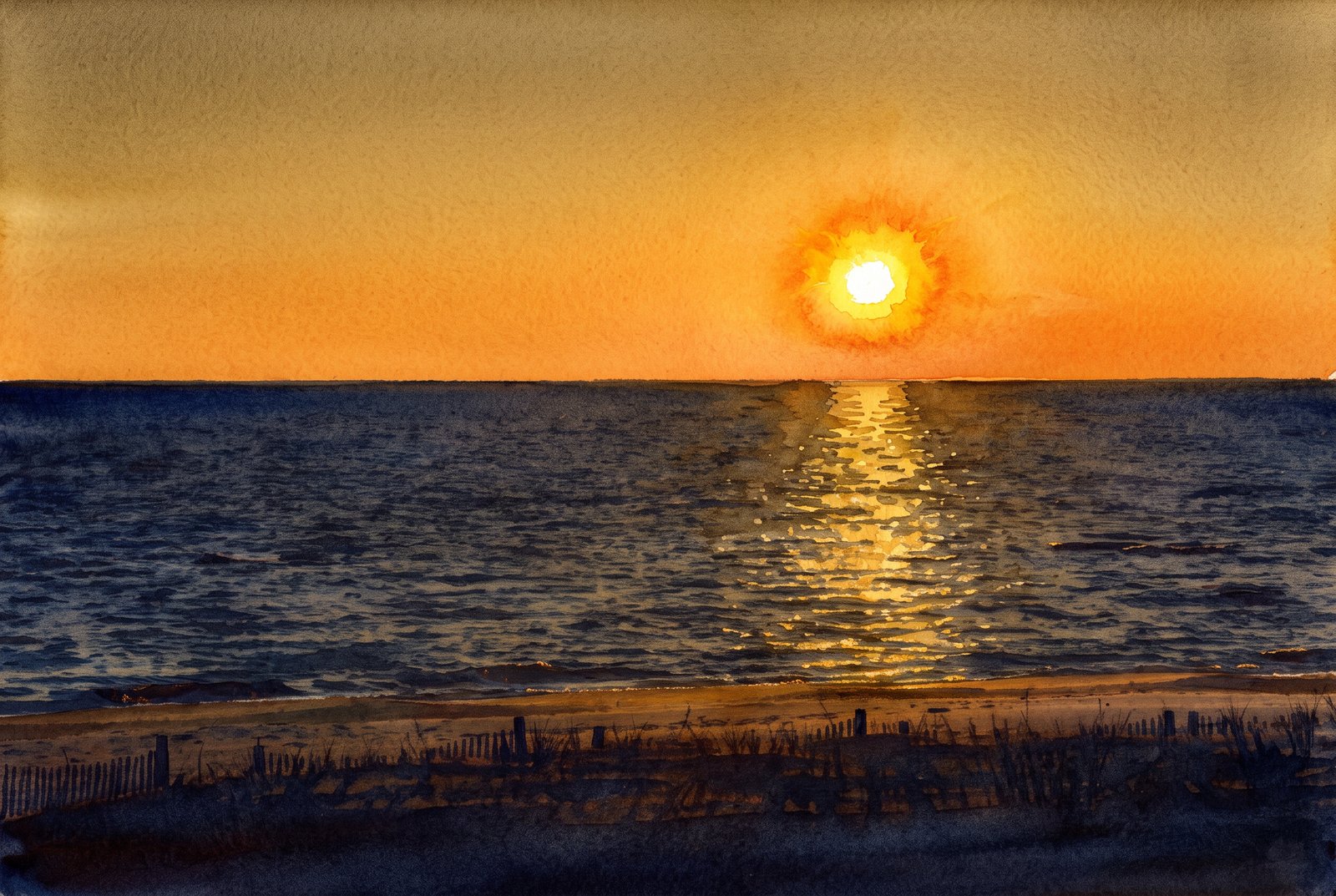 Watercolor
Gulf Coast Mississippi
The setting sun lays a bright path across the calm Mississippi Sound, seen from the edge of the dunes on Mississippi's Gulf Coast, with wooden sand fencing and beach grass in silhouette above the shore. Key Features: The Beach: Part of what is often called the world's largest man-made beach, running 26 miles along coastal Mississippi. The Water: Barrier islands several miles offshore buffer the mainland from the open Gulf of Mexico, keeping the water calm. The Dune Fencing: Slat fences and native grasses trap sand and hold the dunes against erosion. The Light: This east-west coastline catches long reflections like this when the sun is low.
Prints from $41Prints only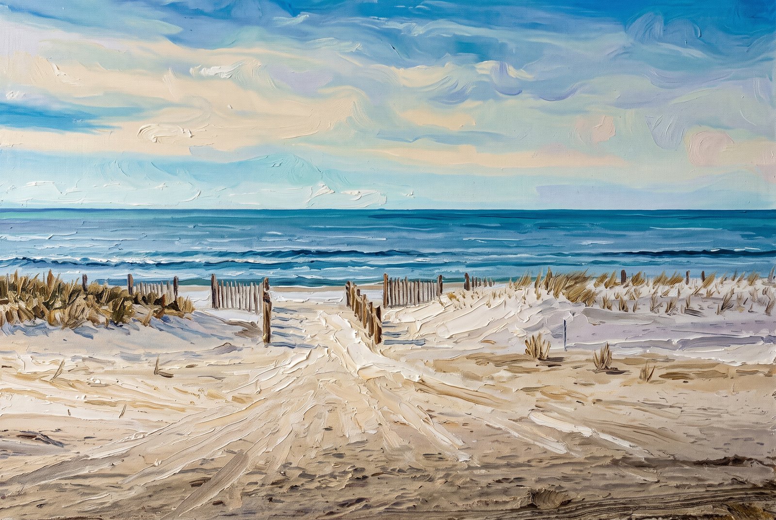 Painterly
Florida Panhandle
Mexico Beach, Florida
A walkway cuts through low dunes of sea oats and beach grass to the Gulf of Mexico at a public beach access in Mexico Beach, on Florida's Panhandle, lined by a wooden sand fence that leads the eye past a strip of white sand to gentle breaking waves. Key Features: The Coastline: Mexico Beach, in Bay County, is known for a quiet, undeveloped shore compared with the Panhandle's bigger resort towns. Dune Restoration: Volunteers and city leaders have rebuilt the dunes with slatted fencing that traps sand and helps sea oats grow, keeping the beach open and the town protected from storms. Storm Recovery: The town took the brunt of Hurricane Michael, a Category 5 storm that came ashore in October 2018, and its dunes have been rebuilt as part of its recovery.
Prints from $41Prints only
Gulf Coast Ducks
Panama City, Florida
Three domestic geese amble single file across a quiet paved lane in Panama City, Florida, seen low and close at goose level, the lead bird's bright orange bill and feet standing out against the muted gray asphalt. Key Features: The Birds: Farmyard geese, heavier than wild Canada geese, with the buff brown feathers and orange bill and legs of domestic breeds kept around Florida's ponds and parks. The Setting: Panama City sits on the Gulf of Mexico in the Florida Panhandle, known for its beaches, bayous and waterside parks. The Composition: Shooting from the ground along their line of travel turns an everyday crossing into a study of texture and color.
Prints from $22Downloads from $19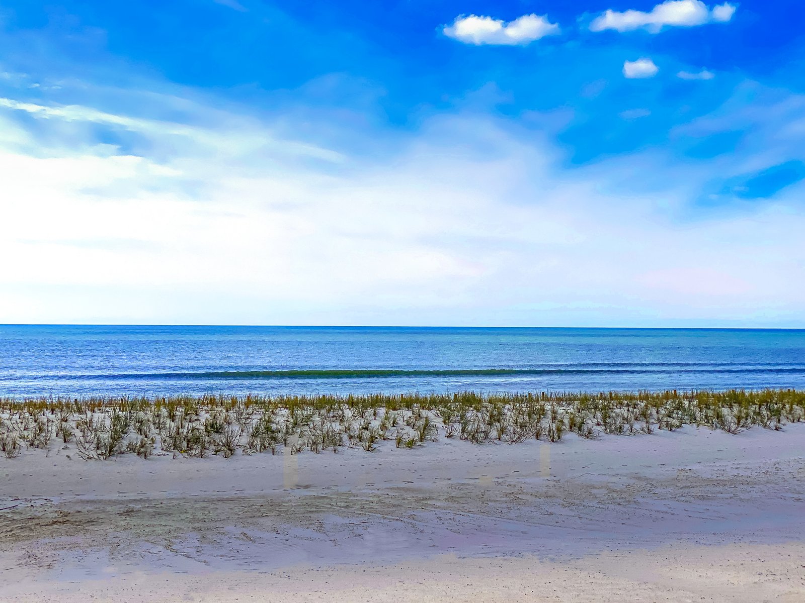
Gulf Coast Mississippi
Mexico Beach, Florida
Sea oats and beach grass hold a low foredune along an undeveloped stretch of the Gulf Coast, looking seaward to a gentle wave line breaking just offshore under a wide, partly clouded sky. Key Features: The Dune Grasses: Sea oats and other native grasses trap blowing sand and anchor the dunes, the coast's first defense against storms. The Shore: Wide, quiet beaches like this one line much of the northern Gulf of Mexico. The Light: A soft, partly clouded sky keeps the sand, grass and water in gentle tones.
Prints from $22Downloads from $19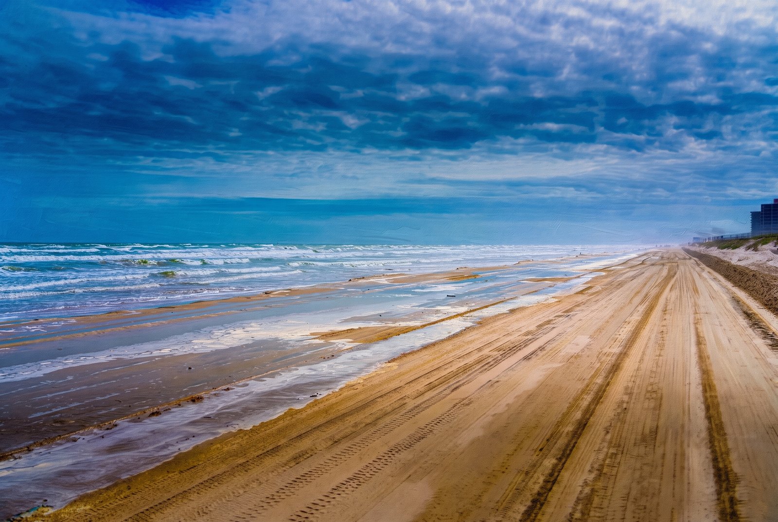 Painterly
1182 Corpus Christi TX
Surf rolls in beside a wide, packed-sand track scored with tire ruts on a drivable beach near Corpus Christi, Texas, running toward the horizon past low dunes and beachfront condominiums fading into haze. Key Features: Drivable Shoreline: Corpus Christi's Gulf beaches are among the few in the country where cars can drive right onto the sand. The Barrier Islands: The beaches face the Gulf from the chain of barrier islands in front of Corpus Christi Bay, including Mustang Island and Padre Island. The Beachfront: Distant high-rises mark the developed resort stretch, beyond the open sand and dunes in front. The Weather: Heavy cloud with breaks of blue and blowing sea spray make for a breezy, changeable Gulf day.
Prints from $41Prints only